Category:Forests in Washington (state)
Jump to navigation
Jump to search
Wikimedia category | |||||
| Upload media | |||||
| Instance of | |||||
|---|---|---|---|---|---|
| Category combines topics | |||||
| Washington | |||||
state of the United States of America someja satełitar in setenbre    | |||||
| Pronunciation audio | |||||
| Instance of | |||||
| Part of | |||||
| Named after | |||||
| Location |
| ||||
| Located in or next to body of water | |||||
| Capital | |||||
| Legislative body | |||||
| Executive body | |||||
| Highest judicial authority | |||||
| Head of government |
| ||||
| Inception |
| ||||
| Highest point | |||||
| Population |
| ||||
| Area |
| ||||
| Elevation above sea level |
| ||||
| Replaces | |||||
| Different from | |||||
| Maximum temperature record |
| ||||
| Minimum temperature record |
| ||||
| official website | |||||
 | |||||

Subcategories
This category has the following 15 subcategories, out of 15 total.
Media in category "Forests in Washington (state)"
The following 200 files are in this category, out of 201 total.
(previous page) (next page)-
-
 14-foot diameter fir tree at Mineral City, Washington.jpg 460 × 600; 125 KB
-

-

-

-

-
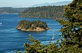
 2c Alger alp view (7518584836).jpg 1,201 × 802; 545 KB
-
 3b Forest texture (7518584308).jpg 1,600 × 879; 1.23 MB
-
 A trail at Carlisle Lake Park.jpg 3,000 × 4,000; 8.32 MB
-

-
 Alta Mountain west aspect.jpg 7,952 × 5,304; 12.46 MB
-
 Argus - A.Y.P. ed. - Page 48a.jpg 4,624 × 6,650; 7.47 MB
-

-

-
 Bellevue WA 0005.jpg 3,008 × 2,000; 2.95 MB
-
 Bellevue WA 0007.jpg 3,008 × 2,000; 2.91 MB
-
 Black Diamond, United States (Unsplash).jpg 5,472 × 3,078; 10.16 MB
-
 Black-tailed deer in free-roaming area. (532ba2942e3c456a89038d8fc708a80c).jpg 5,760 × 3,840; 13.71 MB
-
 Blowdown forest 2014 - Mt St Helens Washington.jpg 4,000 × 3,000; 4.37 MB
-
 Cabin Time.jpg 3,264 × 2,448; 2.31 MB
-
 Small forest landownerships, Oregon and Washington (IA CAT10507599).pdf 1,104 × 1,537, 34 pages; 2.19 MB
-
 Cedar River Watershed, 1911 (36952091370).jpg 1,200 × 971; 594 KB
-
 Cedar River Watershed, 1911 (50148622247).jpg 699 × 566; 129 KB
-
 Cloudy day at Evans Creek Preserve.jpg 2,448 × 3,264; 2.49 MB
-
 Deception Pass, Puget Sound, Washington State - panoramio.jpg 2,925 × 1,879; 3.63 MB
-

-
 Ellensburg, WA, USA - panoramio (1).jpg 848 × 1,280; 335 KB
-
 Ellensburg, WA, USA - panoramio (2).jpg 1,280 × 848; 286 KB
-
 Ellensburg, WA, USA - panoramio (3).jpg 847 × 1,280; 319 KB
-
 Evans Creek Preserve Boardwalk.jpg 2,448 × 3,264; 3.97 MB
-
 Fall colors (dc9b8b61827c4864abf043ee8239001a).JPG 2,560 × 1,920; 2.33 MB
-
 Fall colors (e945108bb3674564b56271b9fa6dbb16).JPG 2,560 × 1,920; 2.2 MB
-

-
 Fantasy Forest - panoramio.jpg 1,728 × 2,304; 3.74 MB
-
 Ferns and trees at Evans Creek Preserve.jpg 2,448 × 2,448; 2.87 MB
-
 First good view of Twin Sisters - Flickr - brewbooks.jpg 4,288 × 3,216; 3.73 MB
-
 Flickr - brewbooks - Carla and George's Species Iris Garden (1).jpg 3,888 × 1,890; 4.87 MB
-
 Flickr - brewbooks - Carla and George's Woodland Garden (1).jpg 3,518 × 2,348; 3.09 MB
-
 Flickr - brewbooks - Carla and George's Woodland Garden (2).jpg 3,593 × 2,592; 4.86 MB
-
 Flickr - brewbooks - Carla and George's Woodland Garden (3).jpg 3,743 × 2,317; 4.51 MB
-
 Flickr - brewbooks - Carla and George's Woodland Garden (4).jpg 3,888 × 2,592; 7.23 MB
-
 Flickr - brewbooks - Carla and George's Woodland Garden.jpg 2,720 × 2,366; 3.29 MB
-
 Flickr - brewbooks - Fritillaria affinis.jpg 2,437 × 2,265; 1.33 MB
-
 Flickr - brewbooks - Iris (need to add species) (1).jpg 3,634 × 2,466; 3.73 MB
-
 Flickr - brewbooks - Iris (need to add species).jpg 3,711 × 2,592; 3.17 MB
-
 Flickr - brewbooks - Trillium (need to add species) (3).jpg 3,634 × 2,031; 2.57 MB
-
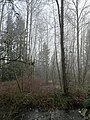
 Fog in forest and creek at Kent, Washington.jpg 3,024 × 4,032; 5.78 MB
-
 Fog in forest at Kent, Washington - 1.jpg 3,024 × 4,032; 5.61 MB
-
 Fog in forest at Kent, Washington - 2.jpg 3,024 × 4,032; 6.55 MB
-
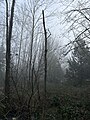
 Fog in the Buckhorn Wilderness, Olympic National Forest (23306867063).jpg 2,095 × 1,433; 3.47 MB
-
 Forest (d08eba7c993145329778fc1a6f73e99c).JPG 2,816 × 2,112; 2.69 MB
-

-
 Forest fire aftermath.jpg 1,874 × 1,398; 2.51 MB
-
-
 Forest Fog (16089332918).jpg 5,472 × 3,648; 11.65 MB
-
 Forest In Makah Indian Reservation (193306545).jpeg 2,048 × 1,536; 1.07 MB
-
 Forest on Olympic National Park Three Lakes Trail.jpg 2,981 × 1,749; 2 MB
-
 Forest reflected in Horseshoe Lake. (83fef4aab8854db5832e8e4844e47156).jpg 3,840 × 5,760; 16.39 MB
-
 Forest reflection in Horseshoe Lake. (60fc11b7c7a04579b412a437a9662178).jpg 5,760 × 3,840; 15.9 MB
-

-
 Forest up.jpg 2,272 × 1,704; 562 KB
-
 Forest waterfall (3230008730).jpg 4,552 × 6,948; 17.83 MB
-
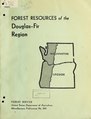 Forest resources of the Douglas-fir region (IA forestresourceso389andr).pdf 1,172 × 1,539, 198 pages; 17.97 MB
-
 Glacier Basin Trail (59e55949-a3fe-402f-9eef-78c1be6dd396).JPG 5,472 × 3,648; 12.49 MB
-
 Glacier Peak 7118.JPG 1,600 × 1,200; 519 KB
-
 Goat Rocks Wilderness - Flickr - Joe Parks (8).jpg 1,280 × 930; 627 KB
-
 Gobblers Knob Fire Lookout (0b0323fc-a5ea-4f9e-9926-1fb075bc0085).jpg 4,032 × 3,024; 1.65 MB
-
 Gold Creek Alaska Lake 0299.jpg 1,800 × 1,200; 938 KB
-
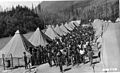
 Greenwood Log Company, Aberdeen, 1913 - DPLA - 85da3f03b558fba4bc4a2a1ef32e5326.jpg 8,513 × 6,758; 6.73 MB
-
 Grey Moon Rising (Unsplash).jpg 4,480 × 6,720; 14.06 MB
-

-
 Group snowshoes past snow covered tree. (b186e3f2e4914a1ab3420d44123b5087).jpg 2,848 × 4,288; 3.54 MB
-

-
 Happy log at Evans Creek Preserve.jpg 2,448 × 2,448; 1.77 MB
-
 Heavily wooded area. Typical of HDC - NARA - 299685.jpg 3,000 × 2,281; 1.3 MB
-
 Hemlock Forest (5038318348).jpg 866 × 1,154; 514 KB
-

-
-
 House and Trees (13702412963).jpg 2,100 × 1,000; 956 KB
-
 Ice Encased Trees and Bushes in Winter.jpg 2,272 × 1,704; 1.77 MB
-
 Indian Henry's Patrol Cabin (561759e5-ef3e-41ff-846f-6fb0be02acd4).jpg 2,288 × 1,712; 724 KB
-
 Indian Henry's Patrol Cabin (d94f0c28-cbb3-4c48-8d73-20519d692187).jpg 3,079 × 1,925; 2.88 MB
-
 Instability of forest land ownership in western Oregon and Washington, 1932-41 (IA instabilityoffor01wils).pdf 1,106 × 1,529, 100 pages; 4.51 MB
-
 King County, WA, USA - panoramio (1).jpg 1,280 × 848; 524 KB
-
 King County, WA, USA - panoramio (2).jpg 1,280 × 848; 312 KB
-
 King County, WA, USA - panoramio (4).jpg 1,280 × 847; 330 KB
-
 King County, WA, USA - panoramio (6).jpg 848 × 1,280; 320 KB
-
 King County, WA, USA - panoramio.jpg 1,280 × 848; 308 KB
-

-

-

-

-
 Lake George (d22855ce81384c80af9a70969834fe95).JPG 2,560 × 1,920; 2.37 MB
-
 Lake Washington sunken forests.png 225 × 777; 341 KB
-
 Lenticular clouds (5e26d953e391407198c04646284cca27).JPG 3,072 × 2,304; 1.9 MB
-
 Lewis and Clark State Park (Washington); Old Growth (1649679326).jpg 941 × 534; 89 KB
-
 Light at the End of the Road - panoramio.jpg 2,304 × 1,220; 3.14 MB
-
 Lila Lake - panoramio.jpg 1,280 × 848; 369 KB
-
 Little forest in Pierce County Washington.jpg 1,733 × 2,348; 1.94 MB
-
 The logged-off lands of western Washington (IA loggedofflandsof00wash).pdf 1,008 × 1,608, 72 pages; 8.54 MB
-
 Longmire Museum during move (5d7ed6c7-e3a6-46aa-b420-d8b1f6f311d5).jpg 2,776 × 1,907; 1.52 MB
-

-
 Male elk lying down in forest. (e387056776cb466daaaa554c2adb0d6b).jpg 3,840 × 5,760; 18.2 MB
-
 May Valley Trail (6020598475).jpg 1,000 × 667; 345 KB
-
 May Valley Trail 2 (6021152018).jpg 667 × 1,000; 490 KB
-
 Mist Covering a Meadow under Forest Encroachment.jpg 2,048 × 1,360; 1.66 MB
-
 Mist on the Mountain (4551400548).jpg 1,265 × 840; 233 KB
-
 Misty day on the South Fork Snoqualmie River.jpg 2,448 × 3,264; 2.87 MB
-
 Misty Mountains (Unsplash zR40wedS1aQ).jpg 6,000 × 3,376; 2.39 MB
-
 More Hemlock Forest (5037700279).jpg 1,154 × 866; 429 KB
-
 Moss (e531ade01e084f2e8912673868cf869e).JPG 2,304 × 3,072; 1.9 MB
-
 Mossopolis.jpg 1,280 × 960; 1.84 MB
-
 Mossy rocks on South Fork Snoqualmie River.jpg 2,448 × 2,448; 3.09 MB
-
 Mossy trees and licorice ferns at Evans Creek Preserve.jpg 2,448 × 2,448; 2.39 MB
-
 Mount Adams from East Canyon Ridge.jpg 1,024 × 768; 340 KB
-
 Mount Adams from East Canyon Ridge.png 1,024 × 768; 1.27 MB
-
 Mount Adams from Trout Lake.jpg 2,048 × 1,536; 1.3 MB
-
 Mount Baker 8675s.JPG 4,978 × 2,800; 5.4 MB
-
 Mount Rainier National Park, Washington (22693349213).jpg 2,458 × 1,645; 1.31 MB
-
 Mount Rainier National Park, Washington (23294351266).jpg 2,371 × 1,587; 816 KB
-
 Mount Washington Cascades.jpg 1,600 × 1,200; 776 KB
-
 Mountain Ash. Unicorn and Foss Peaks in background (e83ccff52ffc458390920333813b59fe).JPG 2,560 × 1,920; 2.42 MB
-
 MountainHemlock 0965.jpg 800 × 600; 127 KB
-
 Mt Rainier (09841d94470f433299ef5baa8380593a).JPG 2,560 × 1,920; 2.28 MB
-
 Mt Rainier (83f5f0e49e8c4f0588f9361cb62cc168).JPG 2,560 × 1,920; 2.34 MB
-
 Mt Rainier (8c6ca9e755ac41c0b0ecb6720513431a).JPG 1,920 × 2,560; 2.39 MB
-
 Mt Rainier (ae257f6807ba4fee90b7086f898c75b9).JPG 2,560 × 1,920; 2.21 MB
-
 Mt Rainier (dffdcfca0c674b16aa01c7caab30765c).JPG 2,560 × 1,920; 1.86 MB
-
 Mt Wow (e740685cae994e3598be61dfd2f636b3).JPG 2,816 × 2,112; 2.53 MB
-
 Mt. Rainier leaves.jpg 2,988 × 5,312; 2.97 MB
-
 Nisqually River (022bea6e34fc4c8e9e2a2503bfacdec8).JPG 2,560 × 1,920; 2.34 MB
-
 Nisqually Vista trail (ad1ec64ffb1549e387c3e855973ea821).JPG 4,288 × 2,848; 3.07 MB
-
 Oct 7, 2008. Blacktail Buck (e4d57724e15844c68108e427c768ea05).JPG 2,560 × 1,920; 2.23 MB
-
 Okanogan-Wenatchee National Forest.jpg 3,840 × 2,160; 2.6 MB
-
 Old Growth Forest along US 101 in Washington.jpg 2,560 × 1,920; 1.89 MB
-
 Old Sauk Trail (5969895831).jpg 739 × 1,000; 553 KB
-
 Old Sauk Trail (5970453848).jpg 1,000 × 667; 666 KB
-
 Old-growth forest, ca 1925 (MOHAI 6325).jpg 557 × 700; 74 KB
-
 Olym forest4full (rainforest hiker).jpg 461 × 614; 224 KB
-
 Olympic Rainforest Hiker.jpg 600 × 450; 146 KB
-
 On the Pacific Northwest Trail.jpg 3,000 × 4,000; 5.34 MB
-
 Original Mystic Lake Cabin (8cf716b1-0625-4dc8-bf34-15b69352de19).jpg 4,864 × 3,446; 2.39 MB
-
 Our national parks (1909) (14596253638).jpg 1,952 × 2,888; 1.18 MB
-
 Pierce County, WA, USA - panoramio (1).jpg 848 × 1,280; 301 KB
-
 Pierce County, WA, USA - panoramio (13).jpg 4,128 × 2,322; 4.56 MB
-
 Pierce County, WA, USA - panoramio (6).jpg 4,608 × 3,456; 3.43 MB
-
 Portion denoting funding on sign for the King County portion of North Creek Forest.JPG 3,264 × 2,448; 2.08 MB
-
 Prairie Ridge, WA, USA - panoramio.jpg 3,070 × 2,302; 774 KB
-
 RAIN FOREST IN ELWHA - panoramio.jpg 2,848 × 4,288; 4.54 MB
-
 Rain forest in Northwestern Washington State (43339181475).jpg 4,096 × 3,071; 3.43 MB
-
 Rainforest living up to its name.jpg 2,048 × 1,536; 2.11 MB
-
 Rattlesnake Ledge, Washington.jpg 1,200 × 800; 941 KB
-
 Reflection in lake of trees. (87cf956f398a496aaa7dd4dd23656588).jpg 5,760 × 3,840; 18.64 MB
-
 Reflection of forest in lake water. (edbfdc057a2e48cc8b8f42e3fe2105a9).jpg 5,760 × 3,840; 12.34 MB
-

-
 Road through forest, Washington, ca 1928 (TRANSPORT 232).jpg 398 × 512; 51 KB
-
 Rockport State Park 1 (6086827534).jpg 1,000 × 667; 687 KB
-
 Seymour Peak (d1c2f63b8104425fbd22dabca285dbd3).JPG 2,560 × 1,920; 2.4 MB
-
 Sign and restoration area in the King County portion of North Creek Forest 01.JPG 3,264 × 2,448; 4.74 MB
-
 Sign and restoration area in the King County portion of North Creek Forest 02.JPG 3,264 × 2,448; 4.96 MB
-
 Sign in the King County portion of North Creek Forest.JPG 3,264 × 2,448; 1.92 MB
-

-

-

-

-
 Snow covered trees in Longmire. (db9fea4c9350400895e4c96af47deb99).jpg 2,848 × 4,288; 3.82 MB
-
 Snowy Field (d745206407a14f11968fd483b14f4e8a).JPG 3,072 × 2,304; 2.25 MB
-
 South Fork Snoqualmie River near Twin Falls.jpg 2,448 × 2,448; 2.58 MB
-

-
 SR410 viewed from Sunrise Point (7b65ea6b-e79e-4184-856a-c00ab306b917).jpeg 2,076 × 1,412; 995 KB
-
 Stand of Douglas fir, Washington, 1926 (KINSEY 2822).jpg 409 × 512; 81 KB
-

-
 Stone tower on South Fork Snoqualmie River near Twin Falls.jpg 2,448 × 2,448; 2.65 MB
-
 Stuart + Larch (2925131599).jpg 1,024 × 680; 801 KB
-
 Suiattle River Valley and Glacier Peak.jpg 1,097 × 720; 1,017 KB
-

-
 Swamp Creek Valley (5038430454).jpg 1,154 × 866; 163 KB
-
 Taking the Mountain Road into Wenas - panoramio.jpg 2,304 × 1,536; 3.84 MB
-
 Tatoosh Range (7f2c0049e94e4d8b962affca66f875a3).JPG 4,288 × 2,848; 3.02 MB
-
 Temperate rainforest, Pacific coast of North America, 2004.jpg 2,048 × 3,072; 1.88 MB
-
 The Beauties of the state of Washington - a book for tourists (1915) (14589778477).jpg 2,020 × 3,512; 1.97 MB
-

-
 The Nisqually Suspension Bridge in 1993. (51ac89f5-680b-40fd-a31a-4c8027156944).jpeg 2,059 × 1,397; 1.06 MB
-
 Township Range Section Marker on Forest Service Road.jpg 4,592 × 3,448; 7.75 MB
-
 Trail on fallen, moss covered tree, Washington (4557924513).jpg 393 × 512; 207 KB
-
 Tree trunk and bark. (dc91c00cb194450cabb020105d4200dd).JPG 2,816 × 2,112; 2.74 MB
-
 Trees (c6696390c568417dbcf81937ba91c948).JPG 4,288 × 2,848; 3.02 MB
-
 Trees (c8145897b89047459aece3096f2c91e4).jpg 2,374 × 3,387; 2.27 MB
-
 Two men in Cedar River Watershed, 1912 (51117070597).jpg 3,000 × 2,438; 4.34 MB
-

-
 Untitled1 - panoramio (1394).jpg 4,608 × 3,456; 3.41 MB
-
 Untitled1 - panoramio (1397).jpg 4,608 × 3,456; 3.46 MB
-
 Upper elevations of Cow Canyon, Wenas, WA - panoramio.jpg 2,304 × 1,536; 1.74 MB
-
 UpperFalls Apr2010.jpg 576 × 768; 380 KB
-
 Van Trump Patrol Cabin (05318a51-135c-456e-8b67-70be86d9ff1d).jpeg 2,069 × 1,412; 681 KB
-
 View from Eastside Trail (04a00d76-a107-4ff1-8b8a-207f1b4558db).JPEG 3,024 × 4,032; 6.97 MB
-
 View of South Fork Snoqualmie River near Twin Falls.jpg 2,448 × 3,264; 3.52 MB
-
 Vista Creek Rainforest (5038409924).jpg 866 × 1,154; 359 KB
-
 White wolf behind fence. (85f3fb677c0c43a58e57d46692cea1e6).jpg 5,760 × 3,840; 13.6 MB
-
 White wolf in woods. (fcc01a6d448e4a6b9a8c1417917f2232).jpg 5,760 × 3,840; 15.53 MB
.jpg)


_conference_and_field_trip._From_left_to_right_R._Lejeune;_T._Silver;_W._Benedict;_N._Johnson;_and_H._Richmond._Mt._St._Helens_area,_Washington._(33461287041).jpg)
_shaded_windfall_infested_by_Douglas-fir_beetle._McDonald_Forest,_Washington._(34326010945).jpg)
.jpg)
.jpg)
.jpg)


.jpg)


.jpg)
.jpg)


.jpg)
.jpg)


.jpg)
.jpg)
.jpg)

.JPG)
.JPG)
.jpg)


.jpg)
.jpg)
.jpg)
.jpg)
.jpg)


_(1).jpg)
.jpg)
_(3).jpg)


.jpg)
.JPG)
.JPG)

.jpg)
.jpg)
.jpeg)

.jpg)
.jpg)
.jpg)

.jpg)
.JPG)

.jpg)
.jpg)


.jpg)
.jpg)
.jpg)
.JPG)


.jpg)
.jpeg)
.jpeg)
.jpg)

.jpg)
.jpg)
.jpg)
.jpg)
.jpg)
.jpg)


.JPG)
.JPG)
;_Old_Growth_(1649679326).jpg)


.jpg)
.jpg)
.jpg)
.jpg)
.jpg)

.jpg)

.jpg)
.jpg)
.JPG)


.jpg)
.jpg)

.JPG)

.JPG)
.JPG)
.JPG)
.JPG)
.JPG)
.JPG)

.JPG)
.JPG)
.JPG)


.jpg)
.jpg)
.jpg)
.jpg)


.jpg)
_(14596253638).jpg)
.jpg)
.jpg)
.jpg)


.jpg)


.jpg)
.jpg)
.jpeg)
.jpg)
.JPG)


.jpg)

.jpg)
.JPG)

.jpeg)
.jpeg)
.jpg)
.jpg)

.jpg)


.jpg)

.JPG)

_(14589778477).jpg)
_(14781043044).jpg)
.jpeg)

.jpg)
.JPG)
.JPG)
.jpg)
.jpg)
.jpeg)
.jpg)
.jpg)


.jpeg)
.JPEG)

.jpg)
.jpg)
.jpg)
&filefrom=Woman+hiking+near+Skagit+River%2C+1913+%2831513743095%29+%282%29.jpg#mw-category-media)
.jpg)