Category:Fishtoft
Jump to navigation
Jump to search
English: Fishtoft is one of eighteen parishes which, together with Boston, form the Borough of Boston in the county of Lincolnshire, England. The local government has been arranged in this way since the reorganization of April 1 1974, which resulted from the Local Government Act 1972. This parish forms an electoral ward in itself.
Main Wikipedia article: Fishtoft.

village and civil parish in Lincolnshire, England  | |||||
| Upload media | |||||
| Instance of | |||||
|---|---|---|---|---|---|
| Location | Boston, Lincolnshire, East Midlands, England | ||||
 | |||||
Subcategories
This category has the following 6 subcategories, out of 6 total.
F
- Fields in Fishtoft (4 F)
- St Guthlacs, Fishtoft (27 F)
- Fishtoft War Memorial (2 F)
P
R
- Rochford Tower (2 F)
W
- Wesleyan Chapel, Fishtoft (3 F)
Media in category "Fishtoft"
The following 200 files are in this category, out of 388 total.
(previous page) (next page)-

-

-
 'Tricia B' making her way up The Haven to Boston - geograph.org.uk - 5071161.jpg 3,776 × 2,520; 4.22 MB
-
 A52 Wainfleet Road leaving Boston - geograph.org.uk - 5673352.jpg 640 × 480; 53 KB
-
 A52 Wainfleet Road near Round House - geograph.org.uk - 5673357.jpg 640 × 480; 44 KB
-
 Access road - geograph.org.uk - 5403967.jpg 640 × 480; 60 KB
-
 Across the Haven - geograph.org.uk - 430183.jpg 640 × 477; 79 KB
-
 Agricultural field and buildings - geograph.org.uk - 389068.jpg 640 × 480; 83 KB
-

-
 Anton's Gowt Lock - geograph.org.uk - 2233621.jpg 800 × 531; 117 KB
-
 Anton's Gowt Lock - geograph.org.uk - 2233624.jpg 800 × 531; 123 KB
-
 Anton's Gowt Lock - geograph.org.uk - 2233628.jpg 800 × 531; 126 KB
-
 Approaching Fishtoft form the NE - geograph.org.uk - 5574402.jpg 640 × 427; 82 KB
-

-
 Back to Boston - geograph.org.uk - 1430819.jpg 640 × 480; 71 KB
-
 Barn on the lean - geograph.org.uk - 1799300.jpg 3,648 × 2,736; 2.19 MB
-
 Bench on the bank - geograph.org.uk - 4212734.jpg 1,600 × 1,200; 623 KB
-
 Bend in footpath - geograph.org.uk - 5403962.jpg 640 × 480; 92 KB
-
 Bend on Eastwood Road - geograph.org.uk - 3897384.jpg 640 × 480; 66 KB
-

-

-

-
 Bird on a wire - geograph.org.uk - 2661993.jpg 640 × 427; 116 KB
-
 Boats heading out into The Wash - geograph.org.uk - 3128700.jpg 2,733 × 1,864; 1.94 MB
-

-
 Boston Long Hedges - geograph.org.uk - 2792066.jpg 1,280 × 853; 332 KB
-
 Boston Long Hedges - geograph.org.uk - 3897430.jpg 640 × 480; 46 KB
-

-
 Boston Pendulum - geograph.org.uk - 2233615.jpg 800 × 531; 102 KB
-
 Boston Pendulum - geograph.org.uk - 4363476.jpg 480 × 640; 100 KB
-
 Boston Sleeper Depot - geograph.org.uk - 2233598.jpg 800 × 531; 100 KB
-
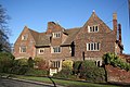 Burton Hall - geograph.org.uk - 718654.jpg 640 × 427; 82 KB
-
 Bushes on the bank - geograph.org.uk - 4212737.jpg 1,600 × 1,200; 629 KB
-
 Cabbage field - geograph.org.uk - 3897386.jpg 640 × 480; 89 KB
-

-
 Camelot Gardens - geograph.org.uk - 5753927.jpg 640 × 572; 90 KB
-
 Car Park - geograph.org.uk - 6342631.jpg 640 × 480; 56 KB
-
 Car park at Havenside Country Park - geograph.org.uk - 3128391.jpg 2,639 × 1,770; 1.89 MB
-
 Cattle on the bank - geograph.org.uk - 4212869.jpg 1,600 × 1,200; 605 KB
-
 Cattle trough near Cut End car park - geograph.org.uk - 3698342.jpg 1,600 × 1,107; 404 KB
-
 Colourful scene at Hilldyke - geograph.org.uk - 3604410.jpg 640 × 427; 60 KB
-

-
 Corporation Point along The Haven - geograph.org.uk - 3668105.jpg 4,000 × 3,000; 3.43 MB
-
 Cottages on Shortfield Lane - geograph.org.uk - 3897422.jpg 640 × 480; 100 KB
-

-

-
 Cow negotiating a fence - geograph.org.uk - 3132802.jpg 1,393 × 1,185; 709 KB
-
 Cow on the sea bank - geograph.org.uk - 3698376.jpg 1,600 × 1,140; 439 KB
-
 Cowbridge Drain - geograph.org.uk - 163727.jpg 640 × 427; 62 KB
-
 Cowbridge Drain - geograph.org.uk - 5466975.jpg 480 × 640; 53 KB
-

-
 Cowbridge footbridge (geograph 7125029).jpg 1,024 × 768; 255 KB
-
 Cowbridge House Inn - geograph.org.uk - 5519159.jpg 640 × 480; 66 KB
-
 Cowbridge Lock - geograph.org.uk - 3615087.jpg 1,064 × 1,600; 495 KB
-
 Cowbridge Lock - geograph.org.uk - 674598.jpg 640 × 427; 62 KB
-
 Cows along the north bank of The Haven - geograph.org.uk - 3721397.jpg 1,600 × 1,178; 501 KB
-
 Cows and a pillbox - geograph.org.uk - 4212878.jpg 1,600 × 1,200; 549 KB
-

-
 Cows grazing the sea bank - geograph.org.uk - 3698357.jpg 1,600 × 1,048; 368 KB
-
 Cows near a stile - geograph.org.uk - 3132718.jpg 3,264 × 2,448; 3.91 MB
-
 Cows on the bank of The Haven - geograph.org.uk - 3128420.jpg 2,267 × 1,640; 1.38 MB
-
 Cows on The Haven sea bank - geograph.org.uk - 3132724.jpg 3,031 × 2,193; 3.06 MB
-
 Cows on The Haven sea bank - geograph.org.uk - 3132740.jpg 2,171 × 1,841; 1.71 MB
-
 Cows on the sea bank - geograph.org.uk - 3128400.jpg 3,264 × 2,448; 3.9 MB
-
 Crop field near Boston Long Hedges - geograph.org.uk - 3897419.jpg 640 × 480; 62 KB
-
 Crop field near Cowbridge - geograph.org.uk - 3595117.jpg 640 × 474; 67 KB
-
 Crop field off Wythes Lane - geograph.org.uk - 3897387.jpg 640 × 480; 59 KB
-
 Crop field west of Sibsey Road - geograph.org.uk - 3877708.jpg 640 × 480; 60 KB
-
 Cut End hide - geograph.org.uk - 5469510.jpg 640 × 480; 47 KB
-
 Cut End Road - geograph.org.uk - 2661880.jpg 640 × 427; 86 KB
-
 Cut End Road - geograph.org.uk - 3229012.jpg 3,088 × 2,056; 1 MB
-
 Cut End Road car park - geograph.org.uk - 3128669.jpg 2,579 × 2,178; 2.47 MB
-
 Cut End Road near Fishtoft - geograph.org.uk - 3682234.jpg 640 × 426; 111 KB
-
 Cut End Road near Fishtoft - geograph.org.uk - 3682318.jpg 426 × 640; 122 KB
-
 Cut End Road near Fishtoft - geograph.org.uk - 3682398.jpg 640 × 426; 114 KB
-
 Cut End Road south of Fishtoft - geograph.org.uk - 5574410.jpg 640 × 427; 52 KB
-
 Cut End Road south of Fishtoft - geograph.org.uk - 5574420.jpg 640 × 427; 63 KB
-
 Cut End Road towards Marsh Farm - geograph.org.uk - 3721375.jpg 1,600 × 1,062; 464 KB
-
 Cut End Road towards Nunn's Bridge - geograph.org.uk - 3721284.jpg 1,600 × 1,163; 342 KB
-
 Cycle Route 1 alongside the Witham - geograph.org.uk - 5070419.jpg 3,776 × 2,520; 4.22 MB
-

-
 Downstream along The Haven - geograph.org.uk - 3666434.jpg 4,000 × 3,000; 3.39 MB
-
 Drain and houses from Toot Lane - geograph.org.uk - 2788478.jpg 1,280 × 853; 360 KB
-

-
 Drain off Wainfleet Road - geograph.org.uk - 3897401.jpg 640 × 480; 90 KB
-
 Drain off Wythes Lane - geograph.org.uk - 2788492.jpg 682 × 1,024; 225 KB
-

-
 Dusk over Hob Hole Drain - geograph.org.uk - 3229021.jpg 3,088 × 2,056; 732 KB
-

-
 Eastwood Road - geograph.org.uk - 3897382.jpg 640 × 480; 55 KB
-

-
 Entrance to Pilgrim Hospital, Boston - geograph.org.uk - 5551553.jpg 1,600 × 1,065; 608 KB
-
 Entrance to Shortfield Lane - geograph.org.uk - 2792072.jpg 1,280 × 853; 430 KB
-
 Ex Lincolnshire Loop Line - geograph.org.uk - 2233610.jpg 800 × 531; 101 KB
-
 Ex Lincolnshire Loop Line - geograph.org.uk - 2233613.jpg 800 × 531; 99 KB
-
 Ex Lincolnshire Loop Line - geograph.org.uk - 2233614.jpg 800 × 531; 104 KB
-
 Ex Lincolnshire Loop Line - geograph.org.uk - 2233616.jpg 800 × 531; 91 KB
-
 Ex Lincolnshire Loop Line - geograph.org.uk - 2233618.jpg 800 × 531; 82 KB
-
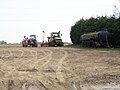 Farm machinery near the Grange - geograph.org.uk - 1799365.jpg 3,648 × 2,736; 2.08 MB
-
 Farmland and power lines - geograph.org.uk - 3897403.jpg 640 × 480; 56 KB
-
 Farmland east of Sibsey Road - geograph.org.uk - 3877712.jpg 640 × 480; 45 KB
-
 Farmland near Havenside Country Park - geograph.org.uk - 3721342.jpg 1,600 × 1,044; 394 KB
-
 Farmland north of Wainfleet Road - geograph.org.uk - 3897402.jpg 640 × 480; 84 KB
-
 Farmland off Rawsons Lane - geograph.org.uk - 3598707.jpg 640 × 480; 63 KB
-
 Farmland, Lonicera - geograph.org.uk - 3897389.jpg 640 × 480; 54 KB
-
 Fenland drain - geograph.org.uk - 2662067.jpg 640 × 427; 109 KB
-
 Fields of Lincolnshire - geograph.org.uk - 2233619.jpg 800 × 531; 89 KB
-
 Fish and Chip shop, Boston - geograph.org.uk - 1805063.jpg 3,648 × 2,736; 2.17 MB
-

-
 Fishtoft - geograph.org.uk - 33581.jpg 640 × 480; 80 KB
-
 Fishtoft - geograph.org.uk - 437691.jpg 640 × 427; 73 KB
-
 Fishtoft Academy - geograph.org.uk - 5403926.jpg 640 × 480; 62 KB
-
 Fishtoft mound - geograph.org.uk - 2661854.jpg 640 × 427; 70 KB
-
 Flat farmland near Anton's Gowt - geograph.org.uk - 4365962.jpg 640 × 480; 73 KB
-
 Flat Fields and the River Witham - geograph.org.uk - 2233617.jpg 800 × 531; 55 KB
-
 Footpath - geograph.org.uk - 2233601.jpg 800 × 531; 102 KB
-
 Footpath - geograph.org.uk - 5403960.jpg 640 × 480; 86 KB
-
 Footpath along bank - geograph.org.uk - 5403900.jpg 640 × 480; 91 KB
-
 Footpath along The Haven - geograph.org.uk - 1495585.jpg 640 × 480; 75 KB
-
 Footpath along the Witham - geograph.org.uk - 5071420.jpg 3,776 × 2,520; 4.16 MB
-
 Footpath and drain - geograph.org.uk - 5403954.jpg 640 × 480; 93 KB
-
 Footpath near an Old Junction - geograph.org.uk - 2233602.jpg 800 × 531; 103 KB
-
 Footpath west along the sea bank - geograph.org.uk - 3128676.jpg 3,092 × 2,212; 3.28 MB
-
 Footpath west along the sea bank - geograph.org.uk - 3128708.jpg 3,264 × 2,448; 2.96 MB
-
 Former Chapel - geograph.org.uk - 5403918.jpg 640 × 480; 72 KB
-
 Former jetty - geograph.org.uk - 5403283.jpg 640 × 480; 95 KB
-
 Former Junction - geograph.org.uk - 2233608.jpg 800 × 531; 123 KB
-
 Former Wesleyan Chapel, Fishtoft - geograph.org.uk - 5071552.jpg 3,776 × 2,520; 4.26 MB
-
 Frampton Marsh , aerial 2016 - geograph.org.uk - 4962453.jpg 640 × 427; 52 KB
-
 Freiston Bridge - geograph.org.uk - 2788883.jpg 1,280 × 853; 403 KB
-
 Freiston Bridge over the Hobhole Drain - geograph.org.uk - 4337649.jpg 640 × 480; 191 KB
-
 Frith Bank Bridge - geograph.org.uk - 5519183.jpg 640 × 480; 82 KB
-
 Frith Bank Bridge over Frith Bank Drain - geograph.org.uk - 2916644.jpg 1,280 × 853; 317 KB
-
 Frith Bank Drain - geograph.org.uk - 3598683.jpg 640 × 480; 69 KB
-
 Frith Bank Drain - geograph.org.uk - 5519180.jpg 640 × 480; 81 KB
-
 Fruit Pickers, Fishtoft - geograph.org.uk - 557743.jpg 640 × 480; 111 KB
-
 Fruit Pickers, Fishtoft - geograph.org.uk - 557759.jpg 640 × 480; 94 KB
-
 Fruit Pickers, Fishtoft - geograph.org.uk - 557764.jpg 640 × 480; 106 KB
-
 Garage services, Boston - geograph.org.uk - 1805095.jpg 3,648 × 2,736; 2.03 MB
-
 Gated track along the Haven Bank - geograph.org.uk - 5574506.jpg 640 × 427; 60 KB
-
 Gaysfield Road - geograph.org.uk - 5403941.jpg 640 × 480; 76 KB
-
 Grassland on the bank of The Haven - geograph.org.uk - 3128428.jpg 2,536 × 1,826; 1.51 MB
-
 Grazing near Rawson's Bridge - geograph.org.uk - 3595122.jpg 640 × 411; 42 KB
-
 Grazing, Burton Hall - geograph.org.uk - 3877706.jpg 640 × 480; 63 KB
-

-

-
 Haven bank footpath - geograph.org.uk - 1377712.jpg 427 × 640; 74 KB
-
 Havenside - geograph.org.uk - 2662078.jpg 640 × 427; 85 KB
-
 Havenside Country Park - geograph.org.uk - 3128372.jpg 3,258 × 2,218; 3.06 MB
-
 Havenside footpath - geograph.org.uk - 2661981.jpg 640 × 427; 120 KB
-
 Havenside Nature Reserve - geograph.org.uk - 1377723.jpg 640 × 427; 78 KB
-

-
 Herd of cows near The Haven - geograph.org.uk - 3721404.jpg 1,600 × 1,200; 604 KB
-
 Hob Hole Drain - geograph.org.uk - 2661895.jpg 640 × 427; 75 KB
-
 Hob Hole pumping station - geograph.org.uk - 5403289.jpg 640 × 480; 94 KB
-
 Hobhole Drain (left) joining the River Witham (The Haven) - geograph.org.uk - 5071502.jpg 3,776 × 2,520; 4.03 MB
-
 Hobhole Drain - geograph.org.uk - 5403300.jpg 640 × 480; 72 KB
-
 Hobhole Drain - geograph.org.uk - 5403913.jpg 640 × 480; 58 KB
-
 Hobhole Drain - geograph.org.uk - 5403914.jpg 640 × 480; 48 KB
-
 Hobhole Drain near Fishtoft - geograph.org.uk - 3681965.jpg 640 × 426; 80 KB
-
 Hobhole Drain near Fishtoft - geograph.org.uk - 3681971.jpg 640 × 426; 104 KB
-

-

-
 Horncastle Road out of Boston - geograph.org.uk - 5002982.jpg 1,500 × 1,113; 152 KB
-

-
 Houses on Wythes Lane - geograph.org.uk - 3897395.jpg 640 × 480; 60 KB
-
 Johnsons Garden Centre - geograph.org.uk - 6342627.jpg 640 × 480; 60 KB
-
 Jolly Sailor house along The Haven - geograph.org.uk - 3665533.jpg 2,292 × 1,692; 1.38 MB
-
 Junction of waterways, Cowbridge Lock - geograph.org.uk - 3615090.jpg 1,600 × 1,064; 426 KB
-
 Lagoons along The Haven - geograph.org.uk - 3666695.jpg 4,000 × 3,000; 3.15 MB
-

-
 Lane heading north - geograph.org.uk - 3897418.jpg 640 × 480; 52 KB
-
 Lane heading north - geograph.org.uk - 3897425.jpg 640 × 480; 49 KB
-
 Level Crossing - geograph.org.uk - 5519147.jpg 640 × 480; 74 KB
-
 Level crossing on Horncastle Road - geograph.org.uk - 5001493.jpg 1,500 × 991; 208 KB
-
 Level crossing on Horncastle Road - geograph.org.uk - 5002983.jpg 1,500 × 1,098; 260 KB
-
 Level crossing on Pilley's Lane - geograph.org.uk - 5002985.jpg 1,500 × 1,055; 170 KB
-

-

-

-
 Lock on Anton's Gowt - geograph.org.uk - 5069568.jpg 3,776 × 2,520; 4.33 MB
-
 Lonely outpost - geograph.org.uk - 1430827.jpg 640 × 480; 94 KB
-

-

-
 Looking north across The Haven - geograph.org.uk - 3667910.jpg 3,661 × 2,528; 2.69 MB
-
 Looking south over Mastin's Bridge - geograph.org.uk - 3604421.jpg 640 × 427; 45 KB
-
 Looking towards A52 - geograph.org.uk - 6342633.jpg 640 × 480; 44 KB
-

-
 Lots of water, big skies - geograph.org.uk - 1555340.jpg 640 × 480; 56 KB
-
 Low bank into the saltmarsh - geograph.org.uk - 4212866.jpg 1,600 × 1,200; 616 KB
-
 Low earthworks in the saltmarsh - geograph.org.uk - 4212845.jpg 1,600 × 1,200; 618 KB
-
 Marshy corner in the Haven - geograph.org.uk - 5574509.jpg 640 × 427; 60 KB
-
 Mary Angus - geograph.org.uk - 3132747.jpg 2,711 × 1,833; 1.47 MB
-
 Mastin's Bridge (geograph 6546112).jpg 1,024 × 768; 164 KB
-
 Mastin's Bridge - geograph.org.uk - 5466973.jpg 631 × 640; 57 KB
-
 Mastin's Bridge, loo with a view - geograph.org.uk - 3604417.jpg 640 × 427; 60 KB
-
 Mastins Bridge - geograph.org.uk - 2787331.jpg 1,280 × 853; 371 KB
-
 Meeting of the waters - geograph.org.uk - 4979739.jpg 8,321 × 4,096; 5.2 MB
-
 Memorial to Pilgrim Fathers - geograph.org.uk - 5403262.jpg 446 × 640; 80 KB
-
 Memorial to the Pilgrim Fathers - geograph.org.uk - 5071477.jpg 3,776 × 2,520; 4.11 MB
_-_geograph.org.uk_-_5574378.jpg)
_-_geograph.org.uk_-_5574381.jpg)


_-_geograph.org.uk_-_5574518.jpg)


_-_geograph.org.uk_-_4962381.jpg)


_and_Hobhole_Drain,_aerial_2017_-_geograph.org.uk_-_5468620.jpg)


_and_Welland_Rivers_-_geograph.org.uk_-_5573709.jpg)


.jpg)


_inbound_to_Boston_Dock_on_the_high_tide_-_geograph.org.uk_-_5574387.jpg)


_-_geograph.org.uk_-_3128379.jpg)


_joining_the_River_Witham_(The_Haven)_-_geograph.org.uk_-_5071502.jpg)


_and_Hobhole_Drain_-_geograph.org.uk_-_5574513.jpg)


_-_geograph.org.uk_-_5574372.jpg)
_-_geograph.org.uk_-_5574384.jpg)


.jpg)


