Category:February 2012 in La Palma
Jump to navigation
Jump to search
Subcategories
This category has the following 3 subcategories, out of 3 total.
E
- February 2012 in El Paso (14 F)
F
- February 2012 in Fuencaliente (65 F)
T
- February 2012 in Tijarafe (2 F)
Media in category "February 2012 in La Palma"
The following 200 files are in this category, out of 386 total.
(previous page) (next page)-
 D00 262 Stricklava.jpg 1,944 × 2,592; 2.11 MB
-
 D00 263 Malpaís del Volcán de San Juán.jpg 2,592 × 1,944; 1.27 MB
-
 D00 264 Malpaís del Volcán de San Juán.jpg 2,592 × 1,944; 1.69 MB
-
 D00 271 Viveres Lalá.jpg 2,592 × 1,944; 753 KB
-
 D00 278 Lomo de los Caballos.jpg 2,592 × 1,944; 1.79 MB
-
 D00 279 Lomo de los Caballos.jpg 2,592 × 1,944; 1.65 MB
-
 D00 280 Trennung Cascada colorada.jpg 1,944 × 2,592; 1.36 MB
-
 D00 281 Wasserfall.jpg 1,944 × 2,592; 1.76 MB
-
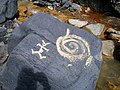 D00 282 Schlammzeichnung.jpg 2,592 × 1,944; 1.73 MB
-
 D00 283 Barranco Rivanceras.jpg 1,944 × 2,592; 2.17 MB
-
 D00 284 »La Estrechura«.jpg 1,944 × 2,592; 1.77 MB
-
 D00 285 Pista forestal general.jpg 1,944 × 2,592; 2.17 MB
-
 D00 286 unterhalb der Fuente de Tión.jpg 2,592 × 1,944; 1.64 MB
-
 D00 287 Wegweiser SL-FU 110.jpg 1,944 × 2,592; 2.12 MB
-
 D00 288 Trennung SU-FL 110.jpg 2,592 × 1,944; 2.04 MB
-
 D00 289 Los Sables.jpg 2,592 × 1,944; 1.42 MB
-
 D00 290 Trennung PR-LP 15.jpg 2,592 × 1,944; 2.3 MB
-
 D00 291 Wegweiser PR-LP 15.jpg 1,944 × 2,592; 1.53 MB
-
 D00 292 Hoyo de la Sima.jpg 2,592 × 1,944; 1.93 MB
-
 D00 293 Kehre unter Montaña de Magdalena.jpg 2,592 × 1,944; 1.55 MB
-
 D00 294 Wegkreuzung unter Volcán de San Juan.jpg 1,944 × 2,592; 1.39 MB
-
 D00 295 Trennung SL-LP 105.jpg 2,592 × 1,944; 1.72 MB
-
 D00 296 Wegweiser SL-LP 105.jpg 1,944 × 2,592; 1.18 MB
-
 D00 297 Wegweiser Polarstern.jpg 1,944 × 2,592; 648 KB
-
 D00 298 Wegweiser Polarstern.jpg 2,592 × 1,944; 637 KB
-
 D00 299 Wegweiser Polarstern.jpg 2,592 × 1,944; 760 KB
-
 D00 301 Tafel Polarstern.jpg 2,399 × 1,913; 1.74 MB
-
 D00 302 Tafel Polarstern, Ausschnitt.jpg 1,535 × 1,826; 1.18 MB
-
 D00 303 drehbare Sternkarte.jpg 2,592 × 1,944; 1.05 MB
-
 D00 304 Ttafel Lichtverschmutzung.jpg 2,532 × 1,804; 1.65 MB
-
 D00 306 Sternbilder nach Jahreszeit.jpg 2,512 × 1,721; 1.59 MB
-
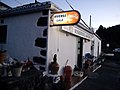
 D00 313 Pensión Berlin.jpg 2,592 × 1,944; 1.03 MB
-
 D00 314 Verbotsschild.jpg 2,592 × 1,944; 976 KB
-
 D00 315 Barranco de las Angustias.jpg 2,592 × 1,944; 1.79 MB
-
 D00 316 Galería Charco de las Ovejas.jpg 2,592 × 1,944; 1.77 MB
-
 D00 317 Stollenmundloch.jpg 1,944 × 2,592; 1.36 MB
-
 D00 318 Warnschild.jpg 2,592 × 1,944; 892 KB
-
 D00 320 Los Brecitos, Parkverbot.jpg 1,944 × 2,592; 1.94 MB
-
 D00 321 Weg Richtung Caldera.jpg 1,944 × 2,592; 1.85 MB
-
 D00 322 Calderarand, Pico de la Nieve.jpg 2,592 × 1,944; 1.6 MB
-
 D00 326 Los Brecitos, Wegende.jpg 1,944 × 2,592; 1.81 MB
-
 D00 327 Barranco de las Piedras redondas.jpg 2,592 × 1,944; 1.48 MB
-
 D00 328 Barranco de las Piedras redondas.jpg 1,944 × 2,592; 1.64 MB
-
 D00 329 Barranco de las Piedras redondas.jpg 1,944 × 2,592; 1.47 MB
-
 D00 330 Schild B.co de las Piedras redondas.jpg 1,944 × 2,592; 1.6 MB
-
 D00 331 sendero PR LP 13.jpg 1,944 × 2,592; 2.19 MB
-
 D00 332 Mirador del Lomo de Tagasaste.jpg 2,592 × 1,944; 2.07 MB
-
 D00 333 Mirador del Lomo de Tagasaste.jpg 2,592 × 1,944; 1.79 MB
-
 D00 334 Pico Bejenado.jpg 2,592 × 1,944; 1.18 MB
-
 D00 335 Streckenwegweiser.jpg 2,592 × 1,944; 1.01 MB
-
 D00 337 Mirador del Lomo de Tagasaste.jpg 2,592 × 1,944; 1.52 MB
-
 D00 338 Streckenwegweiser.jpg 2,592 × 1,944; 1.63 MB
-
 D00 339 Barranco del Ciempies.jpg 1,944 × 2,592; 1.71 MB
-
 D00 340 Wegende Los Brecitos.jpg 1,944 × 2,592; 1.7 MB
-
 D00 341 Plaza de Glorieta.jpg 2,592 × 1,944; 1.81 MB
-
 D00 342 Plaza de Glorieta.jpg 2,592 × 1,944; 1.59 MB
-
 D00 343 Plaza de Glorieta.jpg 2,592 × 1,944; 2.16 MB
-
 D00 344 Plaza de Glorieta.jpg 2,592 × 1,944; 1.35 MB
-
 D00 345 Plaza de Glorieta.jpg 1,944 × 2,592; 1.47 MB
-
 D00 346 Plaza de Glorieta.jpg 2,592 × 1,944; 2.13 MB
-
 D00 347 Plaza de Glorieta.jpg 2,592 × 1,944; 1.47 MB
-
 D00 348 Fruchtstände.jpg 2,592 × 1,944; 999 KB
-
 D00 349 Fruchtstände.jpg 1,944 × 2,592; 958 KB
-
 D00 350 Plaza de Glorieta, Fußboden.jpg 2,592 × 1,944; 1.74 MB
-
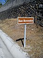 D00 351 Ortsschild San Borondón.jpg 1,944 × 2,592; 2.05 MB
-
 D00 352 Mirador El Time.jpg 2,592 × 1,944; 883 KB
-
 D00 354 Wanderweg GR-131.jpg 2,592 × 1,944; 1.13 MB
-
 D00 355 Bf Los Llanos, Drachenbaum.jpg 2,592 × 1,944; 1.81 MB
-
 D00 356 Drachenbaumfrüchte.jpg 2,592 × 1,944; 1.33 MB
-
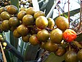 D00 357 Drachenbaumfrüchte.jpg 2,592 × 1,944; 996 KB
-
 D00 358 Drachenbaumkrone von innen.jpg 2,592 × 1,944; 1.18 MB
-
 I08 596 Barranco Rey Magdaletín.jpg 4,494 × 2,996; 6.69 MB
-
 I08 597 Barranco Rey Magdaletín.jpg 4,494 × 2,996; 7.28 MB
-
 I08 598 Abbruchkante.jpg 4,494 × 2,996; 6.51 MB
-
 I08 599 Wegkehre.jpg 2,996 × 4,494; 6.83 MB
-
 I08 600 Barranco Rey Magdaletín, zweite Abbruchkante.jpg 2,996 × 4,494; 7.3 MB
-
 I08 601 Weg durch die Abbruchkante.jpg 4,494 × 2,996; 7.02 MB
-
 I08 602 Barranco Rey Magdaletín.jpg 2,996 × 4,494; 7.35 MB
-
 I08 603 Barranco Rey Magdaletín.jpg 2,996 × 4,494; 7.18 MB
-
 I08 604 Tafel sendero San Antonio del Monte – La Zarza.jpg 4,257 × 2,838; 5.03 MB
-
 I08 605 Barranco Rey Magdaletín.jpg 4,494 × 2,996; 6.92 MB
-
 I08 606 Barranco Rey Magdaletín.jpg 4,494 × 2,996; 6.42 MB
-
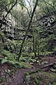
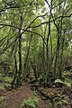 I08 607 kanarischer Lorbeerwald.jpg 2,996 × 4,494; 7.49 MB
-
 I08 608 Barranco Rey Magdalentín.jpg 4,494 × 2,996; 7.72 MB
-
 I08 609 Fuente La Vica.jpg 2,996 × 4,494; 6.57 MB
-
 I08 610 Fuente de los Dornajos.jpg 4,494 × 2,996; 7.23 MB
-
 I08 611 Barranco Fagundo.jpg 4,494 × 2,996; 5.43 MB
-
 I08 612 Barranco Fagundo.jpg 4,249 × 2,833; 6.19 MB
-
 I08 613 Barranco Fagundo.jpg 4,494 × 2,996; 5.62 MB
-
 I08 614 Don Pedro, El Tablado.jpg 4,494 × 2,996; 4.95 MB
-
 I08 615 Mirador de la Calzada.jpg 4,249 × 2,833; 6.16 MB
-
 I08 616 kanarische Gänsedistel.jpg 2,845 × 4,267; 4.16 MB
-
 I08 617 Strelizien.jpg 2,833 × 4,249; 3.6 MB
-
 I08 618 Mirador de la Calzada.jpg 4,293 × 2,862; 6.43 MB
-
 I08 619 Barranco Fagundo.jpg 4,494 × 2,996; 6.22 MB
-
 I08 620 Drachenbäume.jpg 2,833 × 4,249; 6.19 MB
-
 I08 621 GR 130 Richtung El Tablado.jpg 2,996 × 4,494; 5.45 MB
-
 I08 622 Barranco Fagundo, Aufstieg.jpg 2,833 × 4,249; 6.15 MB
-
 I08 623 Aufstieg, El Tablado.jpg 4,398 × 2,848; 5.93 MB
-
 I08 624 Barranco Fagundo, GR 130.jpg 4,494 × 2,996; 7.98 MB
-
 I08 625 Terrassenreste.jpg 2,996 × 4,494; 6.7 MB
-
 I08 626 Drachenbäume.jpg 4,249 × 2,833; 6.4 MB
-
 I08 628 Barranco Fagundo.jpg 2,996 × 4,494; 5.47 MB
-
 I08 629 Barranco Fagundo.jpg 2,996 × 4,494; 6.12 MB
-
 I08 630 Barranco Fagundo, Talgrund.jpg 2,996 × 4,494; 5.39 MB
-
 I08 631 Barranco Fagundo, Talgrund.jpg 2,996 × 4,494; 6.51 MB
-
 I08 633 Barranco Fagundo.jpg 2,996 × 4,494; 6.75 MB
-
 I08 634 Nordküste.jpg 2,996 × 4,494; 4.53 MB
-
 I08 635 La Fajana.jpg 2,833 × 4,249; 4.58 MB
-
 I08 636 Drachenbaum.jpg 2,845 × 4,267; 5.82 MB
-
 I08 637 Drachenbaum.jpg 4,494 × 2,996; 5.69 MB
-
 I08 638 El Tablado.jpg 4,494 × 2,996; 6.72 MB
-
 I08 639 Drachenbaum.jpg 2,833 × 4,249; 7.09 MB
-
 I08 659 Barranco del Ciempies.jpg 2,956 × 4,434; 7.61 MB
-
 I08 660 Barranco de las Cañeras.jpg 2,996 × 4,494; 6.92 MB
-
 I08 661 Barranco de las Angustias.jpg 4,249 × 2,833; 3.77 MB
-
 I08 662 Barranco de las Angustias.jpg 2,862 × 4,293; 5.7 MB
-
 I08 663 sendero PR LP 13.jpg 2,996 × 4,494; 7.26 MB
-
 I08 664 Caldera de Taburiente.jpg 2,996 × 4,494; 6.29 MB
-
 I08 665 Konglomeratgestein.jpg 4,434 × 2,956; 6.62 MB
-
 I08 667 Caldera de Taburiente, Cumbrecita.jpg 4,494 × 2,996; 4.8 MB
-
 I08 668 Cumbrecita.jpg 4,494 × 2,996; 4.37 MB
-
 I08 669 Caldera de Taburiente.jpg 2,996 × 4,494; 5.37 MB
-
 I08 670 Caldera de Taburiente.jpg 2,833 × 4,249; 5.51 MB
-
 I08 671 sendero PR LP 13.jpg 2,996 × 4,494; 7.48 MB
-
 I08 672 Caldera de Taburiente.jpg 4,494 × 2,996; 6.02 MB
-
 I08 673 Playa de Taburiente.jpg 4,494 × 2,996; 8.06 MB
-
 I08 674 Playa de Taburiente.jpg 4,494 × 2,996; 6 MB
-
 I08 675 Playa de Taburiente.jpg 4,357 × 2,905; 5.59 MB
-
 I08 676 Playa de Taburiente.jpg 4,434 × 2,956; 6.18 MB
-
 I08 677 Besucherzentrum.jpg 4,434 × 2,956; 7.23 MB
-
 I08 678 Río Taburiente.jpg 2,996 × 4,494; 5.56 MB
-
 I08 679 Río Almendro amargo.jpg 2,996 × 4,494; 6.38 MB
-
 I08 680 Roque Idafe.jpg 2,833 × 4,249; 4.14 MB
-
 I08 681 Río Almendro amargo.jpg 2,862 × 4,293; 6.15 MB
-
 I08 682 Roque Idafe.jpg 2,886 × 4,329; 5.19 MB
-
 I08 683 Roque Idafe.jpg 2,833 × 4,249; 3.75 MB
-
 I08 684 Roque Idafe.jpg 2,833 × 4,249; 4.99 MB
-
 I08 685 El Reventón.jpg 2,996 × 4,494; 7.34 MB
-
 I08 686 Río Almendro amargo.jpg 2,996 × 4,494; 6.72 MB
-
 I08 687 Roque Idafe.jpg 2,905 × 4,357; 5.79 MB
-
 I08 688 Río Almendro amargo.jpg 2,833 × 4,249; 6.36 MB
-
 I08 689 El Reventón.jpg 4,494 × 2,996; 6.23 MB
-
 I08 690 Dos Aguas.jpg 4,494 × 2,996; 6.88 MB
-
 I08 691 Dos Aguas, Wasserfassung.jpg 4,494 × 2,996; 7.48 MB
-
 I08 692 Barranco de las Angustias.jpg 2,996 × 4,494; 6.43 MB
-
 I08 693 la Estrechura, Wasserfassung.jpg 4,494 × 2,996; 8.25 MB
-
 I08 694 Wasserfassung.jpg 4,249 × 2,833; 6.24 MB
-
 I08 695 La Estrechura.jpg 2,833 × 4,249; 6.67 MB
-
 I08 697 La Estrechura, Seitental.jpg 2,996 × 4,494; 6.4 MB
-
 I08 698 Kanalbrücke.jpg 4,494 × 2,996; 6.07 MB
-
 I08 699 Salto de la Estrechura.jpg 2,996 × 4,494; 5.02 MB
-
 I08 700 Salto de la Estrechura.jpg 4,494 × 2,996; 6.09 MB
-
 I08 701 Salto de la Estrechura.jpg 2,996 × 4,494; 4.47 MB
-
 I08 702 Salto de la Estrechura.jpg 2,996 × 4,494; 5.04 MB
-
 I08 703 Salto de la Estrechura.jpg 4,494 × 2,996; 5.83 MB
-
 I08 704 Rast am Salto de la Estrechura.jpg 2,833 × 4,249; 3.53 MB
-
 I08 705 Barranco de las Angustias.jpg 4,494 × 2,996; 6.46 MB
-
 I08 706 Barranco de las Angustias.jpg 4,494 × 2,996; 6.34 MB
-
 I08 707 Barranco de las Angustias.jpg 4,249 × 2,833; 6.65 MB
-
 I08 708 Barranco de las Angustias.jpg 4,494 × 2,996; 6.73 MB
-
 I08 709 Allradbus.jpg 4,257 × 2,838; 3.84 MB
-
 I08 710 Eisansatz.jpg 4,293 × 2,862; 4.46 MB
-
 I08 711 »Ruta de los Volcanes«.jpg 2,886 × 4,329; 4.3 MB
-
 I08 712 Abzw Nambroque.jpg 4,494 × 2,996; 4.26 MB
-
 I08 713 Vulkanroutenwegweiser (2).jpg 4,494 × 2,996; 5.1 MB
-
 I08 714 Aschefeld.jpg 4,434 × 2,956; 5.06 MB
-
 I08 715 Vulkanaschefeld.jpg 4,494 × 2,996; 6.29 MB
-
 I08 716 Abstieg von der Montaña Bermejales.jpg 4,494 × 2,996; 6.03 MB
-
 I08 717 Volcán de San Martín.jpg 4,494 × 2,996; 4.75 MB
-
 I08 718 Volcán de San Martín.jpg 4,249 × 2,833; 2.89 MB
-
 I08 719 Montaña Cabrera.jpg 4,434 × 2,956; 5.46 MB
-
 I08 720 Montaña Cabrera.jpg 4,249 × 2,833; 4.7 MB
-
 I08 721 Montaña de los Faros.jpg 4,357 × 2,905; 5.01 MB
-
 I08 722 Volcán de San Martín.jpg 4,494 × 2,996; 5.68 MB
-
 I08 723 Volcán de San Martín, cráter.jpg 4,494 × 2,996; 5.73 MB
-
 I08 724 Volcán de San Martín, Krater.jpg 4,494 × 2,996; 5.84 MB
-
 I08 725 Volcán de San Martín.jpg 4,494 × 2,996; 5.07 MB
-
 I08 726 Fuencaliente.jpg 4,249 × 2,833; 4.24 MB
-
 I08 727 Südspitze.jpg 4,494 × 2,996; 5.15 MB
-
 I08 728 Volcán de San Martín, Krater.jpg 4,494 × 2,996; 5.09 MB
-
 I08 729 Volcán de San Martín, Faro La Salamera.jpg 4,494 × 2,996; 6.45 MB
-
 I08 730 Montaña de Cabrera.jpg 4,494 × 2,996; 6.25 MB
-
 I08 731 Volcán de San Martín.jpg 4,494 × 2,996; 6.03 MB
-
 I08 732 Faro de Arenas Blancas.jpg 4,249 × 2,833; 5.39 MB
-
 I08 733 Vulkanhöhlen-Einbrüche.jpg 4,249 × 2,833; 8.89 MB
-
 I08 734 Einbruchstelle.jpg 2,956 × 4,434; 7.43 MB
-
 I08 735 Abzw Fuente del Tión.jpg 4,494 × 2,996; 5.49 MB
-
 I08 736 Montaña de los Faros.jpg 4,494 × 2,996; 6.64 MB
-
 I08 737 Montaña Peleada.jpg 4,434 × 2,956; 5.31 MB
-
 I08 738 Montaña Peleada.jpg 4,494 × 2,996; 4.63 MB
-
 I08 739 Volcán de San Martín.jpg 4,494 × 2,996; 5.83 MB
-
 I08 740 Volcán de San Martín.jpg 4,357 × 2,905; 5.33 MB
-
 I08 741 lava del Volcán de San Martín.jpg 4,494 × 2,996; 5.74 MB
-
 I08 743 lava del Volcán de San Martín.jpg 4,249 × 2,833; 5.11 MB
-
 I08 745 pinos canarios.jpg 4,494 × 2,996; 5.3 MB
-
 I08 746 pinos canarios, Brandspuren.jpg 4,494 × 2,996; 6.93 MB
-
 I08 747 Ruta de los Volcanes.jpg 4,494 × 2,996; 4.45 MB
-
 I08 748 Holperpfad.jpg 2,833 × 4,249; 5.9 MB
-
 I08 749 iglesia de San Antonio Abad.jpg 1,974 × 3,583; 2.04 MB


.jpg)


