Category:Featured maps
Jump to navigation
Jump to search
Wikimedia category | |||||
| Upload media | |||||
| Instance of | |||||
|---|---|---|---|---|---|
| |||||
Pages in category "Featured maps"
This category contains only the following page.
Media in category "Featured maps"
The following 71 files are in this category, out of 71 total.
-
 1375 Atlas Catalan Abraham Cresques.jpg 11,811 × 3,850; 23.67 MB
-
 1580 Lucas Janszoon Waghenaer Carte de l'ouest de la bretagne.jpg 6,312 × 4,208; 16.89 MB
-
 1794 Samuel Dunn Wall Map of the World in Hemispheres - Geographicus - World2-dunn-1794.jpg 6,000 × 5,054; 8.92 MB
-
 Abkhazia map-fr.svg 945 × 737; 813 KB
-
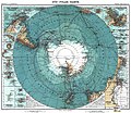 Antarctica 1912 edit.jpg 4,940 × 4,296; 17.94 MB
-
 Bartolomeu Velho 1568.jpg 3,255 × 2,402; 6.21 MB
-
 Batalla-ter.jpg 8,367 × 6,167; 16.56 MB
-
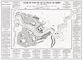 Btv1b530849639 plan du port et de la ville de Brest 1855 restored.jpg 9,526 × 6,928; 42.49 MB
-
 1581 Bunting clover leaf map.jpg 4,441 × 3,496; 14.36 MB
-
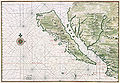 California island Vinckeboons5.jpg 8,359 × 5,800; 39.02 MB
-
 Carte de Brest - ca 1700 - Bibliothèque Nationale de France - Btv1b8439976x.jpg 4,948 × 3,624; 12.86 MB
-
 Carte du cours du Rhône de Genève à Lyon - 1787.jpg 5,823 × 6,096; 17.78 MB
-
 Caspar Merian, Paris wie solche Ao. 1620 im wessen gestanden, 1655 - David Rumsey.jpg 11,395 × 8,724; 87.01 MB
-
 Claude Bernou Carte de lAmerique septentrionale.jpg 3,841 × 3,641; 5.86 MB
-
 Corsica-geographic map-fr.svg 2,200 × 4,030; 14.15 MB
-
 CzechRepublic-geographic map-en.svg 1,949 × 1,200; 14.56 MB
-
 Daedongyeojido-full.jpg 17,837 × 30,000; 99.08 MB
-
 De Fer Trier 1692.jpg 7,101 × 5,168; 30.14 MB
-
 Delaware Bay Vinckeboons 14.jpg 8,382 × 5,888; 34.25 MB
-
 EB&EC Kellogg Brothers, Illustrative Map of Human Life, 1847 Cornell CUL PJM 1054 01.jpg 3,086 × 4,295; 4.39 MB
-
 Ethel Franklin Betts, Save the Survivors, 1918 Cornell CUL PJM 2029 01.jpg 4,000 × 3,029; 2.1 MB
-
 Ethnographic map of austrian monarchy czoernig 1855.jpg 7,997 × 5,862; 23.73 MB
-
 Florida topographic map-en.svg 2,890 × 2,810; 2.51 MB
-
 Georgin François, The 3 Roads to Eternity, 1825 Cornell CUL PJM 1040 01.jpg 5,000 × 3,318; 5.34 MB
-
 Henry Mayer, The Awakening, 1915 Cornell CUL PJM 1176 01 - Restoration.jpg 9,045 × 6,003; 36.57 MB
-
 Hispaniola Vinckeboons4.jpg 8,594 × 6,055; 32.07 MB
-
 How The Public Domain Has Been Squandered 1884 Cornell CUL PJM 1088.jpg 6,600 × 9,300; 12.12 MB
-
 IAN 0134 Bellin 1797 Ionian Sea.jpg 2,977 × 3,882; 12.03 MB
-
-

-
 Jorge Aguiar 1492 MR.jpg 5,016 × 3,878; 13.06 MB
-
 Kunyu Wanguo Quantu (坤輿萬國全圖).jpg 11,726 × 5,266; 16.75 MB
-
 Map of Europe, 1946 (25289557032).jpg 5,367 × 4,017; 3.32 MB
-
 Map of Hindoostan, 1788, by Rennell.jpg 14,638 × 12,501; 67.82 MB
-
 Map of Paris by Claes Jansz. Visscher - Harold B. Lee Library.jpg 20,207 × 13,139; 43.36 MB
-
 Michelangelo Caetani, Overview of the Divine Comedy, 1855 Cornell CUL PJM 1071 01.jpg 4,748 × 6,391; 5.64 MB
-
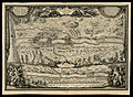
 Mortier, Situation du Paradise Terrestre, 1700 Cornell CUL PJM 1014 01.jpg 8,818 × 7,844; 7.87 MB
-
 Moxon A Map of the Earth 1681 Cornell CUL PJM 1012 01.jpg 8,940 × 7,127; 8.96 MB
-
 New York state geographic map-en.svg 2,811 × 2,000; 18.34 MB
-

-
 Plan de Paris en 1657.JPG 5,500 × 4,605; 17.62 MB
-
 Plan et vue du port ville et chateau de Brest ca 1700.jpg 5,752 × 7,822; 34.75 MB
-
 Public Roads of the contiguous United States, from the 2018 TIGER GIS dataset.png 16,668 × 10,249; 138.99 MB
-
 Roussel, Paris, ses fauxbourgs et ses environs, 1731.jpg 28,638 × 20,658; 597.61 MB
-
 Sitting Leo Belgicus - Visscher.jpg 3,500 × 2,886; 3.36 MB
-
 The seat of war in the West Indies 1740.jpg 7,522 × 6,504; 11.88 MB
-
 Turgot map of Paris - Norman B. Leventhal Map Center.jpg 35,690 × 28,030; 853.45 MB
-
 Turgot map of Paris, general map - Norman B. Leventhal Map Center.jpg 9,080 × 6,920; 35.34 MB
-
 Turgot map of Paris, sheet 1 - Norman B. Leventhal Map Center.jpg 9,070 × 5,540; 37.27 MB
-
 Turgot map of Paris, sheet 10 - Norman B. Leventhal Map Center.jpg 8,950 × 5,710; 40.9 MB
-
 Turgot map of Paris, sheet 11 - Norman B. Leventhal Map Center.jpg 8,980 × 5,710; 38.94 MB
-
 Turgot map of Paris, sheet 12 - Norman B. Leventhal Map Center.jpg 9,050 × 5,710; 43.96 MB
-
 Turgot map of Paris, sheet 13 - Norman B. Leventhal Map Center.jpg 9,070 × 5,680; 42.51 MB
-
 Turgot map of Paris, sheet 14 - Norman B. Leventhal Map Center.jpg 8,950 × 5,680; 45.44 MB
-
 Turgot map of Paris, sheet 15 - Norman B. Leventhal Map Center.jpg 8,980 × 5,680; 45.25 MB
-
 Turgot map of Paris, sheet 16 - Norman B. Leventhal Map Center.jpg 9,050 × 5,680; 42.53 MB
-
 Turgot map of Paris, sheet 17 - Norman B. Leventhal Map Center.jpg 9,070 × 5,850; 49.27 MB
-
 Turgot map of Paris, sheet 18-19 - Norman B. Leventhal Map Center.jpg 17,930 × 5,850; 74.54 MB
-
 Turgot map of Paris, sheet 2 - Norman B. Leventhal Map Center.jpg 8,950 × 5,540; 36.87 MB
-
 Turgot map of Paris, sheet 20 - Norman B. Leventhal Map Center.jpg 9,050 × 5,850; 37.82 MB
-
 Turgot map of Paris, sheet 3 - Norman B. Leventhal Map Center.jpg 8,980 × 5,540; 41.28 MB
-
 Turgot map of Paris, sheet 4 - Norman B. Leventhal Map Center.jpg 9,050 × 5,540; 43.95 MB
-
 Turgot map of Paris, sheet 5 - Norman B. Leventhal Map Center.jpg 9,070 × 5,730; 47.97 MB
-
 Turgot map of Paris, sheet 6 - Norman B. Leventhal Map Center.jpg 8,950 × 5,730; 42.4 MB
-
 Turgot map of Paris, sheet 7 - Norman B. Leventhal Map Center.jpg 8,980 × 5,730; 38.57 MB
-
 Turgot map of Paris, sheet 8 - Norman B. Leventhal Map Center.jpg 9,050 × 5,730; 41.57 MB
-
 Turgot map of Paris, sheet 9 - Norman B. Leventhal Map Center.jpg 9,070 × 5,710; 42.68 MB
-
 Victor Gillam A Thing Well Begun Is Half Done 1899 Cornell CUL PJM 1136 01.jpg 4,000 × 2,593; 2.64 MB
-
 Visscher Die Gelegenheit Des Paradeis 1665 Cornell CUL PJM 2004 01.jpg 8,029 × 6,295; 7.58 MB
-
 Waldseemuller map 2.jpg 13,708 × 7,590; 19.65 MB
-
 Wright The Journey of Life 1775 Cornell CUL PJM 1025 01.jpg 5,112 × 8,549; 8.46 MB


.jpg)
.jpg)


