Category:Farningham
Jump to navigation
Jump to search
English: Farningham is a village and civil parish in the Sevenoaks District of Kent, England. The parish is located on the River Darent, south of Dartford with a population of about 1250 people. The M20 motorway and the A20 road both pass through the parish.
village in Kent, England, UK  | |||||
| Upload media | |||||
| Instance of | |||||
|---|---|---|---|---|---|
| Location | Sevenoaks, Kent, South East England, England | ||||
| Said to be the same as | Farningham (Wikimedia duplicated page, civil parish) | ||||
 | |||||
Subcategories
This category has the following 6 subcategories, out of 6 total.
F
- Farningham cattle screen (13 F)
M
- Mill House, Farningham (3 F)
O
- Oasts in Farningham (3 F)
P
- St Peter and St Paul, Farningham (14 F)
- Pied Bull, Farningham (2 F)
W
- The Water Mill, Farningham (3 F)
Media in category "Farningham"
The following 200 files are in this category, out of 291 total.
(previous page) (next page)-
 10th Tee of Pedham Place Golf Centre - geograph.org.uk - 1302822.jpg 640 × 480; 51 KB
-
 5 ^ 6, High St - geograph.org.uk - 3535306.jpg 640 × 430; 75 KB
-
 7, High St - geograph.org.uk - 3535308.jpg 640 × 430; 65 KB
-
 A blooming,terrace - geograph.org.uk - 1706333.jpg 1,417 × 945; 1.7 MB
-
 A view of Farningham from Folly Hill - geograph.org.uk - 1302739.jpg 640 × 360; 57 KB
-
 A20 from near Gabrielspring Road - geograph.org.uk - 3175972.jpg 4,000 × 3,000; 3.91 MB
-
 A20 over the River Darent - geograph.org.uk - 3526006.jpg 640 × 430; 89 KB
-

-
 A20 south near Farningham - geograph.org.uk - 3204689.jpg 2,560 × 1,920; 1.7 MB
-
 Airman's Memorial - geograph.org.uk - 1236137.jpg 480 × 640; 144 KB
-
 Alaska the Bald Eagle at Eagle Heights - geograph.org.uk - 360183.jpg 640 × 480; 122 KB
-
 Alchin's Wood from Donkey Lane - geograph.org.uk - 3175939.jpg 4,000 × 3,000; 4.29 MB
-
 An old lampstandard - geograph.org.uk - 3535359.jpg 430 × 640; 93 KB
-
 Approach to Farningham Wood - geograph.org.uk - 3175112.jpg 4,000 × 3,000; 4.48 MB
-

-
 Barn in the middle of Maplescombe Lane - geograph.org.uk - 4426735.jpg 2,560 × 1,920; 2.12 MB
-
 Beesfield Lane - geograph.org.uk - 3175961.jpg 4,000 × 3,000; 4.03 MB
-
 Beesfield Lane, Farningham - geograph.org.uk - 1706180.jpg 2,048 × 1,536; 1,003 KB
-
 Beesfield Lane, Farningham - geograph.org.uk - 4428190.jpg 2,560 × 1,920; 1.26 MB
-
 Beesfield Lane, Farningham - geograph.org.uk - 4897499.jpg 3,264 × 2,448; 1.75 MB
-
 Beesfield Lane, near Farningham - geograph.org.uk - 1706184.jpg 2,048 × 1,536; 1.1 MB
-
 Bend, Darenth Valley Path - geograph.org.uk - 3525928.jpg 640 × 430; 114 KB
-

-
 Bridge Cottage and Mill Cottages, Farningham.jpg 4,032 × 3,024; 4.46 MB
-
 Bridge Cottage ^ Mill Cottage - geograph.org.uk - 3526120.jpg 640 × 430; 71 KB
-
 Bridge over the M20 Motorway - geograph.org.uk - 3604429.jpg 4,608 × 2,966; 2.51 MB
-
 Bridge over the River Darent, Farningham - geograph.org.uk - 3160514.jpg 4,000 × 3,000; 4.25 MB
-
 Button Street - geograph.org.uk - 3040240.jpg 640 × 427; 75 KB
-
 Button Street - geograph.org.uk - 3175114.jpg 4,000 × 3,000; 4.28 MB
-
 Button Street, near Swanley Village - geograph.org.uk - 1640980.jpg 640 × 480; 54 KB
-
 Byway in Farningham Woods - geograph.org.uk - 5074697.jpg 1,600 × 1,200; 975 KB
-
 Calfstock Lane - geograph.org.uk - 3164204.jpg 4,000 × 3,000; 4.22 MB
-
 Calfstock Lane and Farningham Woods - geograph.org.uk - 3164208.jpg 4,000 × 3,000; 4.24 MB
-
 Calfstock Lane, Farningham - geograph.org.uk - 1706175.jpg 2,048 × 1,536; 1.29 MB
-
 Calfstock Lane, near Farningham - geograph.org.uk - 4897667.jpg 3,264 × 2,448; 2.62 MB
-

-
 Cattle screen on River Darent, Farningham - geograph.org.uk - 5391036.jpg 1,600 × 1,200; 785 KB
-
 Cherry Tree Cottage, Owl Cottage, Farningham Butchers - High St, Farningham.jpg 4,032 × 3,024; 5.12 MB
-
 Cherry ^ Owl Cottages - geograph.org.uk - 3526140.jpg 640 × 430; 74 KB
-

-
 Cleared area in Farningham Woods - geograph.org.uk - 5074717.jpg 1,600 × 1,067; 700 KB
-
 Coppiced area in Farningham Woods - geograph.org.uk - 1302780.jpg 640 × 480; 124 KB
-
 Cottage on the Hill - geograph.org.uk - 3535360.jpg 640 × 430; 75 KB
-
 Cottage, High St - geograph.org.uk - 3535313.jpg 640 × 430; 69 KB
-
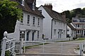
 Cottages at Farningham, Kent - geograph.org.uk - 2270145.jpg 800 × 542; 252 KB
-
 Course crossing point, Gorse Hill - geograph.org.uk - 3127607.jpg 640 × 427; 88 KB
-
 Darent Valley Path - geograph.org.uk - 3525958.jpg 640 × 430; 94 KB
-
 Darent Valley Path - geograph.org.uk - 3526044.jpg 640 × 430; 116 KB
-
 Darent Valley Path - geograph.org.uk - 3526050.jpg 640 × 430; 125 KB
-
 Darent Valley Path by the River Darent - geograph.org.uk - 3525951.jpg 640 × 430; 106 KB
-

-

-
 Dartford Rd - geograph.org.uk - 3526149.jpg 640 × 430; 70 KB
-
 Dartford Road, Farningham - geograph.org.uk - 1582843.jpg 640 × 480; 68 KB
-
 Dartford Road, Farningham - geograph.org.uk - 1582856.jpg 640 × 480; 52 KB
-
 Dartford Road, Farningham - geograph.org.uk - 4897648.jpg 3,264 × 2,448; 1.91 MB
-
 Dartford Road, Farningham - geograph.org.uk - 4897649.jpg 3,264 × 2,448; 1.64 MB
-
 Dartford Road, near Farningham - geograph.org.uk - 4897656.jpg 3,264 × 2,448; 2.24 MB
-
 Disused car park, Farningham Woods - geograph.org.uk - 2073451.jpg 640 × 428; 107 KB
-
 Doing a Bee's Job^ - geograph.org.uk - 191177.jpg 640 × 426; 87 KB
-
 Donkey Lane, near Farningham - geograph.org.uk - 1706186.jpg 640 × 480; 45 KB
-
 Eddie Stobart lorry, jct3 on the M25 - geograph.org.uk - 5445353.jpg 2,304 × 1,728; 876 KB
-
 Eddie Stobart trailer, jct3 on the M25 - geograph.org.uk - 5445352.jpg 2,304 × 1,728; 832 KB
-
 Electricity pylons - geograph.org.uk - 6126798.jpg 768 × 1,024; 151 KB
-
 Eynsford Road, Farningham - geograph.org.uk - 4897506.jpg 3,264 × 2,448; 1.93 MB
-

-
 Farmland by the M20 - geograph.org.uk - 3525946.jpg 640 × 430; 96 KB
-
 Farmland in the Darent Valley - geograph.org.uk - 3535377.jpg 640 × 430; 92 KB
-
 Farmland near Farningham - geograph.org.uk - 3525981.jpg 640 × 430; 71 KB
-
 Farningham - The Mount (geograph 7529874).jpg 2,553 × 3,139; 4.61 MB
-
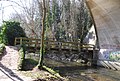
 Farningham Bridge - geograph.org.uk - 3526108.jpg 640 × 430; 90 KB
-
 Farningham Butchers' Shop - geograph.org.uk - 3526145.jpg 640 × 430; 78 KB
-
 Farningham Cattle Screen - geograph.org.uk - 4300211.jpg 640 × 480; 120 KB
-
 Farningham Corn Mill - geograph.org.uk - 1295517.jpg 640 × 480; 75 KB
-
 Farningham High Street - geograph.org.uk - 5391020.jpg 1,600 × 1,200; 513 KB
-
 Farningham Hill Road - geograph.org.uk - 3803211.jpg 1,024 × 768; 217 KB
-
 Farningham Shopfront - geograph.org.uk - 2206742.jpg 1,052 × 671; 446 KB
-
 Farningham Village - geograph.org.uk - 1298397.jpg 640 × 480; 94 KB
-
 Farningham Village - geograph.org.uk - 1298421.jpg 480 × 640; 51 KB
-
 Farningham Village Hall - geograph.org.uk - 1397626.jpg 640 × 480; 105 KB
-
 Farningham Village Sign - geograph.org.uk - 4897517.jpg 2,448 × 3,264; 1.89 MB
-
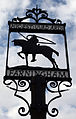 Farningham village sign.jpg 2,157 × 3,378; 1.49 MB
-
 Farningham Wood Nature Reserve - geograph.org.uk - 1302799.jpg 640 × 480; 64 KB
-
 Farningham Woods - geograph.org.uk - 1706171.jpg 2,048 × 1,536; 1.31 MB
-
 Farningham Woods Information Sign - geograph.org.uk - 1302762.jpg 640 × 480; 103 KB
-
 Farningham Woods Map - geograph.org.uk - 1706173.jpg 2,048 × 1,536; 1.29 MB
-
 Farningham, The Lion.jpg 5,049 × 3,787; 3.44 MB
-

-
 Field by Farningham Woods - geograph.org.uk - 2073453.jpg 640 × 428; 85 KB
-
 Fields behind Franks Farm - geograph.org.uk - 2073553.jpg 640 × 428; 103 KB
-
 Footbridge goes over the M20 - geograph.org.uk - 4067762.jpg 1,600 × 1,200; 992 KB
-
 Footbridge over M20 - geograph.org.uk - 6316496.jpg 1,024 × 576; 87 KB
-
 Footbridge, River Darent - geograph.org.uk - 3526013.jpg 640 × 430; 114 KB
-
 Footpath in Farningham Woods - geograph.org.uk - 3202338.jpg 4,288 × 3,216; 3.75 MB
-
 Footpath next to the M20 - geograph.org.uk - 3175978.jpg 4,000 × 3,000; 3.97 MB
-
 Ford, River Darent - geograph.org.uk - 3525963.jpg 640 × 430; 130 KB
-
 Former Ford at Farningham - geograph.org.uk - 3742517.jpg 3,872 × 2,592; 4.84 MB
-
 Gantry over the M20 - geograph.org.uk - 3604431.jpg 4,463 × 2,792; 2.31 MB
-
 Gardeners Cottage (geograph 6570373).jpg 1,024 × 684; 207 KB
-
 Gorse Hill (A20), Farningham - geograph.org.uk - 1352164.jpg 640 × 480; 77 KB
-
 Gorse Hill (A20), Farningham - geograph.org.uk - 1633528.jpg 640 × 480; 56 KB
-
 Gorse Hill (A20), Farningham - geograph.org.uk - 1633533.jpg 640 × 480; 54 KB
-
 Gorse Hill - geograph.org.uk - 3127599.jpg 640 × 427; 75 KB
-
 Gorse Hill meets London Road, Farningham - geograph.org.uk - 2889347.jpg 1,600 × 1,200; 597 KB
-
 Gorsehill Nursery on the A20 - geograph.org.uk - 324213.jpg 640 × 428; 87 KB
-
 Hampton Court House - geograph.org.uk - 3535337.jpg 640 × 430; 44 KB
-
 High St - geograph.org.uk - 3526136.jpg 640 × 430; 96 KB
-
 High St, Farningham.jpg 4,032 × 3,024; 5.16 MB
-
 High Street Farningham - geograph.org.uk - 4426776.jpg 2,560 × 1,920; 2.01 MB
-
 High Street, Farningham - geograph.org.uk - 1387306.jpg 640 × 480; 114 KB
-
 High Street, Farningham - geograph.org.uk - 1388734.jpg 640 × 480; 109 KB
-
 High Street, Farningham - geograph.org.uk - 1388739.jpg 640 × 480; 100 KB
-
 High Street, Farningham - geograph.org.uk - 4897493.jpg 3,264 × 2,448; 2.91 MB
-
 High Street, Farningham - geograph.org.uk - 4897495.jpg 3,264 × 2,448; 1.91 MB
-
 High Street, Farningham - geograph.org.uk - 4897515.jpg 3,264 × 2,448; 2.15 MB
-
 High Street, Farningham - geograph.org.uk - 4897527.jpg 3,264 × 2,448; 1.54 MB
-
 Horton Way, Farningham - geograph.org.uk - 4897509.jpg 3,264 × 2,448; 2.06 MB
-
 House, Sparepenny Lane - geograph.org.uk - 3535314.jpg 640 × 430; 101 KB
-
 Houses along London Road from the A20, Farningham - geograph.org.uk - 2889346.jpg 1,600 × 1,200; 501 KB
-
 Houses in the Darent Valley - geograph.org.uk - 3535375.jpg 640 × 430; 74 KB
-
 July mx 2004 no003 martin guilford and colin dunkley 01 jamie clarke.jpg 933 × 853; 234 KB
-
 Junction 3, M25 (A20) - geograph.org.uk - 2735330.jpg 640 × 430; 61 KB
-
 Junction 3, M25 (M20) - geograph.org.uk - 2735325.jpg 640 × 430; 59 KB
-
 Junction 3, M25 - geograph.org.uk - 3729722.jpg 640 × 515; 51 KB
-
 Junction of Button Street and London Road, Swanley - geograph.org.uk - 2888834.jpg 1,600 × 1,200; 488 KB
-
 Junction3, M25 - geograph.org.uk - 3004483.jpg 800 × 600; 67 KB
-
 Layby on the A20 London Road, Farningham - geograph.org.uk - 2889349.jpg 1,600 × 1,200; 581 KB
-
 Layby on the A20 London Road, Farningham - geograph.org.uk - 2889350.jpg 1,600 × 1,200; 524 KB
-
 Lion Cottages, Farningham 01.jpg 4,032 × 3,024; 4.15 MB
-
 Lion Cottages, Farningham 02.jpg 4,032 × 3,024; 4.42 MB
-
 Lion Hotel - geograph.org.uk - 3526092.jpg 640 × 409; 74 KB
-
 Lion Hotel, Farningham - geograph.org.uk - 4897525.jpg 3,264 × 2,448; 2.02 MB
-
 Lion Hotel, Farningham 01.jpg 4,032 × 3,024; 5.42 MB
-
 Lion Hotel, Farningham 02.jpg 4,032 × 3,024; 4.62 MB
-
 Lion Hotel, Farningham 03.jpg 4,032 × 3,024; 5.17 MB
-
 London Road, Farningham - geograph.org.uk - 4897634.jpg 3,264 × 2,448; 2.16 MB
-
 London Road, Farningham - geograph.org.uk - 4897638.jpg 3,264 × 2,448; 1.65 MB
-
 London Road, Farningham - geograph.org.uk - 4897645.jpg 3,264 × 2,448; 2.02 MB
-
 London Road, near Farningham - geograph.org.uk - 4897640.jpg 3,264 × 2,448; 2.37 MB
-
 Looking across the A20, Farningham - geograph.org.uk - 2889345.jpg 1,600 × 1,200; 538 KB
-
 Looking to the woodland edge, Farningham Woods - geograph.org.uk - 5074709.jpg 1,600 × 1,200; 971 KB
-
 Looking towards the old mill Farningham - geograph.org.uk - 5391028.jpg 1,600 × 1,200; 279 KB
-
 M20 - geograph.org.uk - 2735335.jpg 640 × 430; 70 KB
-
 M20 - geograph.org.uk - 3729727.jpg 640 × 430; 51 KB
-
 M20 bridge over the River Darent - geograph.org.uk - 3525975.jpg 640 × 430; 114 KB
-
 M20 from Button Street - geograph.org.uk - 3164225.jpg 4,000 × 3,000; 4 MB
-
 M20 from the Button Street bridge - geograph.org.uk - 3162787.jpg 4,000 × 3,000; 3.89 MB
-
 M20 from the Button Street bridge - geograph.org.uk - 3164234.jpg 4,000 × 3,000; 4.04 MB
-
 M20 near Swanley - geograph.org.uk - 3803207.jpg 1,024 × 768; 149 KB
-
 M20 on an embankment - geograph.org.uk - 3525933.jpg 640 × 430; 60 KB
-
 M20 towards the Darent Valley - geograph.org.uk - 3175915.jpg 4,000 × 3,000; 4.03 MB
-
 M20 westbound - geograph.org.uk - 4231732.jpg 640 × 452; 37 KB
-
 M20 westbound - geograph.org.uk - 4231733.jpg 640 × 480; 47 KB
-
 M20, Button Street Bridge - geograph.org.uk - 3708851.jpg 640 × 480; 216 KB
-
 M20, Southbound - geograph.org.uk - 3708856.jpg 640 × 480; 215 KB
-
 M20, Swanley Interchange - geograph.org.uk - 3708812.jpg 640 × 480; 245 KB
-
 M20-M25 Interchange at Swanley - geograph.org.uk - 3708820.jpg 640 × 480; 235 KB
-
 M20-M25 slip road - geograph.org.uk - 3803205.jpg 1,024 × 768; 198 KB
-
 M25, anti-clockwise - geograph.org.uk - 5724558.jpg 640 × 426; 57 KB
-
 M25, junction 3 (A20) - geograph.org.uk - 2028689.jpg 640 × 430; 131 KB
-
 M25, junction 3 (M20) - geograph.org.uk - 2028667.jpg 640 × 430; 125 KB
-
 Main Road Gorse Hill - geograph.org.uk - 3182896.jpg 4,000 × 3,000; 3.96 MB
-
 Main Road, Farningham - geograph.org.uk - 4897643.jpg 3,264 × 2,448; 1.68 MB
-
 Maplescombe Farm - geograph.org.uk - 3182949.jpg 4,000 × 3,000; 4.37 MB
-
 Maplescombe Farmhouse - geograph.org.uk - 1314980.jpg 640 × 480; 94 KB
-
 Maplescombe Lane - geograph.org.uk - 1706192.jpg 2,048 × 1,536; 919 KB
-
 Maplescombe Lane - geograph.org.uk - 3175946.jpg 4,000 × 3,000; 4.43 MB
-
 Maplescombe Lane - geograph.org.uk - 3175951.jpg 4,000 × 3,000; 4.24 MB
-
 Maplescombe Lane - geograph.org.uk - 3182957.jpg 4,000 × 3,000; 4.14 MB
-
 Maplescombe Lane, near Farningham - geograph.org.uk - 1706182.jpg 2,048 × 1,536; 1.05 MB
-
 Maplescombe Valley - geograph.org.uk - 3175928.jpg 4,000 × 3,000; 4.29 MB
-
 Maplescombe Valley - geograph.org.uk - 3183092.jpg 4,000 × 3,000; 4.2 MB
-
 Market Meadow, Farningham - geograph.org.uk - 3381318.jpg 4,320 × 3,240; 5.05 MB
-

-
 Motocross at Canada Heights - geograph.org.uk - 1236123.jpg 640 × 480; 94 KB
-

-
 Motorway flyover - geograph.org.uk - 3803231.jpg 1,024 × 768; 139 KB
-
 Motorway junction - geograph.org.uk - 4231735.jpg 640 × 480; 46 KB
-
 Motorway junction - geograph.org.uk - 4231736.jpg 640 × 431; 47 KB
-
 Motorway slip road - geograph.org.uk - 4231748.jpg 640 × 466; 54 KB
-
 Motorway underpass - geograph.org.uk - 3803228.jpg 1,024 × 768; 367 KB
-
 Mount Pleasant - geograph.org.uk - 3535335.jpg 640 × 430; 90 KB
-
 Muddy field near Button Street - geograph.org.uk - 3165189.jpg 4,000 × 3,000; 4.3 MB
-
 North Downs - geograph.org.uk - 6126802.jpg 1,024 × 768; 145 KB
-
 Old Dartford Road, Farningham - geograph.org.uk - 4897651.jpg 3,264 × 2,448; 2.31 MB
-
 Old Dartford Road, Farningham - geograph.org.uk - 4897653.jpg 3,264 × 2,448; 2.24 MB
-
 Oliver Crescent, Farningham - geograph.org.uk - 4897490.jpg 3,264 × 2,448; 2.06 MB
-
 Owl Cottage and Farningham Butchers, High St, Farningham.jpg 4,032 × 3,024; 4.83 MB
-
 Paralympic Cycling - geograph.org.uk - 3126811.jpg 4,000 × 3,000; 2.39 MB
-
 Paralympic Cycling - geograph.org.uk - 3126830.jpg 4,000 × 3,000; 2.26 MB
-
 ParalympicGB, Scratchers Lane - geograph.org.uk - 3130306.jpg 640 × 427; 103 KB
-
 Path in Farningham Woods - geograph.org.uk - 5074703.jpg 1,600 × 1,200; 1.03 MB
-
 Petrol station on the A20, Farningham - geograph.org.uk - 2888663.jpg 1,600 × 1,200; 587 KB
-
 Plaque on Farningham Bridge, Kent - geograph.org.uk - 2270606.jpg 640 × 411; 117 KB
-
 Police patrol car area - geograph.org.uk - 3803240.jpg 1,024 × 768; 306 KB
-
 Pond in Farningham Woods - geograph.org.uk - 1302785.jpg 640 × 480; 130 KB
-
 Power lines across Pedham Place golf course - geograph.org.uk - 3803200.jpg 1,024 × 768; 107 KB
-
 Private Road off High Street Farningham - geograph.org.uk - 4426775.jpg 2,560 × 1,920; 2 MB
-
 Pylon - geograph.org.uk - 5726335.jpg 640 × 426; 28 KB
-
 Pylon adjacent to Button Street - geograph.org.uk - 3803221.jpg 768 × 1,024; 205 KB


.jpg)


.jpg)
,_Farningham_-_geograph.org.uk_-_1352164.jpg)
,_Farningham_-_geograph.org.uk_-_1633528.jpg)
,_Farningham_-_geograph.org.uk_-_1633533.jpg)


_-_geograph.org.uk_-_2735330.jpg)
_-_geograph.org.uk_-_2735325.jpg)


_-_geograph.org.uk_-_2028689.jpg)
_-_geograph.org.uk_-_2028667.jpg)


