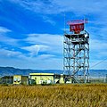
Category:FAA radar tower, Sunnyvale, California
Jump to navigation
Jump to search
| Object location | | View all coordinates using: OpenStreetMap |
|---|
Media in category "FAA radar tower, Sunnyvale, California"
The following 7 files are in this category, out of 7 total.
-
 Baylands Radar.jpg 6,240 × 3,512; 4.75 MB
-
 Baylands radar.jpg 3,031 × 3,031; 1.91 MB
-
 USA-Sunnyvale-FAA Radar Tower-1.jpg 2,448 × 3,264; 1.23 MB
-
 USA-Sunnyvale-FAA Radar Tower-2.jpg 2,448 × 3,264; 1.27 MB
-
 USA-Sunnyvale-FAA Radar Tower-3.jpg 2,448 × 3,264; 1.43 MB
-
 USA-Sunnyvale-FAA Radar Tower-4.jpg 2,448 × 3,264; 1.4 MB
-
 USA-Sunnyvale-FAA Radar Tower-5.jpg 2,448 × 3,264; 1.61 MB


