Category:Election maps of Lower Austria
Jump to navigation
Jump to search
States of Austria: Burgenland · Carinthia · Lower Austria · Salzburg · Styria · Tyrol · Upper Austria · Vienna · Vorarlberg
Deutsch: Karten von Niederösterreich mit Wahlergebnissen.
English: Maps of Lower Austria showing election results.
Media in category "Election maps of Lower Austria"
The following 8 files are in this category, out of 8 total.
-
 Landtagswahl Niederösterreich 2023.svg 976 × 914; 5.68 MB
-
 Landtagswahlkarte Niederösterreich 2013.svg 809 × 822; 229 KB
-
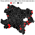
 Landtagswahlkarte Niederösterreich 2018.svg 809 × 829; 2.14 MB
-
 Landtagswahlkreise Niederoesterreich 2016.svg 413 × 401; 69 KB
-
 Landtagswahlkreise Niederoesterreich.svg 413 × 401; 67 KB
-
 LTWNÖ2008.png 1,020 × 925; 36 KB
-
 Niederösterreich Parteien 2018.svg 935 × 642; 1.92 MB
-
 State election card Lower Austria 2018.svg 809 × 829; 2.14 MB


