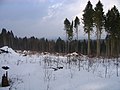
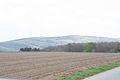
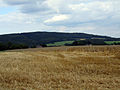
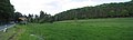
Category:Donoer Berg
Jump to navigation
Jump to search
Français : Montes Dono à Rödinghausen, arrondissement de Herford, Rhénanie-du-Nord-Westphalie, Allemagne.
| Object location | | View all coordinates using: OpenStreetMap |
|---|
mountain  | |||||
| Upload media | |||||
| Instance of | |||||
|---|---|---|---|---|---|
| Location | Herford, Detmold Government Region, North Rhine-Westphalia, Germany | ||||
| Mountain range | |||||
| Elevation above sea level |
| ||||
 | |||||
Media in category "Donoer Berg"
The following 39 files are in this category, out of 39 total.
-
 2010-02 Wittekindsweg Nonnenstein-Heidbrink 006.jpg 1,600 × 1,200; 771 KB
-
 2010-02 Wittekindsweg Nonnenstein-Heidbrink 007.jpg 1,600 × 1,200; 623 KB
-
 2010-02 Wittekindsweg Nonnenstein-Heidbrink 008.jpg 1,600 × 1,200; 593 KB
-
 2010-02 Wittekindsweg Nonnenstein-Heidbrink 009.jpg 1,200 × 1,600; 772 KB
-
 2010-02 Wittekindsweg Nonnenstein-Heidbrink 010.jpg 1,600 × 1,200; 683 KB
-
 2010-02 Wittekindsweg Nonnenstein-Heidbrink 011.jpg 1,600 × 1,200; 592 KB
-
 2010-02 Wittekindsweg Nonnenstein-Heidbrink 012.jpg 1,600 × 1,200; 454 KB
-
 2010-02 Wittekindsweg Nonnenstein-Heidbrink 013.jpg 1,600 × 1,200; 453 KB
-
 2010-02 Wittekindsweg Nonnenstein-Heidbrink 014.jpg 1,600 × 1,200; 508 KB
-
 2010-02 Wittekindsweg Nonnenstein-Heidbrink 016.jpg 1,600 × 1,200; 562 KB
-
 2010-02 Wittekindsweg Nonnenstein-Heidbrink 017.jpg 1,600 × 1,200; 504 KB
-
 2010-02 Wittekindsweg Nonnenstein-Heidbrink 018.jpg 1,600 × 1,200; 514 KB
-
 2010-02 Wittekindsweg Nonnenstein-Heidbrink 019.jpg 1,600 × 1,200; 788 KB
-
 2010-02 Wittekindsweg Nonnenstein-Heidbrink 020.jpg 1,600 × 1,200; 471 KB
-
 2010-02 Wittekindsweg Nonnenstein-Heidbrink 021.jpg 1,600 × 1,200; 475 KB
-
 2010-02 Wittekindsweg Nonnenstein-Heidbrink 022.jpg 1,600 × 1,200; 505 KB
-
 2010-02 Wittekindsweg Nonnenstein-Heidbrink 023.jpg 1,600 × 1,200; 495 KB
-
 2010-02 Wittekindsweg Nonnenstein-Heidbrink 024.jpg 1,600 × 1,200; 467 KB
-
 2010-02 Wittekindsweg Nonnenstein-Heidbrink 025.jpg 1,600 × 1,200; 631 KB
-
 2010-04-27 Rödinghausen 051.jpg 3,888 × 2,592; 2.8 MB
-
 2014-01 Steinbruch Donoer Berg.jpg 3,200 × 2,368; 2.67 MB
-
 Altes Verbrenn, Donoer Berg Panorama.jpg 4,607 × 1,473; 1.35 MB
-
 Blick auf Donoer Berge.jpg 2,048 × 1,536; 513 KB
-
 Donoer Berge.jpg 2,048 × 1,536; 356 KB
-
 Falk Oberdorf Die Egge Höhenschichtung.png 1,083 × 703; 183 KB
-
 Panorama Donoer Berg 1.jpg 4,237 × 1,448; 2.28 MB
-
 Panorama Donoer Berg.jpg 7,891 × 1,843; 2.92 MB
-
 Panorama HP Neue Mühle.jpg 11,945 × 1,588; 6.64 MB
-
 Panorama Neue Mühle 2.jpg 6,369 × 1,888; 2.14 MB
-
 Panorama Neue Mühle.jpg 16,714 × 1,560; 7.09 MB
-
 Panorama Nonnenstein Maschberg Donoer Berge Juni 2009.jpg 10,916 × 1,629; 4.37 MB
-
 Panorama Schwenningdorf 3.jpg 3,034 × 1,512; 1.2 MB
-
 Panorama Schwenningdorf.jpg 6,985 × 1,452; 1.86 MB
-
 Rödinghausen 04.2009 180.jpg 2,048 × 1,536; 890 KB
-
 Rödinghsn 4 2009 177.jpg 1,600 × 1,200; 567 KB
-
 Schwenningdorf Mai 2009 085.jpg 2,048 × 1,536; 1.06 MB
-
 Siek in Schwenningdorf 2.jpg 2,048 × 1,536; 869 KB
-
 View to Donoer Berge.jpg 2,048 × 1,536; 566 KB
-
 Windräder Bieren.jpg 2,048 × 1,536; 613 KB


