Category:District-Maps of Cologne
Jump to navigation
Jump to search
Media in category "District-Maps of Cologne"
The following 108 files are in this category, out of 108 total.
-
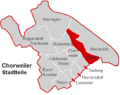
 Chorweiler Stadtteil Blumenberg.PNG 400 × 316; 8 KB
-
 Chorweiler Stadtteil Chorweiler.PNG 400 × 316; 8 KB
-
 Chorweiler Stadtteil Esch Auweiler.PNG 400 × 316; 8 KB
-
 Chorweiler Stadtteil Fühlingen.PNG 400 × 316; 8 KB
-
 Chorweiler Stadtteil Heimersdorf.PNG 400 × 316; 8 KB
-
 Chorweiler Stadtteil Lindweiler.PNG 400 × 316; 8 KB
-
 Chorweiler Stadtteil Merkenich.PNG 400 × 316; 8 KB
-
 Chorweiler Stadtteil Pesch.PNG 400 × 316; 8 KB
-
 Chorweiler Stadtteil Roggendorf Thenhoven.PNG 400 × 316; 8 KB
-
 Chorweiler Stadtteil Seeberg.PNG 400 × 316; 8 KB
-
 Chorweiler Stadtteil Volkhoven Weiler.PNG 400 × 316; 8 KB
-
 Chorweiler Stadtteil Worringen.PNG 400 × 316; 8 KB
-
 Ehrenfeld Stadtteil Bickendorf.PNG 400 × 333; 7 KB
-
 Ehrenfeld Stadtteil Bocklemünd Mengenich.PNG 400 × 333; 7 KB
-
 Ehrenfeld Stadtteil Ehrenfeld.PNG 400 × 333; 7 KB
-
 Ehrenfeld Stadtteil Neuehrenfeld.png 400 × 333; 7 KB
-
 Ehrenfeld Stadtteil Ossendorf.PNG 400 × 333; 7 KB
-
 Ehrenfeld Stadtteil Vogelsang.PNG 400 × 333; 7 KB
-
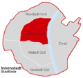 Innenstadt Stadtteil Altstadt-Nord.PNG 400 × 376; 7 KB
-
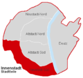
 Innenstadt Stadtteil Altstadt-Süd.PNG 400 × 376; 7 KB
-
 Innenstadt Stadtteil Deutz.PNG 400 × 376; 7 KB
-
 Innenstadt Stadtteil Neustadt-Nord.PNG 400 × 376; 7 KB
-
 Innenstadt Stadtteil Neustadt-Süd.PNG 400 × 376; 7 KB
-
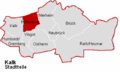
 Kalk Stadtteil Brück.PNG 553 × 330; 40 KB
-
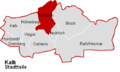
 Kalk Stadtteil Humboldt Gremberg.PNG 553 × 330; 40 KB
-
 Kalk Stadtteil Höhenberg.PNG 553 × 330; 40 KB
-
 Kalk Stadtteil Kalk.PNG 553 × 330; 40 KB
-
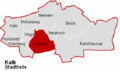
 Kalk Stadtteil Merheim.PNG 553 × 330; 40 KB
-
 Kalk Stadtteil Neubrück.PNG 553 × 330; 41 KB
-
 Kalk Stadtteil Ostheim.PNG 553 × 330; 41 KB
-
 Kalk Stadtteil Rath Heumar.PNG 404 × 241; 9 KB
-
 Kalk Stadtteil Vingst.PNG 553 × 330; 41 KB
-
 Koeln bezirke 1innenstadt.png 601 × 622; 23 KB
-
 Koeln bezirke 2rodenkirchen.png 601 × 622; 23 KB
-
 Koeln bezirke 3lindenthal.png 601 × 622; 23 KB
-
 Koeln bezirke 4ehrenfeld.png 601 × 622; 23 KB
-
 Koeln bezirke 5nippes.png 601 × 622; 24 KB
-
 Koeln bezirke 6chorweiler.png 601 × 622; 22 KB
-
 Koeln bezirke 7blank.png 601 × 622; 14 KB
-
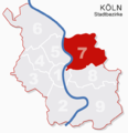
 Koeln bezirke 7muelheim.png 601 × 622; 22 KB
-
 Koeln bezirke 7nummern.png 601 × 622; 17 KB
-
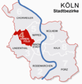
 Koeln bezirke 8kalk.png 601 × 622; 22 KB
-
 Koeln bezirke 9porz.png 601 × 622; 22 KB
-
 Koeln bezirke1.png 601 × 622; 22 KB
-
 Koeln bezirke7 muehlheim.png 601 × 622; 18 KB
-
 Köln Stadtbezirk Innenstadt.PNG 400 × 376; 7 KB
-
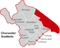
 Köln-Chorweiler Stadtbezirk-Chorweiler.PNG 400 × 316; 8 KB
-
 Köln-Kalk Stadtbezirk-Kalk.PNG 404 × 241; 10 KB
-
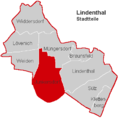
 Köln-Lindenthal Stadtbezirk Lindenthal.PNG 400 × 397; 8 KB
-
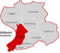
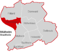
 Köln-Mülheim Stadtbezirk-Mülheim.PNG 400 × 357; 8 KB
-
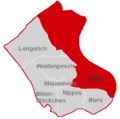
 Köln-Nippes Stadtbezirk-Nippes.PNG 400 × 398; 7 KB
-
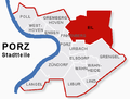
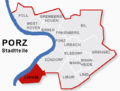
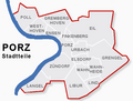 Köln-Porz Stadtbezirk-Porz.png 557 × 421; 29 KB
-
 Köln-Rodenkirchen Stadtbezirk-Rodenkirchen.png 473 × 456; 23 KB
-
 Lindenthal Stadtteil Braunsfeld.PNG 400 × 397; 8 KB
-
 Lindenthal Stadtteil Junkersdorf.PNG 400 × 397; 8 KB
-
 Lindenthal Stadtteil Klettenberg.PNG 400 × 397; 8 KB
-
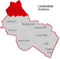
 Lindenthal Stadtteil Lindenthal.PNG 400 × 397; 8 KB
-
 Lindenthal Stadtteil Lövenich.PNG 400 × 397; 8 KB
-
 Lindenthal Stadtteil Müngersdorf.PNG 400 × 397; 8 KB
-
 Lindenthal Stadtteil Sülz.PNG 400 × 397; 8 KB
-
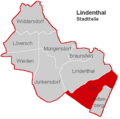
 Lindenthal Stadtteil Weiden.PNG 400 × 397; 8 KB
-
 Lindenthal Stadtteil Widdersdorf.PNG 400 × 397; 8 KB
-
 Mülheim Stadtteil Buchforst.PNG 400 × 357; 8 KB
-
 Mülheim Stadtteil Buchheim.PNG 400 × 357; 8 KB
-
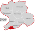
 Mülheim Stadtteil Dellbrück.PNG 400 × 357; 8 KB
-
 Mülheim Stadtteil Dünnwald.PNG 400 × 357; 8 KB
-
 Mülheim Stadtteil Flittard.PNG 400 × 357; 8 KB
-
 Mülheim Stadtteil Holweide.PNG 400 × 357; 8 KB
-
 Mülheim Stadtteil Höhenhaus.PNG 400 × 357; 8 KB
-
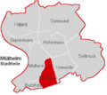
 Mülheim Stadtteil Mülheim.PNG 400 × 357; 8 KB
-
 Mülheim Stadtteil Stammheim.PNG 400 × 357; 8 KB
-
 Nippes Stadtteil Bilderstöckchen.PNG 400 × 398; 7 KB
-
 Nippes Stadtteil Longerich.PNG 400 × 398; 7 KB
-
 Nippes Stadtteil Mauenheim.PNG 400 × 398; 7 KB
-
 Nippes Stadtteil Niehl.PNG 400 × 398; 7 KB
-
 Nippes Stadtteil Nippes.PNG 400 × 398; 7 KB
-
 Nippes Stadtteil Riehl.PNG 400 × 398; 7 KB
-
 Nippes Stadtteil Weidenpesch.PNG 400 × 398; 7 KB
-
 Porz Stadtteil Eil.png 557 × 421; 29 KB
-
 Porz Stadtteil Elsdorf.png 557 × 421; 29 KB
-
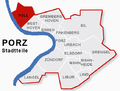
 Porz Stadtteil Ensen.png 557 × 421; 29 KB
-
 Porz Stadtteil Finkenberg.PNG 557 × 421; 29 KB
-
 Porz Stadtteil Gremberghoven.png 557 × 421; 29 KB
-
 Porz Stadtteil Grengel.png 557 × 421; 29 KB
-
 Porz Stadtteil Langel.png 557 × 421; 29 KB
-
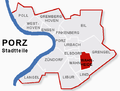
 Porz Stadtteil Libur.png 557 × 421; 29 KB
-
 Porz Stadtteil Lind.png 557 × 421; 29 KB
-
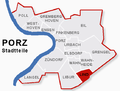
 Porz Stadtteil Poll.png 557 × 421; 29 KB
-
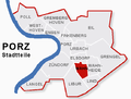
 Porz Stadtteil Porz.png 557 × 421; 30 KB
-
 Porz Stadtteil Urbach.png 557 × 421; 30 KB
-
 Porz Stadtteil Wahn.png 557 × 421; 29 KB
-
 Porz Stadtteil Wahnheide.png 557 × 421; 30 KB
-
 Porz Stadtteil Westhoven.png 557 × 421; 30 KB
-
 Porz Stadtteil Zündorf.png 557 × 421; 30 KB
-
 Rodenkirchen Stadtteil Bayenthal.png 473 × 456; 20 KB
-
 Rodenkirchen Stadtteil Godorf.png 473 × 456; 20 KB
-
 Rodenkirchen Stadtteil Hahnwald.png 473 × 456; 20 KB
-
 Rodenkirchen Stadtteil Immendorf.png 473 × 456; 20 KB
-
 Rodenkirchen Stadtteil Marienburg.png 473 × 456; 20 KB
-
 Rodenkirchen Stadtteil Meschenich.png 473 × 456; 20 KB
-
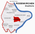
 Rodenkirchen Stadtteil Raderberg.png 473 × 456; 20 KB
-
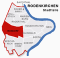
 Rodenkirchen Stadtteil Raderthal.png 473 × 456; 20 KB
-
 Rodenkirchen Stadtteil Rodenkirchen.png 473 × 456; 20 KB
-
 Rodenkirchen Stadtteil Rondorf.png 473 × 456; 20 KB
-
 Rodenkirchen Stadtteil Suerth.png 473 × 456; 20 KB
-
 Rodenkirchen Stadtteil Weiss.png 473 × 456; 20 KB
-
 Rodenkirchen Stadtteil Zollstock.png 473 × 456; 20 KB
-
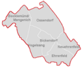 Stadtbezirk Ehrenfeld nur Grenzen.PNG 400 × 333; 7 KB


