Category:Currabubula
Jump to navigation
Jump to search
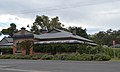
English: Currabubula is a village on the North West Slopes of the New England region of New South Wales, Australia. It is located on the Werris Creek Road 30 kilometres south-west of Tamworth and 15 km north-east of Werris Creek. Currabubula is in the Liverpool Plains Shire Local Government Area. (→Currabubula)
locality in New South Wales, Australia | |||||
| Upload media | |||||
| Instance of | |||||
|---|---|---|---|---|---|
| Location |
| ||||
| Population |
| ||||
| Elevation above sea level |
| ||||
 | |||||
Subcategories
This category has the following 2 subcategories, out of 2 total.
H
- Currabubula Hotel (2 F)
W
Media in category "Currabubula"
The following 4 files are in this category, out of 4 total.
-
 Currabubula Building 001.JPG 5,654 × 3,399; 6.52 MB
-
 Currabubula Town Entry Sign A.JPG 5,659 × 3,553; 5.7 MB
-
 Currabubula Town Entry Sign B.JPG 5,599 × 3,449; 5.67 MB
-
 Currabubula.JPG 2,592 × 1,944; 571 KB


