Category:County lines
Jump to navigation
Jump to search
border of a county | |||||
| Upload media | |||||
| Subclass of | |||||
|---|---|---|---|---|---|
| Facet of | |||||
| |||||
Borders between counties, a type of political subdivision in many countries.
Subcategories
This category has the following 9 subcategories, out of 9 total.
A
- Adams-Gray House (4 F)
B
C
- County Line Covered Bridge (1 F)
- County lines in Alabama (10 F)
- County lines in China (1 F)
J
Media in category "County lines"
The following 32 files are in this category, out of 32 total.
-
 75th St Pitkin Av td 01 - IND Subway via Pitkin Av.jpg 5,472 × 3,648; 4.36 MB
-
 75th St Pitkin Av td 02 - IND Subway via Pitkin Av.jpg 5,472 × 3,648; 5.97 MB
-
 75th St Pitkin Av td 03 - IND Subway via Pitkin Av.jpg 5,472 × 3,648; 3.78 MB
-
 Allegheny River Bend.jpg 2,272 × 1,704; 1.42 MB
-
 Blaine near Grand in Scott.jpg 6,016 × 4,000; 6.53 MB
-
 Brooklyn Bridge (11600520765).jpg 5,472 × 3,648; 10.08 MB
-
 Cabery IL Main Street.jpg 1,280 × 960; 189 KB
-
 Champaign Piatt County Lincoln marker.jpg 2,304 × 3,456; 1.28 MB
-
 Columbia County line on State Route 2102.JPG 2,256 × 1,504; 2.59 MB
-
 Columbia-Lycoming County line 2.JPG 2,256 × 1,504; 2.63 MB
-
 Fairfield Township Columbiana County highway.jpg 2,576 × 1,920; 2.01 MB
-
 GGB Marin County line.jpg 4,368 × 2,912; 4.63 MB
-
 Haines Chapel from southeast.jpg 6,016 × 4,000; 6.41 MB
-
 I am in Texas but my Ass is in New Mexico.jpg 1,500 × 950; 1.04 MB
-
 I-215 northbound at Grand Terrace, CA city limits (2006) (crop).jpg 277 × 160; 47 KB
-
 I-215 northbound at Grand Terrace, CA city limits (2006).jpg 1,024 × 768; 153 KB
-
 Illinois state line marker.jpg 2,048 × 3,072; 2.99 MB
-
 Market east of West in Washingtonville.jpg 6,016 × 4,000; 6.41 MB
-
 Miami near Main, Bradford.jpg 6,016 × 4,000; 5.64 MB
-
 Montour County line on State Route 2102.JPG 2,256 × 1,504; 2.87 MB
-
 Northumberland County line on State Route 2102.JPG 2,256 × 1,504; 2.84 MB
-
 Pennsylvania Route 93 bridge over the Susquehanna River with sign.JPG 3,088 × 2,056; 1.33 MB
-
 Piatt and DeWitt County Lincoln marker wide.jpg 3,456 × 2,304; 1.44 MB
-
 Piatt and Dewitt County Lincoln marker.jpg 2,304 × 3,456; 1.48 MB
-
 Queens-Midtown Tunnel td (2021-06-15) 03 - Manhattan-Queens Border.jpg 5,472 × 3,648; 4.27 MB
-
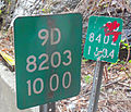 Reference markers on New York State Route 9D at the Dutchess-Putnam county line.jpg 3,548 × 3,032; 6.84 MB
-
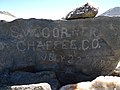 S.W. Corner Chaffee Co. rock.jpg 3,648 × 2,736; 4.52 MB
-
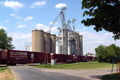 State Line elevator.png 1,500 × 1,000; 2.54 MB
-
 VirginiaNC State Line on Steel Bridge Road.jpg 700 × 525; 305 KB
-
 West Side of I-25 and County Line Road.jpg 2,160 × 1,440; 886 KB
-
 WOTwb continuation.jpg 1,560 × 1,420; 518 KB
-
 WOTwb end.jpg 1,530 × 1,010; 298 KB


.jpg)


_(crop).jpg)
.jpg)


_03_-_Manhattan-Queens_Border.jpg)


