Category:Construction of the Pathfinder Dam
Jump to navigation
Jump to search
Media in category "Construction of the Pathfinder Dam"
The following 139 files are in this category, out of 139 total.
-
 "Another view of wheat field on Dutch Flats near Mitchell, Nebr." - NARA - 294481.jpg 3,000 × 2,286; 4.5 MB
-

-
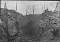
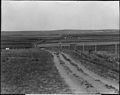
 "Rack in masonry, north side of notch. (Oblique end view.)" - NARA - 294397.jpg 3,000 × 2,112; 935 KB
-
 "Showing character and nature of Scottsbluff, Nebraska." - NARA - 294353.jpg 3,000 × 2,276; 824 KB
-

-
-
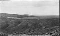
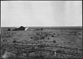
 "Stannard's Camp, showing rolling character of land." - NARA - 294356.jpg 3,000 × 2,270; 802 KB
-
 "Three-foot face stone in storage. Pathfinder Dam." - NARA - 294417.jpg 3,000 × 2,134; 1.01 MB
-
 "Touring thru the irrigated district of the Dutch Flats country." - NARA - 294494.jpg 3,000 × 2,301; 586 KB
-
 "Tristate lateral headgate from opposite bank." - NARA - 294414.jpg 3,000 × 2,128; 583 KB
-

-

-
 "View of Mitchell, Nebraska." - NARA - 294455.jpg 3,000 × 2,315; 959 KB
-

-

-
 Alfalfa field in Pleasant Valley - NARA - 294488.jpg 3,000 × 2,291; 1.09 MB
-

-
 Another view of harvesting wheat crop on Ballantine Thomas ranch - NARA - 294491.jpg 3,000 × 2,264; 1.06 MB
-
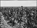 Corn fields on the Dutch Flats near Mitchell, Nebr. - NARA - 294493.jpg 3,000 × 2,264; 1.02 MB
-
 Crops and settlement in Sunflower Valley - NARA - 294482.jpg 3,000 × 2,301; 900 KB
-
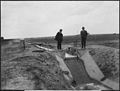
 Drop 1 and lateral out-take in Lateral 21A Canal - NARA - 294458.jpg 3,000 × 2,291; 1.07 MB
-
 Drop 12 - Lateral 21-M Canal - NARA - 294459.jpg 3,000 × 2,333; 1.07 MB
-
 Drop 19 on lateral 15 east - NARA - 294449.jpg 3,000 × 2,265; 844 KB
-
 Drop 3 - Lateral 21-M Canal - NARA - 294460.jpg 3,000 × 2,260; 929 KB
-
 Drop 8 in lateral 21A Canal - NARA - 294456.jpg 3,000 × 2,288; 1.02 MB
-
 Drops in Main Lateral 21 - NARA - 294472.jpg 3,000 × 2,289; 816 KB
-
 Dutch Flats, irrigation under the North Platte Project - NARA - 294447.jpg 3,000 × 2,298; 647 KB
-
 Dutch Flats, lateral 11 - NARA - 294448.jpg 3,000 × 2,295; 650 KB
-
 Dutch Flats, plowing - NARA - 294443.jpg 3,000 × 2,149; 784 KB
-
 Dutch flats, plowing - NARA - 294444.jpg 3,000 × 2,089; 849 KB
-

-
 East portal of the Pathfinder Tunnel - NARA - 294360.jpg 3,000 × 2,258; 1.2 MB
-
 Foundation of Pathfinder Dam - NARA - 294373.jpg 3,000 × 2,026; 893 KB
-

-

-
 Interstate Canal - NARA - 294438.jpg 3,000 × 1,731; 551 KB
-
 Interstate Canal - NARA - 294439.jpg 3,000 × 1,720; 477 KB
-
 Interstate Canal, Spring Canyon flume, looking north - NARA - 294387.jpg 3,000 × 2,106; 788 KB
-
 Interstate Canal. 11-foot drop, lateral No.1, posts - NARA - 294413.jpg 3,000 × 2,184; 861 KB
-
-

-

-
 Interstate Canal. Detailed view of drop basin of Cottonwood flume - NARA - 294402.jpg 3,000 × 2,289; 1.04 MB
-
 Interstate Canal. Distribution gates in laterals DF - NARA - 294416.jpg 3,000 × 2,276; 885 KB
-

-
-

-
 Interstate Canal. Hauphoff culvert - NARA - 294404.jpg 3,000 × 2,232; 1.03 MB
-
 Interstate Canal. Hauphoff flume, looking north. - NARA - 294386.jpg 3,000 × 2,091; 752 KB
-
 Interstate Canal. Headgate at Sta. 2088. - NARA - 294383.jpg 3,000 × 2,126; 657 KB
-
 Interstate Canal. Lateral No. 10 headgate. - NARA - 294473.jpg 3,000 × 2,288; 579 KB
-
-
-
 Interstate Canal. Office Building, Mitchell, Nebr. - NARA - 294384.jpg 3,000 × 2,124; 549 KB
-

-
 Interstate Canal. Patent four wheeled scrapers. - NARA - 294367.jpg 3,000 × 2,161; 646 KB
-

-
 Interstate Canal. Rawhide siphon. - NARA - 294408.jpg 3,000 × 2,252; 645 KB
-
 Interstate Canal. Spillway and railroad crossing at Mollie's Fork. - NARA - 294403.jpg 3,000 × 2,301; 815 KB
-
 Interstate Canal. Spring Canyon flume from northwest. - NARA - 294380.jpg 3,000 × 2,160; 638 KB
-
 Interstate Canal. Spring Canyon flume, side and top view. - NARA - 294407.jpg 3,000 × 2,248; 884 KB
-
 Interstate Canal. Spring Canyon flume. - NARA - 294406.jpg 3,000 × 2,240; 858 KB
-
 Interstate Canal. View showing diversion gate in No. 10 Lateral. - NARA - 294479.jpg 3,000 × 2,314; 564 KB
-
 Interstate Canal. Wet Sheep Creek culvert under construction. - NARA - 294409.jpg 3,000 × 2,227; 1.07 MB
-
 Interstate Canal. Willey Draw culvert. - NARA - 294405.jpg 3,000 × 2,224; 1.2 MB
-

-
 Lateral out-take and drop in lateral 21A - NARA - 294457.jpg 3,000 × 2,257; 933 KB
-
 Lower face of Pathfinder Dam, showing location of loaded drill holes - NARA - 294467.jpg 3,000 × 2,139; 718 KB
-
 Main Canal, looking down - NARA - 294445.jpg 3,000 × 2,246; 585 KB
-
 Main Street, Mitchell, Nebraska - NARA - 294497.jpg 3,000 × 2,268; 958 KB
-
 Mitchell, Nebraska, and the valley about the town - NARA - 294484.jpg 3,000 × 2,318; 836 KB
-
 New residences in the town of Mitchell, Nebr. - NARA - 294495.jpg 3,000 × 2,270; 1.02 MB
-

-
 Pathfinder Dam site looking upstream - NARA - 294364.jpg 2,180 × 3,000; 940 KB
-

-
 Pathfinder dam, bed rock in foundation - NARA - 294376.jpg 3,000 × 2,070; 1.07 MB
-
 Pathfinder Dam, bedrock in foundation - NARA - 294374.jpg 3,000 × 2,076; 1 MB
-
 Pathfinder Dam, bulkhead for closing tunnel - NARA - 294400.jpg 3,000 × 2,118; 795 KB
-
 Pathfinder Dam, centrifugal pumps in foundation - NARA - 294366.jpg 3,000 × 1,984; 832 KB
-
 Pathfinder Dam, contractor's plant from south side of canyon - NARA - 294424.jpg 3,000 × 2,099; 843 KB
-
 Pathfinder Dam, crusher and mixing house - NARA - 294382.jpg 3,000 × 2,017; 808 KB
-
 Pathfinder Dam, diversion flume - NARA - 294365.jpg 3,000 × 2,151; 956 KB
-
 Pathfinder Dam, footbridge across North Platte River - NARA - 294389.jpg 3,000 × 2,084; 857 KB
-
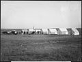
 Pathfinder Dam, freight teams - NARA - 294370.jpg 3,000 × 2,007; 892 KB
-
 Pathfinder Dam, gate-keeper's house - NARA - 294379.jpg 3,000 × 2,047; 1,000 KB
-

-

-
 Pathfinder Dam, guide wall at north end of dam - NARA - 294433.jpg 3,000 × 2,065; 869 KB
-
 Pathfinder Dam, High pressure gates looking upstream - NARA - 294419.jpg 3,000 × 2,068; 672 KB
-
 Pathfinder Dam, High pressure gates, looking downstream - NARA - 294418.jpg 3,000 × 2,155; 794 KB
-
 Pathfinder dam, laying first stone - NARA - 294375.jpg 3,000 × 2,148; 971 KB
-
 Pathfinder Dam, looking upstream - NARA - 294425.jpg 3,000 × 2,095; 764 KB
-
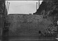
 Pathfinder Dam, lower face - NARA - 294395.jpg 3,000 × 2,057; 781 KB
-
 Pathfinder Dam, lower face - NARA - 294415.jpg 3,000 × 2,145; 708 KB
-
 Pathfinder Dam, lower face - NARA - 294420.jpg 3,000 × 2,210; 700 KB
-
 Pathfinder Dam, lower face - NARA - 294427.jpg 2,106 × 3,000; 717 KB
-
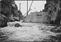
 Pathfinder Dam, lower face during flood - NARA - 294392.jpg 3,000 × 2,063; 688 KB
-
 Pathfinder Dam, Method of closing Pathfinder tunnel - NARA - 294399.jpg 3,000 × 2,049; 846 KB
-

-
 Pathfinder Dam, method of piling cement, looking northwest - NARA - 294422.jpg 3,000 × 2,109; 716 KB
-
 Pathfinder Dam, progress of masonry - NARA - 294381.jpg 3,000 × 2,103; 793 KB
-
 Pathfinder Dam, progress of masonry - NARA - 294385.jpg 3,000 × 2,030; 759 KB
-
 Pathfinder Dam, rack in masonry, north side of notch - NARA - 294396.jpg 3,000 × 2,056; 911 KB
-
 Pathfinder Dam, Upper face - NARA - 294398.jpg 3,000 × 2,069; 656 KB
-
 Pathfinder Dam, upper face - NARA - 294421.jpg 3,000 × 2,135; 696 KB
-
 Pathfinder Dam, upper face - NARA - 294426.jpg 2,105 × 3,000; 669 KB
-
 Pathfinder Dam, upper face - NARA - 294452.jpg 3,000 × 1,977; 664 KB
-
 Pathfinder Dam, upper face - NARA - 294463.jpg 3,000 × 2,084; 807 KB
-
 Pathfinder Dam, upper face at close of 1908 season - NARA - 294428.jpg 2,136 × 3,000; 709 KB
-
 Pathfinder Dam, upper face of dam - NARA - 294391.jpg 3,000 × 2,071; 829 KB
-
-

-
 Pathfinder Dam. Dam during a freshet - NARA - 294394.jpg 3,000 × 2,020; 1,004 KB
-
 Pathfinder Dam. Dam during flood - NARA - 294390.jpg 3,000 × 2,032; 806 KB
-

-
 Pathfinder Dam. Sandbag core wall in temporary dam - NARA - 294363.jpg 3,000 × 2,086; 897 KB
-
 Pathfinder dike, looking south, showing preparation of site - NARA - 294468.jpg 3,000 × 2,142; 749 KB
-
 Pathfinder reservoir, dam, and site of dike at extreme left - NARA - 294377.jpg 3,000 × 2,141; 816 KB
-

-
 Pathfinder tunnel, Construction of grizzly looking northwest - NARA - 294430.jpg 3,000 × 2,156; 706 KB
-
 Pathfinder tunnel, showing boulder lodged in waterway below A gate - NARA - 294461.jpg 3,000 × 2,167; 972 KB
-

-

-
 View showing hauling of balanced valves to the Pathfinder Dam - NARA - 294474.jpg 3,000 × 2,092; 627 KB
-
 View showing hauling of balanced valves to the Pathfinder Dam - NARA - 294475.jpg 3,000 × 2,099; 701 KB
-

-

-
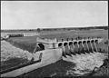
 Whalen diversion dam and headworks - NARA - 294453.jpg 3,000 × 2,131; 3.27 MB
-
 Whalen diversion dam and headworks - NARA - 294454.jpg 3,000 × 2,148; 2.95 MB
-
 Whalen diversion dam and headworks, looking across river from north side - NARA - 294435.jpg 3,000 × 2,108; 3.08 MB
-
 Whalen diversion dam and headworks, looking across river from north side - NARA - 294437.jpg 3,000 × 2,122; 2.89 MB
-
 Whalen diversion dam and headworks, looking up river from north side - NARA - 294436.jpg 3,000 × 2,071; 3.16 MB
-
 Whalen diversion dam, looking down river - NARA - 294434.jpg 3,000 × 2,081; 3.06 MB
-
 Wheat crop on Dr. Blackburn's ranch near Mitchell, Nebraska - NARA - 294487.jpg 3,000 × 2,281; 4.11 MB
-
 Wheat field in shock under the Mitchell ditch, Mitchell Valley - NARA - 294486.jpg 3,000 × 2,340; 4.05 MB
-
 Wheat field near Mitchell, Nebraska - NARA - 294471.jpg 3,000 × 2,276; 3.56 MB
-
 Wheat field on Dutch flats near Mitchell, Nebr. Farm of T.C. Shawver - NARA - 294480.jpg 3,000 × 2,298; 4.54 MB
-
 Wheat in shocks Pleasant Valley, farm of Benj. Martin - NARA - 294483.jpg 3,000 × 2,334; 3.78 MB
-
 Winter Creek Bottom, taken from hill south of Fairchild's place - NARA - 294492.jpg 3,000 × 2,363; 3.7 MB


%22_-_NARA_-_294397.jpg)


