Category:Columbia Island
Jump to navigation
Jump to search
island in Washington, D.C.  | |||||
| Upload media | |||||
| Instance of | |||||
|---|---|---|---|---|---|
| Location | Washington, D.C., District of Columbia | ||||
| Located in or next to body of water | |||||
| Owned by |
| ||||
| Manufacturer | |||||
| Inception |
| ||||
| Area |
| ||||
| Elevation above sea level |
| ||||
| Drainage basin | |||||
 | |||||
Subcategories
This category has the following 3 subcategories, out of 3 total.
B
L
N
Media in category "Columbia Island"
The following 49 files are in this category, out of 49 total.
-
 WestPotomacParkAerial1943.jpg 740 × 588; 143 KB
-

-

-

-
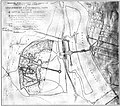 Army Quartermaster Corps proposed Arlington Memorial Bridge and approaches - 1926.jpg 1,236 × 1,096; 393 KB
-
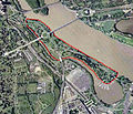
 Boundary Channel - Potomac River - US Coastal Pilot 2013.jpg 905 × 1,289; 1.03 MB
-
 CH-3E over the Pentagon DC 1979.JPEG 2,780 × 1,870; 1.88 MB
-
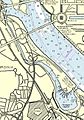
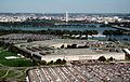
 Columbia Island - aerial view 2005.jpg 473 × 406; 240 KB
-
 Daffodils in Lady Bird Johnson Memorial Park - 2011.jpg 3,000 × 2,250; 4.82 MB
-

-
 Dredging operations in Potomac River - 1930.jpg 3,656 × 2,267; 6.17 MB
-

-

-

-

-

-
 Looking W across Columbia Island down Memorial Drive at Arlington National Cemetery - 1930s.jpg 5,632 × 4,389; 19.11 MB
-
 Mount Vernon Trail (1cfb45a6-946d-47cf-bb82-7e4729b23b58).jpg 5,307 × 3,518; 2.08 MB
-
 Mount Vernon Trail (2f1ed218-4ae6-486f-a407-82967d2f0467).jpg 3,360 × 2,359; 1.25 MB
-

-

-

-

-

-

-

-

-
 The Pentagon US Department of Defense building.jpg 2,734 × 1,726; 964 KB
-

-

-

-
 Traffic plaza on Columbia Island - Arlington Memorial Bridge - 2011.jpg 3,000 × 2,250; 2.62 MB
-
 Trail under the Humpback Bridge (05d8fc7b-e639-47e4-a3fe-d960e84bb888).jpg 4,104 × 2,724; 959 KB
-
 Trail under the Humpback Bridge (12ee5709-abb2-4105-9abc-d02c8a130850).jpg 5,545 × 3,697; 1.32 MB
-
 Trail under the Humpback Bridge (220982b1-46a0-422f-aeec-8f3044049e0a).jpg 1,970 × 2,646; 631 KB
-
 Trail under the Humpback Bridge (3b085c34-f891-4f53-b910-d325fc1fb1b9).jpg 5,589 × 3,726; 2.54 MB
-
 Trail under the Humpback Bridge (3d1dfa6c-2e63-4ed9-9b11-fcc1ea65e8a8).jpg 5,760 × 3,840; 1.05 MB
-
 Trail under the Humpback Bridge (9a3dd714-039e-45b0-ad74-693a5f22c304).jpg 2,423 × 3,378; 907 KB
-
 Trail under the Humpback Bridge (a7335d2b-6a01-4282-ae32-6980d9d894d8).jpg 5,515 × 3,677; 2.57 MB
-
 Trail under the Humpback Bridge (b87a264a-b793-4188-8a72-92858f5540c1).jpg 5,274 × 1,392; 871 KB
-
 Trail under the Humpback Bridge (db75c4ca-8811-4f1b-b46d-8e3679abcb2b).jpg 2,726 × 3,647; 528 KB
-
 Trail under the Humpback Bridge (dd9f5072-52d5-41c5-b73e-9f81f07c2624).jpg 1,751 × 2,750; 550 KB
-
 Trail under the Humpback Bridge (ed7602f2-c7d0-4e06-9865-58c7cb84c4d7).jpg 2,022 × 1,356; 429 KB
-

-
 Tunnel under Huampback Bridge (c2f3c1bc-3d86-4d9b-83d2-0fe61c04ce44).jpg 5,760 × 3,840; 2.18 MB
-
 USSAkronOverWashingtonDC.jpg 740 × 555; 142 KB
-
 View from Lady Bird Johnson Park (fe322e55-7cab-4380-949c-21444c315b51).jpg 3,647 × 4,866; 1.8 MB
-
 Washington 77.04477W 38.88819N.jpg 1,280 × 958; 252 KB
-
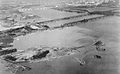
 Washington-Hoover Airport - 1930 - with Gravelley Point.jpg 2,000 × 1,422; 1.66 MB

_as_it_crosses_the_Potomac_River_from_the_southeast_end_of_Columbia_Island_in_Washington,_D.C..jpg)


.jpg)
.jpg)
.jpg)
.jpg)

.jpg)
.jpg)
.jpg)
.jpg)
.jpg)
.jpg)
.jpg)
.jpg)
.jpg)
.jpg)

.jpg)

.jpg)
.jpg)
.jpg)
.jpg)
.jpg)
.jpg)
.jpg)
.jpg)
.jpg)
.jpg)
.jpg)

.jpg)


.jpg)
.jpg)
.jpg)