Category:Cliffsend
Jump to navigation
Jump to search
English: Cliffsend is a village and civil parish situated almost 2 miles (3km) west of Ramsgate, Kent, United Kingdom, in the Thanet local government district.
village in Kent, England, UK | |||||
| Upload media | |||||
| Instance of | |||||
|---|---|---|---|---|---|
| Location | Thanet, Kent, South East England, England | ||||
 | |||||
Subcategories
This category has the following 4 subcategories, out of 4 total.
Media in category "Cliffsend"
The following 200 files are in this category, out of 338 total.
(previous page) (next page)-
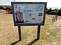
 "Hugin" Replica Viking Boat - geograph.org.uk - 2070497.jpg 640 × 480; 95 KB
-
 9th (last) green, Stonelees golf course. - geograph.org.uk - 302958.jpg 640 × 480; 138 KB
-
 A Hoverlloyd hovercraft in Pegwell Bay - geograph.org.uk - 2192295.jpg 640 × 452; 156 KB
-
 A newly ploughed field - geograph.org.uk - 711617.jpg 640 × 428; 152 KB
-
 A nice little roadside pub - geograph.org.uk - 2592790.jpg 640 × 480; 101 KB
-
 Anti invasion cylinders, Pegwell Bay country park - geograph.org.uk - 4596780.jpg 2,272 × 1,704; 799 KB
-
 Arundel Road, Cliffsend - geograph.org.uk - 4596720.jpg 2,272 × 1,704; 881 KB
-
 Ashford to Ramsgate line - geograph.org.uk - 3038073.jpg 640 × 480; 92 KB
-
 Bare bushes on the Thanet Coast Path - geograph.org.uk - 6018870.jpg 5,202 × 3,465; 3.28 MB
-
 Beacon at Cliffsend - geograph.org.uk - 6395559.jpg 3,632 × 5,456; 2.28 MB
-
 Beacon near the Viking Ship - geograph.org.uk - 3092700.jpg 3,872 × 2,592; 3.54 MB
-
 Beacon near the Viking Ship - geograph.org.uk - 3097726.jpg 640 × 430; 37 KB
-
 Bird watching hide on Thanet Coast Path - geograph.org.uk - 6018866.jpg 5,202 × 3,465; 2.96 MB
-
 Building site, Cliffs End Road - geograph.org.uk - 5506408.jpg 3,264 × 2,448; 3.83 MB
-
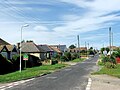
 Canterbury Road West - geograph.org.uk - 5581177.jpg 640 × 480; 117 KB
-
 Canterbury Road West, Cliffsend - geograph.org.uk - 2818895.jpg 4,320 × 3,240; 3.85 MB
-
 Canterbury Road West, Cliffsend - geograph.org.uk - 2818896.jpg 4,320 × 3,240; 3.37 MB
-
 Car park, Pegwell Bay Country Park - geograph.org.uk - 3094678.jpg 640 × 430; 64 KB
-
 Cliff View Road, Cliffsend - geograph.org.uk - 4596708.jpg 2,272 × 1,704; 827 KB
-
 Cliffs between Cliffsend and Ramsgate.jpg 3,748 × 2,648; 3.31 MB
-
 Cliffs End Grove - geograph.org.uk - 3097721.jpg 640 × 430; 64 KB
-
 Cliffs End Road - geograph.org.uk - 3036300.jpg 640 × 480; 48 KB
-
 Cliffs End sign - geograph.org.uk - 3143649.jpg 680 × 1,024; 106 KB
-
 Cliffs End sign - geograph.org.uk - 3226540.jpg 1,000 × 1,500; 148 KB
-
 Cliffs End, Cliffsend Point - geograph.org.uk - 2741639.jpg 3,648 × 2,736; 3.78 MB
-
 Cliffs End, Public Footpath No. TR33 - geograph.org.uk - 2741910.jpg 3,648 × 2,736; 3.12 MB
-

-
 Cliffsend - 2014 - geograph.org.uk - 4223989.jpg 3,648 × 2,736; 1.47 MB
-
 Cliffsend - 2014 - geograph.org.uk - 4223990.jpg 3,648 × 2,736; 1.73 MB
-
 Cliffsend - 2014 - geograph.org.uk - 4223991.jpg 3,648 × 2,736; 1.7 MB
-
 Cliffsend - 2014 - geograph.org.uk - 4223993.jpg 3,648 × 2,736; 2 MB
-
 Cliffsend - 2014 - geograph.org.uk - 4223996.jpg 3,648 × 2,736; 1.54 MB
-
 Cliffsend - 2014 - geograph.org.uk - 4223998.jpg 3,648 × 2,736; 1.74 MB
-
 Cliffsend - 2014 - geograph.org.uk - 4224001.jpg 3,648 × 2,736; 1.88 MB
-
 Cliffsend Grove, Cliffsend - geograph.org.uk - 4596743.jpg 2,272 × 1,704; 846 KB
-

-
 Cliffsend Level Crossing - geograph.org.uk - 4596731.jpg 2,272 × 1,704; 786 KB
-
 Cliffsend Road, Cliffsend - geograph.org.uk - 4596701.jpg 2,272 × 1,704; 806 KB
-
 Cliffsend Sign - geograph.org.uk - 6395561.jpg 5,456 × 3,632; 878 KB
-
 Cliffsend Village Sign - geograph.org.uk - 5916518.jpg 768 × 1,024; 180 KB
-
 Cliffsend, A256, car park near Viking Longboat 'Hugin' - geograph.org.uk - 2741642.jpg 3,648 × 2,736; 3.9 MB
-
 Cliffsend, A256, Viking Longboat 'Hugin' - geograph.org.uk - 2741640.jpg 3,648 × 2,736; 3.76 MB
-
 Cliffsend, A256, Viking Longboat 'Hugin' - geograph.org.uk - 2741643.jpg 3,648 × 2,736; 3.59 MB
-
 Cliffsend, A256, Viking Longboat 'Hugin' - geograph.org.uk - 2741644.jpg 3,648 × 2,736; 3.59 MB
-
 Cliffsend, A256, Viking Longboat 'Hugin' - geograph.org.uk - 2741717.jpg 3,648 × 2,736; 2.19 MB
-
 Cliffsend, A256, Viking Longboat 'Hugin' - geograph.org.uk - 2741905.jpg 3,648 × 2,736; 1.73 MB
-
 Cliffsend, A256, Viking Longboat 'Hugin' - geograph.org.uk - 2742290.jpg 3,648 × 2,736; 1.42 MB
-
 Cliffsend, Cliffsend Point, Beacon - geograph.org.uk - 2741901.jpg 3,648 × 2,736; 1.72 MB
-

-
 Cliffsend, Commemorative Stone near Viking longship 'Hugin' - geograph.org.uk - 2741896.jpg 3,648 × 2,736; 1.75 MB
-
 Cliffsend, Commemorative Stone near Viking longship 'Hugin' - geograph.org.uk - 2741898.jpg 3,648 × 2,736; 1.54 MB
-
 Cliffsend, Information board at Viking Longboat 'Hugin' - geograph.org.uk - 2741726.jpg 3,648 × 2,736; 2.32 MB
-
 Cliffsend, Information board at Viking Longboat 'Hugin' - geograph.org.uk - 2741890.jpg 3,648 × 2,736; 1.2 MB
-
 Cliffsend, NCN Signpost - geograph.org.uk - 2741647.jpg 3,648 × 2,736; 2.8 MB
-
 Cliffsend, NCN Signpost - geograph.org.uk - 2741716.jpg 3,648 × 2,736; 4.27 MB
-
 Cliffsend, Viking Longboat 'Hugin' - geograph.org.uk - 2741722.jpg 3,648 × 2,736; 3.45 MB
-
 Cliffsend, Viking Longboat 'Hugin' - geograph.org.uk - 2741900.jpg 3,648 × 2,736; 1.54 MB
-
 Clive Road, Cliffsend - geograph.org.uk - 4596707.jpg 2,272 × 1,704; 925 KB
-
 Coastal hinterland at Pegwell Bay - geograph.org.uk - 3091422.jpg 3,872 × 2,592; 5.77 MB
-
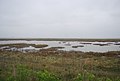
 Coastal Marshes, Pegwell Bay - geograph.org.uk - 3042006.jpg 640 × 430; 46 KB
-
 Commemorative Stone, The Viking Ship - geograph.org.uk - 3097735.jpg 640 × 430; 48 KB
-
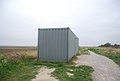 Container by the Thanet Coastal Path - geograph.org.uk - 3094663.jpg 640 × 430; 39 KB
-
 Cottington Road, Cliff's End - geograph.org.uk - 3092627.jpg 3,872 × 2,592; 5.69 MB
-
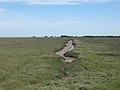
 Creek in the marshes - geograph.org.uk - 3041999.jpg 640 × 430; 42 KB
-
 Crumbling cliff, Cliffsend - geograph.org.uk - 5581214.jpg 640 × 480; 184 KB
-

-
 Cycle way alongside the Sandwich Road - geograph.org.uk - 6018893.jpg 5,202 × 3,465; 2.45 MB
-
 Daffodils, Sandwich Rd - geograph.org.uk - 3097722.jpg 640 × 430; 71 KB
-
 East Kent Access Road - geograph.org.uk - 3038039.jpg 640 × 480; 75 KB
-
 East Kent Access Road - geograph.org.uk - 3038047.jpg 640 × 480; 66 KB
-

-
 Ebbsfleet Lane - geograph.org.uk - 3040162.jpg 640 × 430; 66 KB
-
 England Coast leaves Sandwich Road - geograph.org.uk - 6395041.jpg 5,456 × 3,632; 3.68 MB
-
 England Coast Path at Pegwell Bay Country Park - geograph.org.uk - 6395468.jpg 5,456 × 3,632; 1.93 MB
-
 England Coast Path at Stonelees - geograph.org.uk - 6395045.jpg 5,456 × 3,632; 3.85 MB
-
 England Coast Path at Stonelees - geograph.org.uk - 6395046.jpg 5,456 × 3,632; 3.37 MB
-
 England Coast Path at Stonelees - geograph.org.uk - 6395464.jpg 5,456 × 3,632; 2.59 MB
-
 England Coast Path at Stonelees - geograph.org.uk - 6395467.jpg 5,456 × 3,632; 3.61 MB
-
 England Coast Path fingerpost at Cliffsend - geograph.org.uk - 6395575.jpg 4,855 × 3,364; 2 MB
-
 England Coast Path towards Cliffsend Point - geograph.org.uk - 6395532.jpg 4,213 × 2,875; 1.47 MB
-
 England Coast Path towards Cliffsend Point - geograph.org.uk - 6395534.jpg 5,456 × 3,632; 1.91 MB
-
 England Coast Path towards Cliffsend Point - geograph.org.uk - 6395535.jpg 4,152 × 2,864; 1.74 MB
-
 England Coast Path towards Ramsgate - geograph.org.uk - 6395549.jpg 4,333 × 3,146; 1.44 MB
-
 England Coast Path towards Ramsgate - geograph.org.uk - 6395557.jpg 4,932 × 3,363; 1.67 MB
-
 England Coast Path towards Ramsgate - geograph.org.uk - 6395577.jpg 5,456 × 3,632; 2.42 MB
-
 England Coast Path, Pegwell Bay Country Park - geograph.org.uk - 6395474.jpg 4,212 × 3,064; 1.94 MB
-
 England Coast Path, Pegwell Bay Country Park - geograph.org.uk - 6395477.jpg 4,565 × 2,914; 2.24 MB
-
 Farm buildings off Cottington Rd, Cliffs End - geograph.org.uk - 6018980.jpg 5,202 × 3,465; 3.19 MB
-
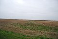
 Farmland near Cliffs End - geograph.org.uk - 3038010.jpg 640 × 480; 54 KB
-
 Farmland near Cliffs End - geograph.org.uk - 3040388.jpg 640 × 480; 63 KB
-
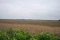
 Field by Sandwich Rd - geograph.org.uk - 3097717.jpg 640 × 430; 40 KB
-
 Flooded marshes - geograph.org.uk - 3094682.jpg 640 × 430; 42 KB
-
 Flooded marshes, Pegwell Bay - geograph.org.uk - 3094687.jpg 640 × 430; 41 KB
-
 Foads Hill, Cliffsend - geograph.org.uk - 4596705.jpg 2,272 × 1,704; 796 KB
-
 Foads Hill, Cliffsend - geograph.org.uk - 4596715.jpg 2,272 × 1,704; 805 KB
-
 Foads Lane - geograph.org.uk - 3097704.jpg 640 × 430; 54 KB
-
 Foads Lane, Cliffs End - geograph.org.uk - 6018897.jpg 5,202 × 3,465; 3.14 MB
-
 Foads Lane, Cliffsend - geograph.org.uk - 4596735.jpg 2,272 × 1,704; 810 KB
-
 Foads Lane, Cliffsend - geograph.org.uk - 4596739.jpg 2,272 × 1,704; 819 KB
-
 Foads Lane, Cliffsend - geograph.org.uk - 4596745.jpg 2,272 × 1,704; 775 KB
-
 Foads Lane, Cliffsend, Kent - geograph.org.uk - 727527.jpg 567 × 380; 226 KB
-
 Foads Lane, Cliffsend, Thanet, Kent - geograph.org.uk - 439216.jpg 640 × 429; 108 KB
-
 Foads Lane, Cottington Road junction. Cliffs End - geograph.org.uk - 6018905.jpg 5,202 × 3,465; 2.81 MB
-
 Footpath by Sandwich Road - geograph.org.uk - 3226539.jpg 1,500 × 1,000; 170 KB
-
 Footpath in Marjorie Chapman Meadow - geograph.org.uk - 2358486.jpg 3,072 × 2,304; 2.75 MB
-
 Footpath in Stonelees Nature Reserve - geograph.org.uk - 2427892.jpg 3,072 × 2,304; 1.85 MB
-
 Footpath junction in Pegwell Bay Nature Reserve - geograph.org.uk - 2427781.jpg 3,072 × 2,304; 2.38 MB
-
 Footpath this way - geograph.org.uk - 3101631.jpg 640 × 430; 98 KB
-
 Former hovercraft pad in Pegwell Bay - geograph.org.uk - 3249945.jpg 1,500 × 1,000; 260 KB
-
 Future site of Thanet Parkway railway station - geograph.org.uk - 5506373.jpg 3,264 × 2,448; 2.44 MB
-
 Hengist Way approaching Ramsgate - geograph.org.uk - 5159904.jpg 2,048 × 1,536; 854 KB
-
 Hengist Way, Cliff's End - geograph.org.uk - 3723958.jpg 640 × 547; 308 KB
-
 Hengist Way, Cliffsend - geograph.org.uk - 5058626.jpg 2,048 × 1,536; 823 KB
-
 Highland Cattle - geograph.org.uk - 3041984.jpg 640 × 430; 62 KB
-
 Hollins Bottom - geograph.org.uk - 3038028.jpg 640 × 480; 54 KB
-

-
 Houses on Sandwich Rd - geograph.org.uk - 3101642.jpg 640 × 430; 38 KB
-
 Houses on Sandwich Road - geograph.org.uk - 3226538.jpg 1,500 × 989; 165 KB
-
 Hoverlloyd hovercraft arriving at Pegwell Bay - geograph.org.uk - 5471654.jpg 1,024 × 669; 143 KB
-
 Hoverlloyd Hovercraft at Pegwell Bay - geograph.org.uk - 5471648.jpg 1,024 × 677; 135 KB
-
 Information Board in Pegwell Bay Nature Reserve - geograph.org.uk - 2427876.jpg 3,072 × 2,304; 2.32 MB
-
 Information Boards in Pegwell Bay Nature Reserve - geograph.org.uk - 2427793.jpg 3,072 × 2,304; 1.93 MB
-
 Jet garage on Sandwich Road - geograph.org.uk - 6395536.jpg 5,456 × 3,632; 1.55 MB
-
 The "Jet" Petrol Station - geograph.org.uk - 690046.jpg 640 × 419; 72 KB
-
 King Arthur Road, Cliffsend - geograph.org.uk - 4596713.jpg 2,272 × 1,704; 889 KB
-
 Kissing gate into Pegwell Bay - geograph.org.uk - 2358338.jpg 3,072 × 2,304; 1.88 MB
-

-
 Lake at Stonelees Nature Reserve - geograph.org.uk - 3815341.jpg 4,000 × 3,000; 4.26 MB
-
 Lake at Stonelees Nature Reserve - geograph.org.uk - 3815376.jpg 4,000 × 3,000; 4.28 MB
-
 Lavender Lane, Cliffs End - geograph.org.uk - 6018975.jpg 5,202 × 3,465; 2.86 MB
-
 Line of pillars at Pegwell Bay Country Park - geograph.org.uk - 3091456.jpg 3,872 × 2,592; 5.05 MB
-
 Looking N along the River Stour - geograph.org.uk - 456010.jpg 640 × 480; 44 KB
-
 Looking northeast from Sandwich Road - geograph.org.uk - 5186636.jpg 3,264 × 2,448; 1.66 MB
-
 Looking out over Pegwell Bay - geograph.org.uk - 5670680.jpg 1,080 × 608; 228 KB
-

-

-
 Manston, Hengist Way - geograph.org.uk - 3723953.jpg 640 × 480; 246 KB
-
 Marsh Drain in Pegwell Bay - geograph.org.uk - 2427836.jpg 3,072 × 2,304; 1.89 MB
-
 Marshes, Cliffsend - geograph.org.uk - 3097705.jpg 640 × 430; 43 KB
-
 Marshes, Cliffsend - geograph.org.uk - 3097708.jpg 640 × 430; 38 KB
-
 Marshes, Pegwell Bay - geograph.org.uk - 3094693.jpg 640 × 430; 46 KB
-
 Marshes, Pegwell Bay - geograph.org.uk - 3097695.jpg 640 × 389; 36 KB
-
 Marshes, Pegwell Bay - geograph.org.uk - 3097700.jpg 640 × 430; 44 KB
-
 Marshes, Pegwell Bay NNR - geograph.org.uk - 3041990.jpg 640 × 430; 45 KB
-
 Marshland of Pegwell Bay - geograph.org.uk - 2358358.jpg 3,072 × 1,728; 1.63 MB
-
 Meverall Avenue, Cliffsend - geograph.org.uk - 4596699.jpg 2,272 × 1,704; 827 KB
-
 Millennium Milepost - geograph.org.uk - 2070778.jpg 480 × 640; 115 KB
-
 Mount Green Avenue - geograph.org.uk - 3097724.jpg 640 × 430; 69 KB
-
 Mudflats and chalk cliffs, Pegwell Bay - geograph.org.uk - 2153537.jpg 1,024 × 768; 215 KB
-
 Mudflats at Pegwell Bay - geograph.org.uk - 2317541.jpg 640 × 480; 185 KB
-
 National Cycle Network 15 - geograph.org.uk - 6395562.jpg 5,456 × 3,632; 2.16 MB
-
 National Cycle Network sign - geograph.org.uk - 772384.jpg 640 × 428; 408 KB
-
 National Cycle Route 1 - geograph.org.uk - 3040168.jpg 640 × 430; 79 KB
-
 National Cycle route 1 - geograph.org.uk - 3094690.jpg 640 × 430; 50 KB
-

-

-

-
 National Cycle route milepost - geograph.org.uk - 3101613.jpg 430 × 640; 46 KB
-
 National Trust Sign at Pegwell Bay - geograph.org.uk - 6395480.jpg 5,456 × 3,632; 4.57 MB
-
 Natural drainage channel in the Stour estuary - geograph.org.uk - 3091435.jpg 3,872 × 2,592; 5.59 MB
-

-
 Nicholas Drive, Cliffsend - geograph.org.uk - 4596736.jpg 2,272 × 1,704; 776 KB
-
 No entry in this direction - geograph.org.uk - 3091449.jpg 3,872 × 2,592; 6.25 MB
-
 Old Post Office, Foads Lane, Cliffs End - geograph.org.uk - 6018901.jpg 5,202 × 3,465; 2.43 MB
-
 Old transformer^ - geograph.org.uk - 727900.jpg 567 × 380; 289 KB
-
 Park in Cliffs End - geograph.org.uk - 6018909.jpg 5,202 × 3,465; 4.02 MB
-
 Path in Pegwell Bay Country Park - geograph.org.uk - 3094685.jpg 640 × 430; 87 KB
-
 Path in Pegwell Bay Nature Reserve - geograph.org.uk - 2427828.jpg 3,072 × 2,304; 2.17 MB
-
 Path in Stonelees Nature Reserve - geograph.org.uk - 3815379.jpg 4,000 × 3,000; 4.28 MB
-
 Path in Stonelees Nature Reserve - geograph.org.uk - 3815380.jpg 4,000 × 3,000; 4.29 MB
-
 Pegwell Bay - geograph.org.uk - 1004244.jpg 640 × 481; 107 KB
-
 Pegwell Bay - geograph.org.uk - 2427692.jpg 3,072 × 1,728; 1.39 MB
-
 Pegwell Bay - geograph.org.uk - 3101687.jpg 640 × 430; 53 KB
-
 Pegwell Bay - geograph.org.uk - 3101694.jpg 640 × 430; 58 KB
-
 Pegwell Bay Country Park - geograph.org.uk - 3040165.jpg 640 × 430; 92 KB
-
 Pegwell Bay Country Park - geograph.org.uk - 3040167.jpg 640 × 430; 56 KB
-
 Pegwell Bay Country Park - geograph.org.uk - 3040170.jpg 640 × 430; 58 KB
-
 Pegwell Bay Country Park - geograph.org.uk - 3040173.jpg 640 × 430; 75 KB
-
 Pegwell Bay Country Park - geograph.org.uk - 3041981.jpg 640 × 430; 42 KB
-
 Pegwell Bay Country Park - geograph.org.uk - 3042009.jpg 640 × 430; 48 KB
-
 Pegwell Bay Country Park - geograph.org.uk - 6395470.jpg 5,456 × 3,632; 3 MB
-
 Pegwell Bay Country Park - geograph.org.uk - 6395473.jpg 4,405 × 2,893; 1.33 MB
-
 Pegwell Bay Information Board - geograph.org.uk - 2427882.jpg 3,072 × 2,304; 2.14 MB
-
 Pegwell Bay Marshes - geograph.org.uk - 3041996.jpg 640 × 430; 40 KB
-
 Pegwell Bay Marshes - geograph.org.uk - 3042003.jpg 640 × 430; 36 KB
-
 Pegwell Bay National Nature Reserve - geograph.org.uk - 3815328.jpg 4,000 × 3,000; 4.04 MB
-
 Pegwell Bay Nature Reserve - geograph.org.uk - 2427816.jpg 3,072 × 1,728; 2.08 MB
-
 Pegwell Bay near Ramsgate - geograph.org.uk - 3249938.jpg 1,500 × 1,000; 191 KB
-
 Pegwell Bay NNR - geograph.org.uk - 3041991.jpg 640 × 430; 42 KB
-
 Pegwell Bay NNR - geograph.org.uk - 3041994.jpg 640 × 430; 40 KB
-
 Pegwell Bay NNR - geograph.org.uk - 3042002.jpg 640 × 394; 42 KB
-
 Pegwell Bay, Ramsgate Hoverport 1973 - geograph.org.uk - 2806123.jpg 640 × 444; 100 KB
-
 Pegwell Country Park, lines of pillars - geograph.org.uk - 6018886.jpg 5,202 × 3,465; 3.87 MB
-
 Pillbox by Sandwich Road, near Ebbsfleet - geograph.org.uk - 4596776.jpg 2,272 × 1,704; 1.43 MB
-
 Portakabin Hide, Pegwell Bay - geograph.org.uk - 2427800.jpg 3,072 × 2,304; 1.73 MB
-
 Railway bridge over Hengist Way, Cliffsend - geograph.org.uk - 5058652.jpg 2,014 × 1,490; 721 KB
-
 Railway Bridge, Cliffsend, Thanet - geograph.org.uk - 730133.jpg 567 × 303; 176 KB
-
 Railway Bridge, Cliffsend, Thanet, Kent - geograph.org.uk - 730149.jpg 567 × 380; 213 KB
-
 Ramp over pipe on Sandwich Road - geograph.org.uk - 6395555.jpg 5,456 × 3,632; 3.39 MB
-
 Ramp, former hovercraft port, Cliffsend - geograph.org.uk - 5581204.jpg 640 × 480; 131 KB

_green,_Stonelees_golf_course._-_geograph.org.uk_-_302958.jpg)


