Category:Church of The Holy Rude churchyard
Jump to navigation
Jump to search
|
This is a category about listed building number 41126. |
| Object location | | View all coordinates using: OpenStreetMap |
|---|
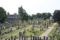
cemetery in Stirling, Scotland, UK  | |||||
| Upload media | |||||
| Instance of | |||||
|---|---|---|---|---|---|
| Location | |||||
| Connects with |
| ||||
| Heritage designation |
| ||||
 | |||||
Subcategories
This category has the following 3 subcategories, out of 3 total.
Media in category "Church of The Holy Rude churchyard"
The following 54 files are in this category, out of 54 total.
-
 Alter Friedhof bei Stirling Castle.jpg 5,604 × 3,737; 4.12 MB
-
 Cemetery - Stirling - geograph.org.uk - 2027257.jpg 1,192 × 792; 439 KB
-
 Cemetery 1 (2340792821).jpg 4,288 × 2,848; 6.23 MB
-
 Cemetery in Stirling, Scotland.jpg 718 × 696; 138 KB
-
 Church of the Holy Rude - Knox.jpg 800 × 508; 229 KB
-
 Church of the Holy Rude 001.jpg 2,844 × 4,270; 2.71 MB
-
 Church of the Holy Rude 002.jpg 2,664 × 4,154; 1.99 MB
-
 Church Of The Holy Rude Churchyard - 01.jpg 2,756 × 1,837; 3.73 MB
-
 Church Of The Holy Rude Churchyard - 02.jpg 3,000 × 2,250; 4.81 MB
-
 Church Of The Holy Rude Churchyard - 03.jpg 3,000 × 2,000; 4.36 MB
-
 Church Of The Holy Rude Churchyard - 04.jpg 2,250 × 3,000; 5.13 MB
-
 Church Of The Holy Rude Churchyard - 05.jpg 3,000 × 2,250; 4.9 MB
-
 Church Of The Holy Rude Churchyard - 06.jpg 3,000 × 2,250; 6.8 MB
-
 Church Of The Holy Rude Churchyard - 07.jpg 3,648 × 2,432; 7.56 MB
-
 Church Of The Holy Rude Churchyard - 10.jpg 3,000 × 2,000; 4.43 MB
-
 Church Of The Holy Rude Churchyard - 11.jpg 3,000 × 2,250; 5.5 MB
-
 Church Of The Holy Rude Churchyard - 12.jpg 3,000 × 2,000; 4.37 MB
-
 Church Of The Holy Rude Churchyard - 13.jpg 3,000 × 2,250; 4.81 MB
-
 Cimitero di Stirling - Tomba 01.jpg 4,000 × 3,000; 4.85 MB
-
 Cimitero di Stirling - Tomba 02.jpg 3,000 × 4,000; 4.88 MB
-
 Cimitero di Stirling - Tomba 03.jpg 3,000 × 4,000; 4.86 MB
-
 Cimitero di Stirling 01.jpg 4,000 × 3,000; 4.77 MB
-
 Cimitero di Stirling 02.jpg 4,000 × 3,000; 4.64 MB
-
 Cimitero di Stirling 03.jpg 4,000 × 3,000; 4.79 MB
-
 Cimitero di Stirling 04.jpg 4,000 × 3,000; 4.84 MB
-
 Cimitero di Stirling 05.jpg 4,000 × 3,000; 4.96 MB
-
 Cimitero di Stirling 06.jpg 4,000 × 3,000; 4.88 MB
-
 Cimitero di Stirling 07.jpg 4,000 × 3,000; 4.73 MB
-
 Cimitero di Stirling 08.jpg 4,000 × 3,000; 4.57 MB
-
 Ebenezer Erskine by Alexander Handyside Ritchie.JPG 2,056 × 3,088; 3.55 MB
-
 Ebenezer Erskine statue, Stirling.jpg 640 × 480; 82 KB
-
 Graveyard of Church of the Holy Rude Stirling (28665787006).jpg 3,216 × 2,136; 1.45 MB
-
 Graveyard outside stirling castle (15227915296).jpg 5,184 × 3,456; 5.15 MB
-
 Holy Rude Cemetery - geograph.org.uk - 206456.jpg 640 × 480; 132 KB
-
 Stirling - Church Of The Holy Rood Churchyard.JPG 3,264 × 2,448; 1.15 MB
-
 Stirling - Church of the Holy Rude, Stirling - 20220705101108.jpg 6,674 × 4,449; 3.41 MB
-
 Stirling - Church of the Holy Rude.jpg 614 × 750; 257 KB
-
 Stirling - Churchyard 01.jpg 2,448 × 3,264; 1.28 MB
-
 Stirling - Churchyard 02.jpg 3,264 × 2,448; 1.28 MB
-
 Stirling - Churchyard 03.jpg 3,264 × 2,448; 1.27 MB
-
 Stirling - Churchyard 04.jpg 2,448 × 3,264; 1.3 MB
-
 Stirling - Churchyard 05.jpg 2,448 × 3,264; 1.28 MB
-
 Stirling - Churchyard 06.jpg 3,264 × 2,448; 1.35 MB
-
 Stirling - Churchyard 07.jpg 3,264 × 2,448; 1.23 MB
-
 Stirling - Churchyard 08.jpg 3,264 × 2,448; 1.21 MB
-
 Stirling - Churchyard 11.jpg 3,264 × 2,448; 1.32 MB
-
 Stirling - Churchyard 12.jpg 2,448 × 3,264; 1.36 MB
-
 Stirling - Churchyard 13.jpg 3,264 × 2,448; 1.24 MB
-
 Stirling - Holy Rude Churchyard.jpg 900 × 574; 239 KB
-
 Stirling Cemetery 4.jpg 1,600 × 1,200; 385 KB
-
 Stirling Cemetery 7.jpg 1,600 × 1,200; 390 KB
-
 Stirling Cemetery 8.jpg 1,600 × 1,200; 392 KB
-
 Stirling cemetery.jpg 2,405 × 1,353; 881 KB
-
 Stirling, Church of The Holy Rude churchyard.jpg 4,000 × 3,000; 3.45 MB


.jpg)


.jpg)
.jpg)


