Category:Chihkan Tower
Jump to navigation
Jump to search

- English: Fort Provintia or Providentia
- 日本語: 赤崁楼(せきかんろう)
- 中文(臺灣):赤崁樓
| Object location | | View all coordinates using: OpenStreetMap |
|---|
A former fort in Tainan  | |||||
| Upload media | |||||
| Instance of | |||||
|---|---|---|---|---|---|
| Location | West Central District, Tainan, ROC | ||||
| Street address |
| ||||
| Architectural style | |||||
| Commissioned by | |||||
| Heritage designation |
| ||||
| Inception |
| ||||
 | |||||
Subcategories
This category has the following 6 subcategories, out of 6 total.
B
- Bixi of Chihkan Tower (13 F)
H
N
- Chihkan Tower at night (38 F)
P
- Penghu Confucian Academy (4 F)
S
- Steles in Chihkan Tower (8 F)
W
Pages in category "Chihkan Tower"
This category contains only the following page.
Media in category "Chihkan Tower"
The following 95 files are in this category, out of 95 total.
-
 02-Feb-2004-Tainan-Temple--Round-Gate.jpg 600 × 450; 91 KB
-
 0pen Air Concert at Chihcan Tower 赤嵌樓露天音樂會 - panoramio.jpg 3,500 × 2,626; 2.27 MB
-
 2010-02-19 Chinese stone lions at the Chihkan Tower, Tainan.jpg 2,112 × 2,816; 1.51 MB
-
 54506-Tainan (49026403948).jpg 3,000 × 2,003; 2.8 MB
-
 Buildings of the Chihkan Tower.jpg 1,045 × 1,392; 185 KB
-
 Chia-Kam-Lâu.jpg 6,844 × 5,419; 9.51 MB
-
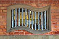 Chihkan Tower (former Fort Provintia), Windows (Taiwan).jpg 3,855 × 2,570; 2.89 MB
-
 Chihkan Tower (Fort Provintia).jpg 2,047 × 1,492; 861 KB
-
 Chihkan Tower 02.JPG 3,072 × 2,304; 2.12 MB
-
 Chihkan Tower 03.JPG 3,072 × 2,304; 2.09 MB
-
 Chihkan Tower 14.JPG 3,072 × 2,304; 2.02 MB
-
 Chihkan Tower 15.JPG 3,072 × 2,304; 1.96 MB
-
 Chihkan Tower 16.JPG 3,072 × 2,304; 2.01 MB
-
 Chihkan Tower 54505-Tainan (44807293862).jpg 3,000 × 1,827; 2.48 MB
-
 Chihkan Tower 54507-Tainan (43946438085).jpg 3,000 × 2,000; 1.77 MB
-
 Chihkan Tower 54510-Tainan (44807297992).jpg 3,000 × 2,003; 2.98 MB
-
 Chihkan Tower 54515-Tainan (30984681738).jpg 3,000 × 2,000; 1.97 MB
-
 Chihkan Tower 54527-Tainan (44807305842).jpg 3,000 × 2,000; 1.57 MB
-
 Chihkan Tower 54532-Tainan (44807308082).jpg 3,000 × 2,003; 1.83 MB
-
 Chihkan Tower 54542-Tainan (43946454385).jpg 3,000 × 2,003; 2.18 MB
-
 Chihkan Tower 54548-Tainan (44136262704).jpg 3,000 × 2,000; 1.91 MB
-
 Chihkan Tower 54551-Tainan (44136266034).jpg 3,000 × 2,000; 1.97 MB
-
 Chihkan Tower 54557-Tainan (29920770467).jpg 3,000 × 1,861; 2.44 MB
-
 Chihkan Tower 54559-Tainan (29932404217).jpg 3,000 × 1,808; 1.78 MB
-
 Chihkan Tower 54566-Tainan (29932408507).jpg 3,000 × 1,838; 2.35 MB
-
 Chihkan Tower entrance.jpg 6,553 × 1,993; 3.85 MB
-
 Chihkan Tower payment seal 20131127.jpg 200 × 200; 29 KB
-
 Chihkan Tower Tour Souvenir 20131127.jpg 480 × 480; 115 KB
-
 Chihkan Tower under Japanese rule.jpg 960 × 667; 103 KB
-
 Chihkan Tower under Japanese rule2.jpg 960 × 618; 103 KB
-
 Chikan Tower - Dutch surrender statue.jpg 3,214 × 2,318; 2.55 MB
-
 Chikan Tower - fish.jpg 3,456 × 2,592; 1.45 MB
-
 Dutch surrender.JPG 2,592 × 1,944; 2.26 MB
-
 Fort Provintia 02.jpg 3,456 × 5,184; 7.79 MB
-
 Fort Provintia 03.jpg 5,184 × 3,456; 7.08 MB
-
 Fort Provintia 04.jpg 5,184 × 3,456; 4.48 MB
-
 Fort Provintia 07.jpg 3,456 × 5,184; 8.33 MB
-
 Fort Provintia 11.jpg 3,456 × 5,184; 7.65 MB
-
 Frontpage of newspaper Travel and Transport in Taiwan 1938-10-15.jpg 667 × 1,080; 242 KB
-
 Goldfish Pond outside Chikan Tower, Tainan - panoramio.jpg 1,920 × 1,440; 1.34 MB
-
 Imperial examination questions.jpg 2,251 × 2,137; 1.27 MB
-
 Map of Tainan (1849).jpg 639 × 954; 239 KB
-
 Roof detail of the Chihkan Tower 20100219.jpg 2,112 × 2,816; 1.12 MB
-
 Tainan Taiwan Fort-Provintia-02.jpg 5,760 × 3,840; 15.19 MB
-
 Tainan Taiwan Fort-Provintia-05.jpg 5,760 × 3,840; 15.96 MB
-
 Tainan Taiwan Fort-Provintia-05a.jpg 5,408 × 3,605; 17.07 MB
-
 Tainan, East District, Tainan City, Taiwan - panoramio (1).jpg 3,264 × 2,448; 2.07 MB
-
 Tainan, East District, Tainan City, Taiwan - panoramio.jpg 3,264 × 2,448; 2.1 MB
-
 The Garden of Fort Provintia 赤崁樓花園 - panoramio.jpg 3,000 × 2,249; 1.89 MB
-
 View from the Chihkan Tower.jpg 4,288 × 2,848; 9.44 MB
-
 Views from Chihkan Tower 01.2023-05-17.jpg 4,032 × 3,024; 2.99 MB
-
 台南市赤崁樓屋頂.JPG 3,456 × 2,304; 1.72 MB
-
 台南赤崁樓 (2).jpg 3,000 × 4,496; 3.81 MB
-
 台南赤崁樓 普羅民遮城 原始入口.jpg 6,000 × 4,000; 2.41 MB
-
 台南赤崁樓.jpg 2,204 × 3,920; 2.35 MB
-
 台南赤崁樓1.jpg 2,488 × 3,754; 5.28 MB
-
 台南赤崁樓2.jpg 2,488 × 3,754; 3.52 MB
-
 台南赤崁樓4.jpg 2,488 × 3,754; 3.52 MB
-
 台南赤崁樓5.jpg 2,488 × 3,754; 5.77 MB
-
 台南赤崁樓側邊.jpg 2,488 × 3,754; 2.97 MB
-
 台南赤崁樓圓門.jpg 2,488 × 3,754; 5.11 MB
-
 台南赤崁樓垂梁.jpg 2,488 × 3,754; 3.69 MB
-
 台南赤崁樓垂梁2.jpg 2,488 × 3,754; 4.29 MB
-
 台南赤崁樓庭園2.jpg 2,488 × 3,754; 6.73 MB
-
 台南赤崁樓普羅民遮城原入口.jpg 2,488 × 3,754; 5.82 MB
-
 台南赤崁樓樓梯.jpg 2,488 × 3,754; 4.16 MB
-
 台南赤崁樓海神廟石獅.jpg 2,488 × 3,754; 4.92 MB
-
 台南赤崁樓石馬.jpg 2,488 × 3,754; 4.83 MB
-
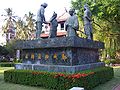
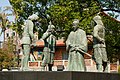
 台南赤崁樓鄭成功群像.jpg 2,488 × 3,754; 4.64 MB
-
 台南赤崁樓鄭成功群像2.jpg 2,488 × 3,754; 4.78 MB
-
 台灣地里圖 section.jpg 1,326 × 1,129; 374 KB
-
 台灣臺南赤崁樓.jpg 5,328 × 4,000; 1.92 MB
-
 國定古蹟 台南赤崁樓 普城稜堡殘跡.jpg 6,000 × 4,000; 3.11 MB
-
 普羅民遮城.jpg 4,032 × 3,024; 2.41 MB
-
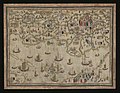 清 佚名 台南地區荷蘭城堡--Forts Zeelandia and Provintia and the City of Tainan MET DP354272.jpg 3,947 × 3,059; 3.66 MB
-
 羽鳥又男銅像.JPG 1,198 × 1,657; 549 KB
-
 臺灣地里圖1.jpg 19,683 × 7,900; 67.83 MB
-
 赤崁樓 (1).JPG 3,888 × 2,592; 4 MB
-
 赤崁樓 (2).jpg 3,898 × 2,799; 2.18 MB
-
 赤崁樓 (5).JPG 3,888 × 2,592; 3.32 MB
-
 赤崁樓.jpg 3,872 × 2,592; 3.49 MB
-
 赤崁樓一景.jpg 1,920 × 1,280; 2.71 MB
-
 赤崁樓之魚.jpg 1,920 × 1,280; 3.05 MB
-
 赤崁樓景.jpg 1,280 × 1,920; 2.22 MB
-
 赤崁樓的飛簷.jpg 1,000 × 753; 559 KB
-
 赤崁樓的馬.jpg 1,280 × 1,920; 2.13 MB
-
 赤崁樓花磚.JPG 3,056 × 4,592; 7.64 MB
-
 赤嵌夕照.jpg 1,143 × 946; 390 KB
-
 赤嵌樓 夜景.jpg 3,600 × 2,400; 3.19 MB
-
 赤嵌樓字.jpg 3,618 × 1,874; 867 KB
-
 赤嵌樓文昌閣之燕尾脊.jpg 6,000 × 4,000; 3.48 MB
-
 赤嵌樓的商店-佐賀家.jpg 1,920 × 1,280; 1.78 MB
-
 赤嵌樓的石獅子.jpg 1,280 × 1,920; 1.86 MB
-
 赤嵌樓的竹節窗.jpg 5,472 × 3,648; 10.56 MB
-
 赤嵌樓石馬.jpg 2,272 × 1,704; 1.54 MB


.jpg)


,_Windows_(Taiwan).jpg)
.jpg)


.jpg)
.jpg)
.jpg)
.jpg)
.jpg)
.jpg)
.jpg)
.jpg)
.jpg)
.jpg)
.jpg)
.jpg)


.jpg)


.jpg)


.jpg)


.JPG)
.jpg)
.JPG)


