Category:Cheswardine
Jump to navigation
Jump to search
English: Cheswardine is a rural village and civil parish in north east Shropshire, England. The village lies close to the border with Staffordshire and is about 8 miles north of Newport and 5 miles south east of Market Drayton. At the 2001 Census, Cheswardine had a population of 991 people.
village and civil parish in Shropshire, UK  Stryd Fawr, Cheswardine | |||||
| Upload media | |||||
| Instance of | |||||
|---|---|---|---|---|---|
| Location | Shropshire, West Midlands, England | ||||
 | |||||
Subcategories
This category has the following 4 subcategories, out of 4 total.
C
- Cheswardine Hall (4 F)
S
- St Swithun, Cheswardine (7 F)
Media in category "Cheswardine"
The following 169 files are in this category, out of 169 total.
-
 "Caution our dogs bite" - geograph.org.uk - 1925783.jpg 640 × 480; 121 KB
-
 'Missus Mouse' at Goldstone Wharf - geograph.org.uk - 5672486.jpg 1,280 × 851; 494 KB
-
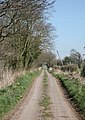 A straight track at Thorneypits - geograph.org.uk - 391731.jpg 453 × 640; 103 KB
-

-

-
 Black barn and a mound of silage - geograph.org.uk - 5456962.jpg 640 × 480; 74 KB
-
 Bridge No. 49, Shropshire Union Canal.jpg 1,280 × 960; 1.01 MB
-
 Canal milepost near Park Heath.jpg 734 × 979; 506 KB
-
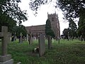
 Cemetery, Cheswardine - geograph.org.uk - 6263058.jpg 800 × 600; 127 KB
-
 Cheswardine - Fox ^ Hounds PH ^ St Swithun's Church - geograph.org.uk - 5608329.jpg 5,184 × 2,920; 6.04 MB
-
 Cheswardine - St Swithun's Church - geograph.org.uk - 5608326.jpg 5,184 × 2,920; 5.95 MB
-
 Cheswardine - Symons Way, miniature stone circle - geograph.org.uk - 5608330.jpg 5,184 × 2,920; 6.11 MB
-
 Cheswardine High Street - geograph.org.uk - 1925725.jpg 640 × 480; 76 KB
-
 Cheswardine Village Sign - geograph.org.uk - 5456887.jpg 640 × 480; 100 KB
-
 Church Lane, Cheswardine - geograph.org.uk - 6262319.jpg 800 × 600; 166 KB
-
 Coal Brook - geograph.org.uk - 574664.jpg 640 × 480; 111 KB
-
 Comprehensive milestone at Cheswardine - geograph.org.uk - 1925793.jpg 480 × 640; 107 KB
-
 Country Lane by Bishops Wood - geograph.org.uk - 430569.jpg 640 × 429; 67 KB
-

-
 Dwelling at Thorneypits - geograph.org.uk - 391730.jpg 640 × 427; 80 KB
-
 Easy does it^ - geograph.org.uk - 5456848.jpg 640 × 480; 54 KB
-
 Elizabeth II postbox, Doley - geograph.org.uk - 6263121.jpg 2,676 × 4,397; 3.36 MB
-
 Ellerton Pool Cottage - geograph.org.uk - 751545.jpg 640 × 480; 123 KB
-
 Ellerton Wood Farm - geograph.org.uk - 3825164.jpg 1,142 × 857; 453 KB
-
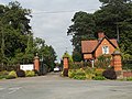 Entrance to Cheswardine Hall - geograph.org.uk - 2030309.jpg 640 × 480; 216 KB
-
 Entrance to Ellerton Woodww - geograph.org.uk - 391711.jpg 427 × 640; 130 KB
-
 Entrance to Lipley Farm - geograph.org.uk - 2302038.jpg 640 × 480; 156 KB
-
 Entrance to Soudley Park Farm - geograph.org.uk - 5456953.jpg 640 × 480; 106 KB
-
 Farm building at Park Heath - geograph.org.uk - 391745.jpg 534 × 640; 104 KB
-

-
 Farm track off Haywood Lane - geograph.org.uk - 6262292.jpg 800 × 600; 175 KB
-
 Farm Tracks - geograph.org.uk - 391690.jpg 640 × 415; 76 KB
-

-
 Farmland near to Hopshort - geograph.org.uk - 391761.jpg 640 × 322; 32 KB
-
 Field beside Shropshire Union Canal - geograph.org.uk - 4599891.jpg 640 × 427; 78 KB
-
 Field Demarcation - geograph.org.uk - 391695.jpg 640 × 444; 66 KB
-
 Field path near Lawn Drumble , NW of Cheswardine - geograph.org.uk - 5608325.jpg 5,184 × 2,920; 6.11 MB
-
 Fields and crops near Hopshot - geograph.org.uk - 2706086.jpg 640 × 480; 97 KB
-
 Footpath near Soudley - geograph.org.uk - 5456908.jpg 640 × 480; 81 KB
-
 Footpath through the spuds - geograph.org.uk - 5456899.jpg 640 × 480; 98 KB
-
 Footpath to Chipnall Lees - geograph.org.uk - 2302040.jpg 640 × 480; 110 KB
-
 Gateway into Castle Wood - geograph.org.uk - 5456868.jpg 640 × 480; 113 KB
-
 Goldstone Wharf, Market Drayton - geograph.org.uk - 280073.jpg 640 × 424; 85 KB
-

-
 Grassland near Lipley Heath Farm - geograph.org.uk - 6262386.jpg 800 × 600; 87 KB
-
 Grazing near Chipnallmill Farm - geograph.org.uk - 6262333.jpg 800 × 600; 112 KB
-
 Grazing near Heatherdale Farm - geograph.org.uk - 6262338.jpg 800 × 600; 97 KB
-
 Grazing off Haywood Lane - geograph.org.uk - 6262289.jpg 800 × 600; 149 KB
-
 Grazing towards Bishop's Wood - geograph.org.uk - 6262389.jpg 800 × 600; 90 KB
-
 Grazing, Chipnall - geograph.org.uk - 6262325.jpg 800 × 600; 169 KB
-
 Haywood Lane - geograph.org.uk - 6262294.jpg 800 × 600; 160 KB
-
 Haywood Lane towards Cheswardine - geograph.org.uk - 6262290.jpg 800 × 600; 134 KB
-
 Haywood Lane, Bridge Farm - geograph.org.uk - 6262288.jpg 800 × 600; 133 KB
-
 Horses in paddock at Soudley - geograph.org.uk - 1925803.jpg 640 × 480; 102 KB
-
 Houses on Haywood Lane - geograph.org.uk - 6262296.jpg 800 × 600; 98 KB
-
 Junction near Goldstone Wharf - geograph.org.uk - 5457765.jpg 640 × 480; 98 KB
-

-
 Lane towards Chipnall Lees - geograph.org.uk - 6262331.jpg 800 × 600; 142 KB
-
 Lane towards Chipnallmill Farm - geograph.org.uk - 6262335.jpg 800 × 600; 154 KB
-
 Lodge to Cheswardine Hall - geograph.org.uk - 6262321.jpg 800 × 531; 105 KB
-
 Maize crop towards Rushymoss Wood - geograph.org.uk - 6262328.jpg 800 × 600; 114 KB
-
 Make way for Electricity - geograph.org.uk - 391742.jpg 640 × 448; 97 KB
-
 Manor Cottage, Doley - geograph.org.uk - 6263122.jpg 5,184 × 3,888; 4.21 MB
-
 Manure mountain at Ellerton - geograph.org.uk - 1925699.jpg 640 × 480; 125 KB
-
 Milepost near Fox Bridge.jpg 979 × 734; 510 KB
-
 Mind your head^ - geograph.org.uk - 5456845.jpg 640 × 480; 69 KB
-

-
 Minor road towards Chipnall - geograph.org.uk - 6262322.jpg 800 × 600; 148 KB
-
 Minor road towards Doley - geograph.org.uk - 6262387.jpg 800 × 600; 185 KB
-
 Minor road towards Doley - geograph.org.uk - 6262391.jpg 800 × 600; 164 KB
-
 Minor road towards Glass Houses - geograph.org.uk - 6262339.jpg 800 × 600; 122 KB
-
 Minor road, Chipnall - geograph.org.uk - 6262327.jpg 800 × 600; 170 KB
-
 Moorings south-west of Cheswardine in Shropshire - geograph.org.uk - 6034343.jpg 1,280 × 960; 1.6 MB
-
 Mother duck and offspring - geograph.org.uk - 5457560.jpg 640 × 480; 81 KB
-
 Narrow boat on narrow canal - geograph.org.uk - 2030206.jpg 640 × 480; 447 KB
-
 Narrow boat with a garden - geograph.org.uk - 5456974.jpg 640 × 480; 69 KB
-
 Narrowboat with pub^ Goldstone Wharf, Shropshire - geograph.org.uk - 5287029.jpg 1,280 × 960; 1.11 MB
-

-

-

-
 On guard at Cheswardine - geograph.org.uk - 2030299.jpg 640 × 480; 274 KB
-
 Ordnance Survey Cut Mark - geograph.org.uk - 5230102.jpg 3,855 × 2,891; 1.62 MB
-
 OS benchmark - New Brighton Bridge - geograph.org.uk - 3822003.jpg 734 × 979; 444 KB
-
 OS rivet and benchmark on Goldstone Bridge - geograph.org.uk - 3825152.jpg 857 × 1,142; 460 KB
-
 Paddock and house at Soudley - geograph.org.uk - 1925801.jpg 640 × 480; 99 KB
-
 Playing field, Cheswardine - geograph.org.uk - 1925791.jpg 640 × 480; 71 KB
-
 Pollarded willows at Sambrook - geograph.org.uk - 1925675.jpg 640 × 480; 126 KB
-
 Postbox at Doley crossroads - geograph.org.uk - 2706397.jpg 640 × 480; 104 KB
-
 Postbox at Ellerton - geograph.org.uk - 2706062.jpg 640 × 480; 88 KB
-
 Private driveway - geograph.org.uk - 3179707.jpg 640 × 480; 143 KB
-

-
 Ready for sowing - geograph.org.uk - 2706074.jpg 640 × 480; 131 KB
-
 Road junction at Ellerton - geograph.org.uk - 1925695.jpg 640 × 480; 63 KB
-
 Rope wear on Soudley Bridge - geograph.org.uk - 3819024.jpg 857 × 1,142; 383 KB
-
 Shropshire cropfields towards Ellerton - geograph.org.uk - 1460916.jpg 640 × 470; 134 KB
-
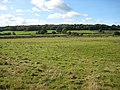
 Shropshire farmland south of Little Soudley - geograph.org.uk - 6034293.jpg 1,600 × 900; 1.59 MB
-
-

-
 Shropshire-Staffordshire county boundary - geograph.org.uk - 5772159.jpg 800 × 631; 106 KB
-
 Sign and stile - geograph.org.uk - 2302052.jpg 640 × 480; 95 KB
-

-
 Signpost at Cheswardine - geograph.org.uk - 1925798.jpg 480 × 640; 94 KB
-
 Signpost on Regional Cycle Route 75 - geograph.org.uk - 2030314.jpg 640 × 480; 293 KB
-
 St Swithun's Church, Cheswardine - geograph.org.uk - 5456879.jpg 640 × 480; 89 KB
-
 St Swithun's Church, Cheswardine - geograph.org.uk - 5456884.jpg 480 × 640; 59 KB
-
 Stubble field near Cheswardine - geograph.org.uk - 6262324.jpg 800 × 600; 119 KB
-
 Stubble field of Haywood Lane - geograph.org.uk - 6261948.jpg 800 × 600; 111 KB
-
 Tandem as planter - geograph.org.uk - 1925717.jpg 640 × 480; 106 KB
-
 The "Red Lion", Cheswardine - geograph.org.uk - 1925721.jpg 640 × 480; 82 KB
-
 The 'Fox ^ Hounds' - Cheswardine - geograph.org.uk - 2030244.jpg 640 × 480; 155 KB
-
 The 'Oak Tree' stretch - geograph.org.uk - 3819020.jpg 1,306 × 979; 346 KB
-
 The Church of St Swithun at Cheswardine - geograph.org.uk - 5230099.jpg 4,000 × 3,000; 2.33 MB
-
 The Fox ^ Hounds, Cheswardine - geograph.org.uk - 5456889.jpg 640 × 480; 51 KB
-
 The Hostels - it's seen better days - geograph.org.uk - 2302050.jpg 640 × 480; 185 KB
-
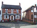 The Red Lion, Cheswardine - geograph.org.uk - 628775.jpg 640 × 480; 78 KB
-
 The road to Doley - geograph.org.uk - 5456901.jpg 640 × 480; 105 KB
-
 The Wharf Tavern Goldstone - geograph.org.uk - 5457555.jpg 640 × 480; 60 KB
-
 The Wharf Tavern near Cheswardine, Shropshire - geograph.org.uk - 5277220.jpg 1,280 × 960; 1.08 MB
-
 The Wharf Tavern Pub, Goldstone - geograph.org.uk - 1835666.jpg 2,048 × 1,536; 648 KB
-

-

-
 The Wharf Tavern, Goldstone - geograph.org.uk - 5456842.jpg 640 × 480; 74 KB
-
 The Wharf Tavern, Goldstone - geograph.org.uk - 5456853.jpg 640 × 480; 53 KB
-

-
 Trees in a hedgerow - geograph.org.uk - 391672.jpg 340 × 640; 110 KB
-

-

-
 Wheat field south of Soudley - geograph.org.uk - 5456913.jpg 640 × 467; 99 KB
-
 Wheatfield south of Soudley - geograph.org.uk - 5456966.jpg 640 × 480; 92 KB
-
 A storm a brewing - geograph.org.uk - 6692.jpg 640 × 480; 116 KB
-
 A view at Little Soudley - geograph.org.uk - 391707.jpg 640 × 308; 43 KB
-
 Back of the Farm - geograph.org.uk - 543430 (cropped).jpg 463 × 114; 12 KB
-
 Back of the Farm - geograph.org.uk - 543430.jpg 640 × 428; 65 KB
-
 Barns near Soudley Park - geograph.org.uk - 391666.jpg 640 × 300; 45 KB
-
 Cattle at Ellerton Farm - geograph.org.uk - 391688.jpg 640 × 363; 53 KB
-
 Chipnall - geograph.org.uk - 574680.jpg 640 × 480; 112 KB
-
 Chipnall Wood south of Tag Lane - geograph.org.uk - 574712.jpg 640 × 480; 103 KB
-
 Farm Buildings Off Goldenhill Lane - geograph.org.uk - 549090.jpg 640 × 480; 69 KB
-
 Field Entrance - geograph.org.uk - 543421.jpg 640 × 428; 69 KB
-
 Field Near Cheswardine - geograph.org.uk - 628786.jpg 640 × 480; 88 KB
-
 Field Near Goldstone Common - geograph.org.uk - 549094.jpg 640 × 480; 97 KB
-
 Footpath Near Cheswardine - geograph.org.uk - 628819.jpg 640 × 480; 80 KB
-
 Footpath Near Lipley - geograph.org.uk - 628798.jpg 640 × 480; 74 KB
-
 Footpath, Goldstone Common - geograph.org.uk - 549093.jpg 640 × 480; 131 KB
-
 Foxbridge Farm at Little Soudley - geograph.org.uk - 762243.jpg 640 × 480; 78 KB
-
 Hedge and tall crop - geograph.org.uk - 574726.jpg 640 × 480; 146 KB
-
 Hinstock Grange - geograph.org.uk - 549081.jpg 640 × 480; 131 KB
-

-
 Inside the horse gin - geograph.org.uk - 728849.jpg 640 × 480; 70 KB
-
 Junction Near Chipnall Lees - geograph.org.uk - 628785.jpg 640 × 480; 130 KB
-
 Lane leading to Shawbroom - geograph.org.uk - 391758.jpg 640 × 498; 142 KB
-
 Lane near to Soudley Park - geograph.org.uk - 391766.jpg 640 × 427; 52 KB
-
 Light Wood Farm - geograph.org.uk - 534110.jpg 640 × 480; 110 KB
-
 Lipley Heath Farm - geograph.org.uk - 628789.jpg 640 × 480; 85 KB
-
 Near Cheswardine Park Farm - geograph.org.uk - 628801.jpg 640 × 480; 94 KB
-
 Near Goldstone - geograph.org.uk - 549091.jpg 640 × 480; 89 KB
-
 Near Lockleywood - geograph.org.uk - 549098.jpg 640 × 480; 76 KB
-
 Park Heath Farm - geograph.org.uk - 391747.jpg 640 × 240; 20 KB
-
 Path towards Soudley - geograph.org.uk - 391675.jpg 640 × 604; 108 KB
-
 Small Woods - geograph.org.uk - 391671.jpg 640 × 278; 32 KB
-
 Straight Track to Thorneypits - geograph.org.uk - 391735.jpg 640 × 542; 118 KB
-
 Tag Lane - geograph.org.uk - 574691.jpg 640 × 480; 125 KB
-

-
 The pool at Shawbroom - geograph.org.uk - 391757.jpg 640 × 396; 107 KB
-
 The Wharf Tavern - geograph.org.uk - 5269.jpg 640 × 480; 46 KB
-
 Towards Ellerton Farm - geograph.org.uk - 391678.jpg 640 × 330; 54 KB
-
 Track to Wood Farm - geograph.org.uk - 574729.jpg 640 × 480; 123 KB
-
-
 Walkers paradise signed. - geograph.org.uk - 6702.jpg 480 × 640; 151 KB


.jpg)