Category:Chesterfield Canal
Jump to navigation
Jump to search
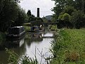
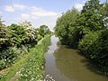
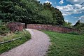
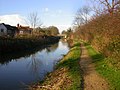
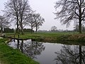
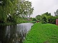
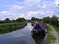
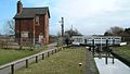
English: The Chesterfield Canal is in the north of England and it is known locally as 'Cuckoo Dyke'. It was opened in 1777 and ran from the River Trent at West Stockwith, Nottinghamshire to Chesterfield, Derbyshire. It is currently navigable as far as Kiveton Park near Rotherham, South Yorkshire, plus an isolated section near Chesterfield. Tapton Lock Visitor Centre is located on the Chesterfield Canal to the north of Tapton Park. (→Chesterfield Canal)

Canal in the East Midlands of England | |||||
| Upload media | |||||
| Instance of | |||||
|---|---|---|---|---|---|
| Location |
| ||||
 | |||||
Subcategories
This category has the following 6 subcategories, out of 6 total.
Media in category "Chesterfield Canal"
The following 200 files are in this category, out of 313 total.
(previous page) (next page)-
 A long,but pleasant walk (3333684116).jpg 2,500 × 1,667; 948 KB
-

-
 Approaching Brimington - geograph.org.uk - 2867604.jpg 3,456 × 4,608; 4.53 MB
-
 Between locks 47 and 48, Chesterfield Canal.jpg 2,048 × 1,536; 748 KB
-
 Bilby Lane Bridge - geograph.org.uk - 1867899.jpg 1,280 × 854; 248 KB
-
 Bilby Lane Bridge - geograph.org.uk - 1991859.jpg 640 × 480; 82 KB
-
 Bilby Lane Bridge - geograph.org.uk - 2867675.jpg 4,608 × 3,456; 3.44 MB
-
 Bilby Lane Bridge - geograph.org.uk - 2896006.jpg 2,848 × 2,144; 1.52 MB
-
 Bilby Lane bridge, Chesterfield canal - geograph.org.uk - 2296108.jpg 950 × 696; 313 KB
-
 Birch trees by the Chesterfield Canal - geograph.org.uk - 2895787.jpg 2,144 × 2,848; 1.5 MB
-
 Bluebank Lock No4 - geograph.org.uk - 2867665.jpg 4,608 × 3,456; 3.44 MB
-
 Bluebank lock on the Chesterfield canal - geograph.org.uk - 2296054.jpg 950 × 700; 256 KB
-
 Bluebank lock on the Chesterfield Canal - geograph.org.uk - 2825243.jpg 768 × 1,024; 205 KB
-
 Bluebank Lock, Chesterfield canal - geograph.org.uk - 5803282.jpg 1,600 × 1,065; 782 KB
-
 Boats Bridge and Chimney - geograph.org.uk - 221240.jpg 640 × 480; 112 KB
-
 Bridge No 1 Chesterfield Canal (3215157903).jpg 4,272 × 2,848; 13.87 MB
-
 Bridge over overflow weir, Chesterfield Canal - geograph.org.uk - 3103865.jpg 1,024 × 768; 197 KB
-
 Brimington Wharf - geograph.org.uk - 2895760.jpg 2,848 × 2,144; 1.5 MB
-
 Brimington Wharf Chesterfield Canal - geograph.org.uk - 2867614.jpg 4,608 × 3,456; 3.39 MB
-
 Brimington Wharf, Chesterfield Canal - geograph.org.uk - 5956864.jpg 1,024 × 768; 233 KB
-
 Canal and Railway - geograph.org.uk - 128708.jpg 640 × 480; 118 KB
-
 Canal and Trees - geograph.org.uk - 179403.jpg 640 × 480; 121 KB
-

-
 Canal boat on the Chesterfield Canal - geograph.org.uk - 89550.jpg 640 × 482; 145 KB
-
 Canal crane, Retford Basin.jpg 1,280 × 981; 359 KB
-
 Canal overflow - panoramio.jpg 2,048 × 1,536; 936 KB
-

-
 Canal, field and tree - geograph.org.uk - 1619307.jpg 480 × 640; 90 KB
-
 Chesterfield , Chesterfield Canal - Bluebank Lock - geograph.org.uk - 5961516.jpg 6,000 × 4,000; 7.66 MB
-
 Chesterfield , Chesterfield Canal - Bluebank Lock - geograph.org.uk - 5961519.jpg 4,000 × 6,000; 7.47 MB
-
 Chesterfield , Chesterfield Canal - Dixon's Lock - geograph.org.uk - 5961555.jpg 6,000 × 4,000; 7.15 MB
-
 Chesterfield , Chesterfield Canal - Dixon's Lock - geograph.org.uk - 5961558.jpg 6,000 × 4,000; 5.88 MB
-
 Chesterfield , Chesterfield Canal - geograph.org.uk - 5955290.jpg 6,000 × 4,000; 6.73 MB
-
 Chesterfield , Chesterfield Canal - geograph.org.uk - 5955291.jpg 6,000 × 4,000; 6.77 MB
-
 Chesterfield , Chesterfield Canal - geograph.org.uk - 5955293.jpg 6,000 × 4,000; 7.49 MB
-
 Chesterfield , Chesterfield Canal - geograph.org.uk - 5955295.jpg 6,000 × 4,000; 6.05 MB
-
 Chesterfield , Chesterfield Canal - geograph.org.uk - 5955298.jpg 6,000 × 4,000; 7.71 MB
-
 Chesterfield , Chesterfield Canal - geograph.org.uk - 5955305.jpg 6,000 × 4,000; 6.55 MB
-
 Chesterfield , Chesterfield Canal - geograph.org.uk - 5957214.jpg 6,000 × 4,000; 7.69 MB
-
 Chesterfield , Chesterfield Canal - geograph.org.uk - 5957216.jpg 6,000 × 4,000; 7.86 MB
-
 Chesterfield , Chesterfield Canal - geograph.org.uk - 5957217.jpg 6,000 × 4,000; 6.31 MB
-
 Chesterfield , Chesterfield Canal - geograph.org.uk - 5957219.jpg 6,000 × 4,000; 6.61 MB
-
 Chesterfield , Chesterfield Canal - geograph.org.uk - 5957220.jpg 6,000 × 4,000; 7.44 MB
-
 Chesterfield , Chesterfield Canal - geograph.org.uk - 5957221.jpg 6,000 × 4,000; 7.45 MB
-
 Chesterfield , Chesterfield Canal - geograph.org.uk - 5957222.jpg 6,000 × 4,000; 6.7 MB
-
 Chesterfield , Chesterfield Canal - geograph.org.uk - 5961511.jpg 6,000 × 4,000; 7.2 MB
-
 Chesterfield , Chesterfield Canal - geograph.org.uk - 5961512.jpg 6,000 × 4,000; 7.35 MB
-
 Chesterfield , Chesterfield Canal - geograph.org.uk - 5961529.jpg 6,000 × 4,000; 6.86 MB
-
 Chesterfield , Chesterfield Canal - geograph.org.uk - 5961530.jpg 6,000 × 4,000; 7.81 MB
-
 Chesterfield , Chesterfield Canal - geograph.org.uk - 5961531.jpg 6,000 × 4,000; 6.4 MB
-
 Chesterfield , Chesterfield Canal - geograph.org.uk - 5961547.jpg 6,000 × 4,000; 6.5 MB
-
 Chesterfield , Chesterfield Canal - geograph.org.uk - 5961549.jpg 6,000 × 4,000; 6.16 MB
-
 Chesterfield , Chesterfield Canal - geograph.org.uk - 5961550.jpg 6,000 × 4,000; 6.89 MB
-
 Chesterfield , Chesterfield Canal - geograph.org.uk - 5961551.jpg 6,000 × 4,000; 7.01 MB
-
 Chesterfield , Chesterfield Canal - Heron - geograph.org.uk - 5961515.jpg 6,000 × 4,000; 4.36 MB
-
 Chesterfield , Chesterfield Canal - Wheeldon Mill Lock - geograph.org.uk - 5957215.jpg 4,000 × 6,000; 7.8 MB
-
 Chesterfield , Chesterfield Canal - Wheeldon Mill Lock - geograph.org.uk - 5957218.jpg 6,000 × 4,000; 6.86 MB
-

-
-

-

-

-

-
 Chesterfield Canal - Bilby Lane Bridge - geograph.org.uk - 4202100.jpg 3,481 × 2,567; 1.81 MB
-
 Chesterfield Canal - Bluebank Canal - geograph.org.uk - 2314314.jpg 800 × 531; 136 KB
-
 Chesterfield Canal - Bluebank Lock - geograph.org.uk - 2314274.jpg 800 × 531; 125 KB
-
 Chesterfield Canal - Bluebank Lock - geograph.org.uk - 2314293.jpg 800 × 531; 133 KB
-
 Chesterfield Canal - Bluebank Lock - geograph.org.uk - 2314305.jpg 800 × 531; 155 KB
-
 Chesterfield Canal - Bridge 1 - geograph.org.uk - 2313934.jpg 800 × 531; 149 KB
-

-
 Chesterfield Canal - Dixon's Lock near Brimington - geograph.org.uk - 5217393.jpg 5,184 × 2,920; 5.94 MB
-
 Chesterfield Canal - geograph.org.uk - 1299086.jpg 480 × 640; 58 KB
-
 Chesterfield Canal - geograph.org.uk - 1334642.jpg 640 × 443; 101 KB
-
 Chesterfield Canal - geograph.org.uk - 1599760.jpg 640 × 480; 86 KB
-
 Chesterfield Canal - geograph.org.uk - 1599772.jpg 640 × 480; 82 KB
-
 Chesterfield Canal - geograph.org.uk - 167251.jpg 640 × 427; 136 KB
-
 Chesterfield Canal - geograph.org.uk - 2314120.jpg 800 × 531; 133 KB
-
 Chesterfield Canal - geograph.org.uk - 2314132.jpg 800 × 531; 139 KB
-
 Chesterfield Canal - geograph.org.uk - 2314140.jpg 800 × 531; 116 KB
-
 Chesterfield Canal - geograph.org.uk - 2314152.jpg 800 × 531; 144 KB
-
 Chesterfield Canal - geograph.org.uk - 2314196.jpg 800 × 531; 114 KB
-
 Chesterfield Canal - geograph.org.uk - 2314213.jpg 800 × 531; 89 KB
-
 Chesterfield Canal - geograph.org.uk - 2314219.jpg 800 × 531; 162 KB
-
 Chesterfield Canal - geograph.org.uk - 2314228.jpg 800 × 531; 123 KB
-
 Chesterfield Canal - geograph.org.uk - 2314236.jpg 800 × 531; 151 KB
-
 Chesterfield Canal - geograph.org.uk - 2314245.jpg 800 × 531; 148 KB
-
 Chesterfield Canal - geograph.org.uk - 2314254.jpg 800 × 531; 187 KB
-
 Chesterfield Canal - geograph.org.uk - 2314263.jpg 800 × 531; 127 KB
-
 Chesterfield Canal - geograph.org.uk - 2314284.jpg 800 × 531; 106 KB
-
 Chesterfield Canal - geograph.org.uk - 2314309.jpg 800 × 531; 92 KB
-
 Chesterfield Canal - geograph.org.uk - 2314319.jpg 800 × 531; 73 KB
-
 Chesterfield Canal - geograph.org.uk - 2314324.jpg 800 × 531; 92 KB
-
 Chesterfield Canal - geograph.org.uk - 2314333.jpg 800 × 531; 98 KB
-
 Chesterfield Canal - geograph.org.uk - 2314340.jpg 800 × 531; 91 KB
-
 Chesterfield Canal - geograph.org.uk - 2314381.jpg 800 × 531; 59 KB
-
 Chesterfield Canal - geograph.org.uk - 2314389.jpg 800 × 531; 134 KB
-
 Chesterfield Canal - geograph.org.uk - 2314398.jpg 800 × 531; 134 KB
-
 Chesterfield Canal - geograph.org.uk - 2314419.jpg 800 × 531; 133 KB
-
 Chesterfield Canal - geograph.org.uk - 2752175.jpg 640 × 386; 50 KB
-
 Chesterfield Canal - geograph.org.uk - 3185908.jpg 640 × 427; 128 KB
-
 Chesterfield Canal - geograph.org.uk - 451513.jpg 640 × 480; 91 KB
-
 Chesterfield Canal - geograph.org.uk - 66175.jpg 640 × 480; 162 KB
-
 Chesterfield Canal - geograph.org.uk - 731966.jpg 640 × 427; 53 KB
-
 Chesterfield Canal - geograph.org.uk - 731968.jpg 640 × 427; 64 KB
-
 Chesterfield Canal - geograph.org.uk - 731973.jpg 640 × 427; 86 KB
-
 Chesterfield Canal - geograph.org.uk - 732025.jpg 640 × 427; 92 KB
-

-
 Chesterfield Canal - panoramio - PJMarriott (3).jpg 3,072 × 2,304; 2.24 MB
-
 Chesterfield Canal - panoramio - PJMarriott (4).jpg 3,072 × 2,304; 1.3 MB
-
 Chesterfield Canal - panoramio - PJMarriott (5).jpg 2,048 × 1,536; 909 KB
-
 Chesterfield Canal - panoramio - PJMarriott (6).jpg 2,048 × 1,536; 921 KB
-
 Chesterfield Canal - panoramio - PJMarriott (7).jpg 2,048 × 1,536; 692 KB
-
 Chesterfield Canal - panoramio - PJMarriott.jpg 2,048 × 1,536; 837 KB
-
 Chesterfield Canal - Towpath WNW of Brimington - geograph.org.uk - 5217409.jpg 5,184 × 2,920; 5.84 MB
-
 Chesterfield Canal - Tunnel at Drakeholes - panoramio.jpg 3,072 × 2,304; 1.55 MB
-
 Chesterfield Canal - Wheeldon Mill Lock - geograph.org.uk - 2314166.jpg 800 × 531; 165 KB
-
 Chesterfield Canal - Wheeldon Mill Lock - geograph.org.uk - 2314183.jpg 800 × 531; 128 KB
-
 Chesterfield Canal - Wheeldon Mill Lock - geograph.org.uk - 2314205.jpg 800 × 531; 158 KB
-

-

-
 Chesterfield Canal - Worksop View - geograph.org.uk - 765419.jpg 640 × 480; 48 KB
-
 Chesterfield Canal and Cuckoo Way - geograph.org.uk - 3308148.jpg 4,000 × 3,000; 1.9 MB
-

-
 Chesterfield Canal and Trans Pennine Way - geograph.org.uk - 175304.jpg 640 × 427; 152 KB
-
 Chesterfield Canal at Bluebank Wood - geograph.org.uk - 2902241.jpg 3,072 × 2,304; 1.46 MB
-
 Chesterfield Canal at Ranby - geograph.org.uk - 170264.jpg 640 × 480; 70 KB
-
 Chesterfield canal below Bluebank lock - geograph.org.uk - 2296059.jpg 950 × 704; 318 KB
-
 Chesterfield Canal below Newbridge Lane - geograph.org.uk - 2895767.jpg 2,848 × 2,144; 1.51 MB
-
 Chesterfield Canal Clayworth - panoramio - PJMarriott.jpg 2,048 × 1,536; 767 KB
-
 Chesterfield Canal Clayworth - panoramio.jpg 2,048 × 1,536; 722 KB
-
 Chesterfield Canal from Bilby Lane Bridge - geograph.org.uk - 2895783.jpg 2,848 × 2,144; 1.51 MB
-
 Chesterfield Canal from Bilby Lane Bridge - geograph.org.uk - 4202102.jpg 3,545 × 2,641; 2.07 MB
-
 Chesterfield canal lock hollingwood.jpg 640 × 360; 59 KB
-

-
 Chesterfield Canal near Bilby Lane Bridge - geograph.org.uk - 2895777.jpg 2,848 × 2,144; 1.51 MB
-
 Chesterfield Canal Near Drakeholes - geograph.org.uk - 451021.jpg 640 × 480; 67 KB
-
 Chesterfield Canal near renishaw.JPG 1,792 × 1,200; 966 KB
-
 Chesterfield Canal North of Ranby - geograph.org.uk - 170272.jpg 640 × 480; 81 KB
-
 Chesterfield Canal pound.jpg 518 × 389; 146 KB
-
 Chesterfield canal Ranby - geograph.org.uk - 637024.jpg 640 × 480; 128 KB
-
 Chesterfield Canal towards Bilby Bridge - geograph.org.uk - 2453928.jpg 950 × 729; 282 KB
-
 Chesterfield Canal towpath - geograph.org.uk - 1901566.jpg 640 × 426; 101 KB
-
 Chesterfield Canal View - geograph.org.uk - 768501.jpg 640 × 480; 57 KB
-
 Chesterfield canal west of Bilby bridge - geograph.org.uk - 2296100.jpg 950 × 684; 274 KB
-

-

-

-
 Chesterfield Canal, west of Dixon's Lock - geograph.org.uk - 2902238.jpg 3,072 × 2,304; 1.11 MB
-

-
 Chesterfield canal.jpg 1,815 × 981; 431 KB
-
 Cuckoo Way - geograph.org.uk - 732051.jpg 640 × 427; 53 KB
-
 Cuckoo Way near Newbridge Lane - geograph.org.uk - 2867645.jpg 4,608 × 3,456; 3.4 MB
-
 Cycling by the Chesterfield Canal - geograph.org.uk - 5598967.jpg 640 × 498; 193 KB
-
 Cyclist on the Chesterfield Canal towpath - geograph.org.uk - 3103837.jpg 1,024 × 768; 173 KB
-
 Dixon's Lock, Chesterfield Canal - geograph.org.uk - 2902235.jpg 3,072 × 2,304; 1.17 MB
-
 Dixon's Lock, Chesterfield canal - geograph.org.uk - 5803278.jpg 1,600 × 1,065; 588 KB
-
 Evening sun on the Chesterfield Canal - geograph.org.uk - 852720.jpg 640 × 480; 77 KB
-
 Filling up the canal - geograph.org.uk - 1780704.jpg 518 × 389; 137 KB
-
 Fishing pegs at Bilby Lane Bridge - geograph.org.uk - 2825245.jpg 1,024 × 768; 225 KB
-
 Footbridge over Lock No 5 - geograph.org.uk - 2867683.jpg 4,608 × 3,456; 3.32 MB
-
 Gringley Top Lock - geograph.org.uk - 605679.jpg 640 × 427; 94 KB
-
 Gringley Top Lock - geograph.org.uk - 605713.jpg 640 × 427; 90 KB
-
 Gringley Top Lock - geograph.org.uk - 605722.jpg 640 × 427; 83 KB
-
 Grove Mill and the Chesterfield Canal - panoramio.jpg 2,304 × 1,728; 1.06 MB
-
 Houses and Canal Basin At Turnerwood - geograph.org.uk - 1091910.jpg 640 × 428; 90 KB
-
 Kilton Lock - geograph.org.uk - 453302.jpg 640 × 480; 86 KB
-
 Kiveton Park - Chesterfield Canal - geograph.org.uk - 1137312.jpg 640 × 480; 81 KB
-
 Kiveton Park - Chesterfield Canal - geograph.org.uk - 1137325.jpg 640 × 480; 107 KB
-

-
 Kiveton Park - geograph.org.uk - 2540.jpg 640 × 480; 57 KB
-
 Lady Bridge Nr Botany Bay Retford - geograph.org.uk - 92805.jpg 640 × 480; 108 KB
-
 Lock 54, Forest Locks - geograph.org.uk - 453673.jpg 640 × 480; 91 KB
-
 Lock 55, Forest Locks - geograph.org.uk - 453821.jpg 640 × 480; 92 KB
-
 Lock 56, Forest Locks - geograph.org.uk - 453822.jpg 640 × 480; 85 KB
-
 Lock 57, Forest Locks - geograph.org.uk - 453824.jpg 640 × 480; 77 KB
-
 Lock near marina at Shireoaks - geograph.org.uk - 426955.jpg 640 × 480; 101 KB
-
 Looking towards Lily Cottage - geograph.org.uk - 4197328.jpg 960 × 1,280; 478 KB
-
 Milestone 16, Chesterfield Canal.jpg 1,024 × 768; 348 KB
-
 Milestone 17, Chesterfield Canal.jpg 343 × 400; 146 KB
-
 Moorings above Doefield Dun Lock - geograph.org.uk - 1804419.jpg 518 × 389; 150 KB
-
 Moorings At Drakeholes - geograph.org.uk - 451012.jpg 640 × 480; 113 KB
-
 Moorings on the Chesterfield Canal - geograph.org.uk - 1780701.jpg 518 × 389; 165 KB
-

-
 Newbridge Lane Lock No 3 - geograph.org.uk - 2867627.jpg 640 × 480; 114 KB
-
 Norwood - Chesterfield Canal - geograph.org.uk - 1128315.jpg 640 × 480; 100 KB
-
 Norwood - Chesterfield Canal and Bridge - geograph.org.uk - 1128320.jpg 640 × 480; 141 KB
-
 Original path of Chesterfield Canal - geograph.org.uk - 175258.jpg 640 × 427; 106 KB
-

-
 Path of Chesterfield Canal - geograph.org.uk - 55007.jpg 640 × 479; 124 KB
-
 Path over the summit - geograph.org.uk - 1780709.jpg 518 × 389; 153 KB
-
 Pond beside the Chesterfield Canal - geograph.org.uk - 1991864.jpg 640 × 480; 91 KB
-
 Pool by the Chesterfield canal - geograph.org.uk - 2296050.jpg 950 × 687; 414 KB
-
 Rainbow at Ranby - geograph.org.uk - 1342600.jpg 640 × 480; 108 KB
-
 Reflection - geograph.org.uk - 1342612.jpg 480 × 640; 60 KB
-
 Retford - geograph.org.uk - 5156.jpg 640 × 480; 62 KB
-
 Retford's Grove Mill - next to the Chesterfield Canal - geograph.org.uk - 3616479.jpg 3,557 × 2,668; 1.87 MB
-
 Ryton aqueduct Chesterfield Canal - panoramio.jpg 2,048 × 1,536; 981 KB
-
 Ryton Aqueduct.jpg 1,600 × 1,181; 898 KB
-

-
 Shireoaks marina - geograph.org.uk - 2537.jpg 640 × 480; 36 KB
.jpg)


.jpg)


_-_20220904095328.jpeg)
_-_20220904095446.jpeg)


.jpg)
.jpg)
.jpg)
.jpg)
.jpg)


