Category:Casquets lighthouses
Jump to navigation
Jump to search
| Object location | | View all coordinates using: OpenStreetMap |
|---|
English: Casquets lighthouses
lighthouse at Les Casquets, Alderney, Guernsey  | |||||
| Upload media | |||||
| Instance of | |||||
|---|---|---|---|---|---|
| Location | Alderney, Guernsey | ||||
| Located in or next to body of water | |||||
| Operator | |||||
| Inception |
| ||||
| Date of official opening |
| ||||
| Significant event |
| ||||
| Source of energy | |||||
| Height |
| ||||
 | |||||
Media in category "Casquets lighthouses"
The following 8 files are in this category, out of 8 total.
-
 Casquets Lighthouses 1833.jpg 1,946 × 1,301; 1.06 MB
-
 Faros de Casquets zoom.jpg 1,600 × 1,006; 1.76 MB
-
 Faros de Casquets.jpg 5,105 × 3,332; 4.3 MB
-
 Fulton-Lebreton.jpg 2,101 × 1,390; 917 KB
-
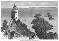
 Les Casquets 1857.jpg 871 × 627; 339 KB
-
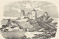
 The Casquets Lighthouses off Alderney 1868.jpg 1,200 × 834; 211 KB
-
 The Channel Islands 1862 Ansted Latham 04.jpg 1,794 × 1,048; 1.62 MB
-
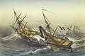
 The Race of Alderney, from the Caskets (about 1868).jpg 1,200 × 845; 190 KB


.jpg)