Category:California State Route 49
Jump to navigation
Jump to search
state highway in California, United States    | |||||
| Upload media | |||||
| Instance of | |||||
|---|---|---|---|---|---|
| Location | |||||
| Transport network |
| ||||
| Owned by | |||||
| Maintained by | |||||
| Inception |
| ||||
| Length |
| ||||
| Terminus | |||||
| Partially coincident with |
| ||||
 | |||||
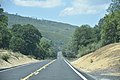
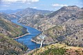
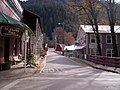
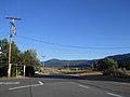
English: Media related to California State Route 49 (Gold Country Highway), a north–south state highway in eastern California, United States. The scenic highway passes through many historic mining communities of the 1849 California Gold Rush in the Sierra Nevada. The highway is numbered after the "49ers", the waves of immigrants who swept into the area looking for gold.
Subcategories
This category has only the following subcategory.
Media in category "California State Route 49"
The following 32 files are in this category, out of 32 total.
-
 California State Route 49.svg 1,152 × 640; 751 KB
-
 California 49.svg 385 × 401; 12 KB
-
 Amador County, CA 1930s?.jpg 3,852 × 2,563; 2.4 MB
-
 Between Downieville and Sierra City.jpg 3,000 × 4,000; 5.27 MB
-
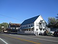
 Butte Store.jpg 1,200 × 800; 321 KB
-
 CA 49 1.jpg 6,000 × 4,000; 5.58 MB
-
 CA 49 2.jpg 6,000 × 4,000; 6.84 MB
-
 CA 49 3.jpg 6,000 × 4,000; 6.03 MB
-
 CA 49 4.jpg 6,000 × 4,000; 5.27 MB
-
 CA49 Tuolumne County.JPG 1,600 × 1,200; 482 KB
-
 California 49 1957.svg 601 × 625; 25 KB
-
 California highways 49 and 89.JPG 3,872 × 2,592; 4.63 MB
-
 California State Route 49 at scenic overlook.jpg 3,000 × 4,000; 4.61 MB
-
 CalifSR49AmerMF.JPG 3,648 × 2,736; 4.36 MB
-
 Downieville, California, at Main and Commercial St., looking south.jpg 1,024 × 768; 203 KB
-
 JacksonCalHwy88Eastward.jpg 3,972 × 2,926; 3.35 MB
-
 Mariposa (CA, USA), Bear Valley -- 2022 -- 141643.jpg 4,480 × 2,800; 12.99 MB
-
 Mariposa (CA, USA), Fremont's Fort Historical Marker -- 2022 -- 141754.jpg 4,480 × 4,480; 18.62 MB
-

-
 Sattley1.jpg 4,000 × 3,000; 4.86 MB
-
 Sattley2.jpg 4,000 × 3,000; 5.1 MB
-
 Sattley3.jpg 4,000 × 3,000; 4.81 MB
-
 Sierra City, California, October 11, 2009 Main St.jpg 1,024 × 768; 207 KB
-
 Sierraville 1.jpg 4,000 × 3,000; 4.89 MB
-
 Sierraville 2.jpg 4,000 × 3,000; 4.89 MB
-
 Sierraville 4.jpg 4,000 × 3,000; 5.18 MB
-
 Sierraville 5.jpg 4,000 × 3,000; 4.91 MB
-
 Sierraville 6.jpg 4,000 × 3,000; 4.99 MB
-
 The old CA-49 bridge on the South Yuba River 2017.jpg 2,176 × 1,633; 4.67 MB
-
 Yuba River, South Fork under Highway 49.jpg 3,072 × 2,304; 2.45 MB
-

-


,_Bear_Valley_--_2022_--_141643.jpg)
,_Fremont%27s_Fort_Historical_Marker_--_2022_--_141754.jpg)
,_Fremont%27s_Fort_Historical_Marker,_Toyota_Highlander_--_2022_--_141813.jpg)


Categories:
- State highways in California by number
- Scenic highways in California
- Sierra Nevada (United States)
- Roads in Amador County, California
- Roads in Calaveras County, California
- Roads in El Dorado County, California
- Roads in Mariposa County, California
- Roads in Madera County, California
- Roads in Placer County, California
- Roads in Nevada County, California
- Roads in Plumas County, California
- Roads in Sierra County, California
- Roads in Tuolumne County, California
- Roads in Yuba County, California
- Roads numbered 49