Category:California State Route 190
Jump to navigation
Jump to search
highway in California   | |||||
| Upload media | |||||
| Instance of | |||||
|---|---|---|---|---|---|
| Located in protected area |
| ||||
| Location |
| ||||
| Transport network |
| ||||
| Owned by | |||||
| Maintained by | |||||
| Inception |
| ||||
| Length |
| ||||
 | |||||
Subcategories
This category has the following 3 subcategories, out of 3 total.
Media in category "California State Route 190"
The following 95 files are in this category, out of 95 total.
-
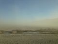
 2013-09-20 17 45 32 Dust storm along California State Route 190 in Panamint Valley.JPG 3,264 × 2,448; 2.75 MB
-
 2013-09-20 17 45 48 Dust storm along California State Route 190 in Panamint Valley.JPG 3,264 × 2,448; 1.74 MB
-
 2013-09-20 17 45 49 Dust storm along California State Route 190 in Panamint Valley.JPG 3,264 × 2,448; 1.85 MB
-
 2013-09-20 17 46 01 Dust storm along California State Route 190 in Panamint Valley.JPG 3,264 × 2,448; 2.15 MB
-

-
 Approaching Death Valley from the west california 2014-03-07.jpg 4,000 × 2,669; 7.15 MB
-
 Badwater Road & CA-190 Flooding (3ff9168b-1d71-4cf1-a2cc-148b4a5d213f).JPG 4,032 × 3,024; 3.39 MB
-
 CA 190 between SPW and Emigrant (c7735929-e5b6-4ab7-9cc3-03edb51f41f6).JPG 3,024 × 4,032; 5.39 MB
-
 CA 190 between Stovepipe Wells and Emigrant (17971acd-0738-4a83-bb68-61fc37ec84ae).jpg 4,032 × 3,024; 6.14 MB
-
 CA-190 washed out September 10, 2022.jpg 1,200 × 900; 361 KB
-
 California 190 1957.svg 701 × 624; 13 KB
-
 California 190 Death Valley junction.jpg 2,487 × 1,658; 940 KB
-
 California 190.svg 449 × 401; 14 KB
-
 California State Route 190.svg 1,152 × 640; 83 KB
-
 CASR 190.JPG 3,872 × 2,592; 3.13 MB
-
 Death Valley National Park 2019-09-15-1.jpg 5,883 × 3,921; 8.07 MB
-
 Death Valley National Park Entrance California State Route 190.JPG 2,048 × 1,536; 748 KB
-
 Death Valley National Park, California (8) (3377428707).jpg 2,816 × 2,112; 2.23 MB
-
 Death Valley Road 4889484654.jpg 2,816 × 1,877; 4.68 MB
-
-
 Death Valley Scenic Byway - Charcoal Kilns in Death Valley - NARA - 7717912.jpg 1,200 × 900; 1.13 MB
-
 Death Valley Scenic Byway - Golden Canyon - NARA - 7717935.jpg 1,200 × 1,008; 1.06 MB
-
 Death Valley Scenic Byway - Golden Canyon in Death Valley - NARA - 7717936.jpg 900 × 1,200; 1.01 MB
-
 Death Valley Scenic Byway - Gower Gulch - NARA - 7717937.jpg 1,024 × 768; 121 KB
-

-
 Death Valley Scenic Byway - Leadfield Dugout - NARA - 7717941.jpg 1,024 × 768; 230 KB
-

-
 Death Valley Scenic Byway - Lower Furnace Creek Wash - NARA - 7717942.jpg 1,024 × 768; 179 KB
-
 Death Valley Scenic Byway - Manly Beacon - NARA - 7717943.jpg 1,024 × 768; 535 KB
-
 Death Valley Scenic Byway - Manly Beacon - NARA - 7717945.jpg 1,024 × 768; 166 KB
-
 Death Valley Scenic Byway - Manly Beacon - NARA - 7717969.jpg 1,024 × 768; 501 KB
-
 Death Valley Scenic Byway - Manly Beacon - NARA - 7717974.jpg 1,024 × 768; 432 KB
-
 Death Valley Scenic Byway - Manly Beacon at Golden Canyon - NARA - 7717944.jpg 850 × 1,200; 902 KB
-

-
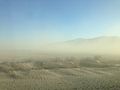
 Death Valley Scenic Byway - Panamint Valley - NARA - 7717986.jpg 3,610 × 2,431; 9.96 MB
-
 Death Valley Scenic Byway - Red Cathedral - NARA - 7717971.jpg 1,024 × 768; 519 KB
-

-

-
 Death Valley Scenic Byway - Red Cathedral in Death Valley - NARA - 7717977.jpg 1,200 × 900; 1.13 MB
-

-
 Death Valley Scenic Byway - Teakettle Junction in Death Valley - NARA - 7717993.jpg 2,207 × 1,485; 594 KB
-
 Death Valley Scenic Byway - The Badlands in Death Valley - NARA - 7717901.jpg 1,024 × 768; 127 KB
-
 Death Valley Scenic Byway - The Death Valley Sand Dunes - NARA - 7717894.jpg 2,028 × 1,358; 593 KB
-
 Death Valley Scenic Byway - The Death Valley Sand Dunes - NARA - 7717953.jpg 1,280 × 960; 492 KB
-
 Death Valley Scenic Byway - The Harmony Borax Works - NARA - 7717940.jpg 1,024 × 768; 571 KB
-
 Death Valley Scenic Byway - The Narrows at Mosaic Canyon - NARA - 7717949.jpg 1,024 × 768; 527 KB
-
 Death Valley Scenic Byway - The Panamint Mountains - NARA - 7717960.jpg 2,048 × 1,536; 2.04 MB
-
 Death Valley Scenic Byway - The Salt Flats - NARA - 7717988.jpg 900 × 1,200; 1.1 MB
-
 Death Valley Scenic Byway - The Salt Flats of Death Valley - NARA - 7717987.jpg 1,200 × 900; 1.3 MB
-
 Death Valley Scenic Byway - The Sand Dunes of Death Valley - NARA - 7717893.jpg 1,367 × 2,028; 959 KB
-
 Death Valley Scenic Byway - The Ubehebe Crator - NARA - 7718000.jpg 1,024 × 693; 988 KB
-
 Death Valley Scenic Byway - Thimble Peak - NARA - 7717996.jpg 1,024 × 768; 194 KB
-
 Death Valley Scenic Byway - Titus Canyon - NARA - 7717997.jpg 1,024 × 768; 218 KB
-

-
 Death Valley Scenic Byway - Ubehebe Crater - NARA - 7717999.jpg 1,024 × 678; 930 KB
-
 Death Valley Scenic Byway - Upper Mosaic Canyon - NARA - 7718001.jpg 1,024 × 768; 557 KB
-
 Death Valley Scenic Byway - View from Red Pass - NARA - 7718002.jpg 1,024 × 768; 213 KB
-
 Death Valley Scenic Byway - View of Badwater from Dante's View - NARA - 7717916.jpg 1,200 × 900; 1.02 MB
-
 Death Valley Scenic Byway - View of the Valley - NARA - 7717919.jpg 1,024 × 768; 174 KB
-
 Death Valley Scenic Byway - Visitor to Racetrack Playa - NARA - 7717976.jpg 1,024 × 748; 711 KB
-
-
 Death Valley Scenic Byway - Water on the Salt Flats of Death Valley - NARA - 7717956.jpg 2,048 × 1,536; 250 KB
-
 Death Valley Scenic Byway - Wildlife Tracks in Sand Dunes - NARA - 7717951.jpg 1,280 × 960; 271 KB
-
 Death Valley Scenic Byway, California, USA (49099071942).jpg 2,500 × 2,500; 5.01 MB
-
 Death Valley, CA, USA - panoramio (45).jpg 5,472 × 3,648; 8.02 MB
-
 Death Valley, CA, USA - panoramio (46).jpg 5,472 × 3,648; 7.66 MB
-
 Death Valley, CA, USA - panoramio (47).jpg 5,472 × 3,648; 5.32 MB
-
 Death Valley, CA, USA - panoramio (48).jpg 5,472 × 3,648; 4.79 MB
-
 DeathValley66.jpg 2,959 × 1,925; 2.17 MB
-
 Devils Cornfield and CA-190 water (b632f403-f5d0-474a-8160-3e488e636526).JPG 4,032 × 3,024; 3.18 MB
-
 Echinocactus polycephalus CA-190.jpg 2,816 × 2,112; 3.95 MB
-
 Father Crowley Overlook U.S. Route 190 1.jpg 8,064 × 6,048; 50.97 MB
-
 Father Crowley Overlook U.S. Route 190 2.jpg 8,064 × 6,048; 77.91 MB
-
 Father Crowley Overlook U.S. Route 190 3.jpg 8,064 × 6,048; 77.28 MB
-
 Father Crowley Overlook U.S. Route 190 4.jpg 8,064 × 6,048; 65.39 MB
-
 Father Crowley Overlook U.S. Route 190 5.jpg 8,064 × 6,048; 53.89 MB
-
 Father Crowley Overlook U.S. Route 190 6.jpg 8,064 × 6,048; 44.44 MB
-
 Father Crowley Overlook U.S. Route 190 7.jpg 8,064 × 6,048; 60.95 MB
-
 Inyo County, CA, USA - panoramio (15).jpg 5,472 × 3,648; 5.59 MB
-
 Inyo County, CA, USA - panoramio (6).jpg 5,472 × 3,648; 6.23 MB
-
 Inyo County, CA, USA - panoramio (7).jpg 5,472 × 3,648; 5.97 MB
-
 Jrballe 20110220 death valley 001.jpg 3,120 × 2,080; 1.34 MB
-

-
 Panamint Valley CA1.jpg 2,272 × 1,704; 2.82 MB
-
 Panamint Valley-Argus Range1.jpg 6,000 × 4,000; 5.65 MB
-
 Panamint Valley-Argus Range2.jpg 6,000 × 4,000; 5.61 MB
-
 Panamint Valley-Argus Range4.jpg 6,000 × 4,000; 5.6 MB
-
 Panamint Valley-Argus Range5.jpg 6,000 × 4,000; 5.75 MB
-
 Panamint Valley-Argus Range6.jpg 6,000 × 4,000; 5.63 MB
-
 Panamint Valley.jpg 3,740 × 2,600; 2.16 MB
-
 Panamint valley.JPG 979 × 649; 349 KB
-
 SR 190 in Panamint Valley.jpg 1,024 × 768; 234 KB
-
 SR 190 Panamint Springs Resort End Death Valley 2013.jpg 4,415 × 2,738; 5.42 MB
-
 SR 190 shield.jpg 669 × 1,024; 145 KB
-
 Valle de la Muerte 1989 03.jpg 979 × 626; 918 KB


.jpg)

.JPG)
.JPG)
.jpg)


_(3377428707).jpg)


.jpg)
.jpg)
.jpg)
.jpg)
.jpg)

.JPG)


.jpg)
.jpg)
.jpg)

_-_NARA_-_68886210.jpg)


