Category:California State Route 14
Jump to navigation
Jump to search
 | number: | (fourteen) |
|---|---|---|
| State highways in California: | 1 · 2 · 3 · 4 · 7 · 9 · 10 · 11 · 12 · 13 · 14 · 15 · 16 · 17 · 18 · 19 · 20 · 22 · 23 · 24 · 25 · 26 · 27 · 28 · 29 · 30 · 32 · 33 · 34 |
state highway in Los Angeles and Kern counties in California, United States   | |||||
| Upload media | |||||
| Instance of | |||||
|---|---|---|---|---|---|
| Location |
| ||||
| Transport network |
| ||||
| Owned by | |||||
| Maintained by | |||||
| Inception |
| ||||
| Length |
| ||||
| Terminus | |||||
 | |||||
English: Media related to California State Route 14, a state highway in northern Los Angeles County and eastern Kern County in southern California, United States.
- A major north—south route across the western Mojave Desert, including the Antelope Valley.
- Runs from the northern San Fernando Valley (Newhall Pass) northward to the junction with Highway 395 (China Lake area), continuing the Sierra Highway.
Subcategories
This category has the following 5 subcategories, out of 5 total.
Pages in category "California State Route 14"
This category contains only the following page.
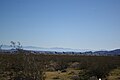
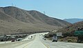
Media in category "California State Route 14"
The following 18 files are in this category, out of 18 total.
-
 California State Route 14.svg 1,152 × 640; 437 KB
-
 Newhall Pass Interchange.png 1,134 × 2,707; 8.05 MB
-
 Aerospace Valley marker 2133.JPG 2,048 × 1,536; 737 KB
-
 Antelope Valley Freeway and California Aqueduct.jpg 1,512 × 2,297; 2.54 MB
-
 CA14-US395.JPG 3,008 × 2,000; 1.45 MB
-
 California 14 1957.svg 601 × 625; 23 KB
-
 California 14.svg 385 × 401; 10 KB
-
 California 14U.svg 449 × 401; 11 KB
-
 Canyon Country, Santa Clarita.jpg 4,032 × 2,520; 3.56 MB
-
 Escondido Summit Approach.jpg 5,392 × 3,235; 3.31 MB
-
 Indian Wells across SR14 2016-04-17.jpg 4,435 × 2,957; 3.03 MB
-
 Mojaveairport.jpg 3,008 × 2,000; 2.16 MB
-
 On the way to Death Valley - По дороге в Долину Смерти - panoramio.jpg 1,366 × 1,046; 364 KB
-
 Sierra Highway.jpg 3,045 × 1,727; 4.07 MB
-
 Soledad Pass2014.jpg 3,648 × 2,119; 1.2 MB
-
 Tehachapiwindfarm.jpg 3,008 × 2,000; 2.11 MB
-
 USGS - 1971 San Fernando earthquake - Collapse of Newhall Pass interchange.jpg 1,400 × 1,400; 2.02 MB
-
 Sierra Highway.svg 576 × 672; 1.77 MB


