Category:Calandahütte
Jump to navigation
Jump to search
| Object location | | View all coordinates using: OpenStreetMap |
|---|
mountain hut   | |||||
| Upload media | |||||
| Pronunciation audio | |||||
|---|---|---|---|---|---|
| Instance of | |||||
| Location | Grisons, Switzerland | ||||
| Owned by |
| ||||
| Inception |
| ||||
| Mountain range | |||||
| Elevation above sea level |
| ||||
| official website | |||||
 | |||||
English: Calandahütte, an alpine hut of the Swiss Alpine Club (SAC)
Media in category "Calandahütte"
The following 6 files are in this category, out of 6 total.
-
 Calanda3.JPG 2,048 × 1,536; 1.39 MB
-
 Calandahütte and Chur from Haldensteiner Calanda.jpg 5,799 × 3,643; 2.11 MB
-
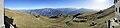 Calandahütte Panorama.jpg 18,067 × 4,209; 10.6 MB
-
De-Calandahütte.ogg 1.4 s; 43 KB
-
 Fingerpost near Calandahütte.jpg 3,456 × 4,608; 4.77 MB
-
 Haldensteiner Calanda from Calandahütte.jpg 4,608 × 3,456; 3.75 MB


