Category:Cairn Gorm
Jump to navigation
Jump to search

Scottish mountain  | |||||
| Upload media | |||||
| Instance of | |||||
|---|---|---|---|---|---|
| Part of | |||||
| Located in protected area | |||||
| Location |
| ||||
| Mountain range | |||||
| Topographic prominence |
| ||||
| Elevation above sea level |
| ||||
| Parent peak | |||||
 | |||||
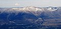
Cairn Gorm (Gaelic: An Càrn Gorm) is a mountain in the Scottish Highlands overlooking Strathspey and the town of Aviemore. At 1245 metres (4084 ft) it is the sixth highest mountain in the United Kingdom. It has given its name to the whole range, the Cairngorms.
Subcategories
This category has the following 12 subcategories, out of 12 total.
A
- An t-Aonach, Cairn Gorm (2 F)
C
- Cairn Gorm chairlift (4 F)
- Cairn Gorm ski centre (14 F)
- Cairngorm mountain garden (7 F)
- Creag an Leth-choin (13 F)
D
- Distant views of Cairn Gorm (33 F)
F
T
- The Saddle, Cairngorms (5 F)
V
- Views from Cairn Gorm (20 F)
Media in category "Cairn Gorm"
The following 26 files are in this category, out of 26 total.
-
 Airgiod-meall, Cairngorm - geograph.org.uk - 321616.jpg 640 × 401; 38 KB
-
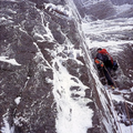 Andy Kirkpatrick Mixed Climb Scotland.webp 1,440 × 1,440; 656 KB
-
 Below Cairngorm summit - Flickr - Graham Grinner Lewis.jpg 2,048 × 1,536; 638 KB
-
 Cairn Gorm - geograph.org.uk - 1287393.jpg 640 × 479; 63 KB
-
 Cairn Gorm - geograph.org.uk - 1287396.jpg 640 × 479; 66 KB
-
 Cairn Gorm - geograph.org.uk - 1287417.jpg 640 × 479; 62 KB
-
 Cairn Gorm - geograph.org.uk - 366811.jpg 640 × 441; 66 KB
-
 Cairn Gorm from Ben Macdui - geograph.org.uk - 3591280.jpg 1,024 × 681; 183 KB
-
 Cairn Gorm Plateau - geograph.org.uk - 4020973.jpg 640 × 480; 90 KB
-
 Cairngorm mountains - geograph.org.uk - 1512462.jpg 640 × 426; 57 KB
-
 Cairngorm mountains with cumulus clouds.JPG 3,008 × 2,000; 1.53 MB
-
 Cairngorm snowfields - geograph.org.uk - 853208.jpg 640 × 398; 46 KB
-
 Clach Bharriag - geograph.org.uk - 419625.jpg 446 × 640; 80 KB
-
 Enjoying the view - geograph.org.uk - 1287408.jpg 640 × 479; 50 KB
-
 Forest and snow from Cairn Gorm road - geograph.org.uk - 776379.jpg 640 × 480; 64 KB
-
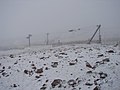
 Frozen Ski Tow on Cairngorm - geograph.org.uk - 145440.jpg 640 × 479; 78 KB
-
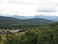 Grantown-On-Spey - geograph.org.uk - 524991.jpg 640 × 480; 58 KB
-
 Icy post - geograph.org.uk - 321607.jpg 422 × 640; 70 KB
-
 New path. - geograph.org.uk - 50820.jpg 640 × 480; 64 KB
-
 No skiing yet - geograph.org.uk - 1592655.jpg 640 × 480; 50 KB
-
 Northern slopes of Cairn Gorm - geograph.org.uk - 657953.jpg 640 × 418; 84 KB
-
 Old path - geograph.org.uk - 50817.jpg 640 × 480; 68 KB
-
 Plaque - geograph.org.uk - 419619.jpg 640 × 500; 97 KB
-
 Reindeer, Cairngorm - geograph.org.uk - 681360.jpg 640 × 480; 107 KB
-
 The Cairngorms from above Creagan Gorm - geograph.org.uk - 13103.jpg 640 × 305; 148 KB
-
 Towards the Cairngorm ski lift - geograph.org.uk - 24393.jpg 480 × 640; 251 KB


