Category:CIA World Factbook maps of Eswatini
Jump to navigation
Jump to search
Media in category "CIA World Factbook maps of Eswatini"
The following 18 files are in this category, out of 18 total.
-
 000 Eswatini harta.png 328 × 353; 5 KB
-
 CIA WFB Map Eswatini.png 328 × 353; 7 KB
-
 Esvatini.gif 328 × 353; 8 KB
-
 Eswatini carte.png 328 × 353; 22 KB
-
 Eswatini CIA map PL.png 328 × 353; 14 KB
-
 Eswatini map be.png 328 × 353; 15 KB
-
 Eswatini mapa.png 328 × 353; 9 KB
-
 Eswatini-Charte-gsw.png 328 × 353; 17 KB
-
 Eswatini-CIA WFB Map.png 496 × 532; 775 KB
-
 Eswatini-map-blank.png 328 × 353; 7 KB
-
 Eswatinikaart.png 437 × 471; 28 KB
-
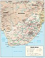 South Africa Physiography.jpg 2,000 × 2,614; 1.68 MB
-
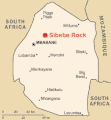
 World Factbook (1982) Swaziland.jpg 587 × 586; 84 KB
-
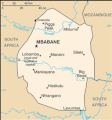
 World Factbook (1990) Swaziland.jpg 484 × 556; 145 KB
-
 Wz-map Eswatini 2.gif 255 × 274; 20 KB
-
 Wz-map Eswatini 2.gif".gif 323 × 348; 11 KB
-
 Wz-map of Eswatini.gif 323 × 348; 8 KB
-
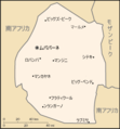 Wz-map-ja.png 328 × 353; 13 KB


_Swaziland.jpg)
_Swaziland.jpg)


