Category:Bus stops in Shropshire
Jump to navigation
Jump to search
Ceremonial counties of England: Bedfordshire · Berkshire · Buckinghamshire · Cambridgeshire · Cheshire · Cornwall · Cumbria · Derbyshire · Devon · Dorset · Durham · East Riding of Yorkshire · East Sussex · Essex · Gloucestershire · Greater London · Greater Manchester · Hampshire · Herefordshire · Hertfordshire · Isle of Wight · Kent · Lancashire · Leicestershire · Lincolnshire · Merseyside · Norfolk · North Yorkshire · Northamptonshire · Northumberland · Nottinghamshire · Oxfordshire · Rutland · Shropshire · Somerset · South Yorkshire · Staffordshire · Suffolk · Surrey · Tyne and Wear · Warwickshire · West Midlands · West Sussex · West Yorkshire · Wiltshire · Worcestershire
City-counties: Bristol · City of London
Former historic counties:
Other former counties:
City-counties: Bristol · City of London
Former historic counties:
Other former counties:
Subcategories
This category has only the following subcategory.
S
- Bus shelters in Shropshire (18 F)
Media in category "Bus stops in Shropshire"
The following 28 files are in this category, out of 28 total.
-
 Bus shelter at Hope Bowdler - geograph.org.uk - 1446065.jpg 640 × 480; 106 KB
-
 Bus shelter in Dale Road - geograph.org.uk - 1462400.jpg 640 × 480; 102 KB
-
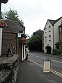
 Bus shelter in Wellington Road - geograph.org.uk - 1462212.jpg 640 × 480; 96 KB
-

-
 Bus stop at All Stretton - geograph.org.uk - 1447687.jpg 640 × 480; 80 KB
-
 Bus stop at Broome - geograph.org.uk - 200764.jpg 480 × 640; 75 KB
-
 Bus stop beside Halesfield 16 - geograph.org.uk - 263531.jpg 640 × 480; 88 KB
-
 Bus stop in Old Street - geograph.org.uk - 1465815.jpg 640 × 480; 63 KB
-
 Bus stop in The Wharfage - geograph.org.uk - 1462529.jpg 480 × 640; 68 KB
-
 Bus stop in Wellington Road - geograph.org.uk - 1462211.jpg 480 × 640; 75 KB
-
 Bus stop near the Post office - geograph.org.uk - 832619.jpg 640 × 480; 89 KB
-
 Bus stop on the B4373 - geograph.org.uk - 1454214.jpg 640 × 480; 74 KB
-
 Bus stop on Whitchurch Road - geograph.org.uk - 1397493.jpg 425 × 640; 82 KB
-
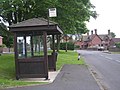
 Bus stops at Mount Pleasant - geograph.org.uk - 1036751.jpg 640 × 480; 78 KB
-
 Church Street, Bishop's Castle - geograph.org.uk - 738313.jpg 640 × 428; 83 KB
-
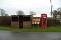 Countryside Bus Stop - geograph.org.uk - 676153.jpg 640 × 426; 50 KB
-
 Gledrid Poachers Pocket bus stop timetable 2.JPG 2,088 × 3,712; 3.21 MB
-
 Gledrid Poachers Pocket bus stop timetable.JPG 2,088 × 3,712; 3.01 MB
-
 Gledrid Poachers Pocket bus stop.JPG 2,088 × 3,712; 3.33 MB
-
 Gledrid Poachers Pocket bus stops.JPG 3,712 × 2,088; 3.06 MB
-
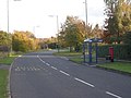
 Meole Brace Park and Ride Bus-Stop. - geograph.org.uk - 716392.jpg 640 × 480; 89 KB
-
 Stoke on Tern bus stop.jpg 4,032 × 3,024; 3.65 MB
-
 Sundorne Road beside the Coracle Inn - geograph.org.uk - 1397503.jpg 640 × 426; 332 KB
-
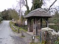 Thatched Bus Stop - geograph.org.uk - 1750553.jpg 800 × 600; 171 KB
-

-
 Wellington Road bus stop - geograph.org.uk - 1462345.jpg 480 × 640; 68 KB
-
 Whitchurch Tesco bus stops 2.JPG 3,712 × 2,088; 3.18 MB
-
 Whitchurch Tesco bus stops.JPG 3,712 × 2,088; 3.18 MB


