Category:Buckland, Massachusetts
Jump to navigation
Jump to search
| Object location | | View all coordinates using: OpenStreetMap |
|---|
town in Franklin County, Massachusetts, United States    | |||||
| Upload media | |||||
| Instance of | |||||
|---|---|---|---|---|---|
| Part of |
| ||||
| Location | Franklin County, Massachusetts | ||||
| Inception |
| ||||
| Population |
| ||||
| Area |
| ||||
| Elevation above sea level |
| ||||
| Different from | |||||
| official website | |||||
 | |||||
Subcategories
This category has the following 5 subcategories, out of 5 total.
Media in category "Buckland, Massachusetts"
The following 13 files are in this category, out of 13 total.
-
 Buckland Historical Museum, Buckland MA.jpg 1,732 × 2,592; 937 KB
-
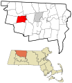
 Buckland ma highlight.png 788 × 466; 54 KB
-
 Buckland Town Hall.JPG 1,600 × 1,200; 343 KB
-
 Buckland, Massachusetts 1850-68.jpg 1,571 × 1,233; 527 KB
-
 BucklandMA GriswoldHouse.jpg 1,024 × 680; 218 KB
-
 BucklandMA OddfellowsHall.jpg 1,024 × 842; 308 KB
-
 BucklandMA WilderHomestead.jpg 1,024 × 680; 252 KB
-
 BucklandStateForest.jpg 1,024 × 680; 344 KB
-
 First Congregational Church of Buckland MA.jpg 2,490 × 1,662; 538 KB
-
 Flag of Buckland, Massachusetts.gif 216 × 301; 6 KB
-
-
 Seal of Buckland, Massachusetts.png 325 × 321; 414 KB
-
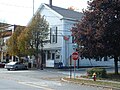
 Upper Street, Buckland MA.jpg 2,592 × 1,728; 1.02 MB


