Category:Bromley maps of the Bronx published in 1938
Jump to navigation
Jump to search
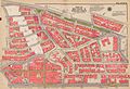
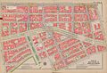
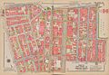
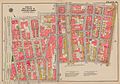
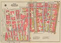
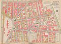
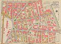
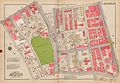
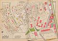
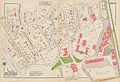
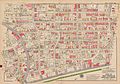
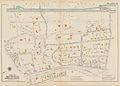
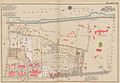
Maps from: Atlas of the City of New York Borough of the Bronx [Volume 2] North of 172nd Street (Philadelphia: G. W. Bromley and Co., 1938), comprising title page, street index, block index, double-page volume index, and 43 double-page plates (maps).
This category includes two versions of the plates, both from The New York Public Library Digital Collections website:
- as originally published: Volume Two: North of 172nd Street [1938]
- as corrected up to November 14, 1957: Volume Two: North of 172nd Street [1957]
This work is in the public domain because it was published in the United States between 1929 and 1963, and although there may or may not have been a copyright notice, the copyright was not renewed. For further explanation, see Commons:Hirtle chart and the copyright renewal logs. Note that it may still be copyrighted in jurisdictions that do not apply the rule of the shorter term for US works (depending on the date of the author's death), such as Canada (70 years p.m.a.), Mainland China (50 years p.m.a., not Hong Kong or Macao), Germany (70 years p.m.a.), Mexico (100 years p.m.a.), Switzerland (70 years p.m.a.), and other countries with individual treaties.
|
 |
Media in category "Bromley maps of the Bronx published in 1938"
The following 91 files are in this category, out of 91 total.
-
 Bromley Bronx title page publ. 1938.jpg 6,960 × 9,343; 13.25 MB
-
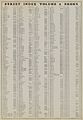 Bromley Bronx street index publ. 1938.jpg 6,307 × 9,128; 14.08 MB
-
 Bromley Bronx block index publ. 1938.jpg 6,090 × 8,934; 11.27 MB
-
 Bromley Bronx table for corrections publ. 1938 corr.1957.jpg 7,211 × 9,424; 12.91 MB
-
 Bromley Bronx volume index publ. 1938.jpg 8,615 × 5,920; 14.02 MB
-
 Bromley Bronx Plate 01 publ. 1938 corr.1957.jpg 9,694 × 6,422; 15.19 MB
-
 Bromley Bronx Plate 01 publ. 1938.jpg 9,168 × 5,967; 13.21 MB
-
 Bromley Bronx Plate 02 publ. 1938 corr.1957.jpg 9,566 × 6,571; 16.57 MB
-
 Bromley Bronx Plate 02 publ. 1938.jpg 9,028 × 6,206; 15.03 MB
-
 Bromley Bronx Plate 03 publ. 1938 corr.1957.jpg 9,819 × 6,729; 14.16 MB
-
 Bromley Bronx Plate 03 publ. 1938.jpg 9,190 × 6,162; 12.89 MB
-
 Bromley Bronx Plate 04 publ. 1938 corr.1957.jpg 9,619 × 6,736; 16.33 MB
-
 Bromley Bronx Plate 04 publ. 1938.jpg 8,951 × 6,290; 14.39 MB
-
 Bromley Bronx Plate 05 publ. 1938 corr.1957.jpg 9,707 × 6,714; 14.37 MB
-
 Bromley Bronx Plate 05 publ. 1938.jpg 8,942 × 6,130; 12.66 MB
-
 Bromley Bronx Plate 06 publ. 1938 corr.1957.jpg 9,569 × 6,595; 13.92 MB
-
 Bromley Bronx Plate 06 publ. 1938.jpg 8,763 × 6,136; 11.57 MB
-
 Bromley Bronx Plate 07 publ. 1938 corr.1957.jpg 9,835 × 6,779; 17.04 MB
-
 Bromley Bronx Plate 07 publ. 1938.jpg 9,127 × 6,253; 14.51 MB
-
 Bromley Bronx Plate 08 publ. 1938 corr.1957.jpg 9,405 × 6,337; 15.9 MB
-
 Bromley Bronx Plate 08 publ. 1938.jpg 8,820 × 5,954; 13.91 MB
-
 Bromley Bronx Plate 09 publ. 1938 corr.1957.jpg 9,414 × 6,758; 16.23 MB
-
 Bromley Bronx Plate 09 publ. 1938.jpg 8,736 × 6,219; 12.52 MB
-
 Bromley Bronx Plate 10 publ. 1938 corr.1957.jpg 9,615 × 6,688; 17.22 MB
-
 Bromley Bronx Plate 10 publ. 1938.jpg 9,061 × 6,260; 13.22 MB
-
 Bromley Bronx Plate 11 publ. 1938 corr.1957.jpg 9,184 × 6,694; 16.86 MB
-
 Bromley Bronx Plate 11 publ. 1938.jpg 8,601 × 6,264; 12.11 MB
-
 Bromley Bronx Plate 12 publ. 1938 corr.1957.jpg 9,339 × 6,628; 16.91 MB
-
 Bromley Bronx Plate 12 publ. 1938.jpg 8,824 × 6,274; 15.06 MB
-
 Bromley Bronx Plate 13 publ. 1938 corr.1957.jpg 9,156 × 6,503; 14.99 MB
-
 Bromley Bronx Plate 13 publ. 1938.jpg 8,614 × 6,168; 13.38 MB
-
 Bromley Bronx Plate 14 publ. 1938 corr. 1957.jpg 9,345 × 6,759; 14.23 MB
-
 Bromley Bronx Plate 14 publ. 1938.jpg 8,743 × 6,310; 10.03 MB
-
 Bromley Bronx Plate 15 publ. 1938 corr. 1957.jpg 9,259 × 6,527; 14.9 MB
-
 Bromley Bronx Plate 15 publ. 1938.jpg 8,595 × 6,187; 12.5 MB
-
 Bromley Bronx Plate 16 publ. 1938 corr. 1957.jpg 9,277 × 6,645; 14.18 MB
-
 Bromley Bronx Plate 16 publ. 1938.jpg 8,719 × 6,225; 12.4 MB
-
 Bromley Bronx Plate 17 publ. 1938 corr. 1957.jpg 9,224 × 6,756; 16.75 MB
-
 Bromley Bronx Plate 17 publ. 1938.jpg 8,535 × 6,278; 12.1 MB
-
 Bromley Bronx Plate 18 publ. 1938 corr. 1957.jpg 9,269 × 6,514; 16.03 MB
-
 Bromley Bronx Plate 18 publ. 1938.jpg 8,641 × 6,145; 14.02 MB
-
 Bromley Bronx Plate 19 publ. 1938 corr. 1957.jpg 9,354 × 6,770; 14.75 MB
-
 Bromley Bronx Plate 19 publ. 1938.jpg 8,750 × 6,325; 15.75 MB
-
 Bromley Bronx Plate 20 publ. 1938 corr. 1957.jpg 9,722 × 6,536; 13.13 MB
-
 Bromley Bronx Plate 20 publ. 1938.jpg 9,143 × 6,227; 14.4 MB
-
 Bromley Bronx Plate 21 publ. 1938 corr. 1957.jpg 9,245 × 6,366; 15.02 MB
-
 Bromley Bronx Plate 21 publ. 1938.jpg 8,725 × 6,034; 13.79 MB
-
 Bromley Bronx Plate 22 publ. 1938 corr. 1957.jpg 9,455 × 6,462; 15.5 MB
-
 Bromley Bronx Plate 22 publ. 1938.jpg 8,892 × 6,076; 13.51 MB
-
 Bromley Bronx Plate 23 publ. 1938 corr. 1957.jpg 9,263 × 6,620; 16.54 MB
-
 Bromley Bronx Plate 23 publ. 1938.jpg 8,798 × 6,226; 14.98 MB
-
 Bromley Bronx Plate 24 publ. 1938 corr. 1957.jpg 9,643 × 6,514; 15.75 MB
-
 Bromley Bronx Plate 24 publ. 1938.jpg 9,021 × 6,161; 13.79 MB
-
 Bromley Bronx Plate 25 publ. 1938 corr. 1957.jpg 9,666 × 6,603; 15.69 MB
-
 Bromley Bronx Plate 25 publ. 1938.jpg 9,105 × 6,242; 14.02 MB
-
 Bromley Bronx Plate 26 publ. 1938 corr. 1957.jpg 9,752 × 6,609; 15.73 MB
-
 Bromley Bronx Plate 26 publ. 1938.jpg 9,078 × 6,212; 14.13 MB
-
 Bromley Bronx Plate 27 publ. 1938 corr. 1957.jpg 9,327 × 6,760; 12.12 MB
-
 Bromley Bronx Plate 27 publ. 1938.jpg 8,730 × 6,277; 10.81 MB
-
 Bromley Bronx Plate 28 publ. 1938 corr. 1957.jpg 9,389 × 6,685; 14.52 MB
-
 Bromley Bronx Plate 28 publ. 1938.jpg 8,817 × 6,294; 12.78 MB
-
 Bromley Bronx Plate 29 publ. 1938 corr. 1957.jpg 9,625 × 6,616; 14.88 MB
-
 Bromley Bronx Plate 29 publ. 1938.jpg 9,016 × 6,252; 13.33 MB
-
 Bromley Bronx Plate 30 publ. 1938 corr. 1957.jpg 9,645 × 6,579; 11.08 MB
-
 Bromley Bronx Plate 30 publ. 1938.jpg 9,131 × 6,161; 10.01 MB
-
 Bromley Bronx Plate 31 publ. 1938 corr. 1957.jpg 9,716 × 6,804; 14.83 MB
-
 Bromley Bronx Plate 31 publ. 1938.jpg 9,235 × 6,366; 15.82 MB
-
 Bromley Bronx Plate 32 publ. 1938 corr. 1957.jpg 9,435 × 6,545; 15.85 MB
-
 Bromley Bronx Plate 32 publ. 1938.jpg 8,956 × 6,122; 14.25 MB
-
 Bromley Bronx Plate 33 publ. 1938 corr. 1957.jpg 9,523 × 6,508; 15.05 MB
-
 Bromley Bronx Plate 33 publ. 1938.jpg 9,062 × 6,192; 12.96 MB
-
 Bromley Bronx Plate 34 publ. 1938 corr. 1957.jpg 9,659 × 6,689; 15.61 MB
-
 Bromley Bronx Plate 34 publ. 1938.jpg 9,194 × 6,217; 13.61 MB
-
 Bromley Bronx Plate 35 publ. 1938 corr. 1957.jpg 9,385 × 6,631; 15.14 MB
-
 Bromley Bronx Plate 35 publ. 1938.jpg 8,981 × 6,266; 13.63 MB
-
 Bromley Bronx Plate 36 publ. 1938 corr. 1957.jpg 9,662 × 6,742; 14.81 MB
-
 Bromley Bronx Plate 36 publ. 1938.jpg 9,245 × 6,322; 10.71 MB
-
 Bromley Bronx Plate 37 publ. 1938 corr. 1957.jpg 9,503 × 6,721; 15.94 MB
-
 Bromley Bronx Plate 37 publ. 1938.jpg 8,999 × 6,372; 13.8 MB
-
 Bromley Bronx Plate 38 publ. 1938 corr. 1957.jpg 9,644 × 6,718; 17.66 MB
-
 Bromley Bronx Plate 38 publ. 1938.jpg 9,194 × 6,303; 15.52 MB
-
 Bromley Bronx Plate 39 publ. 1938 corr. 1957.jpg 9,339 × 6,437; 13.64 MB
-
 Bromley Bronx Plate 39 publ. 1938.jpg 8,818 × 6,161; 12.29 MB
-
 Bromley Bronx Plate 40 publ. 1938 corr. 1957.jpg 9,665 × 6,828; 14.85 MB
-
 Bromley Bronx Plate 40 publ. 1938.jpg 9,163 × 6,077; 9.73 MB
-
 Bromley Bronx Plate 41 publ. 1938 corr. 1957.jpg 9,400 × 6,758; 13.87 MB
-
 Bromley Bronx Plate 41 publ. 1938.jpg 8,850 × 6,375; 9.12 MB
-
 Bromley Bronx Plate 42 publ. 1938 corr. 1957.jpg 9,257 × 6,429; 12.42 MB
-
 Bromley Bronx Plate 42 publ. 1938.jpg 8,812 × 6,011; 10.41 MB
-
 Bromley Bronx Plate 43 publ. 1938 corr. 1957.jpg 9,482 × 6,450; 13.52 MB
-
 Bromley Bronx Plate 43 publ. 1938.jpg 8,862 × 6,117; 14.86 MB


