Category:British War Office
Jump to navigation
Jump to search
Subcategories
This category has the following 2 subcategories, out of 2 total.
M
- Map of Persia (1886) (2 F)
Media in category "British War Office"
The following 45 files are in this category, out of 45 total.
-
 1840 QMG Manuscript Map of Kandahar, Afghanistan and its Immediate Environs.jpg 5,612 × 4,790; 3.07 MB
-
 1908 Map of Central America by the British War Office.jpg 8,447 × 8,841; 14.05 MB
-
 1910s Cable Map of the World by the British War Office.jpg 12,184 × 7,864; 10.39 MB
-
 1916 map of Sinai Peninsula, Egypt, the Gulf of Suez and the Gulf of Akaba by the British War Office.jpg 15,719 × 15,179; 34.02 MB
-
 1916 Sketch map of Turkey in Asia.tif 10,266 × 7,256; 213.14 MB
-
 1920s Timor Island Map.jpg 2,737 × 1,936; 1.08 MB
-
 1921 map of Nigeria by the War Office.jpg 19,255 × 16,392; 65.72 MB
-

-
 1941 map of Kuwait and Basra, Iraq by the British War Office.jpg 15,124 × 19,967; 51.31 MB
-
 1941 map of the The Near and Middle East.tif 12,324 × 8,986; 316.86 MB
-
 1945 map by the British War Office - Bandar Abbas.jpg 17,680 × 15,322; 43.07 MB
-

-
 1946 Air map of the world centred on Delhi.tif 20,931 × 22,550; 1.32 GB
-
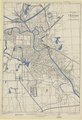
 1949 map of Hong Kong and the New Territories by the British War Office.jpg 12,100 × 8,592; 20.12 MB
-
 1949 Plan of Tientsin.tif 11,498 × 16,800; 552.68 MB
-
 1950 map of Persia and Afghanistan.tif 20,810 × 14,707; 875.65 MB
-
 1957 map by the British War Office - Bandar Abbas.jpg 16,769 × 14,465; 61.68 MB
-
 1957 map by the British War Office - Hofuf.jpg 16,433 × 14,626; 63.9 MB
-
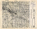
 1957 map of Hong Kong and the New Territories by the British War Office.jpg 23,899 × 17,761; 95.41 MB
-
 1960 map of Kowloon & The New Territories by the British War Office.jpg 17,650 × 22,581; 74.96 MB
-
 1961 map of Beyrouth by the British War Office.tif 12,575 × 9,157; 329.73 MB
-
 20th Century Little Torrington Map.PNG 451 × 421; 523 KB
-
 20th Century Map of Beetley.png 871 × 553; 1.02 MB
-
 20th Century map of Carlton.PNG 395 × 310; 352 KB
-
 Adforton.PNG 1,023 × 805; 2.09 MB
-
 Anglo-Turkish Boundary Commission map of Cape Bab el-Mandeb.jpg 1,731 × 2,905; 2.93 MB
-
 Area surrounding Tingrith Civil Parish, Central Bedfordshire.png 1,101 × 565; 1.52 MB
-
 Beyrouth Tramways Double Track exept to Dora, March 1961.jpg 1,482 × 1,074; 645 KB
-
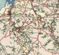
 Ca. 1935 map of Iraq by the War Office.jpg 13,700 × 15,546; 21.31 MB
-
 Cape Bab el-Mandeb Anglo-Turkish Demarcation Line.jpg 1,385 × 1,441; 435 KB
-
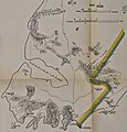
 Diagram to illustrate the progress of the delimitation of British frontiers in Africa.tif 4,608 × 5,652; 74.53 MB
-
 East Indies - btv1b53209798t (1 of 2).jpg 12,039 × 9,166; 16.03 MB
-
 East Indies - btv1b53209798t (2 of 2).jpg 12,039 × 9,130; 16.68 MB
-
 Map of Khiva translated from Russian documents by Lieutenant Colonel T. B. Jervis.jpg 8,348 × 11,626; 7.46 MB
-
 Map of pre World War II Germany TK25 Hemelingen 2919.jpg 9,688 × 7,784; 20.5 MB
-
 Nanjing 1927 AMS-WO,20191215.jpg 1,130 × 760; 564 KB
-
 Nanjing 1927 AMS-WO,20191216.jpg 635 × 321; 144 KB
-
 Palestine N.JPG 636 × 692; 74 KB
-
 Palestine north 1924.jpg 2,596 × 2,675; 2.57 MB
-
 Palestine south 1924.jpg 2,604 × 2,738; 2.8 MB
-
 Peel-Commission Report Map1 AdminDistrictsSyriaPalestine 1154x1846.png 1,154 × 1,846; 36 KB
-
-

-
 Tianjin 1942 AMS.jpg 4,475 × 6,266; 6.36 MB
-
 Wyke and Norwood Green station from OS map 1945.png 682 × 312; 458 KB


.jpg)
.jpg)


