Category:British Camp, Malvern Hills
Jump to navigation
Jump to search
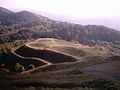
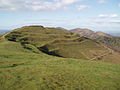
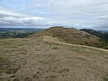
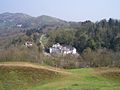
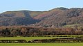
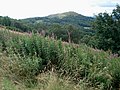
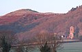
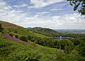
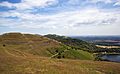
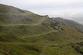
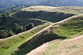
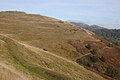
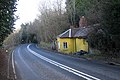
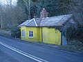
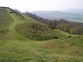
English: The British Camp is an Iron Age hill fort located at the top of Herefordshire Beacon in the Malvern Hills. The hillfort is protected as a Scheduled Ancient Monument and is owned and maintained by Malvern Hills Conservators. The fort is thought to have been first constructed in the 2nd century BC. A Norman castle was built on the site.

Media in category "British Camp, Malvern Hills"
The following 139 files are in this category, out of 139 total.
-
 A soggy British Camp - geograph.org.uk - 3181723.jpg 640 × 480; 71 KB
-
 Aldous Memorial Seat - geograph.org.uk - 650569.jpg 640 × 427; 280 KB
-
 Along the Shire Ditch to Broad Down - geograph.org.uk - 1417378.jpg 640 × 427; 259 KB
-
 Black Hill - geograph.org.uk - 893859.jpg 640 × 403; 282 KB
-
 Bluebell woods at Wynds Point - geograph.org.uk - 837187.jpg 640 × 480; 161 KB
-

-
 Boundary marker, British Camp, Malvern - geograph.org.uk - 2538111.jpg 2,976 × 4,329; 7.85 MB
-
 Boundary stone on British Camp - geograph.org.uk - 1386152.jpg 640 × 399; 236 KB
-
 Boundary Stones, British Camp, the Malvern Hills - geograph.org.uk - 2539910.jpg 5,184 × 3,456; 7.02 MB
-
 British Camp - geograph.org.uk - 1419422.jpg 640 × 375; 238 KB
-
 British Camp - geograph.org.uk - 16198.jpg 640 × 480; 74 KB
-
 British Camp - geograph.org.uk - 4250785.jpg 1,280 × 853; 952 KB
-
 British Camp and the Malvern Hills Range - geograph.org.uk - 4251402.jpg 1,024 × 683; 590 KB
-
 British Camp car park - geograph.org.uk - 1398609.jpg 640 × 427; 282 KB
-

-

-
 British camp central mound 2005 (cropped).jpg 2,272 × 1,224; 96 KB
-
 British camp central mound 2005.jpg 2,272 × 1,704; 784 KB
-

-
 British Camp from Broad Down, Malvern Hills - geograph.org.uk - 4650094.jpg 1,600 × 1,200; 575 KB
-
-
 British Camp Hill, Malvern (52354917988).jpg 3,940 × 2,412; 1.57 MB
-
 British Camp Hotel - geograph.org.uk - 5487.jpg 640 × 479; 66 KB
-
 British Camp Telephone Kiosk - geograph.org.uk - 1706900.jpg 640 × 427; 292 KB
-

-
 British Camp, Herefordshire Beacon - geograph.org.uk - 639324.jpg 640 × 431; 65 KB
-
 British Camp, Malvern Hills - geograph.org.uk - 2781473.jpg 4,446 × 2,461; 6.91 MB
-
 British Camp, Malvern Hills - geograph.org.uk - 3209878.jpg 4,808 × 2,612; 6.2 MB
-
 British Camp, Malvern Hills - geograph.org.uk - 5822803.jpg 1,600 × 1,200; 567 KB
-
 British Camp.jpg 1,024 × 691; 242 KB
-
 Broad Down - geograph.org.uk - 1387208.jpg 640 × 427; 250 KB
-
 Comfort stop at British Camp - geograph.org.uk - 649479.jpg 640 × 480; 200 KB
-

-
 Cyril Martin-Doyle seat, Black Hill - geograph.org.uk - 800132.jpg 640 × 427; 315 KB
-
 Defensive ditch, British Camp, The Malverns - geograph.org.uk - 4268430.jpg 1,024 × 639; 688 KB
-
 Earthworks at British Camp - geograph.org.uk - 4088835.jpg 4,000 × 3,000; 2.77 MB
-
 Earthworks on the British Camp - geograph.org.uk - 5926091.jpg 1,024 × 768; 301 KB
-
 Eastern Path around British Camp - geograph.org.uk - 650370.jpg 640 × 565; 372 KB
-
 Fenced in on Black Hill - geograph.org.uk - 1480504.jpg 640 × 386; 246 KB
-
 Flanks of Pinnacle Hill - geograph.org.uk - 503913.jpg 640 × 480; 114 KB
-
 Footpath at Wynds Point - geograph.org.uk - 907857.jpg 640 × 480; 114 KB
-
 Foxgloves on Pinnacle Hill - geograph.org.uk - 1363930.jpg 640 × 427; 250 KB
-
 Herefordshire Beacon from Millennium Hill - geograph.org.uk - 518593.jpg 640 × 309; 167 KB
-
 Iron age cycling, British Camp - geograph.org.uk - 1135041.jpg 640 × 427; 297 KB
-
 Iron-Age Defences - geograph.org.uk - 705471.jpg 640 × 427; 242 KB
-
 Jubilee Drive - geograph.org.uk - 1056528.jpg 480 × 640; 371 KB
-
 Layers of defences on the Hereford Beacon - geograph.org.uk - 450346.jpg 640 × 480; 131 KB
-
 Little Malvern Hills panorama.jpg 3,817 × 1,593; 3.65 MB
-
 Little Malvern Priory - geograph.org.uk - 1484964.jpg 640 × 429; 229 KB
-
 Little Malvern Priory - geograph.org.uk - 187610.jpg 640 × 479; 60 KB
-

-

-
 Little Malvern Priory at Dawn - geograph.org.uk - 639257.jpg 640 × 403; 218 KB
-

-
 Malvern Hills AONB.jpg 3,965 × 2,832; 4.96 MB
-
 Malvern Hills British Fort.jpg 4,152 × 2,574; 3.9 MB
-
 Milestone on the A449 - geograph.org.uk - 1772686.jpg 640 × 427; 329 KB
-
 Milestone on the A449 - geograph.org.uk - 1772691.jpg 640 × 427; 311 KB
-
 Milestone on the A449 near British Camp - geograph.org.uk - 1132551.jpg 640 × 407; 287 KB
-
 Milestone on the A449 near British Camp - geograph.org.uk - 1132574.jpg 454 × 640; 340 KB
-
 Millennium Hill - geograph.org.uk - 653010.jpg 640 × 357; 185 KB
-
 Multivallate defences on British Camp - geograph.org.uk - 1432488.jpg 640 × 427; 253 KB
-
 Northern Extension to British Camp - geograph.org.uk - 519523.jpg 640 × 429; 266 KB
-
 Northern tumulus, Pinnacle Hill - geograph.org.uk - 1419402.jpg 640 × 384; 211 KB
-

-
 On British Camp - geograph.org.uk - 3630182.jpg 2,560 × 1,920; 2.11 MB
-
 On the slopes of Millennium Hill - geograph.org.uk - 1432550.jpg 640 × 423; 246 KB
-
 Path down from Pinnacle Hill - geograph.org.uk - 1419416.jpg 640 × 416; 291 KB
-

-
 Path to Broad Down - geograph.org.uk - 1135030.jpg 640 × 427; 286 KB
-
 Rape near Little Malvern Priory - geograph.org.uk - 777447.jpg 640 × 408; 228 KB
-
 Red-billed Chough by Michael Colquhoun (48412601381).jpg 1,280 × 853; 385 KB
-
 Road to Netherton Farm - geograph.org.uk - 1717131.jpg 426 × 640; 96 KB
-

-
 Severn Valley from Millennium Hill - geograph.org.uk - 1356940.jpg 640 × 476; 107 KB
-
 Soil Creep, Millennium Hill - geograph.org.uk - 518574.jpg 640 × 412; 298 KB
-
 Steep hillside below the A449 toll house - geograph.org.uk - 1133972.jpg 640 × 427; 248 KB
-
 Steps to British Camp - geograph.org.uk - 3154552.jpg 640 × 427; 265 KB
-
 Steps up British Camp - geograph.org.uk - 705390.jpg 640 × 387; 286 KB
-
 Stream piped under the footpath - geograph.org.uk - 649971.jpg 480 × 640; 236 KB
-
 The A449 on the side of British Camp - geograph.org.uk - 1132607.jpg 640 × 427; 318 KB
-
 The A449 on the side of British Camp - geograph.org.uk - 1133251.jpg 640 × 427; 315 KB
-

-
 The British Camp - geograph.org.uk - 5521378.jpg 1,024 × 683; 210 KB
-
 The British Camp - geograph.org.uk - 5979590.jpg 1,024 × 683; 198 KB
-
 The British Camp and the Malvern Hills - geograph.org.uk - 5523926.jpg 1,024 × 768; 290 KB
-
 The British Camp hill fort - geograph.org.uk - 5854269.jpg 1,024 × 683; 211 KB
-
 The British Camp hill fort - geograph.org.uk - 5882425.jpg 1,024 × 683; 202 KB
-
 The British Camp hill fort - geograph.org.uk - 5882428.jpg 1,024 × 683; 201 KB
-
 The British Camp, Herefordshire Beacon - geograph.org.uk - 5616337.jpg 1,024 × 576; 224 KB
-
 The British Camp, Malvern Hills - geograph.org.uk - 4208411.jpg 1,024 × 680; 231 KB
-
 The Cafe, British Camp - geograph.org.uk - 1133175.jpg 640 × 420; 308 KB
-
 The earthworks on the British Camp - geograph.org.uk - 5979624.jpg 1,024 × 683; 172 KB
-
 The Herefordshire Beacon - geograph.org.uk - 1635076.jpg 640 × 426; 27 KB
-
 The Herefordshire Beacon - geograph.org.uk - 479485.jpg 640 × 480; 127 KB
-

-

-
 The Malvern Hills Hotel - geograph.org.uk - 1135993.jpg 640 × 427; 255 KB
-
 The Malvern Hills Hotel - geograph.org.uk - 370623.jpg 640 × 426; 100 KB
-
 The Malvern Hills Hotel, British Camp - geograph.org.uk - 1133218.jpg 640 × 416; 266 KB
-
 The Malvern Hills in snow - geograph.org.uk - 1635145.jpg 640 × 426; 96 KB
-
 The path around British Camp - geograph.org.uk - 1484982.jpg 640 × 427; 225 KB
-
 The Welland Hills - geograph.org.uk - 889019.jpg 640 × 435; 331 KB
-
 Toll House, A449, near British Camp - geograph.org.uk - 1133944.jpg 640 × 427; 278 KB
-
 Toll House, A449, near British Camp - geograph.org.uk - 1133958.jpg 640 × 427; 258 KB
-
 Tollhouse at British Camp - geograph.org.uk - 907432.jpg 640 × 480; 93 KB
-
 Trees, the Problem and the Solution. - geograph.org.uk - 519563.jpg 640 × 427; 256 KB
-
 Turn left for West Malvern - geograph.org.uk - 580815.jpg 640 × 435; 80 KB
-
 Ant Hills on British Camp - geograph.org.uk - 507325.jpg 640 × 389; 231 KB
-
 Barry Jackson Memorial Seats and Terrace - geograph.org.uk - 506293.jpg 640 × 427; 270 KB
-
 Black Hill - Easier Access Trail - geograph.org.uk - 506286.jpg 640 × 427; 259 KB
-

-
 Boundary Stone on the Malvern Hills - geograph.org.uk - 6380.jpg 640 × 480; 93 KB
-
 British Camp - geograph.org.uk - 1477579 (cropped).jpg 640 × 240; 139 KB
-
 British Camp - geograph.org.uk - 1477579.jpg 640 × 427; 243 KB
-
 British Camp from Black Hill - geograph.org.uk - 1480516.jpg 640 × 393; 231 KB
-

-
 Crossroads, Paths on The Malvern Hills - geograph.org.uk - 369355.jpg 640 × 427; 310 KB
-
 Direction Indicator, near Broad Down - geograph.org.uk - 512071.jpg 640 × 405; 226 KB
-

-
 Earthwork defences on Millennium Hill - geograph.org.uk - 367326.jpg 640 × 426; 103 KB
-
 Eddy Oram Memorial Seat - geograph.org.uk - 507374.jpg 640 × 415; 237 KB
-
 Herefordshire Beacon - geograph.org.uk - 1432513.jpg 640 × 427; 233 KB
-
 Herefordshire Beacon from the North - geograph.org.uk - 445131.jpg 640 × 448; 303 KB
-

-
 Millennium Hill Hut Platforms - geograph.org.uk - 289013.jpg 640 × 321; 187 KB
-
 Oldcastle Farm from British Camp - geograph.org.uk - 5499.jpg 640 × 479; 55 KB
-
 Parabolic Path, Herefordshire Beacon - geograph.org.uk - 519576.jpg 640 × 427; 303 KB
-
 Phone Box at British Camp Car Park - geograph.org.uk - 580813.jpg 640 × 485; 83 KB
-
 Pinnacle Hill in the Mist - geograph.org.uk - 297291.jpg 640 × 333; 157 KB
-
 Refreshments at Wynds Point - geograph.org.uk - 705413.jpg 640 × 427; 302 KB
-
 Simple Bench Seat, Black Hill - geograph.org.uk - 506315.jpg 640 × 427; 242 KB
-
 Site of a Ploughing Match ^ Chances Pitch - geograph.org.uk - 94783.jpg 640 × 479; 112 KB
-
 South flank of Millennium Hill - geograph.org.uk - 618931.jpg 640 × 480; 77 KB
-
 Stone sign at the bottom of British Camp - geograph.org.uk - 547522.jpg 640 × 480; 135 KB
-
 The Climb from British Camp Car Park - geograph.org.uk - 507359.jpg 640 × 427; 299 KB
-
 The Ledbury Road from British Camp - geograph.org.uk - 5500.jpg 640 × 479; 54 KB
-
 The Western Gateway into British Camp - geograph.org.uk - 5503.jpg 640 × 479; 67 KB
-
 West Gateway of British Camp - geograph.org.uk - 5505.jpg 640 × 479; 65 KB


.jpg)


.jpg)


.jpg)


.jpg)