Category:Brasted Chart
Jump to navigation
Jump to search
English: Category:Villages in Kent
village in Kent, England | |||||
| Upload media | |||||
| Instance of | |||||
|---|---|---|---|---|---|
| Location | Brasted, Sevenoaks, Kent, South East England, England | ||||
 | |||||
Media in category "Brasted Chart"
The following 17 files are in this category, out of 17 total.
-
 Access road to Quornden Farm - geograph.org.uk - 1536334.jpg 640 × 427; 81 KB
-
 Bridleway in Chapfield Wood - geograph.org.uk - 1535148.jpg 640 × 427; 110 KB
-
 Bridleway, The Chart - geograph.org.uk - 1501911.jpg 640 × 430; 133 KB
-
 Chart Lane - geograph.org.uk - 1754039.jpg 3,072 × 2,304; 2.81 MB
-
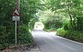 Chart Lane - Steep Hill 10^ - geograph.org.uk - 1428866.jpg 640 × 400; 110 KB
-
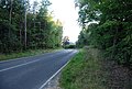 Chart Lane, Toy's Hill - geograph.org.uk - 1499424.jpg 640 × 430; 160 KB
-
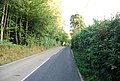 Chart Lane, Toy's Hill - geograph.org.uk - 1499432.jpg 640 × 430; 158 KB
-
 Footpath junction near South Lodge - geograph.org.uk - 1754061.jpg 3,072 × 2,304; 3.04 MB
-
 Junction on Chart Lane - geograph.org.uk - 1754035.jpg 3,072 × 2,304; 2.61 MB
-
 Lake in Manning's Wood - geograph.org.uk - 1754094.jpg 3,072 × 2,304; 2.18 MB
-
 Road mirrors, Brasted Chart, Kent - geograph.org.uk - 173958.jpg 640 × 480; 146 KB
-

-
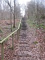 Steps in Manning's Wood - geograph.org.uk - 1754096.jpg 2,304 × 3,072; 3.08 MB
-
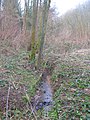 Stream in Manning's Wood (looking upstream) - geograph.org.uk - 1754089.jpg 2,304 × 3,072; 2.95 MB
-
 Track and path junction in Manning's Wood (2) - geograph.org.uk - 1754109.jpg 3,072 × 2,304; 3.25 MB
-
 View from near French Street - geograph.org.uk - 1754119.jpg 3,072 × 1,728; 1.37 MB
-
 Woodland track in Manning's Wood - geograph.org.uk - 1754105.jpg 2,304 × 3,072; 2.67 MB


_-_geograph.org.uk_-_1754089.jpg)
_-_geograph.org.uk_-_1754109.jpg)

