Category:Bordley
Jump to navigation
Jump to search
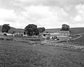
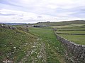
English: Bordley is a village in the civil parish of Hetton-cum-Bordley, in the Craven district of North Yorkshire, England, within the Yorkshire Dales National Park and north of Skipton. According to the 2001 census it had a population of 23.
village in the United Kingdom  | |||||
| Upload media | |||||
| Instance of |
| ||||
|---|---|---|---|---|---|
| Location | Hetton-cum-Bordley, Craven, North Yorkshire, Yorkshire and the Humber, England | ||||
 | |||||
Media in category "Bordley"
The following 50 files are in this category, out of 50 total.
-
 A Buttercup Field - geograph.org.uk - 1354197.jpg 640 × 480; 186 KB
-
 A Yorkshire Dales' farm - geograph.org.uk - 1354178.jpg 640 × 480; 142 KB
-
 Ancient trackway to Weets Top - geograph.org.uk - 605642.jpg 640 × 480; 198 KB
-
 Ash bole - geograph.org.uk - 471729.jpg 510 × 640; 212 KB
-
 Blue sheep at Bordley - geograph.org.uk - 471723.jpg 640 × 480; 139 KB
-
 Bordley 'Town' - geograph.org.uk - 2334960.jpg 4,000 × 3,000; 2.87 MB
-
 Bordley - geograph.org.uk - 2490717.jpg 1,600 × 1,200; 404 KB
-
 Bordley - geograph.org.uk - 2490720.jpg 1,600 × 986; 326 KB
-
 Bordley Beck - geograph.org.uk - 1480316.jpg 640 × 480; 131 KB
-
 Bordley Hall - geograph.org.uk - 1481320.jpg 640 × 480; 105 KB
-
 Bordley Hall - geograph.org.uk - 338800.jpg 640 × 480; 134 KB
-
 Bordley, Yorkshire - geograph.org.uk - 646652.jpg 640 × 518; 88 KB
-
 Bordley.jpg 640 × 480; 121 KB
-
 Boss Moor Lane - geograph.org.uk - 873952.jpg 640 × 480; 107 KB
-
 Bridleway west of Bordley - geograph.org.uk - 1481325.jpg 640 × 480; 99 KB
-
 By Woodgill Plantation - geograph.org.uk - 873583.jpg 640 × 480; 74 KB
-
 Cow Gill Cote - geograph.org.uk - 471715.jpg 640 × 480; 86 KB
-
 Dry stone wall and parish boundary - geograph.org.uk - 605627.jpg 640 × 480; 194 KB
-
 Farm Buildings near Laingber House - geograph.org.uk - 873945.jpg 640 × 480; 69 KB
-
 Footpath beside Bordley Hall - geograph.org.uk - 873590.jpg 640 × 480; 65 KB
-
 Footpath diversion at Bordley Hall - geograph.org.uk - 1480322.jpg 640 × 480; 108 KB
-
 Hillside near Bordley - geograph.org.uk - 296580.jpg 640 × 480; 83 KB
-
 Lee Gate Farm - geograph.org.uk - 216391.jpg 640 × 480; 120 KB
-
 Limekiln - geograph.org.uk - 1009502.jpg 640 × 480; 118 KB
-
 Limestone near Bordley - geograph.org.uk - 294387.jpg 640 × 480; 118 KB
-
 Limestone outcrop at Bordley - geograph.org.uk - 194247.jpg 640 × 424; 106 KB
-
 Limestone pavement above Gordale Scar - geograph.org.uk - 617646.jpg 640 × 426; 99 KB
-
 Malham Moor Lane - geograph.org.uk - 189203.jpg 640 × 480; 54 KB
-
 Mastiles Gate - geograph.org.uk - 1481347.jpg 640 × 480; 115 KB
-
 Mastiles Lane - geograph.org.uk - 45002.jpg 640 × 480; 140 KB
-
 Oil Drum Lane - geograph.org.uk - 338807.jpg 640 × 480; 147 KB
-

-
 Plantation above Bordley Hall - geograph.org.uk - 873926.jpg 640 × 480; 80 KB
-
 Proctor High Mark - geograph.org.uk - 2678383.jpg 640 × 480; 62 KB
-
 Rough grazing near Bordley - geograph.org.uk - 150177.jpg 640 × 480; 120 KB
-
 Sheep pens with sheep scales at Bordley - geograph.org.uk - 1480329.jpg 640 × 480; 111 KB
-
 Smearbottoms Lane - geograph.org.uk - 216404.jpg 640 × 466; 101 KB
-
 The cross at Weets Top - geograph.org.uk - 605156.jpg 640 × 480; 184 KB
-
 Trackway junction with Hawthorns Lane - geograph.org.uk - 605703.jpg 640 × 480; 153 KB
-
 View from above Bordley - geograph.org.uk - 46045.jpg 640 × 458; 105 KB
-
 Weets Gate down to the road - geograph.org.uk - 1745037.jpg 640 × 427; 285 KB
-
 Wood Gill Plantation - geograph.org.uk - 338803.jpg 640 × 480; 155 KB
-
 Hillside below limestone pavement - geograph.org.uk - 496303.jpg 614 × 461; 90 KB
-
 Mastiles Lane - geograph.org.uk - 523085.jpg 636 × 404; 79 KB
-
 Mastiles Lane - geograph.org.uk - 523088.jpg 436 × 640; 80 KB
-
 Nosy cow^ - geograph.org.uk - 523086.jpg 640 × 413; 52 KB
-
 Stile and footpath to Park House - geograph.org.uk - 605606.jpg 640 × 480; 172 KB
-
 Street Gate Road - geograph.org.uk - 639655.jpg 640 × 426; 195 KB
-
 Track and gate at Weets Top - geograph.org.uk - 605426.jpg 640 × 480; 189 KB
-
 Trackway from Weets Top to Hawthorns Lane - geograph.org.uk - 605657.jpg 640 × 480; 210 KB


