Category:Bodies of water in Okinawa prefecture
Jump to navigation
Jump to search

English: Category for bodies of water in Okinawa Prefecture, Japan
日本語: 沖縄県の水域に関するカテゴリ
Subcategories
This category has the following 15 subcategories, out of 15 total.
Media in category "Bodies of water in Okinawa prefecture"
The following 18 files are in this category, out of 18 total.
-
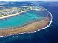
 2018-01-13 Shirahoreef by Peach Airbus A320-214 白保海岸 DSCF9567a.jpg 2,304 × 1,728; 1.1 MB
-
-
 Aerial view of Ishigaki island Taketomi and Kohama 2014.jpg 5,472 × 3,648; 1.13 MB
-
 Awase landsat.jpg 764 × 652; 148 KB
-
 Bay of Motobu 202010.jpg 6,000 × 4,000; 13.8 MB
-
 Crossing of Machinato Inlet.jpg 595 × 332; 50 KB
-
 Hama-Jima coral reef sandbar Aerial photograph.1995.jpg 3,502 × 2,627; 3.07 MB
-
 Ie island - panoramio.jpg 2,336 × 3,504; 1.71 MB
-
 Ie strait aerial.jpg 4,000 × 2,235; 1.05 MB
-
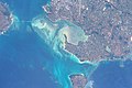
 ISS005-E-10686 Sekisei Lagoon.jpg 1,280 × 960; 259 KB
-
 Kunigami Peninsula.jpg 3,008 × 2,000; 1.86 MB
-
 Nakanshi.jpg 1,700 × 1,400; 280 KB
-
 Rukansho 20081121-gsi.jpg 1,600 × 1,800; 306 KB
-
 Shimoji katsu.jpg 1,280 × 960; 432 KB
-
Sound of the Whales underwater.webm 1 min 20 s, 1,920 × 1,080; 72.31 MB
-
 Urasoko Bay seen from Mount Nosoko 201912.jpg 6,000 × 4,000; 13.75 MB
-
 Yonaha Bay in Miyako Island.jpg 4,928 × 3,280; 1.6 MB
-
 今帰仁城跡 (215250593).jpeg 2,048 × 1,151; 1.07 MB


.jpeg)