Category:Blackwaterfoot
Jump to navigation
Jump to search
Refer to en:Blackwaterfoot
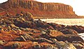
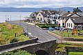
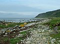
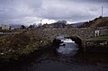
English: Blackwaterfoot ( Scottish Gaelic: Bun na Dubh Abhainn) is a village on the Isle of Arran in the Firth of Clyde, Scotland. It is located in the Shiskine valley in the south-west of the island. It is one of the smaller villages of Arran and home to one of Europe's two 12 hole golf courses. A short walk from Blackwaterfoot is Drumadoon Point, home to the largest Iron Age fort on Arran. Further North is the King's Cave, reputed to be a hiding place of Robert the Bruce.
Gàidhlig: 'S e baile beag ann an Arainn, eilean ann an Linne Chluaidh, a tha ann am Bun na Dubh Abhann (Beurla: Blackwaterfoot).
village on the west coast of Arran, North Ayrshire, Scotland, UK .JPG) | |||||
| Upload media | |||||
| Instance of | |||||
|---|---|---|---|---|---|
| Location | North Ayrshire, Scotland | ||||
| Located in or next to body of water |
| ||||
 | |||||
Media in category "Blackwaterfoot"
The following 113 files are in this category, out of 113 total.
-
 "Sealladhan Dheas" cottage, Bridgend - geograph.org.uk - 545802.jpg 640 × 428; 162 KB
-
 'King's Cave', Arran.JPG 2,523 × 1,695; 1.11 MB
-
 A view of Blackwaterfoot. - geograph.org.uk - 134556.jpg 640 × 480; 120 KB
-
 Basalt, Arran, Scotland, 1967 - Flickr - PhillipC.jpg 1,825 × 1,136; 1.68 MB
-
 Beach at Kilpatrick - geograph.org.uk - 3004236.jpg 640 × 480; 84 KB
-
 Beach to the south of Blackwaterfoot - geograph.org.uk - 5791304.jpg 3,833 × 2,875; 1.98 MB
-
 Black Dyke - geograph.org.uk - 2358718.jpg 800 × 531; 95 KB
-

-
 Blackwaterfoot (40611139363).jpg 7,211 × 4,813; 21.25 MB
-
 Blackwaterfoot - geograph.org.uk - 2358681.jpg 800 × 531; 122 KB
-
 Blackwaterfoot - geograph.org.uk - 3063347.jpg 640 × 467; 77 KB
-
 Blackwaterfoot - geograph.org.uk - 3063356.jpg 640 × 480; 55 KB
-
 Blackwaterfoot - geograph.org.uk - 3154434.jpg 640 × 427; 387 KB
-
 Blackwaterfoot - geograph.org.uk - 6115759.jpg 3,966 × 2,647; 7.99 MB
-
 Blackwaterfoot - Kinloch Hotel - geograph.org.uk - 2353914.jpg 800 × 531; 77 KB
-
 Blackwaterfoot Beach - geograph.org.uk - 2358666.jpg 800 × 531; 125 KB
-
 Blackwaterfoot beach - geograph.org.uk - 2804292.jpg 4,320 × 3,240; 4.6 MB
-
 Blackwaterfoot beach - geograph.org.uk - 452110.jpg 640 × 421; 43 KB
-
 Blackwaterfoot from Kilpatrick - geograph.org.uk - 862787.jpg 640 × 426; 88 KB
-
 Blackwaterfoot Harbour - geograph.org.uk - 2359293.jpg 531 × 800; 42 KB
-
 Blackwaterfoot Harbour - geograph.org.uk - 37713.jpg 640 × 419; 126 KB
-
 Blackwaterfoot Harbour - geograph.org.uk - 557219.jpg 640 × 268; 28 KB
-
 Blackwaterfoot Harbour - geograph.org.uk - 557223.jpg 640 × 268; 38 KB
-
 Blackwaterfoot Harbour and Bridge - geograph.org.uk - 2359526.jpg 800 × 531; 100 KB
-
 Blackwaterfoot Harbour, Bridge and Weir.JPG 5,184 × 3,456; 8.79 MB
-
 Blackwaterfoot, Arran - geograph.org.uk - 1599880.jpg 640 × 427; 237 KB
-
 Blackwaterfoot, Arran - geograph.org.uk - 816335.jpg 640 × 427; 173 KB
-
 Blackwaterfoot, Arran.JPG 2,496 × 1,620; 1.57 MB
-

-

-

-

-
 Blackwaterfoot, harbour channel - geograph.org.uk - 2092116.jpg 640 × 480; 90 KB
-

-
 Blackwaterfoot, Isle of Arran. - geograph.org.uk - 134552.jpg 640 × 480; 84 KB
-

-

-

-

-
 Blackwaterfoot, rock-pools and seaweed - geograph.org.uk - 2092326.jpg 640 × 480; 110 KB
-
 Blackwaterfoot, rocks - geograph.org.uk - 2092321.jpg 640 × 480; 93 KB
-

-
 Blackwaterfoot, rocky shore - geograph.org.uk - 2092301.jpg 640 × 480; 82 KB
-

-

-
 Blackwaterfoot, view along the coast - geograph.org.uk - 2092133.jpg 640 × 480; 74 KB
-
 Blackwaterfoot, village view - geograph.org.uk - 2092336.jpg 640 × 480; 87 KB
-
 Blackwaterfoot, waterfall and bridge - geograph.org.uk - 2092114.jpg 640 × 480; 117 KB
-

-
 Bus for Brodick at Blackwaterfoot - geograph.org.uk - 4661099.jpg 640 × 480; 166 KB
-
 Cave next to King's Cave - geograph.org.uk - 23226.jpg 640 × 418; 95 KB
-
 Cliffs at Blackwaterfoot, Arran.JPG 2,498 × 1,624; 1.3 MB
-
 Coastline at Blackwaterfoot - geograph.org.uk - 5946907.jpg 4,000 × 3,000; 6.56 MB
-
 Drumadoon - geograph.org.uk - 89417.jpg 640 × 480; 97 KB
-
 Drumadoon Bay - geograph.org.uk - 2353931.jpg 800 × 531; 91 KB
-
 Drumadoon Bay - geograph.org.uk - 3063372.jpg 640 × 461; 80 KB
-
 Drumadoon Bay - geograph.org.uk - 4271620.jpg 640 × 480; 50 KB
-
 Drumadoon Point - geograph.org.uk - 9039.jpg 640 × 381; 196 KB
-
 Drumnadoon Point, Arran - geograph.org.uk - 699822.jpg 640 × 480; 220 KB
-
 Felsite Intrusion - geograph.org.uk - 2359269.jpg 800 × 531; 110 KB
-
 Flow Banding in the Felsite - geograph.org.uk - 2359280.jpg 800 × 531; 167 KB
-
 Gull on a Post - geograph.org.uk - 3063378.jpg 483 × 640; 68 KB
-
 Harbour at Blackwaterfoot, Arran - geograph.org.uk - 1051449.jpg 480 × 640; 85 KB
-
 Isle of Arran - Blackwaterfoot - geograph.org.uk - 2358693.jpg 800 × 531; 123 KB
-
 Kilpatrick Dun - geograph.org.uk - 94975.jpg 640 × 480; 99 KB
-
 Low tide at Blackwaterfoot - geograph.org.uk - 452102.jpg 640 × 421; 44 KB
-
 Natural rock groynes at Blackwaterfoot - geograph.org.uk - 3932456.jpg 1,333 × 1,000; 984 KB
-
 Oystercatcher (Haematopus ostralegus) - geograph.org.uk - 3932467.jpg 1,000 × 1,331; 877 KB
-
 Pebbles near Blackwaterfoot - geograph.org.uk - 1171985.jpg 640 × 483; 130 KB
-
 Rock Formation At Blackwaterfoot - geograph.org.uk - 862804.jpg 640 × 426; 83 KB
-
 Rocky coast - Blackwaterfoot, Isle of Arran.jpg 7,360 × 4,912; 16.22 MB
-
 Scotland, Isle of Arran, Blackwaterfoot (1).JPG 1,904 × 1,011; 511 KB
-
 Scotland, Isle of Arran, Blackwaterfoot (2).JPG 1,930 × 1,228; 1.04 MB
-
 Scotland, Isle of Arran, Blackwaterfoot (3).JPG 1,716 × 1,140; 931 KB
-
 Seals on a sandbank - geograph.org.uk - 5946940.jpg 4,000 × 3,000; 5.59 MB
-
 Seals on the Rocks - geograph.org.uk - 2358685.jpg 800 × 532; 76 KB
-
 Shiskine Beach - geograph.org.uk - 3154371.jpg 640 × 418; 361 KB
-
 Shore at Blackwaterfoot - geograph.org.uk - 3063366.jpg 640 × 479; 78 KB
-
 Shore at Blackwaterfoot, Arran - geograph.org.uk - 1051405.jpg 640 × 480; 88 KB
-
 Shore towards King Cave - geograph.org.uk - 95003.jpg 640 × 471; 99 KB
-
 Small Harbour, Blackwaterfoot, Arran - geograph.org.uk - 5772602.jpg 640 × 480; 98 KB
-
 Sunset over Kintyre - geograph.org.uk - 3312337.jpg 2,560 × 1,920; 1.86 MB
-
 The Black Water enters the sea at Blackwaterfoot - geograph.org.uk - 5884596.jpg 1,024 × 575; 208 KB
-
 View out to Sea - geograph.org.uk - 2359524.jpg 531 × 800; 76 KB
-
 Ancient cross - geograph.org.uk - 1156260.jpg 480 × 640; 89 KB
-
 Beach at Blackwaterfoot - geograph.org.uk - 452097.jpg 640 × 421; 84 KB
-
 Blackwaterfoot Estuary - geograph.org.uk - 1461427.jpg 420 × 640; 77 KB
-
 Blackwaterfoot Harbour, Arran - geograph.org.uk - 557229.jpg 640 × 292; 35 KB
-
 Blackwaterfoot shore - geograph.org.uk - 1461412.jpg 640 × 412; 71 KB
-

-
 Bridge at Blackwaterfoot - geograph.org.uk - 452092.jpg 640 × 420; 48 KB
-
 Caves near Kings Cave - geograph.org.uk - 1463171.jpg 640 × 425; 100 KB
-
 Cleiteadh nan Sgarbh - geograph.org.uk - 451675.jpg 640 × 421; 72 KB
-
 Cnoc Ballygown - fort (unfinished) - geograph.org.uk - 321469.jpg 640 × 480; 64 KB
-
 Farm buildings and coastline near Tormore - geograph.org.uk - 545790.jpg 640 × 428; 148 KB
-
 Fishery by Blackwaterfoot, Isle of Arran. - geograph.org.uk - 61012.jpg 640 × 480; 140 KB
-
 Fishery by Blackwaterfoot, Isle of Arran. - geograph.org.uk - 61016.jpg 640 × 480; 166 KB
-
 Fishery near Blackwaterfoot, Isle of Arran - geograph.org.uk - 60759.jpg 640 × 480; 137 KB
-
 Forestry crossroads - geograph.org.uk - 589927.jpg 640 × 480; 127 KB
-
 Fulmars nesting on The Doon - geograph.org.uk - 452238.jpg 640 × 429; 87 KB
-
 Golf course at Blackwater - geograph.org.uk - 452229.jpg 640 × 420; 48 KB
-
 Kings Cave seascape - geograph.org.uk - 452201.jpg 640 × 408; 53 KB
-
 Kinloch Hotel, Arran - geograph.org.uk - 557226.jpg 640 × 480; 43 KB
-
 No Through Road - geograph.org.uk - 589922.jpg 640 × 480; 105 KB
-
 Northern entrances to Kings Cave - geograph.org.uk - 452193.jpg 640 × 425; 81 KB
-
 Path at Torbeg - geograph.org.uk - 214374.jpg 480 × 640; 139 KB
-
 Plaque at Blackwaterfoot Harbour - geograph.org.uk - 557222.jpg 640 × 480; 78 KB
-
 Road near Kilpatrick Point - geograph.org.uk - 452090.jpg 640 × 424; 43 KB
-
 Rock formations at Drumadoon Point - geograph.org.uk - 452132.jpg 640 × 423; 80 KB
-
 Rocky shore at Drumadoon Point - geograph.org.uk - 452145.jpg 640 × 418; 62 KB
-
 Shishkine Golf Course - geograph.org.uk - 452249.jpg 640 × 422; 63 KB
-
 Shishkine Golf Course from the Doon - geograph.org.uk - 95030.jpg 480 × 640; 112 KB
-
 Southern entrances to Kings Cave - geograph.org.uk - 452185.jpg 640 × 420; 102 KB


.jpg)


_-_geograph.org.uk_-_3932467.jpg)


.JPG)
.JPG)


_-_geograph.org.uk_-_321469.jpg)


