Category:Barmston, East Riding of Yorkshire
Jump to navigation
Jump to search
English: Barmston is a village in the East Riding of Yorkshire, England. It is situated on the Holderness coast, overlooking the North Sea and is to the east of the A165 road. Barmston is approximately 6 miles (9.7 km) south of Bridlington town centre.
village and civil parish in the East Riding of Yorkshire, England   | |||||
| Upload media | |||||
| Instance of | |||||
|---|---|---|---|---|---|
| Location | East Riding of Yorkshire, Yorkshire and the Humber, England | ||||
 | |||||
Subcategories
This category has the following 11 subcategories, out of 11 total.
A
- All Saints Church, Barmston (13 F)
B
- Barmston Cliff (37 F)
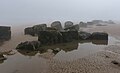
- Barmston Sands (44 F)
- The Black Bull, Barmston (4 F)
F
T
- Trusey Hill (3 F)
Media in category "Barmston, East Riding of Yorkshire"
The following 200 files are in this category, out of 401 total.
(previous page) (next page)-
 1GL bench mark on All Saints', Barmston - geograph.org.uk - 3346784.jpg 480 × 640; 238 KB
-
 A Millennium Stone at Barmston - geograph.org.uk - 2206461.jpg 800 × 600; 170 KB
-
 A quiet beach Auburn Sands - geograph.org.uk - 6080099.jpg 5,184 × 3,888; 2.1 MB
-
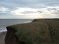
 A receding coast - geograph.org.uk - 3886291.jpg 4,320 × 3,240; 2.36 MB
-
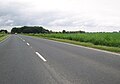
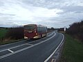
 A165 Bridlington Road - geograph.org.uk - 5320438.jpg 2,800 × 1,882; 2.23 MB
-
 A165 Bridlington Road heading north - geograph.org.uk - 4994793.jpg 1,809 × 1,272; 750 KB
-
 A165 heading north - geograph.org.uk - 5321363.jpg 2,845 × 1,873; 2.07 MB
-
 A165 near Carnaby Moor - geograph.org.uk - 5321370.jpg 2,687 × 1,692; 2.16 MB
-
 A165 near Fraisthorpe - geograph.org.uk - 4787748.jpg 640 × 480; 45 KB
-
 A165 near Manor House Farm - geograph.org.uk - 4787753.jpg 640 × 480; 86 KB
-
 A165 New Cut towards Barmston (geograph 5317822).jpg 2,772 × 1,644; 1.64 MB
-
 A165 north of Barmston - geograph.org.uk - 5320420.jpg 2,678 × 1,713; 1.94 MB
-
 A165 towards Bridlington - geograph.org.uk - 4788785.jpg 640 × 480; 50 KB
-
 A165 towards Hull - geograph.org.uk - 4787718.jpg 640 × 480; 61 KB
-
 A165 towards Hull - geograph.org.uk - 4787744.jpg 640 × 480; 46 KB
-
 A165 west of Fraisthorpe - geograph.org.uk - 5320448.jpg 2,725 × 1,715; 2.21 MB
-
 A165, Barmston - geograph.org.uk - 5358691.jpg 640 × 426; 54 KB
-
 A165, Carnaby Moor - geograph.org.uk - 5358700.jpg 640 × 426; 45 KB
-
 A165, northbound - geograph.org.uk - 5358695.jpg 640 × 426; 56 KB
-

-
-
 All Saints Church, Barmston - geograph.org.uk - 4788495.jpg 640 × 480; 44 KB
-
 All Saints Church, Barmston - geograph.org.uk - 4788498.jpg 640 × 480; 73 KB
-
 All Saints Church, Barmston - geograph.org.uk - 5431810.jpg 640 × 563; 105 KB
-
 All Saints' church - geograph.org.uk - 2472769.jpg 640 × 427; 83 KB
-
 All Saints' church, Barmston - geograph.org.uk - 3346787.jpg 480 × 640; 150 KB
-
 All Saints' church, Barmston - geograph.org.uk - 5568123.jpg 1,024 × 768; 137 KB
-
 All Saints' church, Barmston - geograph.org.uk - 5571088.jpg 1,024 × 768; 193 KB
-
 Amici Italian restaurant, Barmston - geograph.org.uk - 6231814.jpg 1,920 × 1,280; 1.23 MB
-
 An erratic wall - geograph.org.uk - 1013439.jpg 640 × 467; 127 KB
-
 Anti tank defences on Auburn Sands - geograph.org.uk - 5260966.jpg 2,300 × 1,724; 1.11 MB
-
 Anti-tank blocks on Auburn Sands - geograph.org.uk - 5911859.jpg 640 × 399; 49 KB
-
-

-
-
 Auburn Beck crosses the beach - geograph.org.uk - 4316170.jpg 1,024 × 768; 143 KB
-
 Auburn Beck meets the sea - geograph.org.uk - 6081073.jpg 640 × 480; 47 KB
-
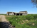
 Auburn Farm has a number of late 18th century buildings - geograph.org.uk - 5260951.jpg 2,262 × 1,670; 1.34 MB
-
 Auburn Farm, Fraisthorpe - geograph.org.uk - 2151082.jpg 800 × 600; 224 KB
-
 Auburn Sands - geograph.org.uk - 4317423.jpg 1,024 × 768; 130 KB
-
 Auburn Sands - geograph.org.uk - 6080095.jpg 5,184 × 3,888; 3.02 MB
-
 Auburn Sands - geograph.org.uk - 6080096.jpg 5,184 × 3,888; 2.53 MB
-
 Auburn Sands - geograph.org.uk - 6319786.jpg 1,024 × 648; 67 KB
-
 Auburn Sands at low tide looking south - geograph.org.uk - 5260971.jpg 2,266 × 1,676; 1.15 MB
-
 Auburn Sands, low tide - geograph.org.uk - 6081074.jpg 5,184 × 3,888; 2.2 MB
-
 Barmston and Fraisthorpe UK parish locator map.svg 1,425 × 1,107; 1.68 MB
-

-
 Barmston beach - geograph.org.uk - 6193195.jpg 960 × 466; 117 KB
-
 Barmston Beach Caravan Park - geograph.org.uk - 4638577.jpg 640 × 427; 48 KB
-
 Barmston Beach Caravan Park - geograph.org.uk - 4638582.jpg 640 × 427; 56 KB
-
 Barmston Beach Caravan Park - geograph.org.uk - 794770.jpg 640 × 480; 227 KB
-
 Barmston Beach Holiday Park - geograph.org.uk - 1277701.jpg 640 × 480; 51 KB
-
 Barmston Beach Holiday Park - geograph.org.uk - 4788541.jpg 640 × 480; 64 KB
-
 Barmston Beach Holiday Park - geograph.org.uk - 4788552.jpg 640 × 480; 56 KB
-
 Barmston car park - geograph.org.uk - 5431780.jpg 640 × 514; 95 KB
-
 Barmston Drain toward the east and the sea - geograph.org.uk - 2002693.jpg 2,816 × 2,112; 2.75 MB
-
 Barmston Duck Pond - geograph.org.uk - 1277613.jpg 640 × 480; 153 KB
-
 Barmston Fox Covert - geograph.org.uk - 1281640.jpg 640 × 480; 55 KB
-
 Barmston Garage - geograph.org.uk - 813084.jpg 640 × 447; 80 KB
-
 Barmston Main Drain - geograph.org.uk - 3886302.jpg 3,240 × 4,320; 1.71 MB
-
 Barmston Main Drain - geograph.org.uk - 4788943.jpg 640 × 480; 64 KB
-

-
 Barmston Main Drain looking inland - geograph.org.uk - 5259806.jpg 2,298 × 1,720; 1.23 MB
-
 Barmston Manor Farmhouse - geograph.org.uk - 1013433.jpg 640 × 427; 72 KB
-
 Barmston Methodist Church.jpg 640 × 439; 81 KB
-
 Barmston outfall - geograph.org.uk - 5431920.jpg 640 × 482; 117 KB
-
 Barmston sands - geograph.org.uk - 3886285.jpg 4,320 × 2,160; 1.26 MB
-
 Barmston Sands - geograph.org.uk - 4638579.jpg 640 × 427; 63 KB
-
 Barmston Sands - geograph.org.uk - 4788553.jpg 640 × 480; 64 KB
-
 Barmston Sands - geograph.org.uk - 4788555.jpg 640 × 480; 54 KB
-
 Barmston Sands - geograph.org.uk - 4788559.jpg 640 × 480; 58 KB
-
 Barmston Sands - geograph.org.uk - 4788809.jpg 480 × 640; 63 KB
-
 Barmston Sands - geograph.org.uk - 4788913.jpg 640 × 480; 61 KB
-
 Barmston Sands - geograph.org.uk - 5431798.jpg 640 × 480; 75 KB
-
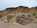
 Barmston Sands with soft eroding cliff - geograph.org.uk - 5259792.jpg 2,228 × 1,620; 1.25 MB
-
 Barmston waste water pumping station - geograph.org.uk - 4788505.jpg 640 × 480; 115 KB
-
 Barmston Wesleyan Chapel - geograph.org.uk - 100552.jpg 640 × 427; 82 KB
-

-
 Barn, Auburn Farm - geograph.org.uk - 6081592.jpg 640 × 480; 83 KB
-
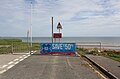
 Beach defence light - geograph.org.uk - 4317432.jpg 1,024 × 768; 189 KB
-
 Beach, Auburn Sands - geograph.org.uk - 3348490.jpg 640 × 480; 48 KB
-
 Bend in the A165 - geograph.org.uk - 4819206.jpg 640 × 482; 48 KB
-
 Between farm and beach Auburn Farm - geograph.org.uk - 5260964.jpg 1,536 × 1,151; 635 KB
-
 Brackendale Farm - geograph.org.uk - 1223584.jpg 640 × 481; 43 KB
-
 Brackendale Farm - geograph.org.uk - 708086.jpg 640 × 451; 102 KB
-
 Bridlington Road (A165) - geograph.org.uk - 4787761.jpg 640 × 480; 71 KB
-
 Bridlington Road (A165) - geograph.org.uk - 4787769.jpg 640 × 480; 47 KB
-
 Bridlington Road (A165) - geograph.org.uk - 4788474.jpg 640 × 480; 89 KB
-
 Bridlington Road (A165) - geograph.org.uk - 4788478.jpg 640 × 480; 36 KB
-
 Bridlington road approaching Marr Plantation - geograph.org.uk - 4994804.jpg 1,515 × 1,123; 693 KB
-
 Burned out car in farmland - geograph.org.uk - 4811772.jpg 640 × 480; 92 KB
-
 Burned out car near Fraisthorpe - geograph.org.uk - 4811770.jpg 640 × 480; 66 KB
-
 Burton Drain near Wharram Hill - geograph.org.uk - 5805901.jpg 1,600 × 1,065; 599 KB
-
 Bus stop on Sands Lane, Barmston - geograph.org.uk - 4788974.jpg 640 × 480; 48 KB
-
 Car park and field near Auburn Farm - geograph.org.uk - 6080093.jpg 4,773 × 3,839; 2.87 MB
-
 Caravan site, Auburn Farm - geograph.org.uk - 6081600.jpg 640 × 480; 83 KB
-

-
 Carr Dike, Fraisthorpe - geograph.org.uk - 708072.jpg 521 × 640; 89 KB
-
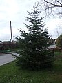 Christmas tree, Barmston - geograph.org.uk - 4788522.jpg 480 × 640; 75 KB
-
 Clay cliffs, Barmston - geograph.org.uk - 5431803.jpg 640 × 480; 56 KB
-

-

-
 Cliff top footpath to Sands Lane and Holiday Park - geograph.org.uk - 5259800.jpg 2,290 × 1,710; 1.49 MB
-

-
 Close up, Elizabeth II postbox on Sands Lane, Barmston - geograph.org.uk - 5646389.jpg 1,632 × 2,735; 908 KB
-
 Close up, Elizabeth II postbox, Fraisthorpe - geograph.org.uk - 4811581.jpg 1,602 × 3,324; 613 KB
-
 Coastal crop field near Barmston - geograph.org.uk - 4788958.jpg 640 × 480; 70 KB
-
 Coastal crop field, Barmston - geograph.org.uk - 4788543.jpg 640 × 480; 59 KB
-
 Coastal erosion of soft cliffs, Auburn Sands - geograph.org.uk - 6080084.jpg 5,184 × 3,888; 3.6 MB
-
 Coastal erosion, Barmston Sands - geograph.org.uk - 4788554.jpg 640 × 480; 62 KB
-

-
 Coastal farmland, South Field - geograph.org.uk - 4788803.jpg 640 × 480; 37 KB
-
 Coastal path above Barmston Sands - geograph.org.uk - 4788558.jpg 640 × 480; 52 KB
-
 Coastal path above Barmston Sands - geograph.org.uk - 4788565.jpg 640 × 480; 60 KB
-
 Coastal path above Barmston Sands - geograph.org.uk - 4788807.jpg 640 × 480; 72 KB
-
 Coastal path above Barmston Sands - geograph.org.uk - 4788813.jpg 640 × 480; 50 KB
-
 Coastal path heading south - geograph.org.uk - 4788911.jpg 640 × 480; 50 KB
-
 Coastal path towards Barmston - geograph.org.uk - 4788956.jpg 640 × 480; 54 KB
-
 Coastal path towards Barmston - geograph.org.uk - 4788963.jpg 640 × 480; 68 KB
-
 Coastal track, Auburn Sands - geograph.org.uk - 3348487.jpg 640 × 480; 72 KB
-
 Coastal track, Auburn Sands - geograph.org.uk - 3348495.jpg 640 × 488; 81 KB
-
 Communications centre, Barmston - geograph.org.uk - 4788527.jpg 640 × 480; 70 KB
-
 Cosa Nostra, Italian Restorante - geograph.org.uk - 2206434.jpg 800 × 600; 200 KB
-
 Cottage in Barmston - geograph.org.uk - 4788968.jpg 640 × 480; 67 KB
-
 Cottage on Sands Lane, Barmston - geograph.org.uk - 4789371.jpg 640 × 480; 47 KB
-
 Cow Shed Cafe at Auburn Farm - geograph.org.uk - 6319775.jpg 1,024 × 768; 187 KB
-
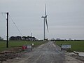
 Crop field and wind turbine - geograph.org.uk - 4811482.jpg 640 × 480; 43 KB
-
 Crop field and wind turbine - geograph.org.uk - 4811491.jpg 640 × 480; 40 KB
-
 Crop field beside the A165 - geograph.org.uk - 4811777.jpg 640 × 480; 59 KB
-

-
 Crop field near Fraisthorpe - geograph.org.uk - 4811766.jpg 640 × 480; 61 KB
-
 Crop field near Sticks Farm - geograph.org.uk - 4788790.jpg 640 × 480; 105 KB
-
 Crop field north of Sands Lane - geograph.org.uk - 4788502.jpg 640 × 480; 48 KB
-
 Crop field off the A165 - geograph.org.uk - 4787729.jpg 640 × 480; 41 KB
-
 Crop field west of the A165 - geograph.org.uk - 4819202.jpg 640 × 480; 94 KB
-
 Crop field, South Field - geograph.org.uk - 4788909.jpg 640 × 480; 49 KB
-
 Demming Farm - geograph.org.uk - 518086.jpg 640 × 480; 129 KB
-
 Demming Hill - geograph.org.uk - 518098.jpg 640 × 480; 104 KB
-
 Detectorists, Barmston - geograph.org.uk - 5431802.jpg 478 × 640; 116 KB
-
 Disused Garage near Barmston - geograph.org.uk - 1281632.jpg 640 × 480; 49 KB
-
 Don't forget your trousers - geograph.org.uk - 3348504.jpg 640 × 480; 70 KB
-
 Drain near South Kingsfield - geograph.org.uk - 4811503.jpg 640 × 480; 66 KB
-
 Drain near South Kingsfield - geograph.org.uk - 4811506.jpg 640 × 480; 76 KB
-
 Drain, near Barmston - geograph.org.uk - 1281639.jpg 640 × 480; 77 KB
-
 Duck pond in winter, Barmston - geograph.org.uk - 4788521.jpg 640 × 480; 112 KB
-
 Earthworks at Barmston - geograph.org.uk - 1014579.jpg 640 × 480; 87 KB
-
 Elizabeth II postbox on Sands Lane, Barmston - geograph.org.uk - 5646388.jpg 2,136 × 2,848; 1.41 MB
-
 Elizabeth II postbox, Fraisthorpe - geograph.org.uk - 4811580.jpg 640 × 591; 147 KB
-

-

-
 End of the road, Auburn Sands - geograph.org.uk - 3348501.jpg 1,024 × 728; 247 KB
-
 End of the road, Sands Lane - geograph.org.uk - 4638571.jpg 640 × 421; 53 KB
-
 End of the road, Sands Lane, - geograph.org.uk - 4788548.jpg 640 × 480; 41 KB
-
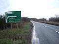
 Entering Barmston - geograph.org.uk - 4788508.jpg 640 × 480; 73 KB
-
 Entering Barmston Village - geograph.org.uk - 4788492.jpg 640 × 480; 85 KB
-

-
 Entrance to Barmston Organics Farm Shop - geograph.org.uk - 1222024.jpg 640 × 427; 325 KB
-
 Eroded soft cliff, Barmston Sands - geograph.org.uk - 4788563.jpg 640 × 480; 75 KB
-
 Eroded soft cliff, Barmston Sands - geograph.org.uk - 4788811.jpg 480 × 640; 65 KB
-
 Eroding cliff above Auburn Sands - geograph.org.uk - 6080094.jpg 5,184 × 3,888; 4.25 MB
-
 Eroding cliffs at Barmston Sands - geograph.org.uk - 5911776.jpg 640 × 394; 54 KB
-
 Eroding cliffs, Auburn Sands - geograph.org.uk - 6081601.jpg 5,184 × 3,888; 2.45 MB
-
 Eroding coast - geograph.org.uk - 4313382.jpg 1,024 × 768; 151 KB
-
 Eroding coastline, Auburn Sands - geograph.org.uk - 6080086.jpg 5,184 × 3,888; 3.5 MB
-

-
-
 Farm buildings, Auburn Farm - geograph.org.uk - 6081594.jpg 640 × 348; 42 KB
-

-
 Farm buildings, Warrens (geograph 6455237).jpg 640 × 480; 87 KB
-
 Farm Track - geograph.org.uk - 287786.jpg 640 × 480; 121 KB
-
 Farm track and bales - geograph.org.uk - 4787756.jpg 640 × 480; 53 KB
-
 Farm Track near Barmston - geograph.org.uk - 1281634.jpg 640 × 480; 45 KB
-
 Farm track near Fraisthorpe - geograph.org.uk - 4313088.jpg 1,024 × 768; 134 KB
-
 Farm track off Sands Lane, Barmston - geograph.org.uk - 4788534.jpg 640 × 480; 59 KB
-
 Farm Track off the A165 - geograph.org.uk - 1281642.jpg 640 × 480; 89 KB
-

-
 Farmhouse, Auburn Farm - geograph.org.uk - 6081590.jpg 640 × 480; 100 KB
-
 Farmland and wind turbines - geograph.org.uk - 4811510.jpg 640 × 480; 38 KB
-
 Farmland beside Marr Plantation - geograph.org.uk - 4788473.jpg 640 × 480; 80 KB
-
 Farmland beside the Earl's Dike - geograph.org.uk - 4811538.jpg 640 × 480; 67 KB
-
 Farmland Quintin Garth - geograph.org.uk - 4787771.jpg 640 × 480; 52 KB
-

-
 Farmland West of Barmston - geograph.org.uk - 1281641.jpg 640 × 480; 44 KB
-
 Farmland, Brickhill Closes - geograph.org.uk - 4789378.jpg 640 × 480; 56 KB
-
 Farmland, South Kingsfield - geograph.org.uk - 4811499.jpg 640 × 480; 49 KB
-
 Farmland, Stone Hills - geograph.org.uk - 4788769.jpg 640 × 480; 59 KB
-
 Field beside drain - geograph.org.uk - 4811771.jpg 640 × 480; 63 KB
-
 Field edge footpath to the left, Hamilton Hill ahead - geograph.org.uk - 5261014.jpg 1,464 × 1,051; 633 KB
-
 Field edge Quintin Garth - geograph.org.uk - 2002740.jpg 2,816 × 2,112; 2.74 MB
-
-
 Field of sunflowers - geograph.org.uk - 5568104.jpg 1,024 × 768; 282 KB
-
 Field Path - geograph.org.uk - 5886196.jpg 3,648 × 2,736; 2.89 MB
-
 Field, Quintin Garth - geograph.org.uk - 4811774.jpg 640 × 480; 66 KB
-

-
 Fields near Barmston - geograph.org.uk - 5431923.jpg 480 × 640; 105 KB
-
 Flat farmland near Barmston - geograph.org.uk - 4788475.jpg 640 × 480; 73 KB
-
 Flat farmland near Barmston - geograph.org.uk - 4788481.jpg 640 × 480; 56 KB
-

-
 Footpath south to Barmston - geograph.org.uk - 5261008.jpg 2,304 × 1,728; 1.45 MB
-
 Footpath to Barmston - geograph.org.uk - 4313387.jpg 1,024 × 768; 137 KB


.jpg)


_-_geograph.org.uk_-_4787761.jpg)
_-_geograph.org.uk_-_4787769.jpg)
_-_geograph.org.uk_-_4788474.jpg)
_-_geograph.org.uk_-_4788478.jpg)


.jpg)


_-_geograph.org.uk_-_4787762.jpg)


.jpg)


