Category:Baptista van Doetecum
Jump to navigation
Jump to search
Dutch engraver-cartographer | |||||
| Upload media | |||||
| Date of death | 1611 Deventer, Deventer | ||||
|---|---|---|---|---|---|
| Occupation | |||||
| Father | |||||
| Sibling |
| ||||
| Work location | |||||
| |||||
Baptista van Doetecum (d. 1611) was a Dutch printmaker. Variations of the name include Baptist, Baptista, Jan Bapista, Johannes Batist. van Doetichum, Doetechum, Duetechum, Deutecum, and Doetecomius.[1]
Subcategories
This category has the following 3 subcategories, out of 3 total.
Media in category "Baptista van Doetecum"
The following 36 files are in this category, out of 36 total.
-

-
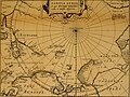
 1598 map of the Polar Regions by Willem Barentsz.jpg 13,719 × 10,160; 30.66 MB
-
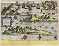
 AMH-6599-KB View of the island of St Helena.jpg 2,400 × 1,835; 1.05 MB
-
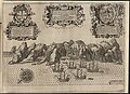
 AMH-6601-KB A number of views of the island of Ascencion.jpg 2,400 × 1,888; 1.16 MB
-
 Barents third voyage.jpg 2,000 × 1,511; 965 KB
-
 Barentskartet, 1598 (12068020364).jpg 2,842 × 2,091; 3.85 MB
-
 Barentsz arctic map.jpg 650 × 517; 102 KB
-
 Barentsz Full Map.jpg 1,000 × 742; 258 KB
-
 Beleg en inname van Grave door Maurits, 1602, RP-P-OB-80.622.jpg 6,194 × 4,312; 5.81 MB
-

-
 Beleg van Grave, 1602, RP-P-AO-16-130A.jpg 5,906 × 4,304; 7.72 MB
-
 Beleg van Oostende gevechten en ontploffingen onder de bolwerken, 1604, RP-P-OB-80.674.jpg 4,274 × 5,548; 6.29 MB
-

-

-

-
-
 Forminsket utgave av Barentskartet - no-nb krt 00487.jpg 4,418 × 3,449; 3.45 MB
-
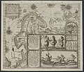
 Fusta by Jan Huygen van Linschoten.jpg 2,102 × 1,667; 1.73 MB
-
 Kaart van de landen in het Noord-Oosten van de Middellandse Zee, RP-P-1990-415.jpg 6,264 × 4,250; 7.14 MB
-

-

-
 Kaart van het Heilige Land Bijbelkaarten (serietitel), RP-P-1990-414.jpg 6,300 × 4,258; 7.13 MB
-

-

-
 Linschoten Map of Scandinavia.jpg 1,536 × 1,316; 540 KB
-
 Linschotens nordenkart, 1601 (12067624705) (2).jpg 4,400 × 3,609; 22.96 MB
-
 Linschotens nordenkart, 1601 (12067624705).jpg 4,037 × 3,455; 22.29 MB
-
 Map - Special Collections University of Amsterdam - OTM- HB-KZL 31-01-12.tif 6,140 × 3,458; 60.75 MB
-

-
 Pontanus 1611 Arctic Map.jpg 2,852 × 2,142; 802 KB
-

-
 Saint Helena Island images 1596.jpg 2,273 × 1,500; 1.03 MB
-
 Spreekwoord Ick bints alleen niet, RP-P-1880-A-4524.jpg 5,514 × 4,356; 7.69 MB
-
 Tabula hydrographica - no-nb krt 00479.jpg 7,795 × 10,157; 22.03 MB
-
 Vera effigies et delineatio Insulae Ascensio (Isla de la Ascensión" (25767337283).jpg 5,645 × 4,293; 3.13 MB
-


.jpg)


,_RP-P-OB-79.804.jpg)


.jpg)


,_RP-P-AO-1-9.jpg)
,_RP-P-1990-414.jpg)
_door_Willem_Barendsz_(titel_op_object),_NG-800.jpg)

_(2).jpg)
.jpg)
.jpg)


.jpg)
,_RP-P-AO-20-7.jpg)
.jpg)