Category:August 2008 in Devon
Jump to navigation
Jump to search
Subcategories
This category has the following 2 subcategories, out of 2 total.
Media in category "August 2008 in Devon"
The following 94 files are in this category, out of 94 total.
-
 09002 Buckfastleigh.jpg 3,456 × 2,304; 4.43 MB
-
 1369 Arrives at Buckfastleigh - geograph.org.uk - 942463.jpg 640 × 427; 121 KB
-

-

-
 Sign for the Drum Inn, Cockington - geograph.org.uk - 943066.jpg 480 × 640; 83 KB
-
 The Drum, Cockington - geograph.org.uk - 943059.jpg 640 × 480; 88 KB
-
 Mount Batten Landing Stage - geograph.org.uk - 1169410.jpg 640 × 427; 73 KB
-
 Grand Hotel Torquay (2763503286).jpg 2,269 × 2,720; 4 MB
-
 Cottage Cockington (2771170070).jpg 3,456 × 2,304; 6.38 MB
-
 High Lodge Cockington (2770332517).jpg 2,256 × 2,001; 3.64 MB
-
 The Forge Cockington (2770345989).jpg 2,559 × 2,082; 3.45 MB
-
 Cockington Court - geograph.org.uk - 943046.jpg 640 × 480; 74 KB
-
 Postbox, Cockington - geograph.org.uk - 942853.jpg 480 × 640; 127 KB
-
 Rose Cottage, Cockington - geograph.org.uk - 942785.jpg 640 × 480; 92 KB
-
 The Forge, Cockington - geograph.org.uk - 942805.jpg 640 × 480; 100 KB
-
 Windsor Road, Torquay - geograph.org.uk - 938911.jpg 640 × 480; 111 KB
-
 Beside Babbacombe Road, Wellswood - geograph.org.uk - 938990.jpg 640 × 485; 145 KB
-
 Thatched Cottage, Cockington - geograph.org.uk - 943039.jpg 480 × 640; 128 KB
-
 33002 at Buckfastleigh.jpg 2,862 × 1,932; 3.47 MB
-
 3803 South Devon Railway (1).jpg 1,812 × 3,068; 3.95 MB
-
 3803 South Devon Railway (2).jpg 2,583 × 2,013; 4.18 MB
-
 3803 South Devon Railway (3).jpg 2,619 × 2,202; 4.24 MB
-
 3803 South Devon Railway (4).jpg 2,300 × 3,184; 4.66 MB
-
 3803 South Devon Railway (5).jpg 3,105 × 2,025; 4.74 MB
-
 3803 South Devon Railway.jpg 2,295 × 2,097; 4.26 MB
-
 4920 Dumbleton Hall South Devon Railway.jpg 2,215 × 2,475; 3.31 MB
-
 5526 Arriving at Staverton - geograph.org.uk - 942495.jpg 640 × 427; 122 KB
-
 5786 South Devon Railway (1).jpg 2,760 × 1,980; 4.69 MB
-
 5786 South Devon Railway (2).jpg 2,124 × 1,797; 3.23 MB
-
 5786 South Devon Railway (4).jpg 2,217 × 1,584; 2.7 MB
-
 5786 South Devon Railway.jpg 2,505 × 1,833; 2.6 MB
-
 68011 at Buckfastleigh.jpg 2,835 × 1,620; 3.45 MB
-
 Age Concern in Litchdon Street - geograph.org.uk - 938920.jpg 640 × 480; 72 KB
-
 Beacon, cat and tractor - geograph.org.uk - 942042.jpg 640 × 482; 68 KB
-

-
 Belmont Avenue. - geograph.org.uk - 935761.jpg 640 × 480; 97 KB
-

-

-

-
 Boiler (2764815491).jpg 3,456 × 2,304; 4.67 MB
-
 Broad Park Avenue. - geograph.org.uk - 937056.jpg 640 × 480; 77 KB
-
 20110 Buckfastleigh (1).jpg 3,456 × 2,304; 4.53 MB
-
 20110 Buckfastleigh.jpg 1,560 × 1,671; 1.78 MB
-
 20118 Buckfastleigh.jpg 2,232 × 2,235; 3.3 MB
-
 D7612 Buckfastleigh.jpg 3,456 × 2,304; 3.84 MB
-

-

-
 Church Hill - geograph.org.uk - 935752.jpg 640 × 480; 107 KB
-

-
 Cottage, Coombeinteignhead - geograph.org.uk - 940855.jpg 640 × 480; 75 KB
-
 Cottage, Coombeinteignhead - geograph.org.uk - 940871.jpg 640 × 480; 79 KB
-
 Cottage, Yalberton - geograph.org.uk - 938163.jpg 640 × 480; 105 KB
-
 Cross Street Car Park - geograph.org.uk - 937165.jpg 640 × 480; 72 KB
-
 D6737 (2764985547).jpg 3,456 × 2,304; 4.53 MB
-
 Dawlish, train passing the seafront - geograph.org.uk - 1469007.jpg 640 × 480; 78 KB
-
 East devon way and footpath.JPG 2,272 × 1,704; 1.06 MB
-

-
 Estate agents in Boutport Street - geograph.org.uk - 941469.jpg 640 × 480; 83 KB
-

-
 Firebox rivets (2765721246).jpg 3,456 × 2,304; 5.24 MB
-
 Footbridge and Hillside - geograph.org.uk - 942659.jpg 640 × 427; 118 KB
-
 Hedge cutting near Chudleigh - geograph.org.uk - 929977.jpg 640 × 480; 134 KB
-
 Hercules at Paignton - geograph.org.uk - 905680.jpg 640 × 474; 77 KB
-
 Huts (2771181780).jpg 3,417 × 939; 2.24 MB
-
 Huts 2 (2770338435).jpg 2,878 × 1,540; 3.04 MB
-
 Inn on the Square, Barnstaple - geograph.org.uk - 938953.jpg 640 × 480; 107 KB
-

-

-
 New shops on Bedford Street, Exeter - geograph.org.uk - 919367.jpg 480 × 640; 72 KB
-
 Newton Abbot, Barnado's, Bank Street - geograph.org.uk - 919980.jpg 640 × 427; 151 KB
-
-
 Peacock (2759780150).jpg 3,300 × 2,400; 6.8 MB
-
 Platform and Rare Breeds Farm - geograph.org.uk - 942061.jpg 640 × 427; 99 KB
-
 Postbox on Sinai Hill - geograph.org.uk - 938414.jpg 640 × 480; 50 KB
-
 Rock Inn pub sign - geograph.org.uk - 934459.jpg 640 × 480; 44 KB
-
 Rock Inn, Haytor Vale - geograph.org.uk - 934458.jpg 640 × 480; 72 KB
-
 Rounding the curve near Langstone Rock.jpg 640 × 480; 84 KB
-
 Royal Castle Hotel, Dartmouth - geograph.org.uk - 940043.jpg 640 × 480; 101 KB
-

-
 Sign on Castle Hill - geograph.org.uk - 938443.jpg 480 × 640; 107 KB
-
 Sleepers (2765667304).jpg 2,784 × 1,722; 3.37 MB
-
 Small boat Crane - geograph.org.uk - 936113.jpg 640 × 428; 75 KB
-
 St Mary's Well, Bovey Tracey - geograph.org.uk - 931603.jpg 640 × 480; 149 KB
-
 Staverton Mill under Renovation - geograph.org.uk - 944481.jpg 640 × 427; 96 KB
-
 Staverton Station - geograph.org.uk - 944458.jpg 640 × 427; 122 KB
-

-
 The Ferry Boat Inn, Teignmouth - geograph.org.uk - 941656.jpg 480 × 640; 69 KB
-
 The ford at Hisley Bridge - geograph.org.uk - 933854.jpg 640 × 480; 139 KB
-
 The Wild Goose, Combeinteignhead - geograph.org.uk - 940894.jpg 640 × 480; 87 KB
-
 Tiverton , Aerial View - geograph.org.uk - 1282944.jpg 640 × 480; 73 KB
-
 Totnes Steamer Quay - Rail River Link 2 (UWV604S).jpg 640 × 428; 92 KB
-

-
 Tunnel entrance, Holcombe - geograph.org.uk - 949674.jpg 640 × 480; 125 KB
-
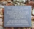 Witchplaque.JPG 2,424 × 2,114; 1.15 MB


.jpg)
.jpg)
.jpg)
.jpg)


.jpg)
.jpg)
.jpg)
.jpg)
.jpg)


.jpg)
.jpg)
.jpg)


.jpg)

.jpg)


.jpg)


.jpg)


.jpg)


.jpg)


.jpg)


.jpg)


.jpg)