Category:August 2007 in Norfolk, England
Jump to navigation
Jump to search

Deutsch: Bilder, die im August 2007 in Norfolk, England aufgenommen worden sind. Bitte beachten Sie, dass dies weder das Datum des Uploads noch das Datum des Scannens eines Fotos ist.
English: Images/pictures taken in Norfolk, England during August 2007. Note this is not the date of the upload, nor the date a photo was scanned.
Español: Fotografías o imágenes tomadas en Norfolk, England durante agosto 2007. No es la fecha de subida ni escaneo, sino la fecha en que las fotografías o imágenes se crearon.
Esperanto: Bildoj faritaj en Norfolk, England en aŭgusto 2007. Tio ne estas la dato, kiam la bildoj estis alŝutitaj aŭ skanitaj.
Français : Photographies ou images prises en Norfolk, England durant août 2007. Ce n'est pas la date du téléchargement ou du scan.
Galego: Fotografías ou imaxes tomadas en Norfolk, England durante agosto 2007. Non é a data de subida nin escaneamento, senón a data na que se crearon as fotografías ou imaxes.
Italiano: Fotografie o immagini scattate a Norfolk, England nel agosto 2007. Nota bene: la data non si riferisce né a quella di upload né a quella in cui la foto è stata digitalizzata.
Norsk bokmål: Bilder tatt i Norfolk, England i løpet av august 2007. Merk at dette ikke er datoen for opplasting, eller når et bilde har blitt skannet.
Norsk nynorsk: Bilete teke i Norfolk, England i løpet av august 2007. Merk at dette ikkje er datoen for opplasting, eller når eit bilete har vorte skanna.
Русский: Изображения, сделанные в Norfolk, England в течение август 2007 (не дата загрузки изображения).
Українська: Зображення, зроблені в Norfolk, England протягом серпень 2007. Зауважте, що це не дата завантаження чи дата сканування фотографії.
| August 2006 | ← | August 2007 | → | August 2008 | |||||||
| Jan | Feb | Mar | Apr | May | Jun | Jul | Aug | Sep | Oct | Nov | Dec |
| 18 | 47 | 128 | 172 | 117 | 116 | 119 | 324 | 133 | 149 | 181 | 60 |
|---|---|---|---|---|---|---|---|---|---|---|---|
Subcategories
This category has the following 2 subcategories, out of 2 total.
Media in category "August 2007 in Norfolk, England"
The following 200 files are in this category, out of 322 total.
(previous page) (next page)-
 -2007-08-25 Letter Box, Staden Park, Trimingham.jpg 545 × 640; 118 KB
-
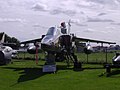
 -2007-08-28 Gloster Meteor F.8 Aircraft, Norwich Aviation Museum (2).JPG 2,560 × 1,920; 1.03 MB
-
 -2007-08-28 Gloster Meteor F.8 Aircraft, Norwich Aviation Museum.JPG 2,560 × 1,920; 1.07 MB
-
 -2007-08-28 SEPECAT Jaguar Aircraft, Norwich Aviation Museum.JPG 2,560 × 1,920; 1.21 MB
-
 Church House - geograph.org.uk - 512527.jpg 640 × 480; 85 KB
-
 River Glaven heading north to the sea - geograph.org.uk - 515828.jpg 640 × 480; 186 KB
-
 After the shower - geograph.org.uk - 534886.jpg 480 × 640; 68 KB
-
 Houses on Craft Lane, Frogshall - geograph.org.uk - 534949.jpg 640 × 480; 70 KB
-
 The Foundry Arms - geograph.org.uk - 535134.jpg 640 × 480; 55 KB
-
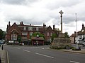 Market Cross - geograph.org.uk - 562030.jpg 640 × 478; 123 KB
-

-

-
 Hill Farm on Happisburgh Road, Holgate - geograph.org.uk - 541210.jpg 640 × 480; 105 KB
-
 A farmer seeding on his field.jpg 640 × 480; 84 KB
-
 A house in West Runton - geograph.org.uk - 540676.jpg 640 × 480; 65 KB
-
 A ride in Drayton Drewray woods - geograph.org.uk - 527857.jpg 480 × 640; 165 KB
-
 A section of the Weavers' Way - geograph.org.uk - 538583.jpg 640 × 480; 121 KB
-
 Abbey Bridge - geograph.org.uk - 575904.jpg 640 × 427; 103 KB
-
 Aldborough Primary School - geograph.org.uk - 521078.jpg 640 × 480; 78 KB
-
 All Saints Church - rood stairs - geograph.org.uk - 629913.jpg 480 × 640; 43 KB
-

-
 All Saints Church, Hemblington - geograph.org.uk - 629903.jpg 480 × 640; 75 KB
-
 All Saints School, Lessingham - geograph.org.uk - 522048.jpg 640 × 480; 63 KB
-
 All Saints' church - geograph.org.uk - 578579.jpg 640 × 427; 70 KB
-
 All Saints' church - geograph.org.uk - 578582.jpg 640 × 427; 74 KB
-
 All Saints' church nave - geograph.org.uk - 578597.jpg 640 × 427; 60 KB
-
 All Saints' church nave - geograph.org.uk - 578602.jpg 640 × 427; 59 KB
-
 Along the groynes - geograph.org.uk - 560422.jpg 640 × 478; 127 KB
-
 Approach to Old Corn Mill, Gimingham - geograph.org.uk - 527329.jpg 640 × 480; 63 KB
-
 Approach to Saxthorpe - geograph.org.uk - 512471.jpg 640 × 480; 113 KB
-

-
 Approaching Scarrow Beck ford - geograph.org.uk - 521125.jpg 480 × 640; 111 KB
-
 Arlene sunbathing at Great Yarmouth Beach.jpg 3,488 × 2,616; 2.1 MB
-
 Astley County Primary School - geograph.org.uk - 515844.jpg 640 × 480; 108 KB
-

-
-

-

-
 Beach at Cromer - geograph.org.uk - 560397.jpg 640 × 478; 142 KB
-
 Beach at Sheringham - geograph.org.uk - 560420.jpg 640 × 478; 136 KB
-
 Beach huts and sea wall - geograph.org.uk - 560416.jpg 640 × 478; 123 KB
-
 Beach huts at night - geograph.org.uk - 540052.jpg 640 × 478; 98 KB
-
 Beach huts on the sea wall - geograph.org.uk - 540045.jpg 640 × 478; 129 KB
-
 Beach west of Sheringham - geograph.org.uk - 560433.jpg 640 × 478; 142 KB
-
 Beeston Village General Stores and .. - geograph.org.uk - 522988.jpg 640 × 516; 91 KB
-
 Boal Street - geograph.org.uk - 524895.jpg 640 × 480; 64 KB
-
 Boat on the slipway - geograph.org.uk - 540044.jpg 478 × 640; 112 KB
-
 Boats at Boal Quay - geograph.org.uk - 524902.jpg 640 × 480; 78 KB
-
 Bridge Farm Fisheries car park - geograph.org.uk - 524950.jpg 640 × 480; 98 KB
-
 Bridge over nothing in South East Cromer - geograph.org.uk - 515671.jpg 640 × 480; 124 KB
-

-
 Bringing a boat ashore - geograph.org.uk - 560398.jpg 640 × 478; 133 KB
-
 Bullock Hills, Pudding Norton (2) - geograph.org.uk - 529777.jpg 640 × 425; 54 KB
-
 Bullock Hills, Pudding Norton (3) - geograph.org.uk - 529784.jpg 640 × 425; 66 KB
-
 Bullock Hills, Pudding Norton (5) - geograph.org.uk - 529805.jpg 640 × 425; 105 KB
-
 Bullock Hills, Pudding Norton - geograph.org.uk - 529768.jpg 640 × 425; 87 KB
-
 Burnham Norton Friary.JPG 3,648 × 2,736; 2.1 MB
-
 Burnt-out car on Little Ouse Path - geograph.org.uk - 517901.jpg 640 × 427; 142 KB
-
 Camperdown, terraced housing - geograph.org.uk - 526103.jpg 640 × 480; 114 KB
-
 Cantley sugar beet processing plant - geograph.org.uk - 690491.jpg 427 × 640; 192 KB
-
 Cantley sugar factory - geograph.org.uk - 690492.jpg 640 × 427; 153 KB
-
 Capless - geograph.org.uk - 547866.jpg 480 × 640; 37 KB
-
 Caravan park - geograph.org.uk - 560415.jpg 640 × 478; 126 KB
-
 Cat pottery and railway junkyard - geograph.org.uk - 542207.jpg 640 × 480; 99 KB
-
 Cattle grid and road to Gunton Hall - geograph.org.uk - 534916.jpg 640 × 480; 88 KB
-
 Church and microwave towers - geograph.org.uk - 562001.jpg 640 × 478; 136 KB
-
 Church over farmland - geograph.org.uk - 561988.jpg 640 × 478; 131 KB
-
 Churchside cottages - geograph.org.uk - 548051.jpg 640 × 427; 94 KB
-
 Cliff top - Sheringham - geograph.org.uk - 560423.jpg 640 × 478; 126 KB
-
 Cobbled houses - geograph.org.uk - 560370.jpg 640 × 478; 137 KB
-
 Coda Plastics Ltd - geograph.org.uk - 529087.jpg 640 × 480; 45 KB
-
 Corystes cassivelaunus - geograph.org.uk - 581812.jpg 640 × 480; 104 KB
-
 Cottages on Lower Hall Lane - geograph.org.uk - 529794.jpg 640 × 480; 66 KB
-
 Country Lane - geograph.org.uk - 522019.jpg 640 × 480; 114 KB
-
 Country lane near Kipton Ash Farm - geograph.org.uk - 530625.jpg 640 × 480; 120 KB
-
 Cows and caravan - geograph.org.uk - 560400.jpg 640 × 478; 151 KB
-
 Craft Shop, Bramerton Woods End - geograph.org.uk - 721692.jpg 640 × 445; 98 KB
-
 Crane's Corner village green - geograph.org.uk - 524766.jpg 640 × 480; 155 KB
-
 Cricket match at North Elmham - geograph.org.uk - 523483.jpg 640 × 480; 67 KB
-
 Lifeboat station and lifeboat - geograph.org.uk - 541407.jpg 640 × 480; 90 KB
-
 Cromer (west) from the pier - geograph.org.uk - 531319.jpg 600 × 400; 137 KB
-
 Cromer carnival - geograph.org.uk - 690467.jpg 640 × 427; 159 KB
-
 Cromer Carnival fireworks - geograph.org.uk - 531323.jpg 400 × 600; 190 KB
-
 Cromer from the pier - geograph.org.uk - 531320.jpg 600 × 400; 126 KB
-
 Cromer Hall - geograph.org.uk - 560394.jpg 640 × 478; 185 KB
-
 Cromer pier - geograph.org.uk - 560396.jpg 640 × 478; 130 KB
-
 The church of All Saints - geograph.org.uk - 874601.jpg 640 × 480; 143 KB
-
 View to Crostwight Heath - geograph.org.uk - 526379.jpg 640 × 480; 82 KB
-
 Dairy Farm, Gunton Park - geograph.org.uk - 534913.jpg 640 × 480; 103 KB
-
 Derelict shed - geograph.org.uk - 524253.jpg 640 × 426; 126 KB
-
 Dilapidated barn on Heath Lane - geograph.org.uk - 527321.jpg 640 × 480; 64 KB
-
 Disused railway bridge, South Lynn.jpg 2,391 × 1,590; 995 KB
-
 Disused sheds south of Shammer - geograph.org.uk - 532472.jpg 640 × 480; 92 KB
-
 Donkeys grazing - geograph.org.uk - 515337.jpg 640 × 480; 83 KB
-
 Drabblegate River Cottage - geograph.org.uk - 539672.jpg 640 × 480; 84 KB
-

-
 Elderton Lodge Hotel - geograph.org.uk - 534898.jpg 640 × 480; 87 KB
-
 Electricity Substation - geograph.org.uk - 547333.jpg 640 × 480; 129 KB
-
 End of the groynes - geograph.org.uk - 560439.jpg 640 × 478; 103 KB
-
 English Electric Lightning at Norwich Aviation Mus 28Aug07.JPG 2,560 × 1,920; 590 KB
-

-
 Entrance to John of Gaunt's House - geograph.org.uk - 535081.jpg 640 × 480; 94 KB
-

-
 Evening light and rainbow, Cromer pier - geograph.org.uk - 531321.jpg 400 × 600; 131 KB
-
 Farm shed - geograph.org.uk - 523399.jpg 480 × 640; 70 KB
-
 Farm track in Gunton Park - geograph.org.uk - 534923.jpg 640 × 480; 61 KB
-
 Farmland near Southrepps Road - geograph.org.uk - 535090.jpg 640 × 480; 127 KB
-
 Farmland towards the sea - geograph.org.uk - 560409.jpg 640 × 478; 142 KB
-
 Ferry Inn and Reedham Ferry - geograph.org.uk - 558709.jpg 640 × 480; 64 KB
-
 Field Lane past Warren Wood - geograph.org.uk - 541199.jpg 640 × 480; 51 KB
-

-
 Footpath across pasture near Swannington - geograph.org.uk - 530947.jpg 480 × 640; 131 KB
-
 Ford - geograph.org.uk - 539113.jpg 640 × 480; 140 KB
-

-
 Fruit-face detail - geograph.org.uk - 521398.jpg 480 × 640; 61 KB
-
 Fruit-face in Budgens window - geograph.org.uk - 521389.jpg 480 × 640; 81 KB
-
 Gala Bingo, King's Lynn - geograph.org.uk - 524891.jpg 640 × 480; 91 KB
-

-
 Great Hall - geograph.org.uk - 542857.jpg 640 × 427; 113 KB
-
 Great Wood Car Park - geograph.org.uk - 518052.jpg 480 × 640; 101 KB
-
 Gresham's School - geograph.org.uk - 562033.jpg 640 × 478; 164 KB
-
 Guided walk at Rockland St Mary - geograph.org.uk - 527764.jpg 640 × 427; 196 KB
-

-
 Hardley Cross - geograph.org.uk - 690496.jpg 640 × 427; 173 KB
-
 Hare and Hounds Inn, Baconsthorpe - geograph.org.uk - 515699.jpg 640 × 480; 110 KB
-

-
 Heathland near Fir Trees Farm - geograph.org.uk - 540775.jpg 640 × 480; 52 KB
-

-
 Hevingham Primary School - geograph.org.uk - 519157.jpg 640 × 480; 64 KB
-
 Hevingham Village Sign - geograph.org.uk - 519176.jpg 640 × 480; 117 KB
-
 Hevingham Village Sign and Green - geograph.org.uk - 519173.jpg 640 × 480; 49 KB
-
 High Bridge - geograph.org.uk - 529352.jpg 3,008 × 2,000; 1.91 MB
-
 High Street, Overstrand - geograph.org.uk - 535109.jpg 640 × 480; 54 KB
-
 High Street, Stalham - geograph.org.uk - 522175.jpg 480 × 640; 55 KB
-
 Himalayan Balsam (Impatiens glandulifera) - geograph.org.uk - 540748.jpg 480 × 640; 117 KB
-
 Holgate Poultry Farm - geograph.org.uk - 540752.jpg 640 × 480; 94 KB
-
 Holgate Road - geograph.org.uk - 540745.jpg 640 × 480; 73 KB
-
 Holgate Road past Fir Trees Farm - geograph.org.uk - 540754.jpg 640 × 480; 57 KB
-
 Holt - geograph.org.uk - 562029.jpg 640 × 478; 126 KB
-

-
 Honing Hall.jpg 640 × 480; 73 KB
-
 House in Sheringham Park - geograph.org.uk - 562039.jpg 640 × 478; 155 KB
-
 House near Bradmoor Farm - geograph.org.uk - 515357.jpg 640 × 480; 59 KB
-

-

-
 Houses on Trunch Road, Swafield - geograph.org.uk - 535043.jpg 640 × 480; 60 KB
-
 Howards Hill - geograph.org.uk - 560399.jpg 640 × 478; 130 KB
-
 Ingleside Hotel, Mundesley - geograph.org.uk - 527282.jpg 640 × 480; 52 KB
-
 Junction of A148 with B1156.jpg 640 × 480; 55 KB
-
 K483EUX First Eastern Counties 30099 - Flickr - megabus13601 (1).jpg 3,072 × 2,304; 1.53 MB
-
 K483EUX First Eastern Counties 30099 - Flickr - megabus13601.jpg 3,072 × 2,304; 1.54 MB
-
 Old Hall Street, Knapton - geograph.org.uk - 529101.jpg 640 × 480; 54 KB
-
 Old Hall Street, Knapton - geograph.org.uk - 529103.jpg 640 × 480; 59 KB
-
 Lane with skid marks - geograph.org.uk - 554950.jpg 640 × 480; 130 KB
-
 Last groyne - geograph.org.uk - 560425.jpg 640 × 478; 131 KB
-

-
 Lenwade.JPG 640 × 480; 110 KB
-

-
 Livestock on the Eau Brink - geograph.org.uk - 516959.jpg 640 × 480; 95 KB
-
 Longham Post Office - geograph.org.uk - 522884.jpg 640 × 480; 124 KB
-

-

-
 Lookout post - geograph.org.uk - 560428.jpg 640 × 478; 150 KB
-
 Lyngate Industrial Estate - geograph.org.uk - 529085.jpg 640 × 480; 38 KB
-
 Lyngate Industrial Estate - geograph.org.uk - 529089.jpg 640 × 480; 70 KB
-

-
 Market Cross - geograph.org.uk - 548059.jpg 427 × 640; 112 KB
-

-
 Memorial Hall, Hanworth Common - geograph.org.uk - 521150.jpg 640 × 480; 103 KB
-
 Middleton village sign - geograph.org.uk - 529289.jpg 2,000 × 3,008; 3.04 MB
-
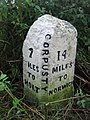 Milestone in the hedge near Corpusty, on B1149 Holt Road.jpg 480 × 640; 125 KB
-
 Mundesley Village Sign - geograph.org.uk - 527287.jpg 640 × 480; 64 KB
-
 Mundesley village sign - geograph.org.uk - 542195.jpg 480 × 640; 97 KB
-
 Narrowboat Kings Lynn.jpg 3,648 × 2,736; 4.68 MB
-
 Nelson Street - geograph.org.uk - 524892.jpg 480 × 640; 81 KB
-
 North Walsham Fire Station - geograph.org.uk - 542549.jpg 640 × 384; 88 KB
-
 North Walsham library - geograph.org.uk - 542214.jpg 640 × 480; 99 KB
-
 North Walsham Methodist Church - geograph.org.uk - 542556.jpg 640 × 399; 98 KB
-
 North Walsham town sign - geograph.org.uk - 542218.jpg 640 × 480; 97 KB
-
 Northrepps Cottage - geograph.org.uk - 515667.jpg 640 × 480; 94 KB
-
 Not draining away^ - geograph.org.uk - 547855.jpg 480 × 640; 123 KB
-
 George VI postbox - geograph.org.uk - 534960.jpg 480 × 640; 77 KB
-
 Off the "beeten" track - geograph.org.uk - 525021.jpg 640 × 426; 97 KB
-
 Old Reading Room.jpg 640 × 480; 46 KB
-
 Old shed - geograph.org.uk - 521850.jpg 640 × 426; 128 KB
-

-
 Out to sea - geograph.org.uk - 543983.jpg 640 × 478; 176 KB
-
 Out to sea - geograph.org.uk - 560434.jpg 640 × 478; 92 KB
-
 Overstrand beach groyne - geograph.org.uk - 542231.jpg 480 × 640; 93 KB
-
 Overstrand village sign - geograph.org.uk - 542222.jpg 492 × 640; 99 KB
-
 Overstrand wind vane - geograph.org.uk - 542575.jpg 480 × 640; 96 KB
-

-
 Park Gate to Bayfield Hall near Home Farm - geograph.org.uk - 515815.jpg 640 × 480; 207 KB
-
 Pavilion Theatre - geograph.org.uk - 560395.jpg 478 × 640; 130 KB
-
 Peter Beales Classic Roses - geograph.org.uk - 515311.jpg 480 × 640; 124 KB
-
 Peter Beales Classic Roses - geograph.org.uk - 515315.jpg 480 × 640; 120 KB
-
 Peter Beales Classic Roses - geograph.org.uk - 515319.jpg 480 × 640; 127 KB
-
 Playing on the beach - geograph.org.uk - 560440.jpg 640 × 478; 105 KB
-
 Pond near Bears Road - geograph.org.uk - 541263.jpg 640 × 480; 78 KB
-
 Postbox in Upper Sheringham - geograph.org.uk - 562007.jpg 640 × 478; 147 KB

.JPG)


_-_geograph.org.uk_-_540589.jpg)


_-_geograph.org.uk_-_529777.jpg)
_-_geograph.org.uk_-_529784.jpg)
_-_geograph.org.uk_-_529805.jpg)


_from_the_pier_-_geograph.org.uk_-_531319.jpg)


_-_detail_-_geograph.org.uk_-_540569.jpg)


_-_geograph.org.uk_-_540748.jpg)


.jpg)


