Category:Archaeological sites in Northumberland
Jump to navigation
Jump to search
Wikimedia category | |||||
| Upload media | |||||
| Instance of | |||||
|---|---|---|---|---|---|
| Category combines topics | |||||
| Northumberland | |||||
ceremonial county and unitary authority area in north east England, UK     | |||||
| Instance of |
| ||||
| Location |
| ||||
| Legislative body |
| ||||
| Population |
| ||||
| Area |
| ||||
| Replaces |
| ||||
| Different from | |||||
| Said to be the same as | Northumberland (historic county of England, ceremonial county of England, 1844) | ||||
| official website | |||||
 | |||||
Subcategories
This category has the following 10 subcategories, out of 10 total.
A
C
- Castle Knowe, Northumberland (3 F)
- Corbridge Lion (3 F)
D
- Devil's Lapful (3 F)
G
- The Goatstones (4 F)
H
- Hepburn Bastle (10 F)
L
R
- Roughting Linn (6 F)
S
- Slate Hill Settlement (1 F)
Media in category "Archaeological sites in Northumberland"
The following 13 files are in this category, out of 13 total.
-
 'Aerial archaeology' from West Hill - geograph.org.uk - 1739443.jpg 1,024 × 769; 376 KB
-
 Cheviot Quarry, Milfield - geograph.org.uk - 1731191.jpg 1,024 × 641; 168 KB
-
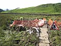 Excavations at "King Arthur's Well" - geograph.org.uk - 999446.jpg 640 × 480; 118 KB
-
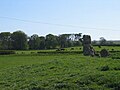
 Hethpool Stone Circle - geograph.org.uk - 1740347.jpg 1,024 × 768; 225 KB
-
 Hethpool Stone Circle - geograph.org.uk - 905429.jpg 640 × 480; 96 KB
-
 Hethpool Stone Circle, southern ring - geograph.org.uk - 1740463.jpg 3,000 × 1,015; 1.11 MB
-
 Lowick Castle - geograph.org.uk - 779489.jpg 640 × 480; 80 KB
-
 Old trenches by the Bushman's Road - geograph.org.uk - 655820.jpg 640 × 480; 64 KB
-

-
 Remains of Chapel, Tughall - geograph.org.uk - 170127.jpg 640 × 480; 74 KB
-

-
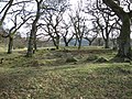 Romano-British farmstead in Riding Wood - geograph.org.uk - 712814.jpg 640 × 480; 147 KB
-
 Site of ancient castle at Alnham - geograph.org.uk - 389661.jpg 640 × 480; 119 KB


