Category:Anthriscus sylvestris in Lincolnshire
Jump to navigation
Jump to search
Media in category "Anthriscus sylvestris in Lincolnshire"
The following 22 files are in this category, out of 22 total.
-
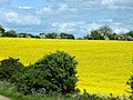
 A rapeseed field in the Lincolnshire Vales, South Kesteven, England 1.jpg 2,560 × 1,920; 5.61 MB
-
 A rapeseed field in the Lincolnshire Vales, South Kesteven, England 2.jpg 2,560 × 1,920; 5 MB
-
 A country lane in the Lincolnshire Vales, South Kesteven, England.jpg 2,560 × 1,920; 4.71 MB
-
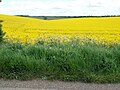
 A rapeseed field in the Lincolnshire Vales, South Kesteven, England 3.jpg 2,560 × 1,707; 4.12 MB
-
 A rapeseed field in the Lincolnshire Vales, South Kesteven, England 4.jpg 2,560 × 1,920; 4.86 MB
-
 A hedgerow in Honington, Lincolnshire, England, on Main Street oposite church 01.jpg 2,560 × 1,920; 2.49 MB
-
 A hedgerow in Honington, Lincolnshire, England, on Main Street oposite church 02.jpg 2,560 × 1,920; 2.53 MB
-
 A view from West Willoughby towards Honington, Lincolnshire, England.jpg 2,560 × 1,920; 2.57 MB
-
 A view west, Woodnook Valley, Little Ponton, Lincolnshire, England 02.jpg 2,560 × 1,920; 4.65 MB
-
 Across meadow to Washdyke Lane, Belton (nr Grantham) - 01.jpg 2,560 × 1,920; 2.99 MB
-
 Across meadow to Washdyke Lane, Belton (nr Grantham) - 02.jpg 2,560 × 1,920; 3.23 MB
-
 Across meadow to Washdyke Lane, Belton (nr Grantham) - 03.jpg 2,560 × 1,920; 2.48 MB
-
 Council Houses, Surfleet, Lincs - geograph.org.uk - 172655.jpg 640 × 480; 294 KB
-
 Farm track, Casthorpe, Lincolnshire - geograph.org.uk - 180081.jpg 640 × 427; 158 KB
-
 Lawn Lane Railway Bridge - geograph.org.uk - 853800.jpg 628 × 478; 99 KB
-
 Lincolnshire Wolds - geograph.org.uk - 102786.jpg 640 × 480; 87 KB
-
 Oslear's Lane - geograph.org.uk - 449260.jpg 640 × 480; 120 KB
-
 Overgate Road into Swayfield - geograph.org.uk - 934984.jpg 640 × 536; 106 KB
-
 Poppies and Wheat - geograph.org.uk - 1913766.jpg 2,956 × 2,356; 1.96 MB
-
 Potato land - geograph.org.uk - 1399150.jpg 640 × 480; 264 KB
-
-
 The Mareham Lane ford - geograph.org.uk - 368085.jpg 640 × 480; 73 KB


_-_01.jpg)
_-_02.jpg)
_-_03.jpg)


