Category:Amt Odervorland
Jump to navigation
Jump to search
| Object location | | View all coordinates using: OpenStreetMap |
|---|
collective municipality in Brandenburg state, Germany  | |||||
| Upload media | |||||
| Instance of |
| ||||
|---|---|---|---|---|---|
| Location | Oder-Spree District, Brandenburg, Germany | ||||
| Population |
| ||||
| official website | |||||
 | |||||
Subcategories
This category has the following 5 subcategories, out of 5 total.
B
J
S
Media in category "Amt Odervorland"
The following 2 files are in this category, out of 2 total.
-
 Brandenburg HzV 2007 Muster10.png 1,200 × 1,200; 245 KB
-
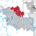 Amt Odervorland in LOS.png 299 × 299; 9 KB
