Category:Amt Meyenburg
Jump to navigation
Jump to search
| Object location | | View all coordinates using: OpenStreetMap |
|---|
collective municipality in Brandenburg state, Germany  Amtsverwaltung  | |||||
| Upload media | |||||
| Instance of |
| ||||
|---|---|---|---|---|---|
| Location | Prignitz District, Brandenburg, Germany | ||||
| Population |
| ||||
| official website | |||||
 | |||||
Subcategories
This category has the following 6 subcategories, out of 6 total.
G
H
K
M
S
Media in category "Amt Meyenburg"
The following 2 files are in this category, out of 2 total.
-
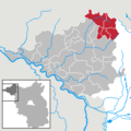 Amt Meyenburg in PR.png 299 × 299; 5 KB
-
 Amt Meyenburg.JPG 3,648 × 2,736; 4.23 MB