Category:Amt Gramzow
Jump to navigation
Jump to search
| Object location | | View all coordinates using: OpenStreetMap |
|---|
Collective municipality in Brandenburg state, Germany    | |||||
| Upload media | |||||
| Instance of |
| ||||
|---|---|---|---|---|---|
| Location | Uckermark District, Brandenburg, Germany | ||||
| Has part(s) | |||||
| Population |
| ||||
| Different from | |||||
| official website | |||||
 | |||||
Subcategories
This category has the following 7 subcategories, out of 7 total.
G
O
R
S
U
Z
Media in category "Amt Gramzow"
The following 3 files are in this category, out of 3 total.
-
 Amt Gramzow 2018 SW.jpg 4,864 × 3,648; 4.27 MB
-
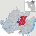 Amt Gramzow in UM.png 299 × 299; 6 KB
-
 Wappen Amt Gramzow.png 800 × 890; 73 KB