Category:Amt Dahme/Mark
Jump to navigation
Jump to search
| Object location | | View all coordinates using: OpenStreetMap |
|---|

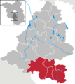
collective municipality in Brandenburg state, Germany  | |||||
| Upload media | |||||
| Instance of |
| ||||
|---|---|---|---|---|---|
| Location | Teltow-Fläming District, Brandenburg, Germany | ||||
| Street address |
| ||||
| Headquarters location | |||||
| Population |
| ||||
| official website | |||||
 | |||||
Subcategories
This category has the following 5 subcategories, out of 5 total.
D
I
N
S
Media in category "Amt Dahme/Mark"
The following 2 files are in this category, out of 2 total.
-
 Amt Dahme-Mark in TF (neu).png 264 × 295; 7 KB
-
 Amt Dahme-Mark in TF.png 264 × 295; 4 KB
.png)