Category:Allenheads
Jump to navigation
Jump to search
village in United Kingdom  | |||||
| Upload media | |||||
| Instance of | |||||
|---|---|---|---|---|---|
| Location | Allendale, Northumberland, North East England, England | ||||
 | |||||
English: For up to date weather news, including temperature, wind speed, air pressure, and information about past weather got to: http://allenheads.myzen.co.uk/

Subcategories
This category has the following 10 subcategories, out of 10 total.
A
- Allenheads Inn (8 F)
- Allenheads War Memorial (1 F)
D
- Dodd Reservoir, Northumberland (11 F)
F
- Frazer's Quarry (12 F)
G
- Gill's Quarry (12 F)
K
- Killhope Law (30 F)
M
- Middlehope Moor (2 F)
S
- Swin Hope valley (46 F)
V
- Viewly Hall, Allenheads (2 F)
W
- West End Farm, Allenheads (20 F)
Media in category "Allenheads"
The following 200 files are in this category, out of 536 total.
(previous page) (next page)-
 (And another) old mine shaft - geograph.org.uk - 720656.jpg 640 × 480; 91 KB
-

-

-

-
 (Another) lime kiln near Blacklot - geograph.org.uk - 1065775.jpg 640 × 480; 71 KB
-
 (Another) old mine shaft - geograph.org.uk - 720650.jpg 640 × 480; 88 KB
-
 (Part of) Corbitmere Dam (2) - geograph.org.uk - 1268397.jpg 640 × 480; 108 KB
-
 (Part of) Corbitmere Dam - geograph.org.uk - 1268394.jpg 640 × 480; 115 KB
-
 (Part of) Quickcleugh Moss - geograph.org.uk - 752230.jpg 640 × 480; 40 KB
-

-
 (The line of the) lead smelting flue - geograph.org.uk - 1131745.jpg 640 × 480; 79 KB
-
 (The line of the) lead smelting flue - geograph.org.uk - 603865.jpg 640 × 480; 80 KB
-
 (Un-named) "hush" near Allenheads - geograph.org.uk - 453280.jpg 480 × 640; 101 KB
-
 19th C cast iron water hydrant - geograph.org.uk - 721449.jpg 480 × 640; 124 KB
-
 19th C cast iron water hydrant - geograph.org.uk - 721464.jpg 480 × 640; 126 KB
-
 A rock in a hard place - geograph.org.uk - 1248005.jpg 640 × 480; 114 KB
-
 Allen Lodge.jpg 8,000 × 6,000; 18.02 MB
-
 Allendale Hall - geograph.org.uk - 1093326.jpg 640 × 480; 56 KB
-
 Allenheads (2) - geograph.org.uk - 1311517.jpg 640 × 480; 83 KB
-
 Allenheads - geograph.org.uk - 1655811.jpg 640 × 427; 98 KB
-
 Allenheads and Estate Offices.jpg 8,000 × 6,000; 15.19 MB
-
 Allenheads Church today.jpg 8,000 × 6,000; 17.73 MB
-
 Allenheads Farmhouse And Adjacent Farmbuildings.jpg 8,000 × 6,000; 14.32 MB
-
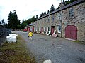
 Allenheads Heritage Centre - geograph.org.uk - 1035497.jpg 640 × 480; 132 KB
-
 Allenheads Heritage Centre - geograph.org.uk - 721819.jpg 640 × 480; 111 KB
-
 Allenheads Hotel - geograph.org.uk - 504133.jpg 640 × 431; 128 KB
-
 Allenheads lead ore works.jpg 8,000 × 6,000; 21.18 MB
-
 Allenheads Mine (disused) - geograph.org.uk - 71431.jpg 640 × 457; 71 KB
-
 Allenheads Plantation - geograph.org.uk - 249931.jpg 640 × 480; 50 KB
-
 Allenheads roofs - geograph.org.uk - 720608.jpg 640 × 480; 149 KB
-
 Allenheads ski tow - geograph.org.uk - 1267789.jpg 640 × 480; 82 KB
-
 Allenheads Slag Hill Lime Kiln - geograph.org.uk - 224535.jpg 640 × 480; 88 KB
-
-
 Arch of the Slag Hill Lime Kiln - geograph.org.uk - 1449768.jpg 640 × 480; 121 KB
-
 Armstrong hydraulic engine.jpg 8,000 × 6,000; 10.31 MB
-
 B6295 north towards Allenheads - geograph.org.uk - 249918.jpg 640 × 480; 60 KB
-
 Bank erosion, South Foul Sike - geograph.org.uk - 1268377.jpg 640 × 480; 86 KB
-
 Barn near Byerhope Farm - geograph.org.uk - 753256.jpg 640 × 480; 93 KB
-
 Barns and sheepfold near Peasmeadows - geograph.org.uk - 730241.jpg 640 × 480; 96 KB
-
 Beaumont House, Allenheads.jpg 8,000 × 6,000; 13.84 MB
-
 Beaumont House, side Allenheads.jpg 8,000 × 6,000; 15.6 MB
-
 Beaumont Mine, Fawside Level Portal In Wall On East Side Of Site.jpg 8,000 × 6,000; 22.76 MB
-
 Beaumont Mine, Tunnel Entrances And Channel To North Of Sawmill.jpg 6,000 × 8,000; 17.88 MB
-
 Beaumont Mine. Former Sawmill And Remains Of Bouse Team Immediately To West.jpg 8,000 × 6,000; 18.41 MB
-
 Beaumont Mine.jpg 8,000 × 6,000; 16.9 MB
-
 Black Cleugh (2) - geograph.org.uk - 1159933.jpg 640 × 480; 97 KB
-
 Black Cleugh - geograph.org.uk - 1122306.jpg 640 × 480; 100 KB
-

-
 Blackcleugh Burn (2) - geograph.org.uk - 1143514.jpg 640 × 480; 104 KB
-
 Blackcleugh Burn (3) - geograph.org.uk - 1159907.jpg 640 × 480; 97 KB
-
 Blackcleugh Burn (4) - geograph.org.uk - 1159914.jpg 640 × 480; 92 KB
-
 Blocked up sheephole in drystone wall - geograph.org.uk - 507435.jpg 640 × 480; 137 KB
-
 Bog asphodel - geograph.org.uk - 510755.jpg 640 × 480; 200 KB
-
 Brecken Sike - geograph.org.uk - 1508812.jpg 426 × 640; 103 KB
-
 Bridge Over River East Allen 20 Metres North-East Of St Peter's Church.jpg 8,000 × 6,000; 22.34 MB
-
 Bridge over Swinhope Burn - geograph.org.uk - 445458.jpg 640 × 480; 134 KB
-
 Burnfoot Farmhouse And Attached Barn To South West.jpg 8,000 × 6,000; 9.34 MB
-
 Byerhope Moss - geograph.org.uk - 249553.jpg 640 × 480; 69 KB
-
 Byerhopemere Head - geograph.org.uk - 224511.jpg 640 × 480; 92 KB
-
 C2C route approaching Allenheads - geograph.org.uk - 1353980.jpg 640 × 480; 75 KB
-
 Carrier's Way - geograph.org.uk - 208150.jpg 640 × 480; 76 KB
-
 Catching Rabbits - geograph.org.uk - 1508952.jpg 640 × 427; 155 KB
-

-

-
 Come on then, fold me - geograph.org.uk - 507481.jpg 640 × 480; 137 KB
-
 Corbitmere Dam - geograph.org.uk - 1508835.jpg 640 × 372; 84 KB
-
 Corbitmere Dam Reservoir - geograph.org.uk - 1268387.jpg 640 × 480; 67 KB
-
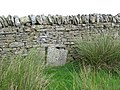
 Corner of Boundary Fences - geograph.org.uk - 860458.jpg 500 × 375; 49 KB
-
 Cottages at Allenheads - geograph.org.uk - 1035495.jpg 640 × 480; 114 KB
-
 Cottages in Allenheads - geograph.org.uk - 463650.jpg 640 × 480; 138 KB
-
 Cottages opposite the old Post Office in allenheads.jpg 8,000 × 6,000; 13.93 MB
-

-
 Dangerous bridge - geograph.org.uk - 705977.jpg 640 × 480; 133 KB
-
-
 Disused quarry above Dodd Reservoir - geograph.org.uk - 1137401.jpg 640 × 480; 100 KB
-
 Dudley Place, And Privy Row Adjacent.jpg 8,000 × 6,000; 15.11 MB
-
 East Allen Dale (2) - geograph.org.uk - 737434.jpg 640 × 424; 63 KB
-
 East Allen Dale (2) - geograph.org.uk - 737466.jpg 640 × 424; 73 KB
-
 East Allen Dale (3) - geograph.org.uk - 737470.jpg 640 × 424; 86 KB
-
-
 East Allen Dale north of Allenheads - geograph.org.uk - 1159978.jpg 640 × 480; 83 KB
-
 Fawside Green end.jpg 8,000 × 6,000; 18.76 MB
-
 Fawside Green.jpg 8,000 × 6,000; 17.87 MB
-
 Footbridge over Quickcleugh Burn - geograph.org.uk - 507438.jpg 640 × 480; 102 KB
-

-
 Footbridge over the River East Allen (3) - geograph.org.uk - 721803.jpg 640 × 480; 153 KB
-
 Footbridge over the River East Allen (4) - geograph.org.uk - 721804.jpg 640 × 480; 163 KB
-
 Footpath through the pines (2) - geograph.org.uk - 721809.jpg 640 × 480; 148 KB
-
 Footpath through the pines (3) - geograph.org.uk - 721811.jpg 640 × 480; 144 KB
-
 Footpath through the pines (4) - geograph.org.uk - 721813.jpg 640 × 480; 148 KB
-
 Footpath through the pines - geograph.org.uk - 721807.jpg 640 × 480; 147 KB
-
 Ford across Blackcleugh Burn (2) - geograph.org.uk - 1159953.jpg 640 × 480; 92 KB
-
 Former mine buildings in Allenheads - geograph.org.uk - 1335906.jpg 640 × 480; 86 KB
-
 Frozen peat haggs on Middlehope Moor - geograph.org.uk - 683259.jpg 640 × 480; 54 KB
-

-
 Garden Walls To East And Railings To South Of Beaumont House.jpg 8,000 × 6,000; 17.07 MB
-
 Green Cleugh (2) - geograph.org.uk - 1281345.jpg 640 × 480; 73 KB
-
 Green Cleugh (3) - geograph.org.uk - 1281350.jpg 640 × 480; 60 KB
-
 Green Cleugh - geograph.org.uk - 1281335.jpg 640 × 480; 84 KB
-
 Greencleugh Sike (2) - geograph.org.uk - 1273402.jpg 640 × 480; 105 KB
-
 Greencleugh Sike - geograph.org.uk - 1273393.jpg 640 × 480; 115 KB
-
 Grouse butt - geograph.org.uk - 443680.jpg 640 × 480; 83 KB
-
 Halleywell Farm (3) - geograph.org.uk - 508180.jpg 640 × 480; 94 KB
-
 Halleywell Farm (4) - geograph.org.uk - 694067.jpg 640 × 480; 95 KB
-
 Halleywell Farm (5) - geograph.org.uk - 705889.jpg 640 × 481; 65 KB
-
 Halleywell Farm - geograph.org.uk - 504232.jpg 640 × 480; 94 KB
-

-

-
 Head of the pass, B6295 - geograph.org.uk - 1758085.jpg 2,848 × 2,136; 1.62 MB
-
 Iceton House.jpg 8,000 × 6,000; 18.03 MB
-

-
 Junction of paths and walls - geograph.org.uk - 860451.jpg 500 × 375; 50 KB
-
 Level Mouth Cottage.jpg 8,000 × 6,000; 19.96 MB
-
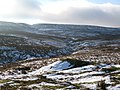
 Middlehope Moor - geograph.org.uk - 1137408.jpg 640 × 480; 89 KB
-
 Moorland above Dodd Reservoir (2) - geograph.org.uk - 1137392.jpg 640 × 480; 76 KB
-
 Moorland above Dodd Reservoir - geograph.org.uk - 1122320.jpg 640 × 480; 90 KB
-
 Moorland above Dodd Reservoir - geograph.org.uk - 1137290.jpg 640 × 480; 75 KB
-

-
-
 Moorland below the Three Curricks - geograph.org.uk - 1272848.jpg 640 × 480; 72 KB
-
 Moorland below the Three Curricks - geograph.org.uk - 1273223.jpg 640 × 480; 86 KB
-
 Moorland east of South Foul Sike - geograph.org.uk - 1268372.jpg 640 × 480; 94 KB
-

-

-

-

-
 Old mine shaft - geograph.org.uk - 720610.jpg 640 × 480; 134 KB
-
 Old mine shaft - geograph.org.uk - 720648.jpg 640 × 480; 92 KB
-
 Old mine shaft near the Corbitmere Dam - geograph.org.uk - 1272827.jpg 640 × 480; 120 KB
-

-

-

-

-
 Old mining area south of Dirt Pot - geograph.org.uk - 721786.jpg 640 × 480; 86 KB
-
 Old sheepfold, Puddingthorn Moor - geograph.org.uk - 213055.jpg 640 × 478; 135 KB
-
 Old stone barn near Dirt Pot - geograph.org.uk - 729936.jpg 640 × 480; 113 KB
-

-

-

-

-

-

-
 Pastures around Blackcleugh Burn - geograph.org.uk - 720763.jpg 640 × 480; 89 KB
-
 Peasmeadows Cottage And Ruin To South.jpg 8,000 × 6,000; 19.39 MB
-
 Peasmeadows House.jpg 6,000 × 8,000; 11.61 MB
-
 Plaque re the Iron Well - geograph.org.uk - 1589346.jpg 640 × 480; 62 KB
-
 Post Office in Allenheads.jpg 8,000 × 6,000; 14.92 MB
-

-
 Quickcleugh Moss - geograph.org.uk - 363283.jpg 640 × 480; 126 KB
-
 Quickcleugh Moss - geograph.org.uk - 752353.jpg 640 × 480; 39 KB
-
 Rapids on theRiver East Allen - geograph.org.uk - 721791.jpg 480 × 640; 136 KB
-
 Riddlehamhope Fell (2) - geograph.org.uk - 508195.jpg 640 × 480; 89 KB
-
 Riddlehamhope Fell - geograph.org.uk - 508188.jpg 640 × 480; 109 KB
-
 Riddlehamhope Fell - geograph.org.uk - 705952.jpg 640 × 480; 87 KB
-
 Riddlehamhope Fell from Quick Cleugh - geograph.org.uk - 705968.jpg 640 × 480; 66 KB
-
 Riddlehamhope Fell near Halleywell - geograph.org.uk - 705880.jpg 640 × 480; 45 KB
-
 Risegreen Moss (2) - geograph.org.uk - 1248126.jpg 640 × 480; 96 KB
-
 Roof of derelict barn, Rookhope Head - geograph.org.uk - 1268344.jpg 640 × 480; 86 KB
-
 Rookhope Head - geograph.org.uk - 1268168.jpg 640 × 480; 77 KB
-
 Rookhopeburn Head (2) - geograph.org.uk - 1273368.jpg 640 × 480; 76 KB
-
 Rookhopeburn Head (3) - geograph.org.uk - 1273377.jpg 640 × 480; 80 KB
-
 Rookhopeburn Head - geograph.org.uk - 1272866.jpg 640 × 480; 76 KB
-
 Rough pastures above Allenheads - geograph.org.uk - 720628.jpg 640 × 480; 81 KB
-
 Rowan's Currick - geograph.org.uk - 214531.jpg 640 × 478; 157 KB
-
 Rowantree Shaft - geograph.org.uk - 721447.jpg 640 × 480; 92 KB
-
 Ruined barn - geograph.org.uk - 720641.jpg 640 × 480; 121 KB
-
 Ruined barn near High Shield (2) - geograph.org.uk - 720770.jpg 640 × 480; 95 KB
-
 Ruined barn near High Shield - geograph.org.uk - 720747.jpg 640 × 480; 71 KB
-
 Ruined farmhouse above Allenheads - geograph.org.uk - 1048869.jpg 640 × 480; 93 KB
-

-
-

-

-

-

-

-
 Ruined house above Allenheads (2) - geograph.org.uk - 720638.jpg 640 × 480; 93 KB
-
 Ruined house and barn above Allenheads - geograph.org.uk - 720646.jpg 640 × 480; 113 KB
-
 Ruins above Allenheads (2) - geograph.org.uk - 720634.jpg 640 × 480; 105 KB
-
 Ruins above Allenheads (3) - geograph.org.uk - 720635.jpg 640 × 480; 102 KB
-
 Ruins near Blackcleugh Burn - geograph.org.uk - 1122285.jpg 640 × 480; 106 KB
-

-
-

-

-
 Sheep rescued from bog - geograph.org.uk - 216592.jpg 640 × 478; 109 KB
-
 Sheepfold at Elpha Green - geograph.org.uk - 821656.jpg 640 × 480; 92 KB
-
 Sheepfold, Rookhopeburn Head - geograph.org.uk - 1273349.jpg 640 × 480; 65 KB
-
 Sike on Riddlehamhope Fell - geograph.org.uk - 705876.jpg 640 × 480; 113 KB
-
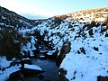
 Snowy cleugh on Burtree Fell - geograph.org.uk - 697602.jpg 640 × 480; 44 KB
-
 Snowy Rookhopeburn Head - geograph.org.uk - 1767647.jpg 640 × 480; 86 KB
-
 South Foul Sike (2) - geograph.org.uk - 1272834.jpg 640 × 480; 89 KB
-
 South Foul Sike - geograph.org.uk - 1268380.jpg 640 × 480; 85 KB
-
 Spoil heaps - geograph.org.uk - 720728.jpg 640 × 480; 93 KB
-
 Spring below the Three Curricks - geograph.org.uk - 1273198.jpg 640 × 480; 94 KB
-
 Springhouse Reservoir - geograph.org.uk - 720622.jpg 640 × 480; 99 KB
-
 St Peter in The Forest, Spartylea - geograph.org.uk - 102070.jpg 640 × 489; 133 KB
-
 St Peter's churchyard - geograph.org.uk - 445389.jpg 480 × 640; 157 KB
-
 Stangend Rigg - geograph.org.uk - 1758149.jpg 2,848 × 2,136; 1.91 MB
-
 Stone barn near West End - geograph.org.uk - 720742.jpg 640 × 481; 62 KB
_old_mine_shaft_-_geograph.org.uk_-_720656.jpg)
_frozen_pond_at_the_(former)_Allenheads_Smelt_Mill_-_geograph.org.uk_-_1115948.jpg)
_grouse_butt_on_Quickcleugh_Moss_-_geograph.org.uk_-_1247994.jpg)
_lime_kiln_near_Blacklot_-_close_up_-_geograph.org.uk_-_1065783.jpg)
_lime_kiln_near_Blacklot_-_geograph.org.uk_-_1065775.jpg)
_old_mine_shaft_-_geograph.org.uk_-_720650.jpg)
_Corbitmere_Dam_(2)_-_geograph.org.uk_-_1268397.jpg)
_Corbitmere_Dam_-_geograph.org.uk_-_1268394.jpg)
_Quickcleugh_Moss_-_geograph.org.uk_-_752230.jpg)
_lead_smelting_flue_(5)_-_geograph.org.uk_-_1116200.jpg)
_lead_smelting_flue_-_geograph.org.uk_-_1131745.jpg)
_lead_smelting_flue_-_geograph.org.uk_-_603865.jpg)
_%22hush%22_near_Allenheads_-_geograph.org.uk_-_453280.jpg)


_-_geograph.org.uk_-_1311517.jpg)


_-_geograph.org.uk_-_71431.jpg)


_-_geograph.org.uk_-_1159933.jpg)


_-_geograph.org.uk_-_1143514.jpg)
_-_geograph.org.uk_-_1159907.jpg)
_-_geograph.org.uk_-_1159914.jpg)


_-_geograph.org.uk_-_737434.jpg)
_-_geograph.org.uk_-_737466.jpg)
_-_geograph.org.uk_-_737470.jpg)


_-_geograph.org.uk_-_721783.jpg)
_-_geograph.org.uk_-_721803.jpg)
_-_geograph.org.uk_-_721804.jpg)
_-_geograph.org.uk_-_721809.jpg)
_-_geograph.org.uk_-_721811.jpg)
_-_geograph.org.uk_-_721813.jpg)

_-_geograph.org.uk_-_1159953.jpg)


_-_geograph.org.uk_-_1281345.jpg)
_-_geograph.org.uk_-_1281350.jpg)

_-_geograph.org.uk_-_1273402.jpg)


_-_geograph.org.uk_-_508180.jpg)
_-_geograph.org.uk_-_694067.jpg)
_-_geograph.org.uk_-_705889.jpg)

_-_geograph.org.uk_-_1310292.jpg)


_-_geograph.org.uk_-_1137392.jpg)


_-_geograph.org.uk_-_1273241.jpg)
_-_geograph.org.uk_-_1281374.jpg)


_-_geograph.org.uk_-_1334521.jpg)
_-_geograph.org.uk_-_1334530.jpg)
_-_geograph.org.uk_-_1334541.jpg)
_-_geograph.org.uk_-_1334558.jpg)
_-_geograph.org.uk_-_1334577.jpg)
_-_geograph.org.uk_-_1334595.jpg)


_-_geograph.org.uk_-_508195.jpg)


_-_geograph.org.uk_-_1248126.jpg)


_-_geograph.org.uk_-_1273368.jpg)
_-_geograph.org.uk_-_1273377.jpg)


_-_geograph.org.uk_-_720770.jpg)


_-_geograph.org.uk_-_720776.jpg)
_-_geograph.org.uk_-_720796.jpg)
_-_geograph.org.uk_-_720802.jpg)
_-_geograph.org.uk_-_1122299.jpg)
_-_geograph.org.uk_-_1143501.jpg)
_-_geograph.org.uk_-_1143509.jpg)
_-_geograph.org.uk_-_1453671.jpg)
_-_geograph.org.uk_-_720638.jpg)

_-_geograph.org.uk_-_720634.jpg)
_-_geograph.org.uk_-_720635.jpg)

_-_geograph.org.uk_-_1122301.jpg)


_-_geograph.org.uk_-_1272834.jpg)


