Category:Albert Anker-Haus
Jump to navigation
Jump to search
| Object location | | View all coordinates using: OpenStreetMap |
|---|
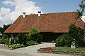
former farmhouse in Ins in the canton of Bern, Switzerland  | |||||
| Upload media | |||||
| Instance of | |||||
|---|---|---|---|---|---|
| Part of | |||||
| Location | Ins, Seeland administrative district, Seeland administrative region, Bern, Switzerland | ||||
| Street address |
| ||||
| Occupant |
| ||||
| Heritage designation | |||||
| Inception |
| ||||
 | |||||
Media in category "Albert Anker-Haus"
The following 5 files are in this category, out of 5 total.
-
 2005-Ins-Ankerhaus.jpg 1,920 × 1,280; 3.1 MB
-
 2005-Ins-Skulptur.jpg 1,280 × 1,920; 2.81 MB
-
 Ankerhaus Garten.JPG 4,608 × 3,456; 5.01 MB
-
 Ankerhaus Strassenseite.JPG 4,497 × 3,318; 4.52 MB
-
 Ins Albert Anker Haus.jpg 499 × 333; 51 KB


