Category:Aerial photographs of the Outer Hebrides
Jump to navigation
Jump to search
Council areas (municipalities) of Scotland: Aberdeen · Aberdeenshire · Angus · Argyll and Bute · Clackmannanshire · Dumfries and Galloway · Dundee · East Ayrshire · East Dunbartonshire · East Lothian · East Renfrewshire · Edinburgh · Falkirk · Fife · Glasgow · Highland · Inverclyde · Midlothian · Moray · North Ayrshire · North Lanarkshire · Outer Hebrides · Orkney Islands · Perth and Kinross · Renfrewshire · Scottish Borders · Shetland Islands · South Ayrshire · South Lanarkshire · Stirling · West Dunbartonshire · West Lothian

Media in category "Aerial photographs of the Outer Hebrides"
The following 71 files are in this category, out of 71 total.
-
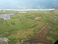
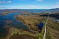 A865 near Aileodair Aerial 01.jpg 5,472 × 3,648; 8.68 MB
-
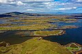 A865 near Aileodair Aerial 02.jpg 5,472 × 3,648; 9.07 MB
-
 A865 near Aileodair Aerial Pan.jpg 17,496 × 6,182; 37.05 MB
-
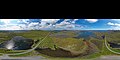 A865 near Aileodair Aerial Pan360.jpg 13,454 × 6,727; 27.57 MB
-
 Aird - geograph.org.uk - 1382595.jpg 640 × 480; 61 KB
-
 Bagh Lamasaigh - geograph.org.uk - 1380659.jpg 640 × 488; 76 KB
-
 Bagh Uisinis - geograph.org.uk - 1380679.jpg 640 × 480; 79 KB
-
 Berneray, North Uist.jpg 3,504 × 2,336; 6.51 MB
-
 Broch Loch an Dùin (Lewis) Aerial 01.jpg 5,472 × 3,648; 9.76 MB
-
 Broch Loch an Dùin (Lewis) Aerial 02.jpg 5,472 × 3,648; 10.15 MB
-
 Broch Loch an Dùin (Lewis) Aerial 03.jpg 5,472 × 3,648; 10.49 MB
-
 Bun an Amair - geograph.org.uk - 1380367.jpg 640 × 502; 50 KB
-
 Butt of Lewis - geograph.org.uk - 359534.jpg 576 × 355; 61 KB
-
 Calanais Stones - geograph.org.uk - 1236575.jpg 640 × 429; 120 KB
-
 Caolas Stulaigh - geograph.org.uk - 1380329.jpg 640 × 453; 59 KB
-
 Ceallasaigh Beag.jpg 4,000 × 3,000; 535 KB
-
 Cidhe Eolaigearraigh from the air - geograph.org.uk - 1379744.jpg 640 × 480; 50 KB
-
 Coire Bheinn to Orasaigh - geograph.org.uk - 1379782.jpg 640 × 480; 66 KB
-
 Culla Beach - geograph.org.uk - 1382544.jpg 640 × 480; 46 KB
-
 Due West from above Loch Fada - geograph.org.uk - 1382394.jpg 640 × 480; 57 KB
-
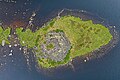
 Dun an Sticir Aerial 01.jpg 11,069 × 5,908; 37.55 MB
-
 Dun an Sticir Aerial 02.jpg 7,040 × 3,609; 14.78 MB
-
 Dun an Sticir Aerial 03.jpg 5,472 × 3,648; 8.95 MB
-
 Dun an Sticir Aerial Pan360.jpg 13,452 × 6,726; 28.99 MB
-
 Dun Bragar Aerial 01.jpg 5,472 × 3,648; 12.32 MB
-
 Dun Bragar Aerial 02.jpg 5,472 × 3,648; 12.25 MB
-
 Dun Bragar Aerial 03.jpg 5,472 × 3,648; 11.89 MB
-
 Dun Bragar Aerial 04.jpg 5,472 × 3,648; 10.78 MB
-
 Dun Bragar Aerial 05.jpg 5,472 × 3,648; 11.89 MB
-
 Dun Bragar Aerial 06.jpg 5,472 × 3,648; 10.61 MB
-
 East of Lionacleit - geograph.org.uk - 1381057.jpg 640 × 480; 75 KB
-

-
 Eilean na Cille.jpg 1,077 × 867; 653 KB
-
 Eileanan Chearabhaigh.jpg 4,000 × 3,000; 632 KB
-

-
 Flying over Coire na Cuilc - geograph.org.uk - 1379799.jpg 640 × 480; 69 KB
-
 From Loch na Liana Moire to Culla - geograph.org.uk - 1382484.jpg 640 × 480; 49 KB
-
 Frozen Loch Grimshader Road - geograph.org.uk - 623921.jpg 640 × 446; 69 KB
-
 Leaving Lochmaddy - geograph.org.uk - 929584.jpg 640 × 480; 43 KB
-
 Loch Uisgebhagh.jpg 4,000 × 3,000; 1.92 MB
-
 Lochmaddy-Loch nam Madadh - geograph.org.uk - 934844.jpg 640 × 404; 40 KB
-
 Lochmor bharabhais.jpg 564 × 380; 50 KB
-
 Luib Bhan - geograph.org.uk - 1381058.jpg 640 × 480; 61 KB
-
 Minor roads north from Luib Bhan - geograph.org.uk - 1382360.jpg 640 × 480; 69 KB
-
 Near Caltanais - geograph.org.uk - 1380797.jpg 640 × 489; 70 KB
-
 North Coast of Barra - geograph.org.uk - 1379761.jpg 640 × 480; 55 KB
-
 North-easterly from Coire na Cuilc - geograph.org.uk - 1380304.jpg 640 × 480; 78 KB
-
 North-west from Cidhe Eolaigearraidh - geograph.org.uk - 1379752.jpg 640 × 480; 52 KB
-
-
 Oitir Mhor.jpg 1,275 × 826; 865 KB
-
 Peighinn a Bhaile - geograph.org.uk - 1382450.jpg 640 × 480; 43 KB
-
 Pol a Charra Hotel - geograph.org.uk - 1379772.jpg 640 × 480; 58 KB
-
 Port of Stornoway - geograph.org.uk - 623918.jpg 640 × 511; 87 KB
-
 Power Station, Sanndabhaig - geograph.org.uk - 1380811.jpg 640 × 480; 67 KB
-
 RAF Benbecula aerial photograph WWII IWM HU 92989.jpg 800 × 604; 75 KB
-
 Rhuba Sheileasdail - geograph.org.uk - 1380645.jpg 640 × 483; 56 KB
-
 Road to Loch a' Charnain - geograph.org.uk - 1380819.jpg 640 × 480; 82 KB
-
 Scolpaig Bay, Loch Scolpaig and Beinn Scolpaig, North Uist.jpg 4,000 × 2,250; 2.25 MB
-
 Sloc Rubha, Scolpaig, North Uist 01.jpg 4,000 × 2,250; 2.68 MB
-
 South-west from above Griminis - geograph.org.uk - 1382379.jpg 640 × 480; 51 KB
-
 Sromaigh.jpg 4,000 × 3,000; 1.24 MB
-
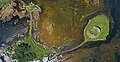
 Steinacleit Aerial 01.jpg 5,472 × 3,648; 12.56 MB
-
 Steinacleit Aerial 02.jpg 5,472 × 3,648; 10.98 MB
-
 Stornoway Airfield - geograph.org.uk - 1236096.jpg 640 × 437; 102 KB
-
 Tiumpan Head.jpg 4,000 × 3,000; 576 KB
-
 Towards Geodha Ban - geograph.org.uk - 1382615.jpg 640 × 480; 59 KB
-
 Traigh na Reill, Fuideigh - geograph.org.uk - 1362073.jpg 640 × 480; 40 KB
-
 Urgha - geograph.org.uk - 201579.jpg 640 × 419; 289 KB
-
 View north-west over Loch Baghasdail - geograph.org.uk - 1379784.jpg 640 × 480; 70 KB
-
 West Loch Tarbert, Isle of Harris and Lewis, Scotland, 23 April 2011 - Flickr - PhillipC.jpg 4,288 × 2,848; 3.19 MB
-
 Wiay from the air.jpg 926 × 547; 358 KB


_Aerial_01.jpg)
_Aerial_02.jpg)
_Aerial_03.jpg)


