Category:Aerial photographs of the Bronx, New York City
Jump to navigation
Jump to search
Boroughs of New York City: Bronx · Brooklyn · Manhattan · Queens · Staten Island
Counties of New York City:
Counties of New York City:
Subcategories
This category has the following 2 subcategories, out of 2 total.
Media in category "Aerial photographs of the Bronx, New York City"
The following 91 files are in this category, out of 91 total.
-
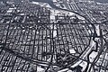
 2010-365-251 The Bronx aerial view (4972664239).jpg 4,752 × 3,168; 8.39 MB
-

-
 239th Street Yard, NYC IRT Subway, Summer, 2010.jpg 2,492 × 1,880; 2.75 MB
-
 Aerial view of Co-op City from the southwest 01 (9456958120).jpg 4,288 × 2,848; 5.57 MB
-
 Aerial view of Co-op City from the southwest 01 - white balanced (9454189949).jpg 4,288 × 2,848; 9.14 MB
-
 AERIAL VIEW OF LOWER BRONX - NARA - 548424.jpg 3,000 × 2,034; 924 KB
-
 AERIAL VIEW OF LOWER BRONX - NARA - 548425.jpg 3,000 × 2,012; 865 KB
-
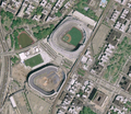
 Aerial View of Old and New Yankee Stadiums - August 2008.jpg 1,728 × 1,296; 325 KB
-

-
 Aerial View of the Throgs Neck Bridge.jpg 1,024 × 562; 199 KB
-
 Aerial View of the Whitestone Bridge.jpg 568 × 212; 9 KB
-
 APARTMENT BUILDINGS IN LOWER BRONX - NARA - 548343.jpg 3,000 × 2,023; 773 KB
-
 Bronx and Harlem with toponyms.jpg 400 × 300; 127 KB
-
 Bronx markets 2008ds.jpg 3,504 × 1,621; 4.48 MB
-
 Bronx River (34432169844).jpg 2,400 × 1,600; 2.97 MB
-

-
 Buhre Av aerial cropped vc.jpg 3,481 × 871; 3.81 MB
-
 Buhre Av aerial vc.jpg 3,887 × 3,009; 9.36 MB
-
 BW Bridge Under Construction 1939 (13720446763).jpg 1,096 × 823; 78 KB
-
 BWApproach Center Lane (6902287890).jpg 2,736 × 3,648; 2.82 MB
-
 BWB-114 (13720407985).jpg 2,700 × 1,994; 837 KB
-
 Castle Hill, Bronx (35145740971).jpg 2,400 × 1,600; 3.37 MB
-
 Co-Op City, Bronx (35145744601).jpg 2,400 × 1,600; 2.8 MB
-

-
 Facing South at Manhattan (35145767341).jpg 2,400 × 1,600; 2.33 MB
-
 Foxhurst - Soundview, Bronx (34432170374).jpg 2,400 × 1,600; 3.73 MB
-
 Fulton Fish Market 2008ds.jpg 1,355 × 556; 335 KB
-
 Hart Island, Bronx, 2012 (cropped).JPG 1,126 × 1,126; 1.42 MB
-
 Hunts Point Market 2008ds.jpg 1,557 × 470; 1,021 KB
-

-

-

-

-

-

-

-

-

-

-
 Hutchinson River Bridge.jpg 1,024 × 793; 181 KB
-
 I-678 Whitestone Expressway Aerial (34466212533).jpg 2,400 × 1,600; 2.68 MB
-
 La Guardia, Riker's Island, fronm over the Bronx (7533825228).jpg 3,872 × 2,592; 3.61 MB
-
 Long Island Sound.jpg 3,504 × 2,336; 6.9 MB
-
 New York (191217159).jpeg 999 × 998; 238 KB
-
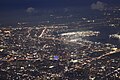
 New York aerial night 2018e.jpg 4,608 × 3,456; 3.51 MB
-

-
 North Manhattan and Bronx ds.jpg 3,904 × 2,160; 8.25 MB
-
 North Shore of Long Island 2021.jpg 6,240 × 4,160; 8.84 MB
-
 NTSBSpuytenDuyvilDerailment2013.jpg 800 × 484; 107 KB
-
 NY Bronx Pelham and New Rochelle IMG 1938.JPG 4,809 × 1,911; 6 MB
-
 NY Bronx Pelham and New Rochelle IMG 1941.JPG 4,545 × 2,832; 7.45 MB
-
 NY Bronx Pelham IMG 1939.JPG 5,184 × 3,196; 9.51 MB
-
 NY Bronx Pelham IMG 1940.JPG 5,184 × 3,456; 9.91 MB
-
 NY Bronx-Pelham and New Rochelle IMG 1942.JPG 5,184 × 3,264; 9.35 MB
-
 NY Bronx-Pelham and New Rochelle IMG 1943.JPG 5,184 × 3,258; 9.27 MB
-
 NY Bronx-Pelham and New RochelleIMG 1937.JPG 5,129 × 2,574; 8.09 MB
-
 NY Bronx-Pelham City Island Hart Island IMG 1951.JPG 4,520 × 3,233; 7.58 MB
-
 NY Bronx-Pelham City Island Hart Island IMG 1952.JPG 4,315 × 2,842; 6.79 MB
-
 NY Bronx-Pelham Pelham Bay City Island Hart Island IIMG 1950.JPG 4,688 × 3,456; 8.58 MB
-
 NYC- Long Island and Manhattan (5068609111).jpg 2,640 × 1,980; 1.23 MB
-
 Orchard Beach - Pelham Bay Park - The Bronx.jpg 1,920 × 1,078; 2.11 MB
-
 Pelham Bay Park aerial cropped vc.jpg 1,141 × 742; 236 KB
-
 Pelham Bay Park aerial vc.jpg 2,816 × 1,584; 1.31 MB
-
 Pelham Bay Park aerial view.jpg 3,516 × 1,954; 4.95 MB
-
 Pelham Gardens and Morris Park (35145742431).jpg 2,400 × 1,600; 3.28 MB
-
 Sobre manhatan - panoramio.jpg 1,280 × 960; 308 KB
-
 Soundview - Bronx River (34466210543).jpg 2,400 × 1,600; 3.65 MB
-
 Soundview - Clason Point - Castle Hill, Bronx (34432171054).jpg 2,400 × 1,600; 3.26 MB
-
 The City of New York under our wings - Is that the Cross Bronx Expressway? (7533826720).jpg 3,872 × 2,592; 3.85 MB
-
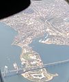 Throggs Neck (cropped).jpg 2,690 × 3,195; 1.34 MB
-
 Throggs Neck.jpg 3,036 × 4,048; 1.75 MB
-
 Throgs Neck Bridge aerial 2003.jpg 1,024 × 557; 415 KB
-
 Throgs Neck Bridge from SW 01 (9453860339).jpg 4,288 × 2,848; 4.85 MB
-
 Throgs Neck Bridge from SW 01 - equalized (9453879185).jpg 4,288 × 2,848; 8.9 MB
-
 Throgs Neck Bridge from the air.jpg 921 × 851; 247 KB
-
 USA - NY, Manhattan - Yankee Stadium - panoramio (1).jpg 3,648 × 2,056; 2.33 MB
-
 USA - NY, Manhattan - Yankee Stadium - panoramio.jpg 3,648 × 2,056; 2.14 MB
-
 USDA Old Yankee almost gone New Yankee built.png 689 × 600; 831 KB
-
 USGS image Old Yankee Stadium and New under construction.png 780 × 596; 997 KB
-
 View of New York from the Air (October 2023) 15.jpg 6,000 × 4,000; 10.81 MB
-
 View of New York from the Air (October 2023) 16.jpg 6,000 × 4,000; 10.42 MB
-
 View of New York from the Air (October 2023) 21.jpg 6,000 × 4,000; 8.57 MB
-
 View of New York from the Air (October 2023) 22.jpg 6,000 × 4,000; 9.37 MB
-
 View of New York from the Air (October 2023) 24.jpg 6,000 × 4,000; 9.37 MB
-
 View of New York from the Air (October 2023) 25.jpg 6,000 × 4,000; 7.41 MB
-
 Vista do Bronx.jpg 640 × 425; 155 KB
-
 Whitestone and Throgs Neck Bridges (4430040614).jpg 3,504 × 2,336; 6.94 MB
-
 Yankee Stadium 001.JPG 3,503 × 2,627; 3.78 MB
-
 Yankee Stadium 002.JPG 3,648 × 2,736; 4.6 MB
-
 Yankee Stadium in Bronx, New York City, from the air (5720974191).jpg 2,896 × 1,944; 2.62 MB
-
 Yankee Stadium was a stadium located in The Bronx in New York City, New York LCCN2011632010.tif 7,430 × 4,880; 207.5 MB
.jpg)
.jpg)

.jpg)
.jpg)


.jpg)

.jpg)
.jpg)
.jpg)
.jpg)
.jpg)
.jpg)
.jpg)
.JPG)

.jpg)
.jpg)

.jpeg)


.jpg)


.jpg)

.jpg)
.jpg)
.jpg)
.jpg)


.jpg)
.jpg)

.jpg)


_15.jpg)
_16.jpg)
_21.jpg)
_22.jpg)
_24.jpg)
_25.jpg)

.jpg)


.jpg)