Category:Aerial photographs of San Juan County, Washington
Jump to navigation
Jump to search
Media in category "Aerial photographs of San Juan County, Washington"
The following 20 files are in this category, out of 20 total.
-
 Aerial Friday Harbor Washington August 2009.jpg 4,601 × 2,914; 5.16 MB
-
 Aerial Visit to the San Juan Islands 4 (8620239882).jpg 4,752 × 3,168; 6.82 MB
-
 Aerial Visit to the San Juan Islands 5 (8620235228).jpg 4,752 × 3,168; 10.19 MB
-
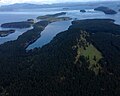
 Deer Harbor, Orcas Island, Washington.jpg 3,264 × 2,448; 2.48 MB
-

-
-
 Iceberg Point (32388919114).jpg 2,848 × 4,120; 8.08 MB
-
 Lopez Island - historic aerial photo (16638468566).jpg 500 × 306; 36 KB
-
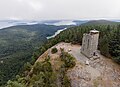 Mt. Constitution Peak.jpg 3,973 × 2,894; 3.05 MB
-
 Orcas Island aerial view EPA photo.jpg 1,600 × 1,064; 380 KB
-
 Patos and Little Patos (32849967010).jpg 4,288 × 2,692; 10 MB
-
 Patos Lighthouse (32849966220).jpg 4,288 × 2,716; 7.55 MB
-
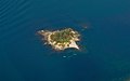 Posey Island (32418201923).jpg 4,288 × 2,680; 4.13 MB
-
 Prevost Harbour.jpg 1,936 × 1,936; 995 KB
-
 Reid Harbour.jpg 1,918 × 1,535; 619 KB
-
 Shaw Island.jpg 1,280 × 960; 581 KB
-
 Turn Point Lighthouse (32418201743).jpg 4,288 × 2,716; 8.96 MB
-
 Turn Point Lighthouse (32849965490).jpg 4,288 × 2,692; 8.33 MB
-
 Watmough Bay (32388916504).jpg 2,848 × 3,724; 9.67 MB
-
 Watmough Bay (32418201533).jpg 4,288 × 2,716; 9.76 MB

.jpg)
.jpg)

.jpg)
_(15654693022).jpg)
.jpg)
.jpg)


.jpg)
.jpg)
.jpg)


.jpg)
.jpg)
.jpg)
.jpg)