Category:Aerial photographs of New Jersey
Jump to navigation
Jump to search
States of the United States: Alabama · Alaska · Arizona · Arkansas · California · Colorado · Connecticut · Delaware · Florida · Georgia · Hawaii · Idaho · Illinois · Indiana · Iowa · Kansas · Kentucky · Louisiana · Maine · Maryland · Massachusetts · Michigan · Minnesota · Mississippi · Missouri · Montana · Nebraska · Nevada · New Hampshire · New Jersey · New Mexico · New York · North Carolina · North Dakota · Ohio · Oklahoma · Oregon · Pennsylvania · Rhode Island · South Carolina · South Dakota · Tennessee · Texas · Utah · Vermont · Virginia · Washington · West Virginia · Wisconsin · Wyoming – District of Columbia: Washington, D.C.
insular area of the United States: American Samoa · Guam · Northern Mariana Islands · Puerto Rico · United States Virgin Islands – United States Minor Outlying Islands: Baker Island · Midway Atoll · Wake Island
insular area of the United States: American Samoa · Guam · Northern Mariana Islands · Puerto Rico · United States Virgin Islands – United States Minor Outlying Islands: Baker Island · Midway Atoll · Wake Island
Subcategories
This category has the following 7 subcategories, out of 7 total.
*
A
N
Media in category "Aerial photographs of New Jersey"
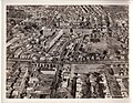
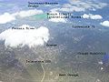
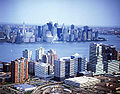
The following 200 files are in this category, out of 460 total.
(previous page) (next page)-
 10 President Ave, Lavallette, NJ 08735, USA - panoramio.jpg 3,264 × 2,448; 1.72 MB
-

-
 17 and 3 interchange Rutherford.jpg 3,072 × 2,304; 2.75 MB
-

-

-

-

-

-

-

-
-

-
-

-
-

-

-

-

-
-
-
-

-
-

-

-
-

-

-

-

-

-

-

-
-

-

-

-

-
-

-

-

-

-

-

-

-

-

-

-
-

-

-

-
-

-

-

-

-
-

-

-

-

-
-

-
-

-
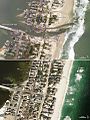 A Changed Coastline in Jersey (8150910119).jpg 720 × 963; 450 KB
-

-

-

-
-

-
-
-
 Aerial view of New Brunswick, New Jersey, September 2015.JPG 3,303 × 2,480; 2.51 MB
-
 Aerial view of Orange Reservoir, West Orange, New Jersey, 2008-05-10.jpg 1,024 × 768; 788 KB
-
 Aerial view of Roosevelt Stadium - 01.jpg 4,660 × 3,604; 8.71 MB
-
 Aerial view of Silver Lake chemical works. (bd27eba84bb84528bb159e30bcaf93b2).jpg 3,116 × 2,412; 5.08 MB
-
 Aerial view of silver lake plant. (35ef5c3cb919491dad863807ae68a874).jpg 2,880 × 2,220; 1.7 MB
-
 Aerial view of silver lake plant. (38829e64e30c4c2fa7ebac424a5a7f81).jpg 2,834 × 2,191; 1.76 MB
-
 Aerial view of silver lake plant. (3b363e9fc6784d17beb97a19be9188fc).jpg 2,863 × 2,221; 1.71 MB
-
 Aerial view of silver lake plant. (42b1c8951e124a7994b6fc8e3b5cafbc).jpg 3,076 × 2,447; 1.51 MB
-
 Aerial view of silver lake plant. (7acc0f16eb724423be9dce729edb8728).jpg 2,876 × 2,220; 1.66 MB
-
 Aerial view of silver lake plant. (83f00ce8cd32417fa7ff404537d99c0e).jpg 2,851 × 2,228; 1.79 MB
-
 Aerial view of silver lake plant. (f51f6a38ebc04b0890840d8c05fe6bdf).jpg 2,881 × 2,236; 1.79 MB
-

-
 Aerial view of West Orange Laboratory. (e7b60b1cc3d346238a96f2cc9c0e41ac).jpg 2,876 × 2,236; 1.62 MB
-
 Aerial view of West Orange site. (0a6ca2281e5541af8a44fded4819c96e).jpg 2,866 × 2,258; 1.74 MB
-
 Aerial view of West Orange site. (1c615f22eea04e57a3825c3b02ffe1c3).jpg 2,871 × 2,249; 1.82 MB
-
 Aerial view of West Orange site. (39d47ba778134181b9039d6d2687048f).jpg 2,872 × 2,204; 1.71 MB
-
 Aerial view of West Orange site. (59cbee0c923f40b59b93cad8d42534be).jpg 2,868 × 2,241; 1.79 MB
-
 Aerial view of West Orange site. (9d6d5a35054b474a804015f1c82d364c).jpg 2,876 × 2,240; 1.81 MB
-
 Aerial view of West Orange site. (e2b20fd2f9a34d3caceb75116a8342e5).jpg 2,855 × 2,240; 1.84 MB
-
 Aerial view of West Orange, New Jersey, 2008-05-10 with toponyms.jpg 500 × 375; 163 KB
-
 Aerial view of West Orange, New Jersey, 2008-05-10.jpg 1,024 × 768; 646 KB
-

-
-
 Aerial.jpg 769 × 600; 439 KB
-
 Aftermath of extensive flooding along New Jersey shore (8151150511).jpg 5,616 × 3,744; 5.25 MB
-
 Aftermath of extensive flooding along New Jersey shore (8151219489).jpg 5,616 × 3,744; 6.41 MB
-
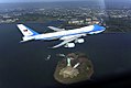
 Air force one flyover.jpg 640 × 427; 24 KB
-
 Air Force One photo op incident- altered by DoD.jpg 1,024 × 683; 780 KB
-
 Air Force One photo op incident.jpg 1,024 × 683; 343 KB
-
 Approaching Washington Bridge.jpg 3,024 × 4,032; 2.93 MB
-
 ArthurKill VerticalLift Goethals bridges.jpg 3,000 × 2,040; 912 KB
-
 AT&T Basking Ridge.jpg 1,000 × 800; 137 KB
-
 AT&T Holmdel-wide-cropped.jpg 568 × 600; 203 KB
-
 AT&T Holmdel-wide.jpg 1,000 × 800; 159 KB
-
 AT&T Holmdel.jpg 1,000 × 800; 125 KB
-
 AT&T Murray Hill.jpg 1,000 × 800; 132 KB
-
 Atardecer en Nueva York..JPG 2,560 × 1,920; 1.13 MB
-
 Atlantic Cape CC.jpg 897 × 1,038; 609 KB
-
 Atlantic City skyline from 47th floor of Revel.jpg 3,072 × 2,304; 1.5 MB
-
 Atlantic City, aerial view.jpg 1,600 × 1,049; 644 KB
-
 Audubon NJ from airplane.jpg 3,072 × 2,304; 1.4 MB
-
 Bayonne NJ aerial view.jpg 3,024 × 4,032; 2.47 MB
-
 Bayonne, New Jersey and Staten Island, New York.jpg 4,000 × 3,000; 2.3 MB
-

-
-
 Beacon Aerial Skyline.jpg 640 × 433; 146 KB
-
 Becton Dickinson HQ by USGS.jpg 483 × 398; 123 KB
-
 Bell Laboratories at New Providence, New Jersey (7235324892) (cropped).jpg 1,442 × 635; 265 KB
-
 Bell Laboratories at New Providence, New Jersey (7235324892).jpg 4,000 × 3,000; 2.94 MB
-
 Bell Labs Holmdel, The Oval.jpg 2,905 × 1,932; 2.68 MB
-
 Bell Labs Holmdel, The Oval2.png 3,008 × 2,000; 8.64 MB
-
 Bell Labs Holmdel.jpg 3,008 × 2,000; 7.51 MB
-
 Bergen CC-NJ.jpg 1,074 × 822; 485 KB
-
 Bergen Hill western view.jpg 1,024 × 804; 243 KB
-
 Betsy Ross and Delair Bridge cut.jpg 1,843 × 1,281; 568 KB
-
 Betsy Ross and Delair Bridge.jpg 3,498 × 2,403; 6.92 MB
-
 Betsy Ross Bridge Across Delaware River, Philadelphia, Pennsylvania (7235308476).jpg 4,000 × 3,000; 2.75 MB
-
 Betsy Ross Bridge from Bridesburg PA to Pennsauken Township NJ.jpg 2,449 × 1,512; 1.02 MB
-

-
 Botany Worsted Mills-Passaic NJ 1997.jpg 4,797 × 3,793; 9.44 MB
-
 Bridgeport, New Jersey (2894760446).jpg 1,280 × 960; 131 KB
-
 Bridgeton NJ - CR635 CR540 Aerial (42702898675).jpg 2,400 × 1,600; 2.01 MB
-
 Brookdale CC-NJ.jpg 721 × 735; 403 KB
-
 Burlington County College.jpg 1,816 × 844; 583 KB
-
 Caldwell University aerial campus.jpg 2,880 × 1,140; 2.32 MB
-
 Camden County College.jpg 1,230 × 990; 697 KB
-

-
 Cape May NJ from airplane (August, 2022).jpg 6,000 × 4,000; 6.29 MB
-
 Cape may satellite map.jpg 581 × 847; 54 KB
-
 Caven Point Pier USGS 1994-4-8.tiff 719 × 482; 499 KB
-
 Centre Street Bridge, Newark, NJ.tif 1,358 × 607; 933 KB
-
 Church Square Park Hoboken November 2021 001.jpg 5,280 × 3,520; 9.7 MB
-
-
 Colts Neck aerial view.jpg 4,526 × 2,833; 2.33 MB
-
 ColumbusHomesNewark demolition.tiff 703 × 472; 504 KB
-
-
-
 County College of Morris.jpg 1,506 × 1,038; 1,011 KB
-
 CRRNJ Newark Bay Bridge.jpg 3,122 × 2,571; 782 KB
-
 CRRNJ Newark Bay Lift Bridge.jpg 989 × 1,024; 211 KB
-
 Cumberland CC-NJ.jpg 579 × 581; 231 KB
-
 Damage to Casino Pier (NJ) (8151148295).jpg 5,616 × 3,744; 6.13 MB
-
 Damage to New Jersey shore amusement park (8151149663).jpg 5,616 × 3,744; 7.49 MB
-
 Danforth Ave Hudson Bergen Light Rail Station.jpg 3,988 × 2,183; 7.61 MB
-
 Day 3 - Cape May NWR Flyover (16045339363).jpg 5,616 × 3,744; 6.45 MB
-
 Day 3 - Cape May NWR Flyover (16045343733).jpg 5,616 × 3,744; 5.57 MB
-
 Day 3 - Cape May NWR Flyover (16457968467).jpg 5,616 × 3,744; 8.37 MB
-
 Delaware Memorial Bridge 2012 03 14 aus-iah-bos 276.jpg 2,275 × 2,236; 3 MB
-
 Delaware Memorial Bridge aerial 2012.jpg 2,875 × 2,776; 5.87 MB
-
 Delaware River North of Penns Grove, New Jersey (2894754680).jpg 1,280 × 960; 125 KB
-

-
-
-
 DelawarePhillyCamdenPettyIslandaerial.jpg 3,887 × 2,206; 7.3 MB
-
-

-

-
-
 Dock Bridge 1974 - HAER NJ-40.35.tif 4,767 × 3,626; 17.92 MB
-
 Downtown Manhattan From Aeroplane.jpg 1,024 × 683; 640 KB
-
 Downtown New Brunswick, NJ 1974 - HAER NJ-40.4.tif 4,730 × 3,563; 18.4 MB
-

-

-
 Elizabeth and Bayonne, New Jersey, with Manhattan in Background (2895658447).jpg 1,280 × 960; 123 KB
-
 Elizabeth, New Jersey - Aerial I (43861389542).jpg 2,400 × 1,600; 2.81 MB
-
 Elizabeth, New Jersey - Aerial II (30040849098).jpg 2,400 × 1,600; 2.75 MB
-

-
 EllisIsland-LibertyState2017.tif 693 × 356; 358 KB
-
 EllisIslandLibertyStateAerial.tif 760 × 491; 470 KB
-
 Eroded Shoreline at Gandy's Beach (15034669722).jpg 5,616 × 3,744; 5.53 MB
-
 Essex CC-NJ.jpg 1,000 × 800; 166 KB
-

-
 Fall Colors (50850892042).jpg 5,285 × 2,973; 23.47 MB
-
 Fall Colors Farmers Field.jpg 5,464 × 3,070; 19.59 MB
-
 Fcc2.jpg 676 × 437; 67 KB
-
 Flemington speedway USGS.jpg 600 × 400; 41 KB
-
 Flickr - Nicholas T - Far View (1).jpg 2,816 × 2,112; 5.27 MB
-
 Flickr - Nicholas T - Far-Reaching.jpg 2,816 × 2,112; 3.95 MB
-
 Flickr - Nicholas T - Vista (1).jpg 3,713 × 2,293; 7.9 MB
-
 Flickr - Nicholas T - Vista (2).jpg 6,187 × 2,896; 12.23 MB
-
 Fort Lee wikivoyage banner.jpg 2,941 × 420; 1.44 MB
-
 FortLeeGWB.jpg 2,947 × 1,050; 2.98 MB
-
 Garden State Parkway - US 9 and NJ440 Aerial (43191753204).jpg 2,400 × 1,600; 2.69 MB
-
 Garden State Parkway, New Jersey (7238114164).jpg 3,000 × 3,355; 2 MB


_Exit_13_and_Union_Freeway_(Interstate_278)_in_Elizabeth,_New_Jersey_from_a_plane_heading_for_Newark_Airport.JPG)
_Exit_13_and_Union_Freeway_(Interstate_278)_in_Elizabeth,_New_Jersey_from_a_plane_heading_for_Newark_Airport.JPG)
_in_Elizabeth,_New_Jersey_from_a_plane_heading_for_Newark_Airport.JPG)

_and_Port_Newark_in_Newark,_Essex_County,_New_Jersey_from_an_airplane_which_just_took_off_from_Newark_Liberty_International_Airport.jpg)
_and_Interstate_78_(New_Jersey_Turnpike_Newark_Bay_Extension)_from_an_airplane_which_just_took_off_from_Newark_Liberty_International_Airport.jpg)


_and_Lincoln_Highway_(center)_as_they_cross_the_Hackensack_River_between_Kearny_and_Jersey_City_in_Hudson_County,_New_Jersey.jpg)
_and_Lincoln_Highway_(upper_right)_as_they_cross_the_Hackensack_River_between_Kearny_and_Jersey_City_in_Hudson_County,_New_Jersey.jpg)


,_Little_Falls_(middle_left),_Cedar_Grove_(lower_left),_Montclair_(lower_center)_and_Clifton_(right)_in_Essex_and_Passaic_Counties,_New_Jersey_from_an_airplane.jpg)
,_North_Caldwell_(lower_left),_Little_Falls_(center_and_right),_Totowa_(upper_right)_and_Wayne_(upper_left)_in_Essex_and_Passaic_counties,_New_Jersey_from_an_airplane.jpg)


,_Denville_(left)_and_Mountain_Lakes_(upper_center)_in_Morris_County,_New_Jersey_from_an_airplane.jpg)
,_Rockaway_Borough_(left_center),_Rockaway_Township_(upper_left),_Denville_(center),_Parsippany-Troy_Hills_(lower_right)_and_Mountain_Lakes_(upper_right)_in_Morris_County,_New_Jersey.jpg)
,_Randolph_(bottom),_Mine_Hill_(lower_left),_Wharton_(upper_left),_Rockaway_Township_(upper_center_and_right),_Rockaway_(right)_and_Victory_Gardens_(lower_right)_in_Morris_County,_New_Jersey.jpg)
,_Roxbury_Township_(left),_Jefferson_Township_(upper_center),_Rockaway_Township_(upper_right)_and_Wharton_(right)_in_Morris_County,_New_Jersey.jpg)


,_Stanhope_(left),_Hopatcong_(upper_left),_Mount_Arlington_(right)_and_Roxbury_(lower_right)_in_Morris_and_Sussex_counties,_New_Jersey,_with_Lake_Hopatcong_visible_in_the_center.jpg)


.jpg)


.jpg)
.jpg)
.jpg)
.jpg)
.jpg)
.jpg)
.jpg)
.jpg)

.jpg)
.jpg)
.jpg)
.jpg)
.jpg)
.jpg)
.jpg)


.jpg)
.jpg)


_(cropped).jpg)
.jpg)


.jpg)

.jpg)

.jpg)
.jpg)


.jpg)


.jpg)
.jpg)


_(8151148295).jpg)
.jpg)

.jpg)
.jpg)
.jpg)


.jpg)


.jpg)


.jpg)
.jpg)
.jpg)

.jpg)


.jpg)


.jpg)

.jpg)
.jpg)
.jpg)
.jpg)
_and_Hackensack_(left)_rivers_as_they_empty_in_Newark_Bay_(upper_right)_along_the_borders_of_Kearny_and_Jersey_City_in_Hudson_County_and_Newark_in_Essex_County,_New_Jersey.jpg)